Hochwildstelle, 2,747m, from the Satteltal Valley through Goldlacken


- Brief description
-
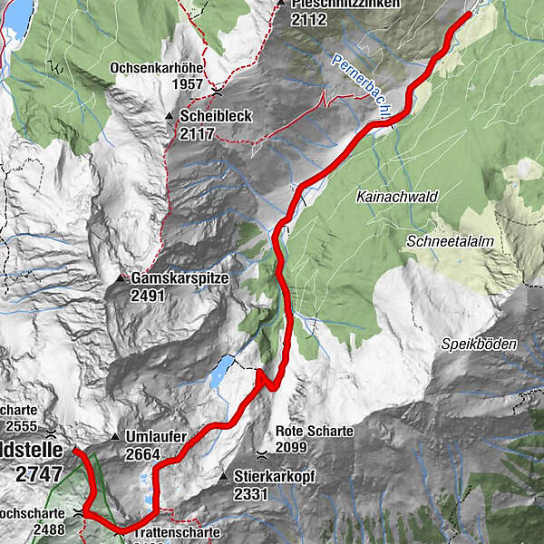
From Sattental, you will hike up until you reach the enclosed Lake Stierkarsee and can look down at Goldlacken - also known as “the little Klafferkesseln” and onwards through Wildlochscharte to the peak of the Hochwildstelle - one of Styria’s highest mountains.
- Difficulty
-
difficult
- Rating
-
- Starting point
-
Parking - "Kainreiter Alm"
- Route
-
Trattenscharte (2,408 m)7.1 kmWildlochscharte (2,488 m)7.5 kmHochwildstelle (2,747 m)8.2 km
- Best season
-
JanFebMarAprMayJunJulAugSepOctNovDec
- Description
-
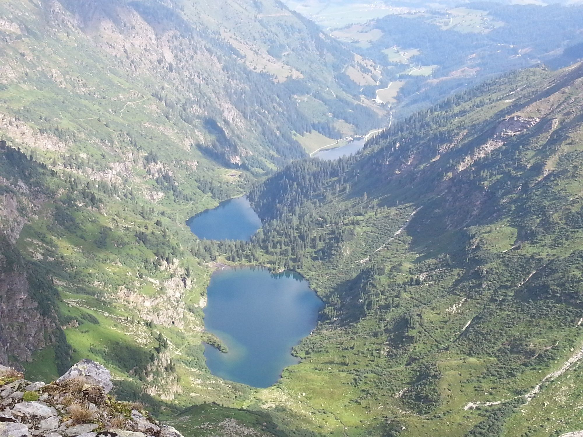
From Sattental, you will hike along a stream up to Lake Stierkarsee. However, you will not climb up to the lake; rather, you will continue upwards to the Goldlacken (no. 26).
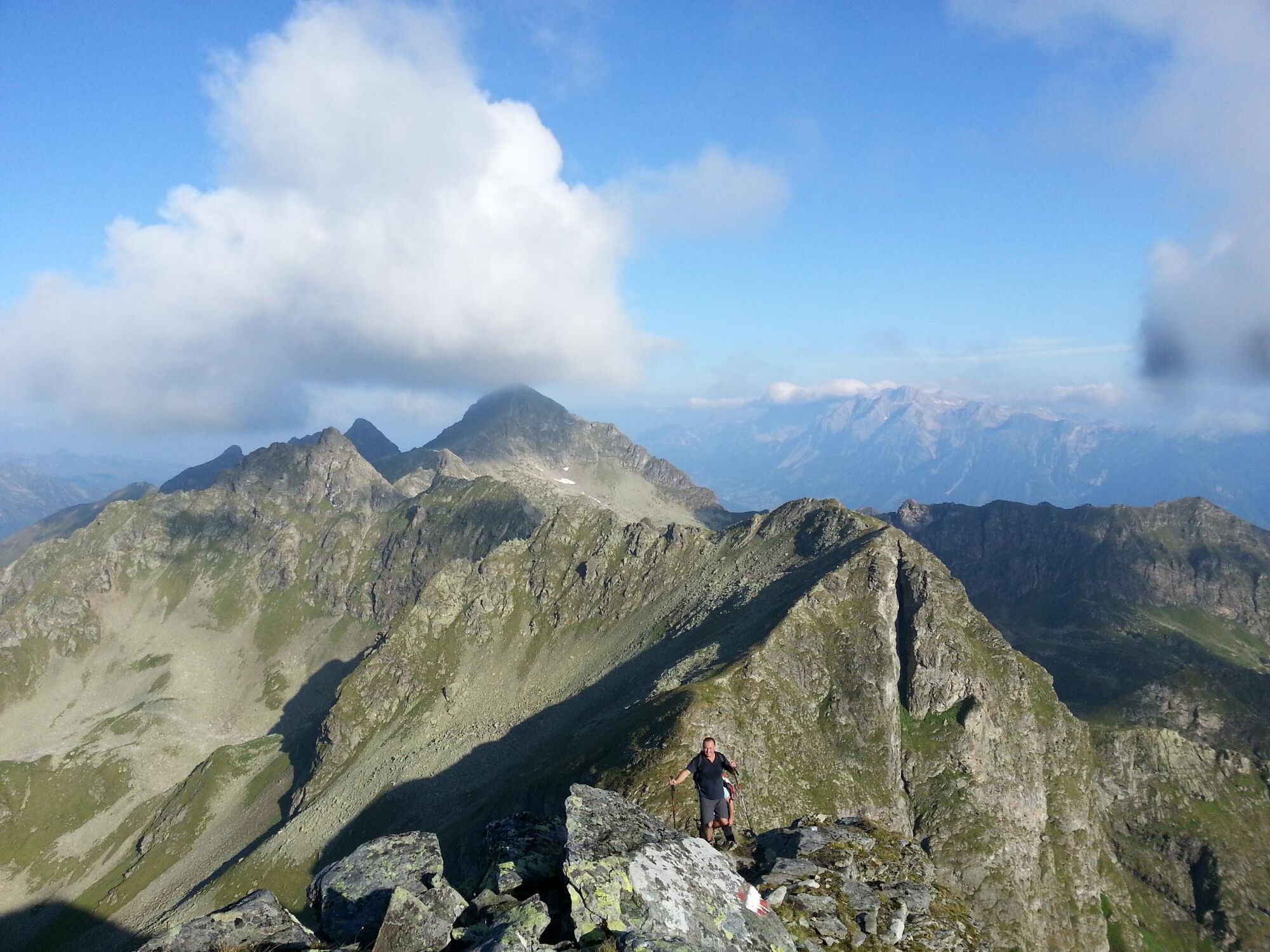
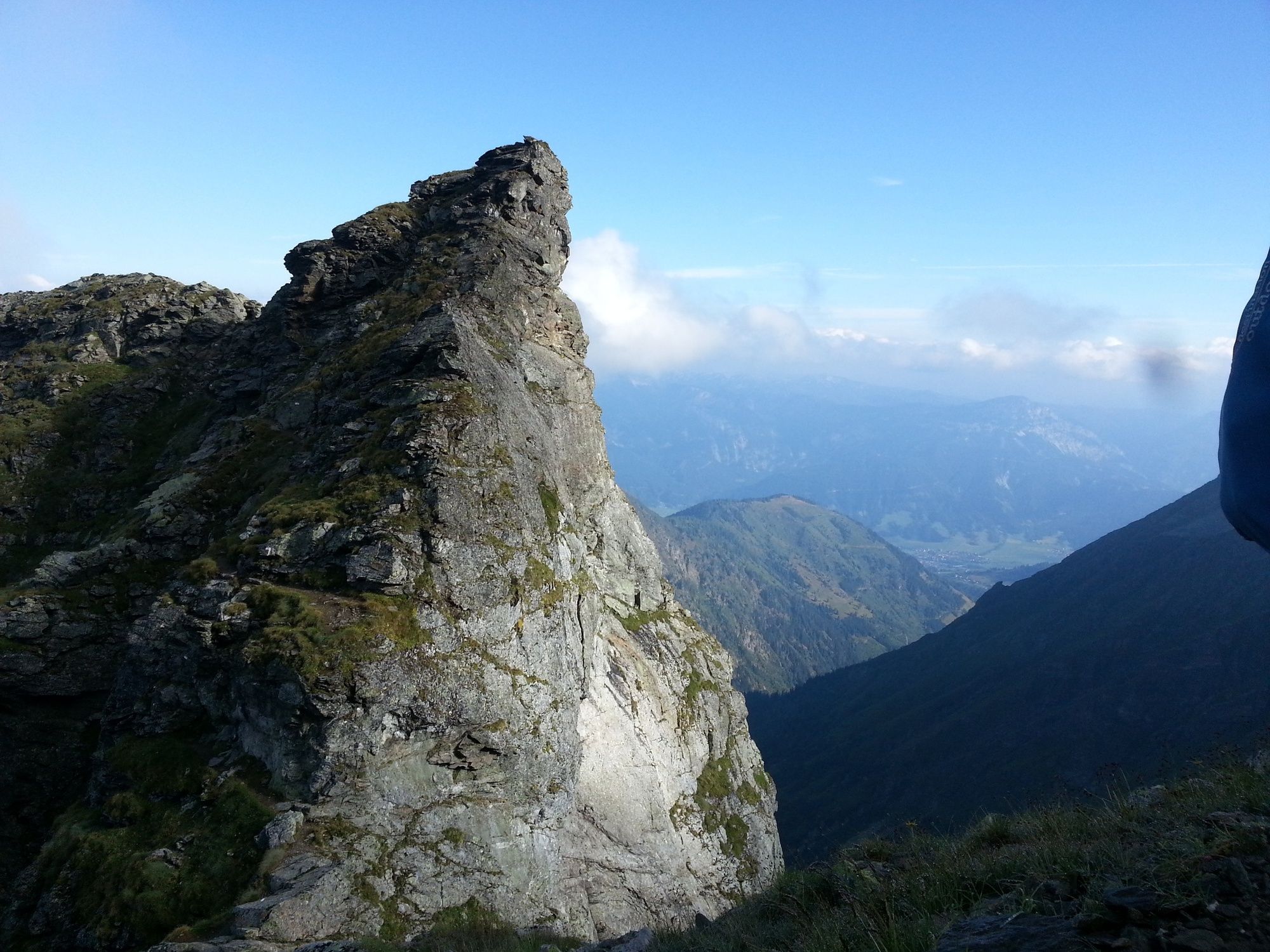
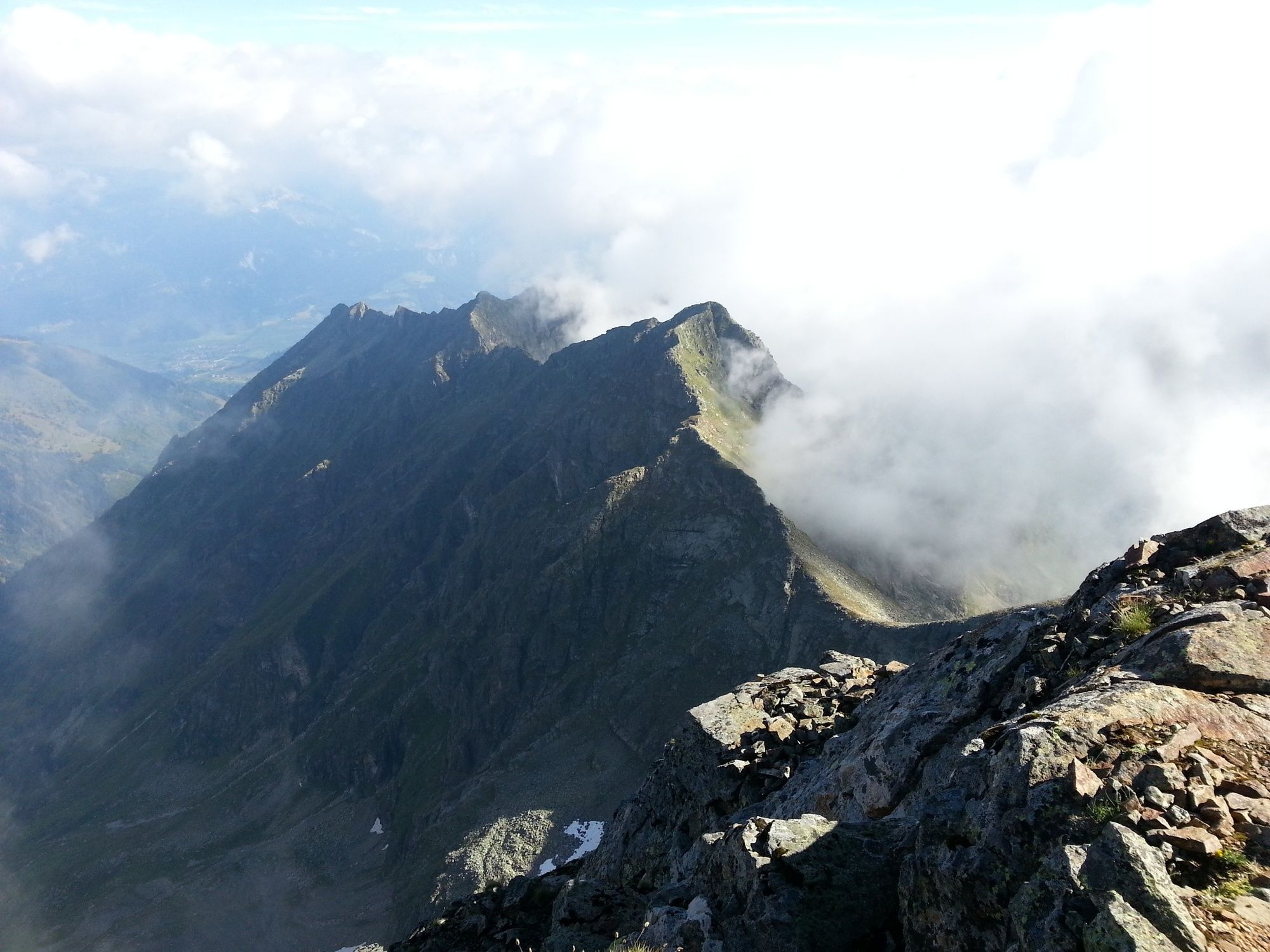
You will continue going uphill until reaching Goldlacken’s small valley. Once you arrive at Goldlacken, you will arrive at hiking trail no. 702, which, coming from the Breitlahn cabin, leads a short distance upwards to Trattenscharte (2,048m). Then you will cross the Wildlochscharte where the south ridge begins to form the peak of the Hochwildstelle. Here, you will begin your climb to the peak via the Blockgrat.
WARNING - only for experienced and sure-footed mountain hikers!
Alternative climb:
Heading northwest, through the little Wildstelle to the Obersee continuing towards the Hans Wödl cabin. After a brief rest, continue climbing to Styrian Lake Constance.
- Directions
-
From Sattental, you will hike along a stream up to Lake Stierkarsee. However, you will not climb up to the lake; rather, you will continue upwards to the Goldlacken (no. 26).
You will continue going uphill until reaching Goldlacken’s small valley. Once you arrive at Goldlacken, you will arrive at hiking trail no. 702, which, coming from the Breitlahn cabin, leads a short distance upwards to Trattenscharte (2,048m). Then you will cross the Wildlochscharte where the south ridge begins to form the peak of the Hochwildstelle. Here, you will begin your climb to the peak via the Blockgrat.
WARNING - only for experienced and sure-footed mountain hikers!
Alternative climb:
Heading northwest, through the little Wildstelle to the Obersee continuing towards the Hans Wödl cabin. After a brief rest, continue climbing to Styrian Lake Constance.
- Highest point
- 2,714 m
- Endpoint
-
Hochwildstelle, 2,747m
- Height profile
-

- Equipment
-
For alpine routes, the basic equipment includes a hood, gloves, a good jacket and trousers. Good, waterproof shoes, sunglasses, sun protection and plenty of drinks are essential. Flashlight, maps, knives and a small first aid box are also included.
- Safety instructions
-
Changes in the weather, sudden drops in temperature, wind, fog and snowfields are objective hazards and require proper measures when on the go. Hut hosts are experienced mountain experts; they can provide good tips regarding the weather or route. Insufficient equipment, overestimating one’s capabilities, carelessness, poor physical fitness, and misjudgement can lead to critical situations. In case of thunderstorms: Avoid peaks, ridges and safety ropes at all costs.
In case of emergency please dial the following emergency number: no. 140 for Mountain rescue and no. 112 - the European emergency call number
- Tips
-
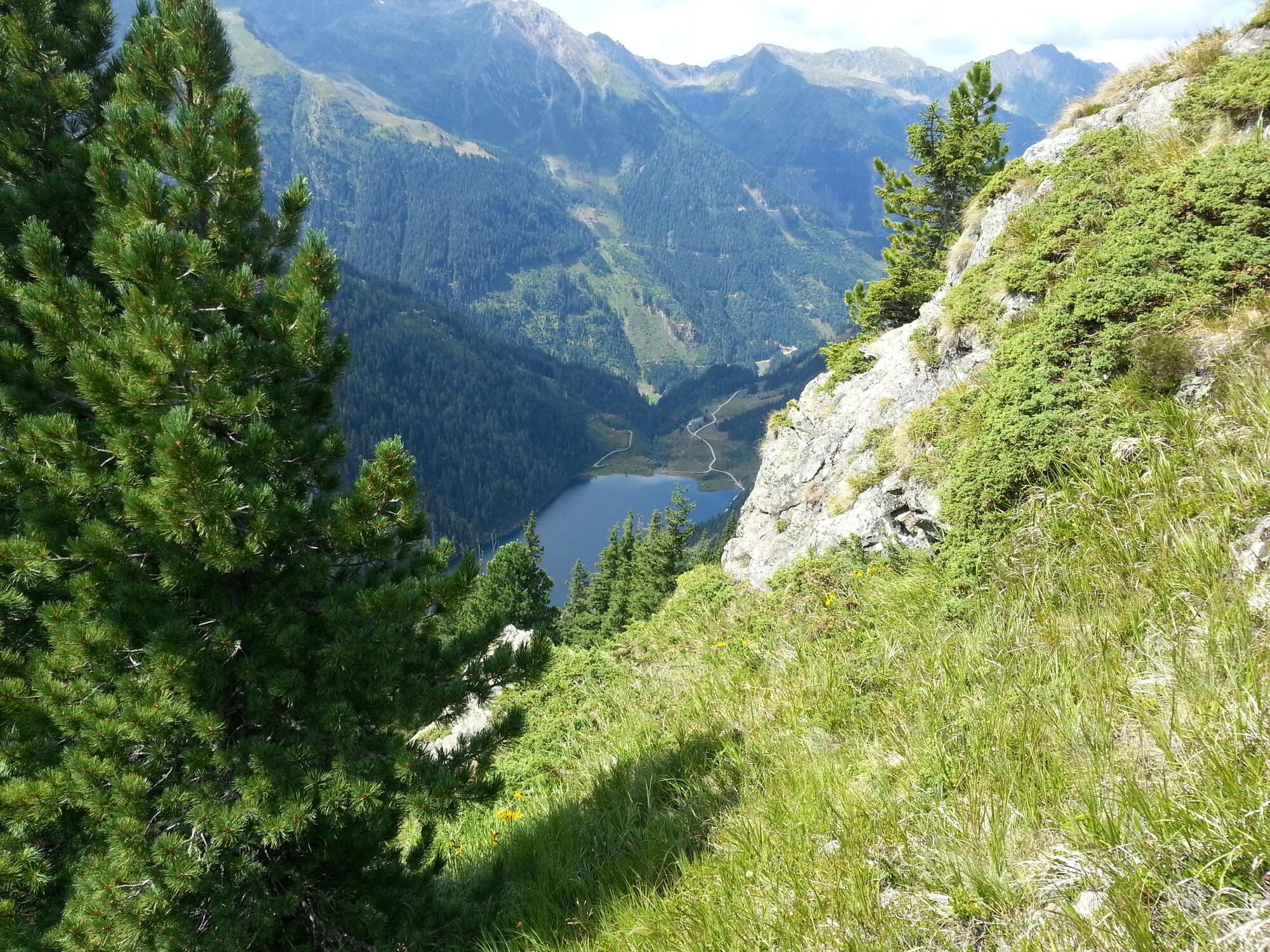
You can take a detour down to the Stierkarsee (1810 m).
- Additional information
-
Tour at your own risk! No liability shall be assumed for any existing or occurring Alpine hazards (weather, etc..).
- Directions
-
B320 - Turn towards Pruggern/Galsterberg - Pruggererberg - turn left towards Sattental
- Parking
-
Parking at "Keinreiter Alm"

-

-
AuthorThe tour Hochwildstelle, 2,747m, from the Satteltal Valley through Goldlacken is used by outdooractive.com provided.


General info
-
Schladming - Dachstein
2999
-
Haus - Aich
1364
-
Michaelerberg-Pruggern
234


