Stage 15 From Glacier to Wine North Route Hochschwab Schiestlhaus - Seewiesen


- Brief description
-
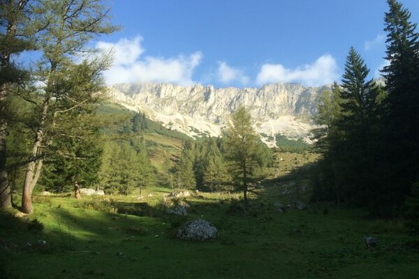
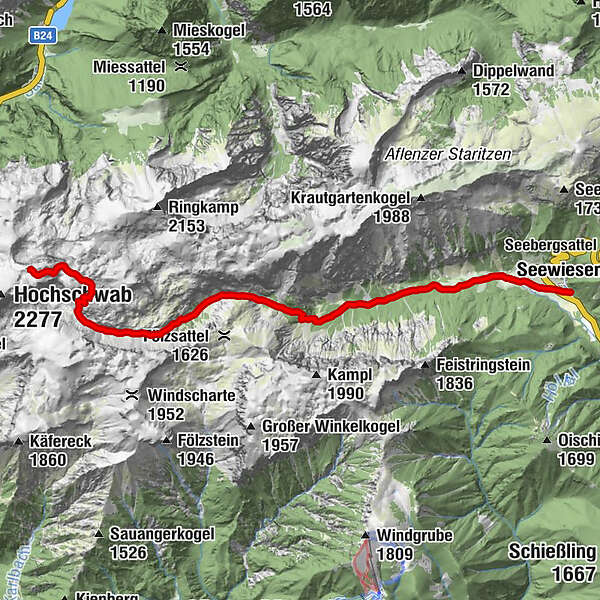
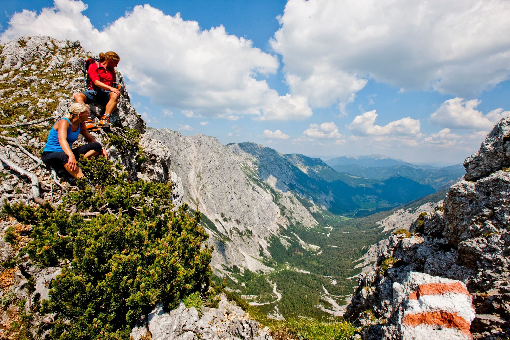
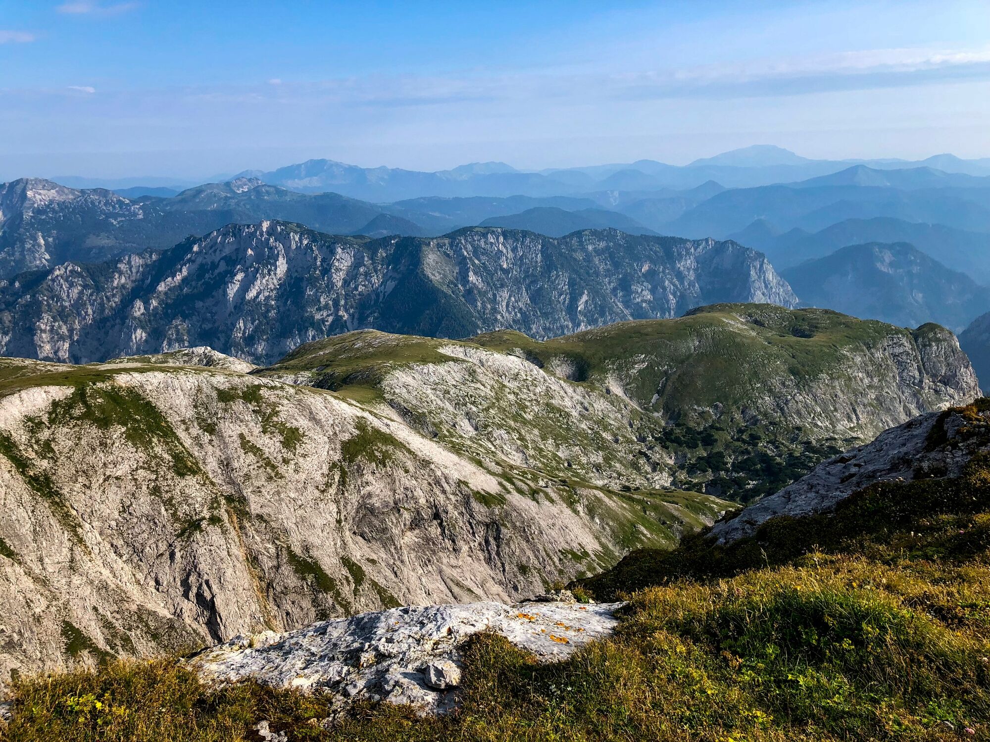
The tour takes us from the Schiestlhaus below the Hochschwab peak to the small, romantic village of Seewiesen at the foot of the Seebergsattel, which represents the transition from the Aflenz Basin to the Mariazell region. This tour is certainly one of the most beautiful stages of the hiking route From Glacier to Wine. However, the views of the surrounding mountains should not distract from the fact that we are here in high alpine terrain and surefootedness is not only important, but also necessary - especially on the descent via the Graf Meran Steig, which is laid out in serpentines and in part also offers steel ropes as an aid.
- Difficulty
-
medium
- Rating
-
- Starting point
-
Schiestlhaus
- Route
-
Voisthalergasse4.2 kmHöllkampl (1,449 m)5.4 kmFlorlhütte (1,284 m)6.5 kmSeewiesen11.6 kmHotel Restaurant Seeberghof11.7 km
- Best season
-
JanFebMarAprMayJunJulAugSepOctNovDec
- Description
-
Water for the cities of Vienna and Graz has been provided by Hochschwab for many, many years. This historical importance of the north side water deposits of the Hochschwab for the federal capital Vienna is possibly well known. Since 1993, however, the water resources of the southern Hochschwab have now also been used to supply Graz and the surrounding area with drinking water. On the southern side of the Hochschwab, huge gravel piles were deposited during the Ice Age. For the karst water that flows in here, this gravel acts as a reservoir and filter. Deep under the rocks in the karst, respectively in the gravel, this water treasure is hidden, because it is pure, clear drinking water. Dolines, shafts, fissures and crevices lead the rain and melt water into the interior of the mountain, which is crisscrossed by a gigantic vascular system of underground water veins and lakes. On our tour, these sinkholes and shafts are our companions. Therefore, especially in fog, the Hochschwab is to be strictly avoided.
We are also on a stage of the BergZeitReise circular tour here, which leads through the wildly romantic mountain landscape of Hochsteiermark.
- Directions
-
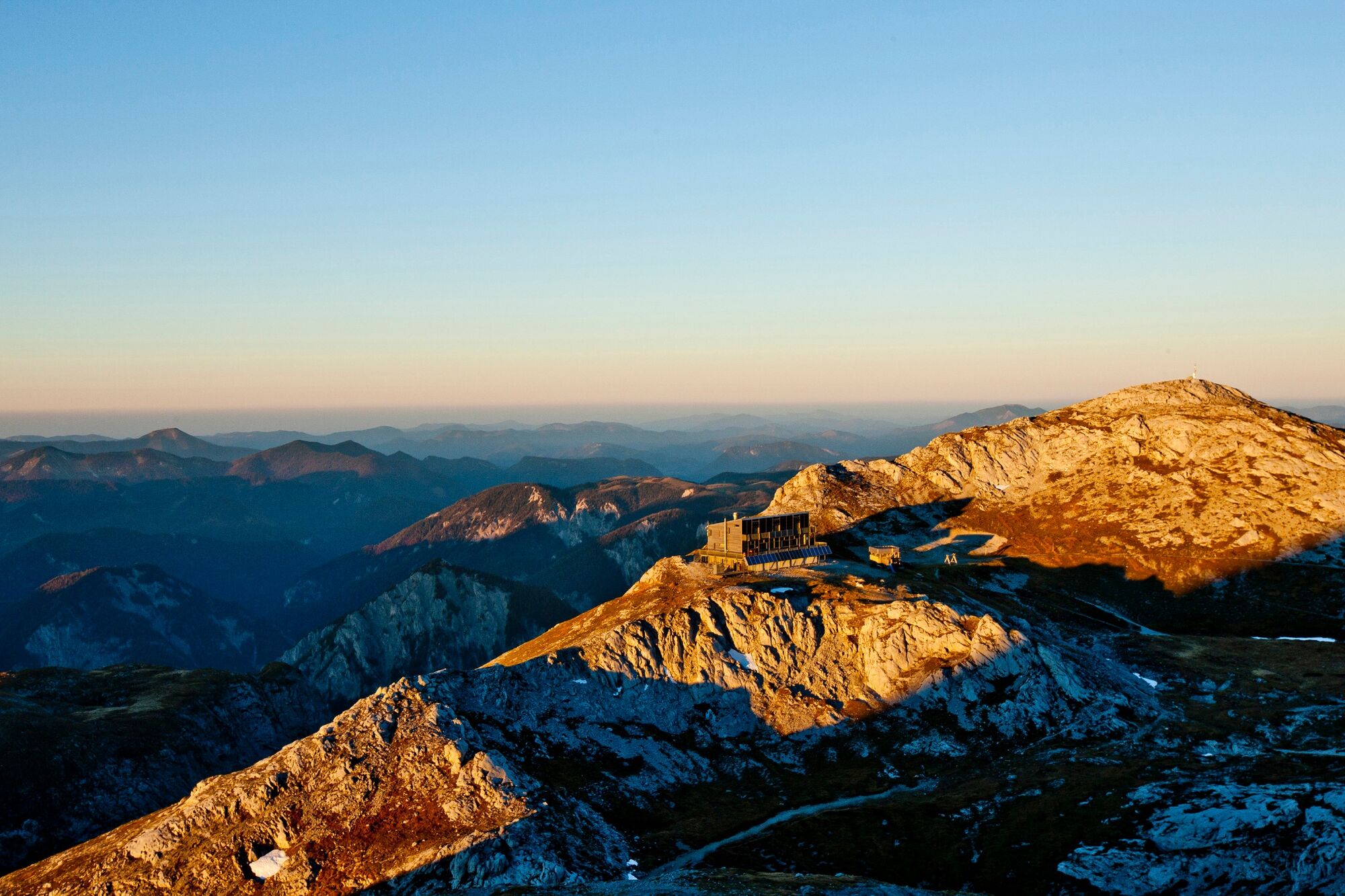
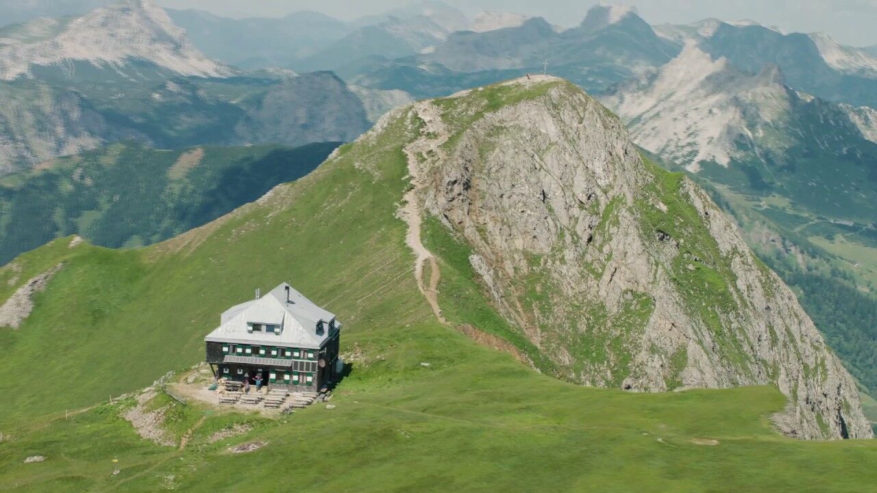
From the Schiestlhaus (Tel. +43 699 10812199) we head east at the beginning to soon reach a fork, where we keep to the right and descend via the Graf Meran Steig into the Obere Dullwitz. Here, despite the scenic beauty, special care is required. Please pay particular attention not to kick loose any stones, as there can also be lively oncoming traffic. We are accompanied here by loud whistling, because on both sides of the path there are marmot burrows. With a little patience, you can watch the cute rodents sunning themselves in front of their burrows. But as soon as hikers or birds of prey approach, they warn their fellow marmots with considerable volume before disappearing into the burrow. Arriving in the Obere Dullwiz, we keep to the left and reach the popular Voisthalerhütte (Tel. +43 664 5112475) one of the most important bases in the Hochschwab area. In a narrow basin in the shadow of mighty rock faces lies the Alpine Club hut, which was built as early as 1898 and has been expanded several times since then. The view into the valley is impressive at any time of day. And this is exactly the view we are going to take.
From the Voisthalerhütte we now walk through the alley of the same name to the Franzosenkreuz. In 1805 Styria was occupied by the French, whereby the population of Seewiesen took up a secure position here on this height and survived. In gratitude for the liberation, a wooden cross was erected on this spot at that time. From here we continue out of the valley to Seewiesen (Tourist Information Tel. +43 664 3548485 and/or +43 3861 3700), today's stage destination on the hiking route "From Glacier to Wine". The next day, the next mountain massif awaits us: we head towards Hohe Veitsch.
- Highest point
- 2,155 m
- Endpoint
-
Seewiesen
- Height profile
-

- Equipment
-
Proper backpack packing makes many things easier: Pack heavy things first. The water bottle should always be within reach in a side pocket. All the things that are often needed, such as sunglasses, camera or hiking map, belong on top. An emergency kit, including blister plasters, belongs in every rucksack and it is always advisable to dress in layers.
- Safety instructions
-
Emergency call mountain rescue: 140
Tips when reporting an emergency – Answer these six WH questions: What happened? How many people are injured? Where did the accident happen (are there GPS coordinates)? Who is reporting the incident (callback number)? When did the accident happen? What is the weather like at the site of the incident?
- Additional information
-
Steiermark Tourismus
Tel. +43 316 4003
If you would like to hire a tour operator, simply book with Steiermark Touristik, the official travel agency of Steiermark Tourismus:
Tel. +43 316 4003 450,
The Steiermark Touren app, available free of charge on Google Play and the App Store (Android, iOS), offers detailed first-hand information: brief facts (length, duration, difficulty, ascent and descent/elevation gain, ratings), map, route descriptions, altimeter, compass, peak finder, navigation along the tour. You can also create your own personal lists of favourite tours and sites, store tours and destinations offline, use social media channels, and much more.
- Public transportation
-
Detailed information about arriving by ÖBB (Austrian Federal Railways) can be found at www.oebb.at or on the Verbundlinie Steiermark website www.busbahnbim.at
With Verbundlinie’s BusBahnBim route planner app, planning your journey has never been easier: simply enter towns and/or addresses, stop names or points of interest to check all bus, train and tram connections in Austria. The app is available free of charge for smartphones – on Google Play and in the App Store
- Parking
-
The Schiestlhaus is not directly accessible by car or public transport, more information can be obtained directly from the Schiestlhaus.


-

-
AuthorThe tour Stage 15 From Glacier to Wine North Route Hochschwab Schiestlhaus - Seewiesen is used by outdooractive.com provided.