Stage 10 From Glacier to Wine North Route Gesäuse Mödlingerhütte - Heßhütte


- Brief description
-
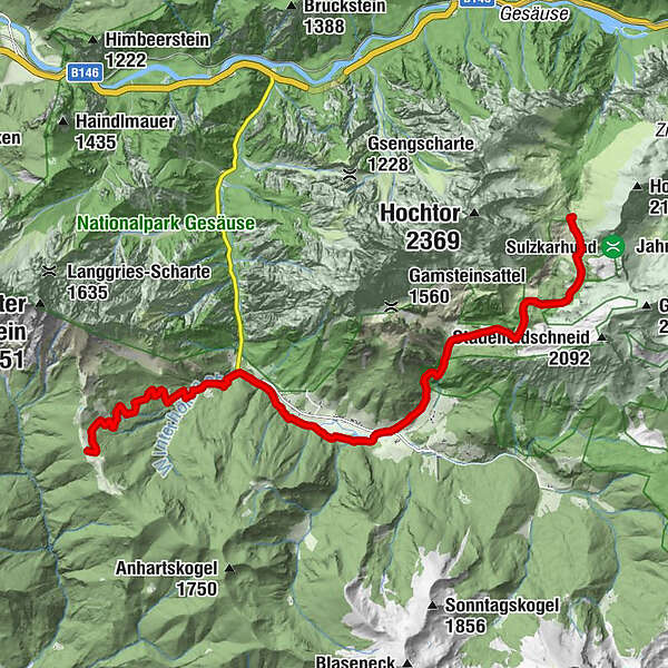
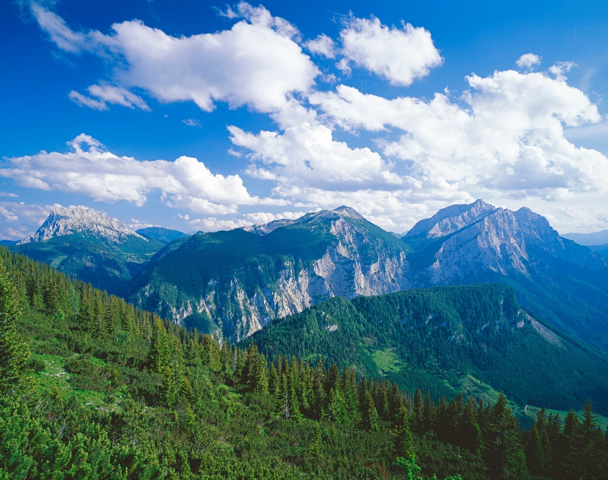
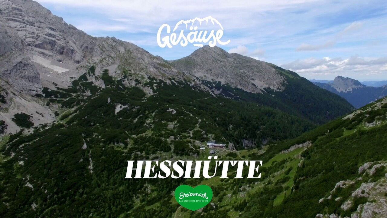
This tour takes us right through the Gesäuse, Austria's youngest national park. From the Mödlinger Hütte at the foot of the Reichenstein, the hiking trail goes via the mountaineering village of Johnsbach to the Heßhütte, probably the most important refuge in the Gesäuse due to its location. Heinrich Heß, who gave the hut its name and is regarded as the person who opened up the Gesäuse mountains, was also one of the initiators of the construction of a hut below the Hochtor peak, as at that time the rush of mountaineers, especially from Vienna, increased so enormously that the existing hay store on the nearby Stadelfeldalm was no longer sufficient as a shelter.
- Difficulty
-
medium
- Rating
-
- Starting point
-
Mödlingerhütte
- Route
-
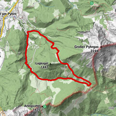
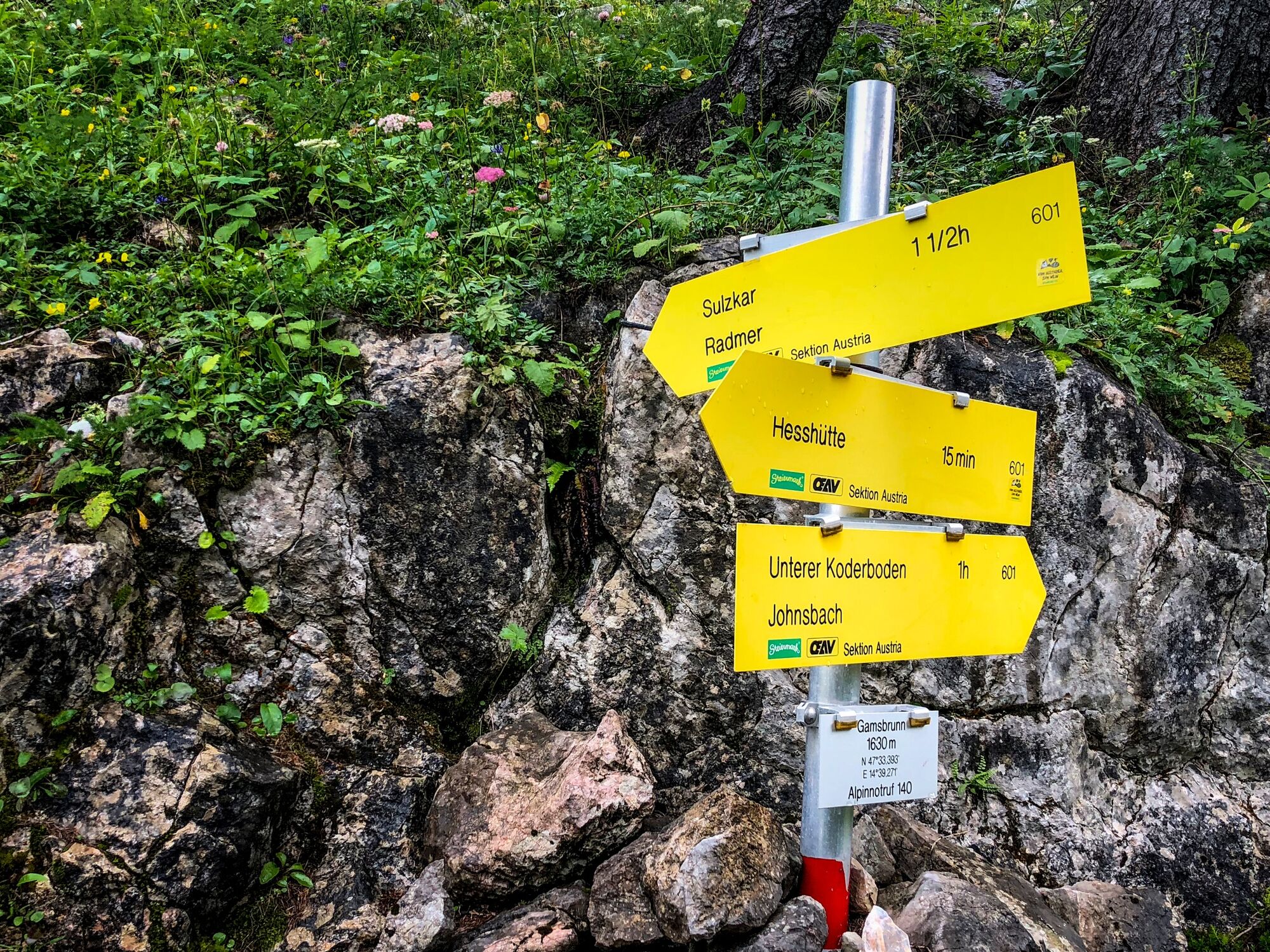
Gasthof Donner4.4 kmJohnsbach (853 m)4.4 kmKölblwirt7.2 kmWolfbauer Wasserfall8.7 kmGamsbrunnen12.6 kmHesshütte13.3 km
- Best season
-
JanFebMarAprMayJunJulAugSepOctNovDec
- Description
-
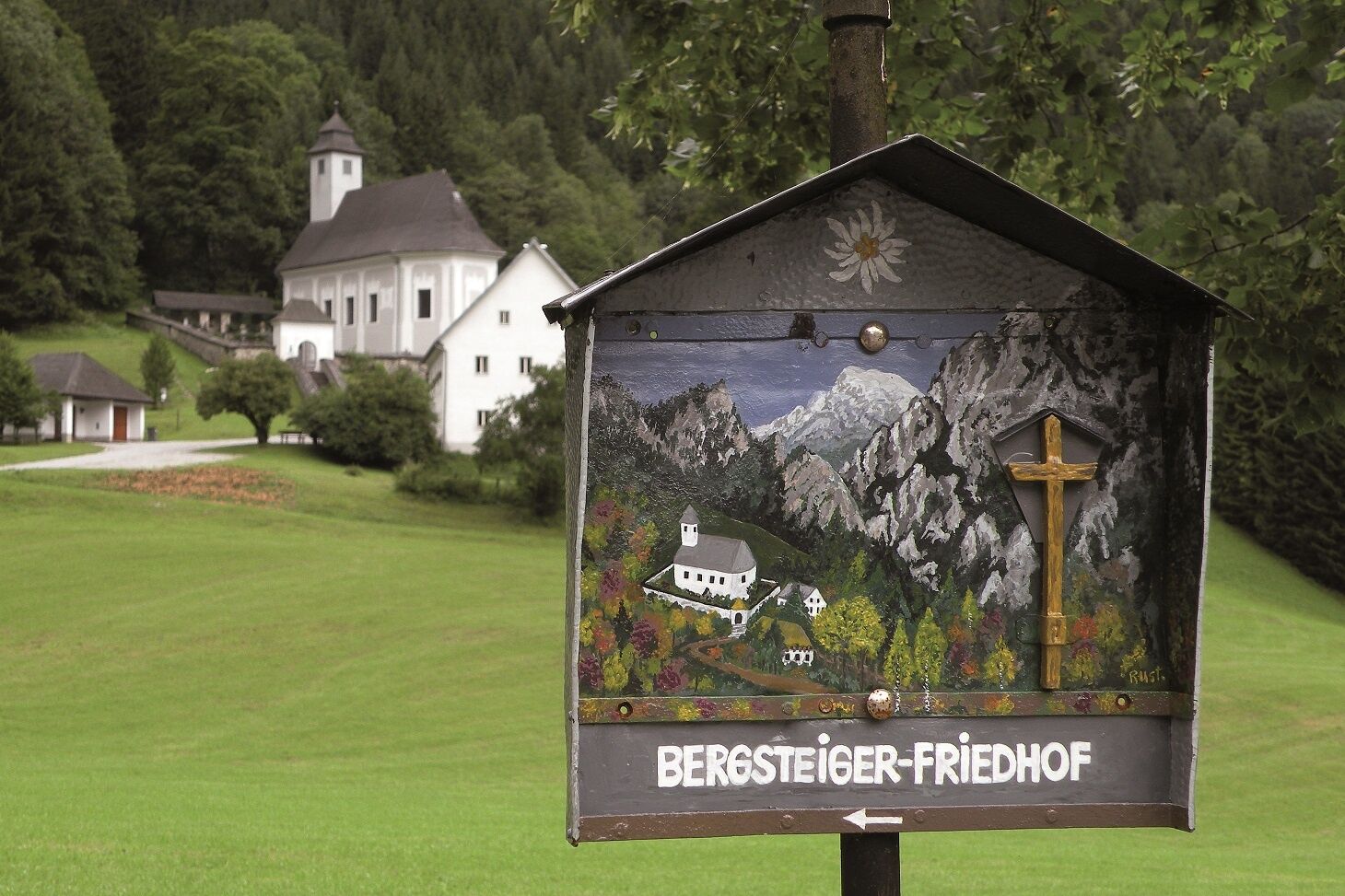
Today we start by walking through the Johnsbach valley, which lies at the foot of the south side of the Gesaeuse. In Alpine circles, the mountaineering village of Johnsbach is known not only for the uniqueness of the landscape and the range of tours, but also for a sad superlative - its mountaineering cemetery, because this mountaineering cemetery is the largest in the world. There is probably a special relationship between heaven and earth here, when you look from the cemetery over the church ridge in a line to the High Ödstein. All those people are buried here in the mountaineers' cemetery who had an accident in the Gesäuse mountains. Gravestones and grave crosses commemorate the 83 alpinists buried here. The inscriptions on the gravestones can tell some stories: of fatal weather falls, rockfalls and crashes.
- Directions
-
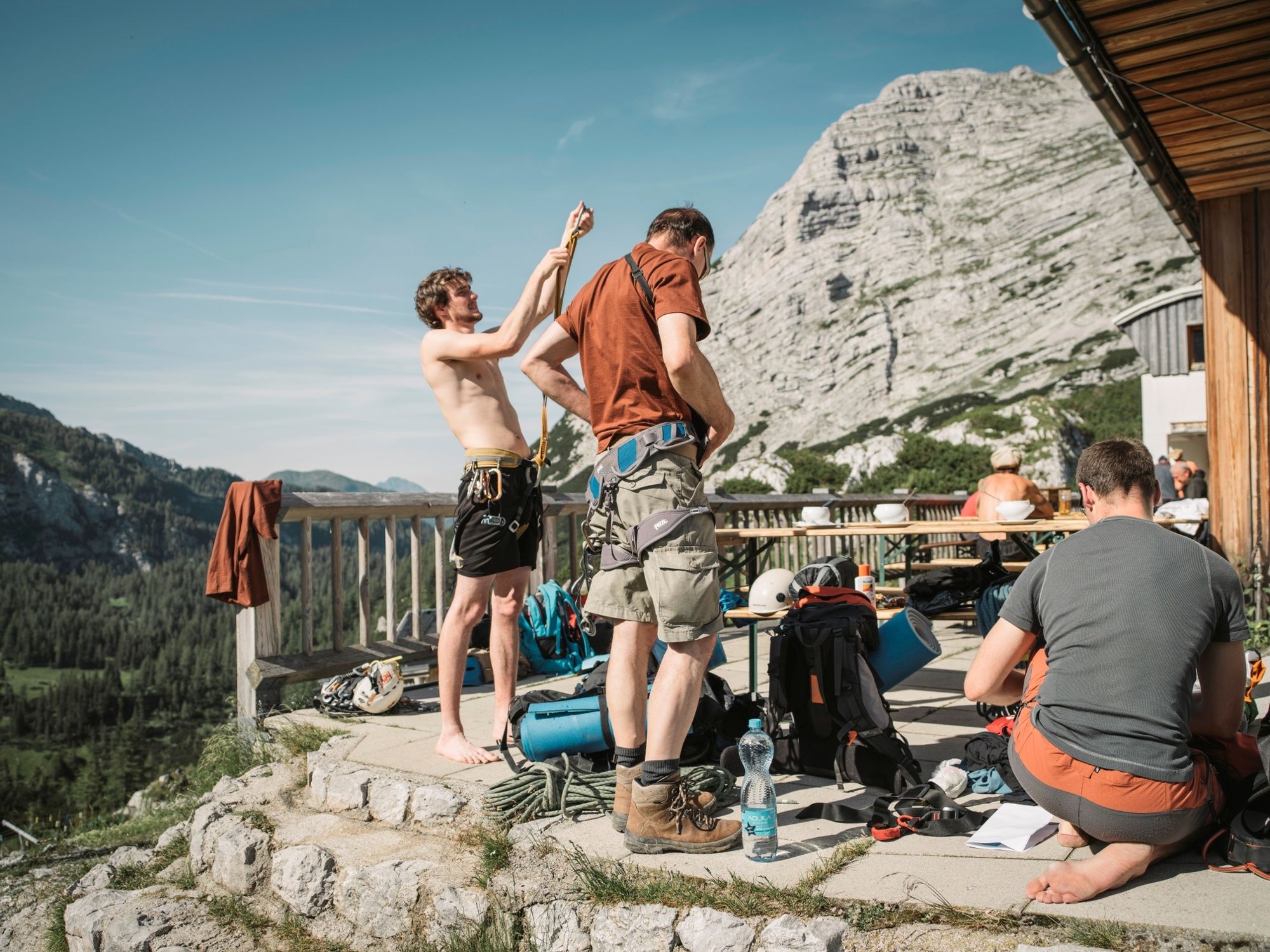
From the Mödlinger Hütte (Tel. +43 680 2057139) in the midst of the Gesäuse mountains, the trail first leads us steadily downhill in switchbacks via the Huberalm to the mountaineering village of Johnsbach (Tourist Information Tel. +43 3613 2116010). The Gesäuse, often referred to as the university of climbing, actually offers long and difficult climbing routes in mostly the best rock. Especially the south side with the center Johnsbach offers excellent rock routes. So it is not surprising that the small village has become a homey center for climbers and ski tourers.
Via the Schattseitenweg along the Johnsbach we reach the Kölblwirt (Tel. +43 3611 216), one of the most popular hiking and ski touring hosts in the Gesäuse. From here, another ascent into the Gesäuse mountains awaits us. In the face of the Hochtor group, we hike impressed by the panorama and the southern walls of the Großer Ödstein and the Hochtor past the Wolfbauern waterfall and over the Untere and Obere Koderalm to a junction at the Gamsbrunn, a spring on the western slope of the Zinödl. Today it is diverted and supplies the Heßhütte as well as the Stadelalm with the best drinking water. Here we keep to the left and after a few hundred meters we reach the Heßhütte (Tel. +43 664 4308060), our today's stage destination on the hiking route "From Glacier to Wine". The Ennseck, on which the Heßhütte stands, used to be called the Hochtor, which means "a high crossing". For centuries, cattle were driven to the high alpine pastures over this mountain pass. The Hochtor, at 2,369 m the highest peak in the Gesäuse, got its name from this passage. Before its ascent, the striking mountain massif was called Hochtorfelsen. A lot of mountain history, into which we dive even deeper on the next stage to Radmer, because here the copper mine with the smallest tunnel railroad in Austria awaits us. Alternatively, there is also an alpine variant to take to Radmer, whereby the descent into the idyllically situated village over high boulders is challenging.
- Highest point
- 1,689 m
- Endpoint
-
Heßhütte
- Height profile
-

- Equipment
-
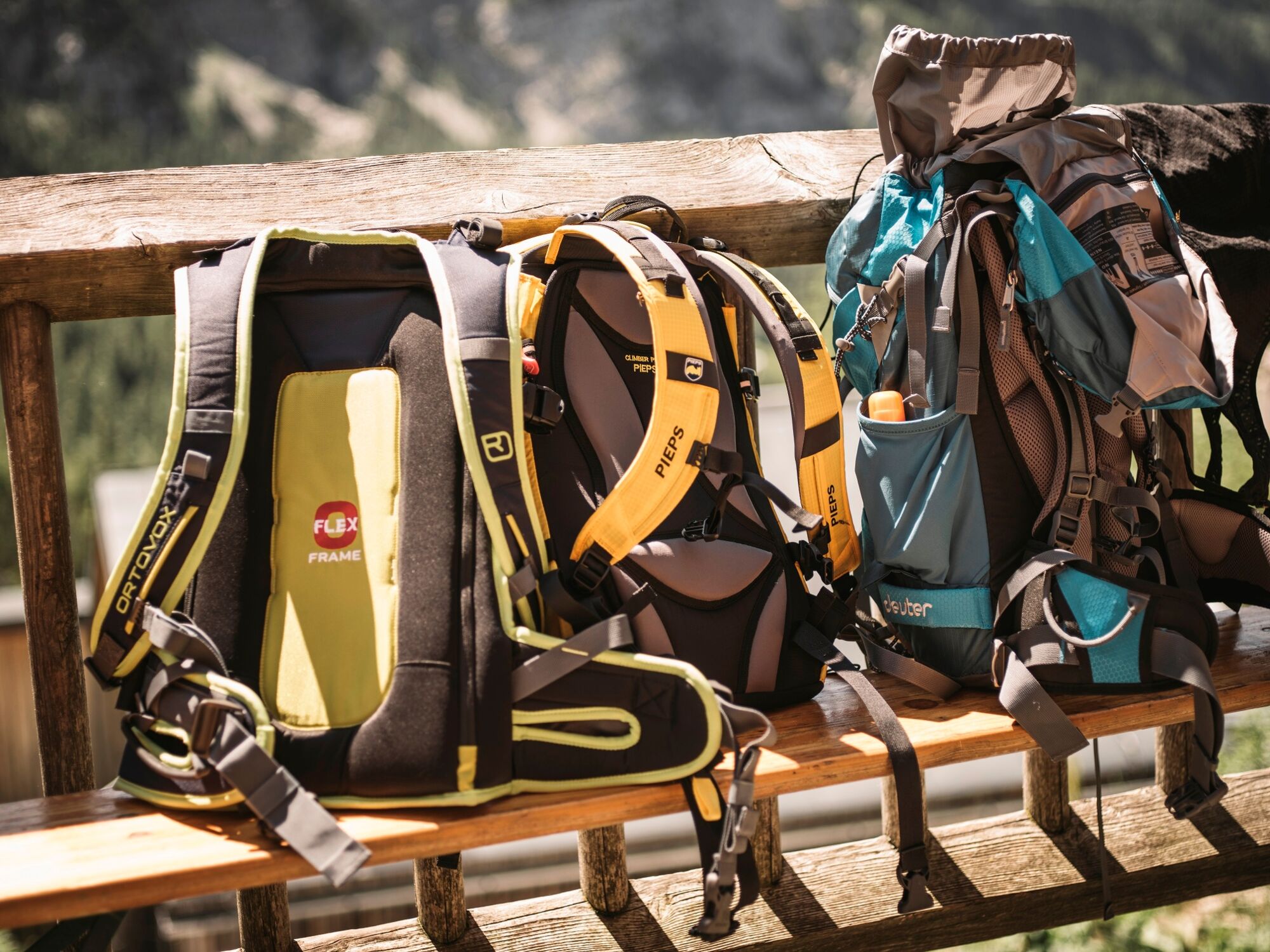
Proper backpack packing makes many things easier: Pack heavy things first. The water bottle should always be within reach in a side pocket. All the things that are often needed, such as sunglasses, camera or hiking map, belong on top. An emergency kit, including blister plasters, belongs in every rucksack and it is always advisable to dress in layers.
- Safety instructions
-
Emergency call mountain rescue: 140
Tips when reporting an emergency – Answer these six WH questions: What happened? How many people are injured? Where did the accident happen (are there GPS coordinates)? Who is reporting the incident (callback number)? When did the accident happen? What is the weather like at the site of the incident?
- Additional information
-
Steiermark Tourismus
Tel. +43 316 4003
If you would like to hire a tour operator, simply book with Steiermark Touristik, the official travel agency of Steiermark Tourismus:
Tel. +43 316 4003 450,
The Steiermark Touren app, available free of charge on Google Play and the App Store (Android, iOS), offers detailed first-hand information: brief facts (length, duration, difficulty, ascent and descent/elevation gain, ratings), map, route descriptions, altimeter, compass, peak finder, navigation along the tour. You can also create your own personal lists of favourite tours and sites, store tours and destinations offline, use social media channels, and much more.
- Public transportation
-
Accessible by train and bus.
Detailed information about arriving by ÖBB (Austrian Federal Railways) can be found at www.oebb.at or on the Verbundlinie Steiermark website www.busbahnbim.at
With Verbundlinie’s BusBahnBim route planner app, planning your journey has never been easier: simply enter towns and/or addresses, stop names or points of interest to check all bus, train and tram connections in Austria. The app is available free of charge for smartphones – on Google Play and in the App Store
- Parking
-
The Mödlingerhütte is not directly accessible by car or public transport, for more information please contact the Mödlingerhütte directly.
-

-
AuthorThe tour Stage 10 From Glacier to Wine North Route Gesäuse Mödlingerhütte - Heßhütte is used by outdooractive.com provided.