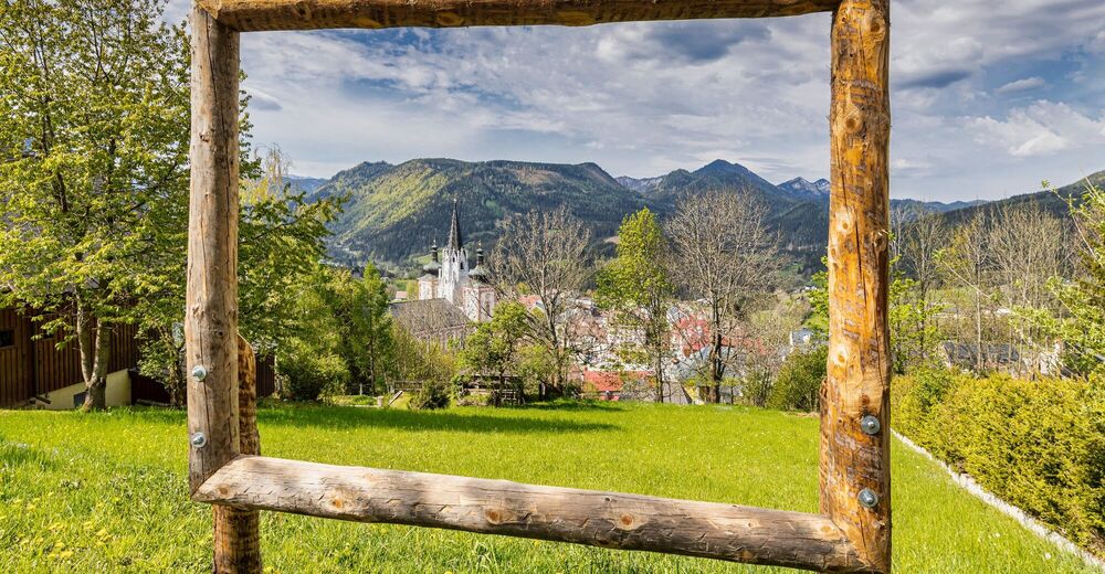


- Brief description
-
Nice walk from the main square Mariazell via Heiligen Brunn Gasse to Kalvarienberg.
- Difficulty
-
easy
- Rating
-
- Starting point
-
main square Mariazell
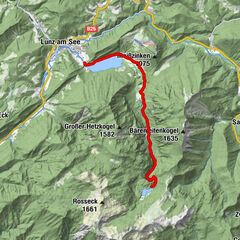
- Route
-
Mariazell0.0 km
- Best season
-
JanFebMarAprMayJunJulAugSepOctNovDec
- Description
-
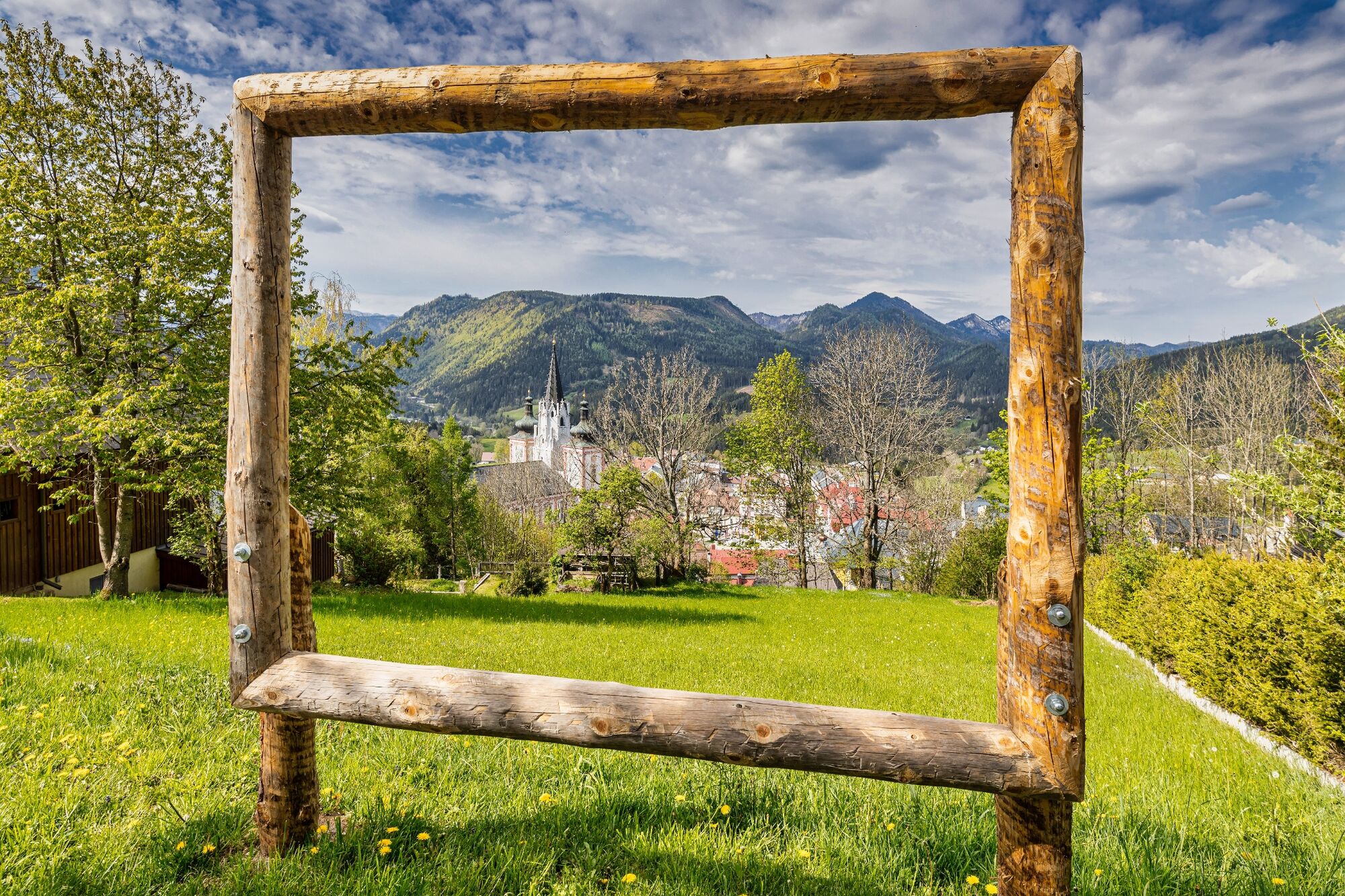
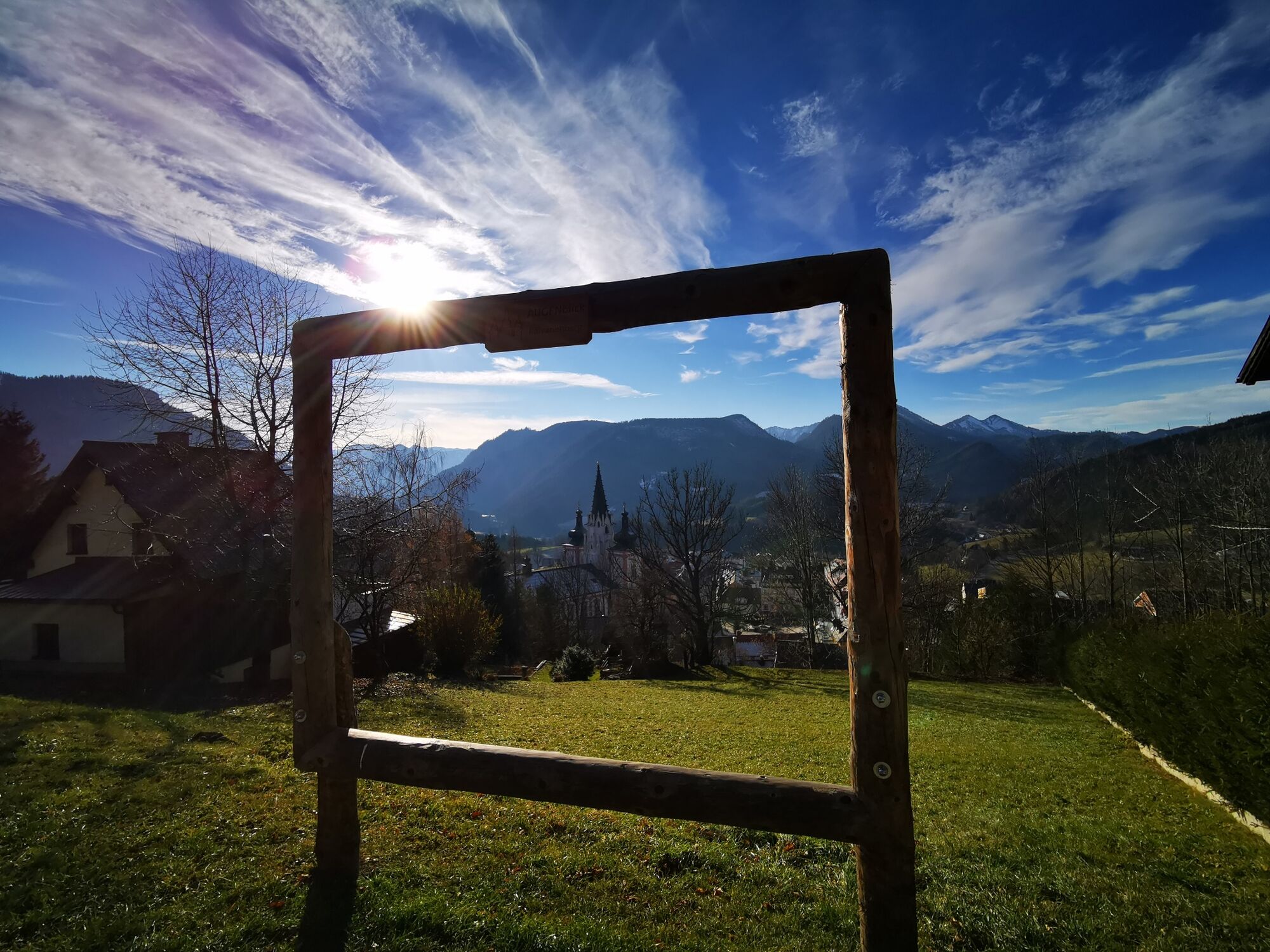
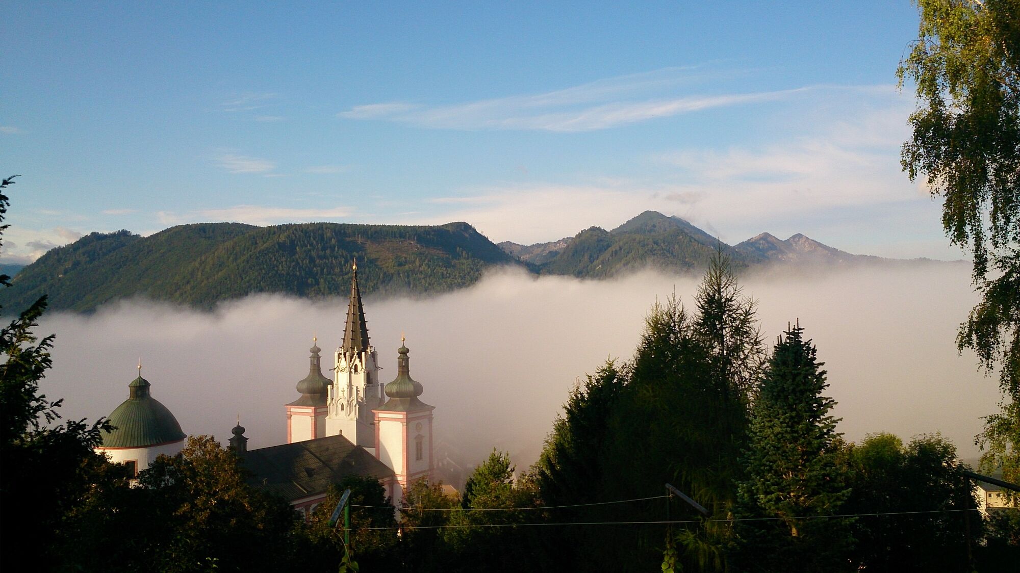
The Kalvarienberg is one of the top 10 Mariazeller AUGENblicken: Treat yourself to your personal time out and enjoy the unique panorama at the vantage points of the Mariazeller AUGENblicke. There is time to catch your breath and let your gaze wander into the distance on the panoramic spots of Mariazell.
In the summer months we can linger on one of the benches at Calvary and enjoy the view.
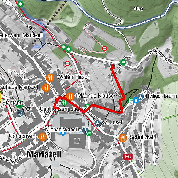
- Directions
-
From the main square of Mariazell we walk along the Heiligen-Brunn-Gasse to the beginning of the Way of the Cross.
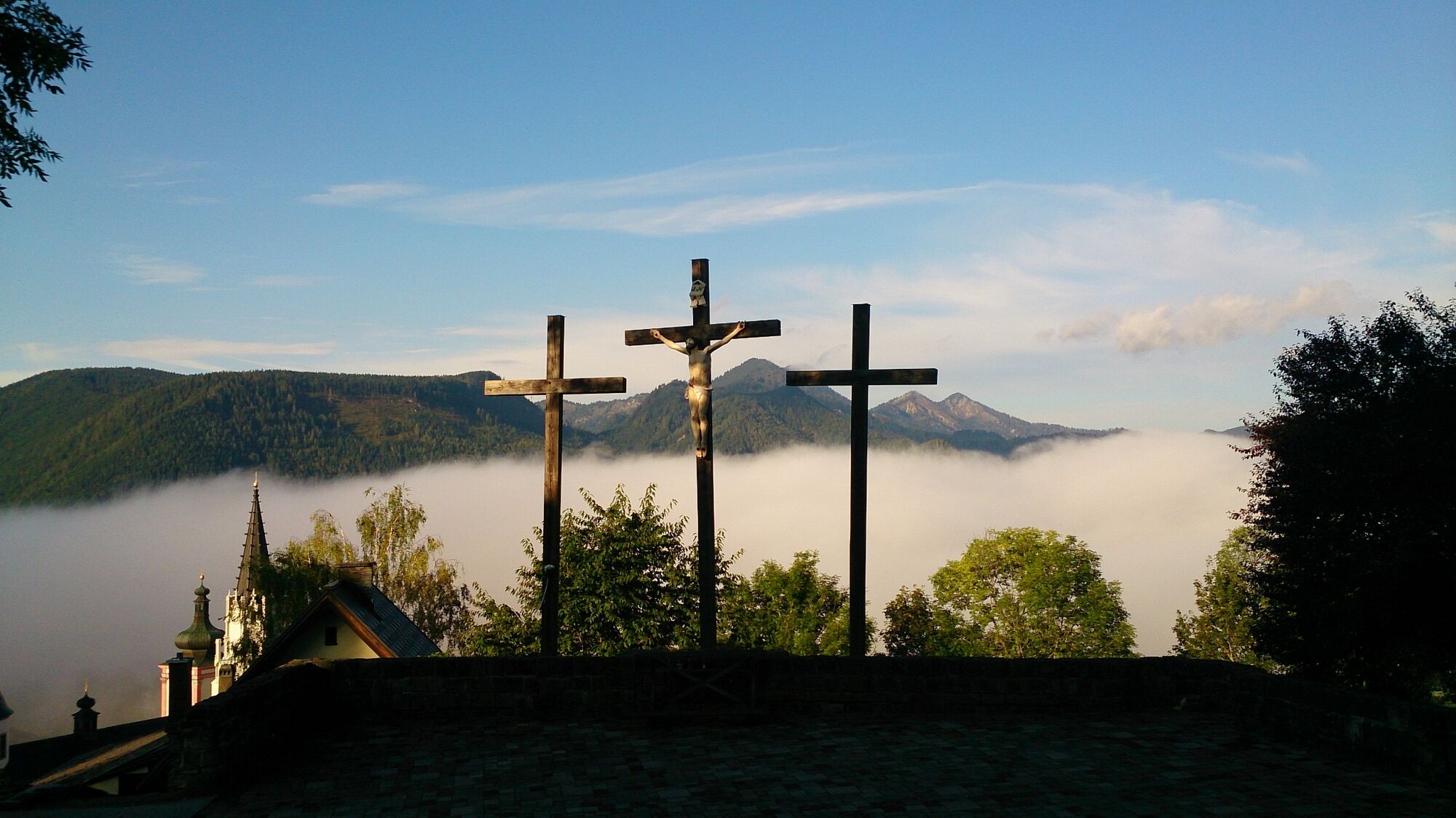
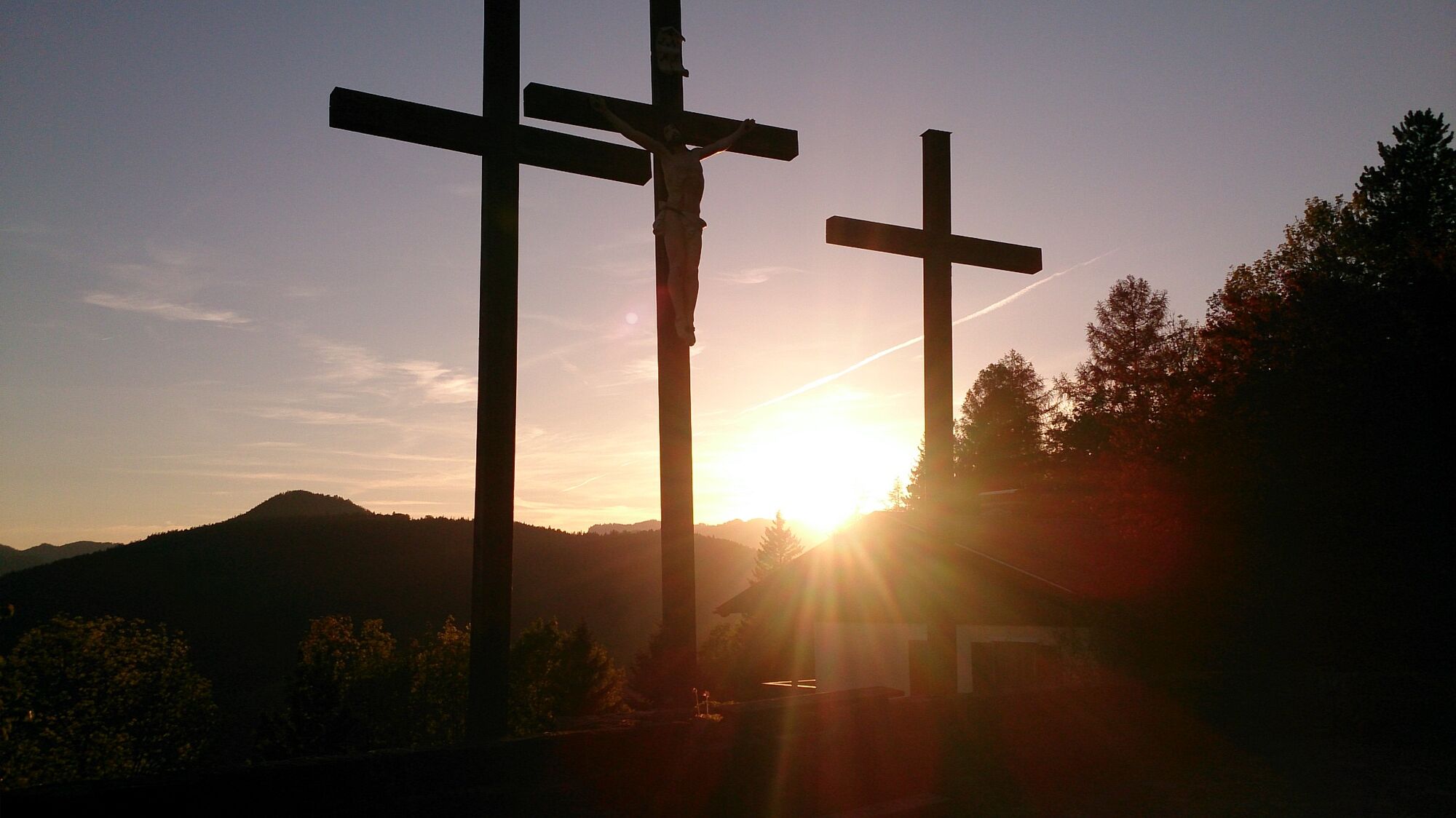
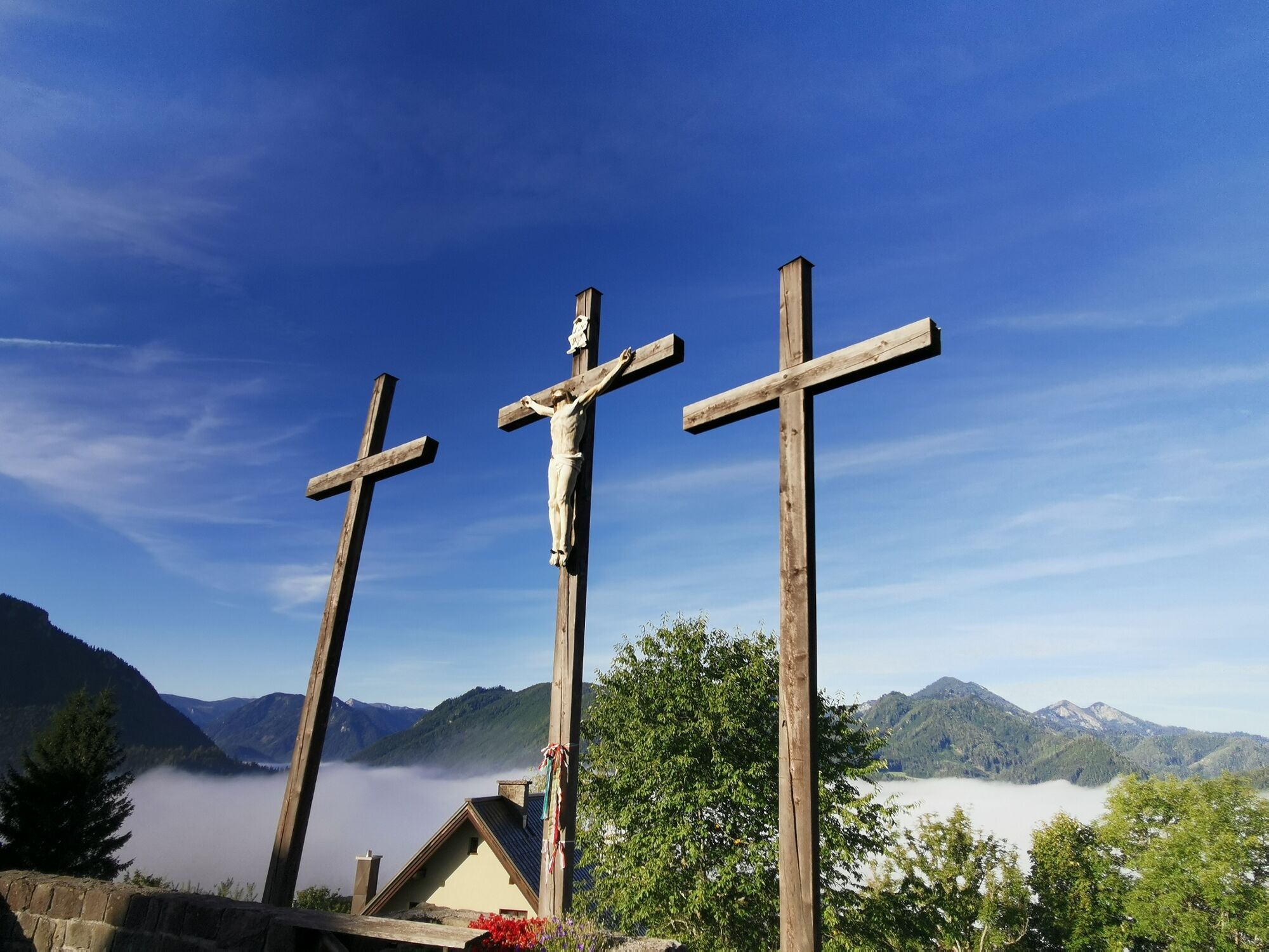
Continue along the 14 Stations of the Cross to Calvary. The fourteen Stations of the Cross on Calvary date from 1955, the ceramic reliefs were created by Anna Heck.
The cross of Calvary bears a body of cast iron, created in the former iron foundry in the neighboring Gußwerk.
- Highest point
- 930 m
- Endpoint
-
Kalvarienberg
- Height profile
-

- Equipment
-
Proper backpacking makes many things easier: pack heavy things first.
The water bottle should always be within easy reach in a side pocket. All things that are often needed, such as sunglasses, camera or hiking map, belong on top. An emergency kit including blister plaster belongs in every backpack and a clothing according to the "onion system" is always recommended!
- Safety instructions
-
No special safety instructions.
- Tips
-
TIP: Visit the Holy Brunn Chapel.
The chapel is open from 01 May to 31 October.
- Additional information
- Directions
-
Coming from Graz:
A9 Phyrnautobahn north, then S35 Brucker Schnellstraße and S6 Semmering Schnellstraße to Kapfenberg exit, then on the B20 (Mariazeller Bundesstraße) 49 km north (signpost).
Variant: S6 Semmeringschnellstraße to exit St. Marein and then over the Pogusch to Turnau and from Au on the B20 to Mariazell.
Coming from Salzburg:
Westautobahn A1 to exit Ybbs, then B25 to Scheibbs, from there two options: Either B28 via Wastl am Wald to B20, then via Annaberg and Josefsbergor B25 further to Grubberg and then B71 via the newly expanded Zellerrain.
Coming from Vienna: Take the A1 Westautobahn to the St. Pölten Süd exit, then the B20 (Mariazeller Bundesstraße) 76 km south, either via Annaberg and Josefsberg or in Freiland turn left from the B20 onto the B21 and continue via Hohenberg and St. Aegyd through the Halltal valley to Mariazell (sufficiently signposted).
Alternative: Südautobahn A2 and S6 Semmering Schnellstraße to Mürzzuschlag, then via Neuberg and Mürzsteg on the B21 to Mariazell.
- Public transportation
-
ÖBB www.oebb.at , Verbundlinie Steiermark www.busbahnbim.at , Mariazellerbahn www.mariazellerbahn.at
With the BusBahnBim app of Verbundlinie, timetable information has never been easier: all connections by bus, train and streetcar in Austria can be queried by entering locations and/or addresses, stops or important points.
The app is available as a free app for smartphones (Android, iOS) - on Google Play and in the App Store.
- Parking

- Author
-
The tour Mariazell EYE Views: Kalvarienberg is used by outdooractive.com provided.


General info
-
Mostviertel
2453
-
Mariazellerland
1504
-
Mariazell
363