- Brief description
-
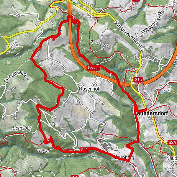
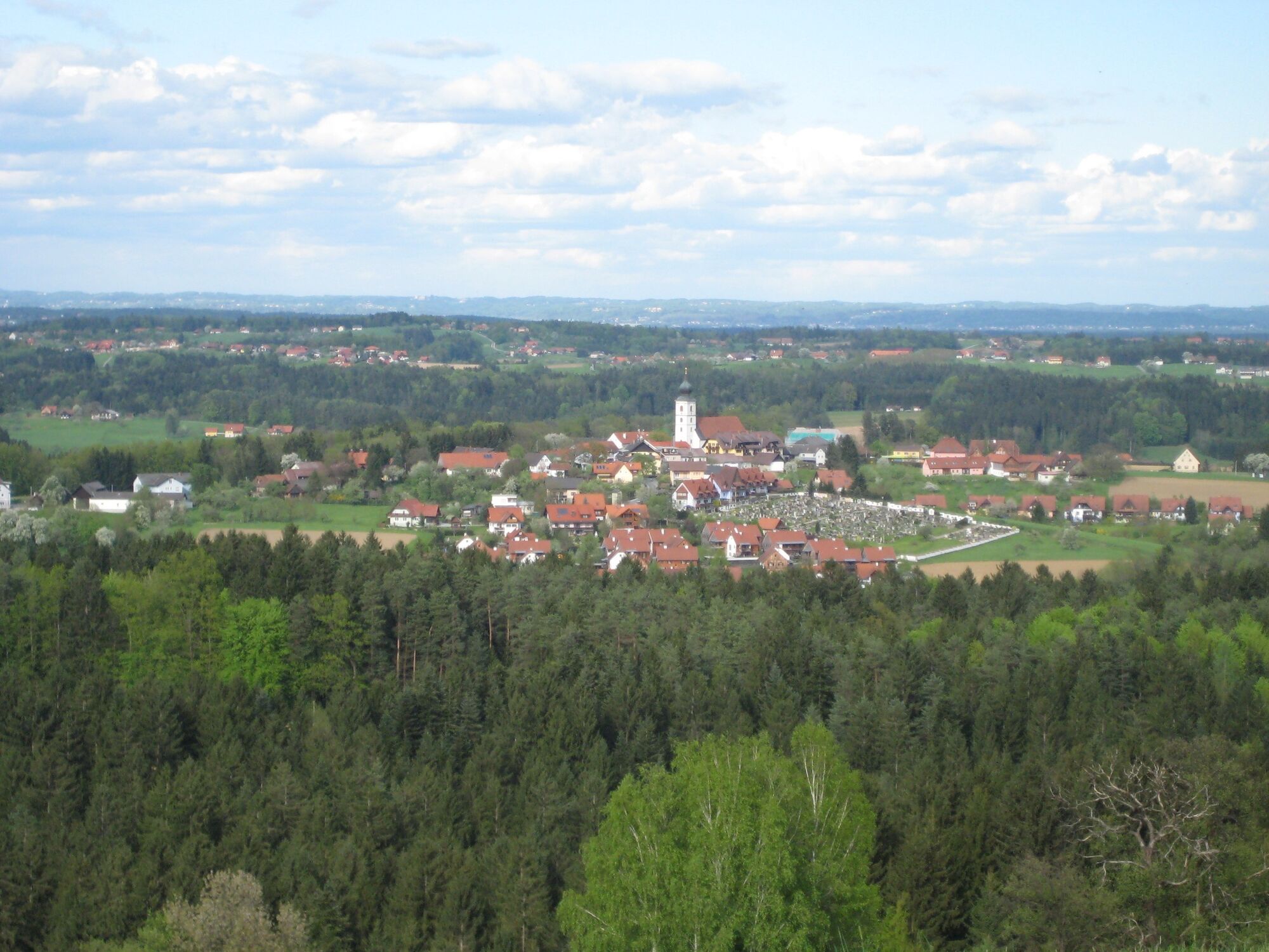
Gundersdorf - BS Ofnerpeter - BS "Grabentschank" - Grubberg - Gundersdorf: A hike back to the origin. The route not only shows you the hidden wonders of our nature, but also takes you to places that already enchanted the Celts.
- Difficulty
-
medium
- Rating
-
- Starting point
-
Gundersdorf
- Route
-
GundersdorfWeinbau & Buschenschank Ofnerpeter2.7 kmBuschenschank Christian Hackl5.2 kmGrubberg6.7 kmGundersdorf8.1 km
- Best season
-
JanFebMarAprMayJunJulAugSepOctNovDec
- Description
-
Raccoons in Western Styria? On this hike you can visit the cute contemporaries at the Buschenschank Ofnerpeter. But first you will walk through a romantic landscape of caves. Especially on hot summer days, you can cool off wonderfully there.
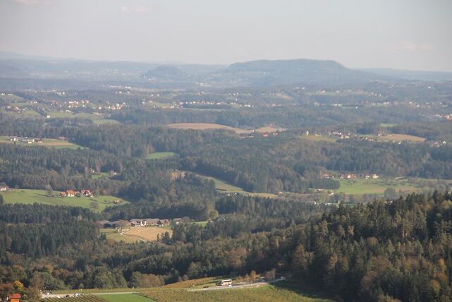
At the highest point of the trail, there is a wonderful opportunity to enjoy the view as far as eastern Styria. On clear days, the view here reaches as far as Riegersburg Castle, which is enthroned on a volcanic rock.
Besides the cute raccoons, an unexpected speciality awaits you. The Celtic tree circle is a magical place that can give new energy. The connection between date of birth, to which a certain tree is assigned, and character is based on ancient Celtic lore.
Numerous traditional wine taverns and inns await you, where they are just waiting to spoil you with Styrian delicacies and a glass of wine. So there are plenty of moments of enjoyment to be had.
- Directions
-
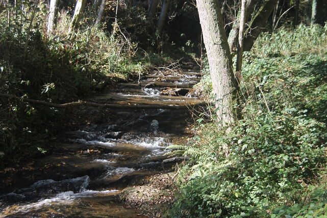
In the small village of Gundersdorf you start a hike that takes you back to the source. A good opportunity to use the path to also find yourself a little. A real highlight awaits you right at the beginning. You hike down into the romantic gorge in the Zachgraben. Enjoy the sound of the water and let nature take its effect on you. On hot summer days you will find welcome cooling here.
After a while, the path begins to climb. The effort truly pays off as you soon reach the Buschenschank Ofnerpeter. In addition to the excellent wine and the rustic snack that leaves nothing to be desired, you should definitely pay a visit to the cute raccoons. The funny fellows are an unexpected experience, especially for children, because they put a smile on every visitor's face.
Continue on to the highest point of the trail at 665 metres above sea level. Here you have a wonderful opportunity to enjoy the view of the Graz basin as far as eastern Styria. On clear days, the view here reaches as far as Riegersburg Castle.
Once you have had your fill, stroll along the path in good spirits. Soon you will reach the next leading culinary establishment. The quietly located Buschenschank Grabentschank. Here you should definitely choose something from the rich selection of desserts. Of course, you should not miss a schnapps to say goodbye.
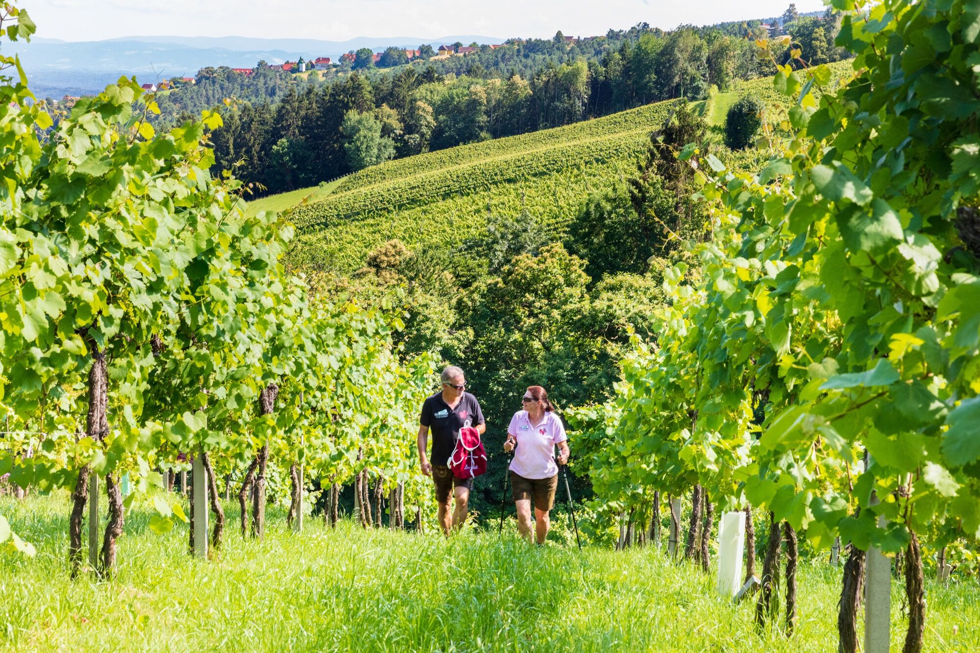
Freshly fortified, the path then leads you through a beautifully tended vineyard and refreshingly shady forest paths downhill to Grubberg. Here you can visit the newly restored Schneider Chapel before returning to the Zachgraben.
After you have hiked through the gorge again, you come to the tip of this tour. The Celtic Tree Circle is a special place where you should definitely pause and let the energy of the trees take effect on you. Each tree is assigned a date of birth. The arrangement is based on ancient Celtic lore. Take a deep breath and simply enjoy the moment at this special place of power.
The eight-kilometre circular trail slowly closes, as you will soon reach Gundersdorf again, where you started. Here you can once again enjoy the full range of culinary delights, as the Buschenschank Machater, the Gasthof Buschenschank Windisch, the Weinhof Florlwirt, and the wine & gourmet shop Kleindienst await you with all the delicacies that Western Styria has to offer. And one thing you can believe, there is plenty before you in both liquid and solid form. A pumpkin dish in autumn or a light fish from local waters round off the hiking day ideally.
- Highest point
- 661 m
- Endpoint
-
Gundersdorf
- Height profile
-

- Equipment
-
Proper backpack packing makes many things easier: Pack heavy things first. The water bottle should always be within easy reach in a side pocket. All things that are often needed, such as sunglasses, camera or hiking map, belong on top. An emergency kit including blister plasters belongs in every rucksack and it is always advisable to dress according to the "onion system"!
- Safety instructions
-
Pleasant summer hiking trail. Sturdy and comfortable footwear required (e.g. gym or hiking shoes). In winter only accessible in good weather. Walk at your own risk!
Rescue: 144
Tip for reporting an emergency - give answers to the six W-questions: What happened? How many injured? Where did the accident happen (possibly GPS coordinates)? Who reported the accident (call-back number)? When did the accident happen? Weather at the accident site?
- Tips
-
Celtic Tree Circle: The connection between date of birth, to which a certain tree is assigned, and character is based on ancient Celtic lore.
- Additional information
- Directions
-
Plan your journey via Google Maps to the starting point of the tour: www.google.at/maps
From the north: Motorway Munich - Salzburg - Eben - Schladming - Liezen onto the A9 towards Graz. Exit at Lieboch and follow the B76 towards Deutschlandsberg/Stainz. A9 is subject to toll - Gleinalmtunnel. Alternative: At St. Michael take the S6 towards Bruck and in Bruck take the S35 towards Graz. On the B76 in Schlieb turn right to St. Stefan ob Stainz until the next crossroads, here turn left through the village centre and continue following the signs to "Autobahn". The road leads directly to Gundersdorf.
From the west: In Villach, take the A2 in the direction of Klagenfurt. Take the Steinberg exit and continue in the direction of Stainz. After a short while you will come directly to Gundersdorf.
From the east: A2: Vienna - Aspang - Hartberg - Fürstenfeld - Graz. From Graz continue on the A2 in the direction of Klagenfurt and take the Lieboch exit in the direction of Stainz/Deutschlandsberg/Eibiswald. Follow the B76 to Deutschlandsberg/Stainz. On the B76 in Schlieb turn right to St. Stefan ob Stainz until the next crossroads, here turn left through the village centre and continue following the signs to "Autobahn". The road leads directly to Gundersdorf.
From the south: A 1 from Marburg as far as Leibnitz. Exit in Leibnitz (Gralla) and continue on the B74 in the direction of Deutschlandsberg, take the second exit at the roundabout in Preding, after approx. 2km turn right onto the L617 in the direction of Stainz. In Stainz, drive through the town centre in the direction of Graz, and at the Spar-Markt crossroads turn left into St. Stefan. In the village of St. Stefan, follow the priority road by the church in the 30 km zone, through the village centre and continue following the signs for "Autobahn". The road leads directly to Gundersdorf.
- Public transportation
-
You can find timetables and travel information directly at
With the BusBahnBim app of the Verbundlinie, timetable information is easier than ever: all connections by bus, train and tram in Austria can be retrieved by entering places and/or addresses, stops or important points. The app is available as a free app for smartphones (Android, iOS) - on Google Play and in the App Store.
- Parking
-
In the centre of Gundersdorf.


-

-
AuthorThe tour Genuss-Schilchern DA is used by outdooractive.com provided.


General info
-
Erlebnisregion Graz
2782
-
Schilcherland Steiermark
1099
-
St. Stefan ob Stainz
297