Planai high trail to Planai | Stage 05 for passionate hikers of Schladminger Tauern Trail


- Brief description
-
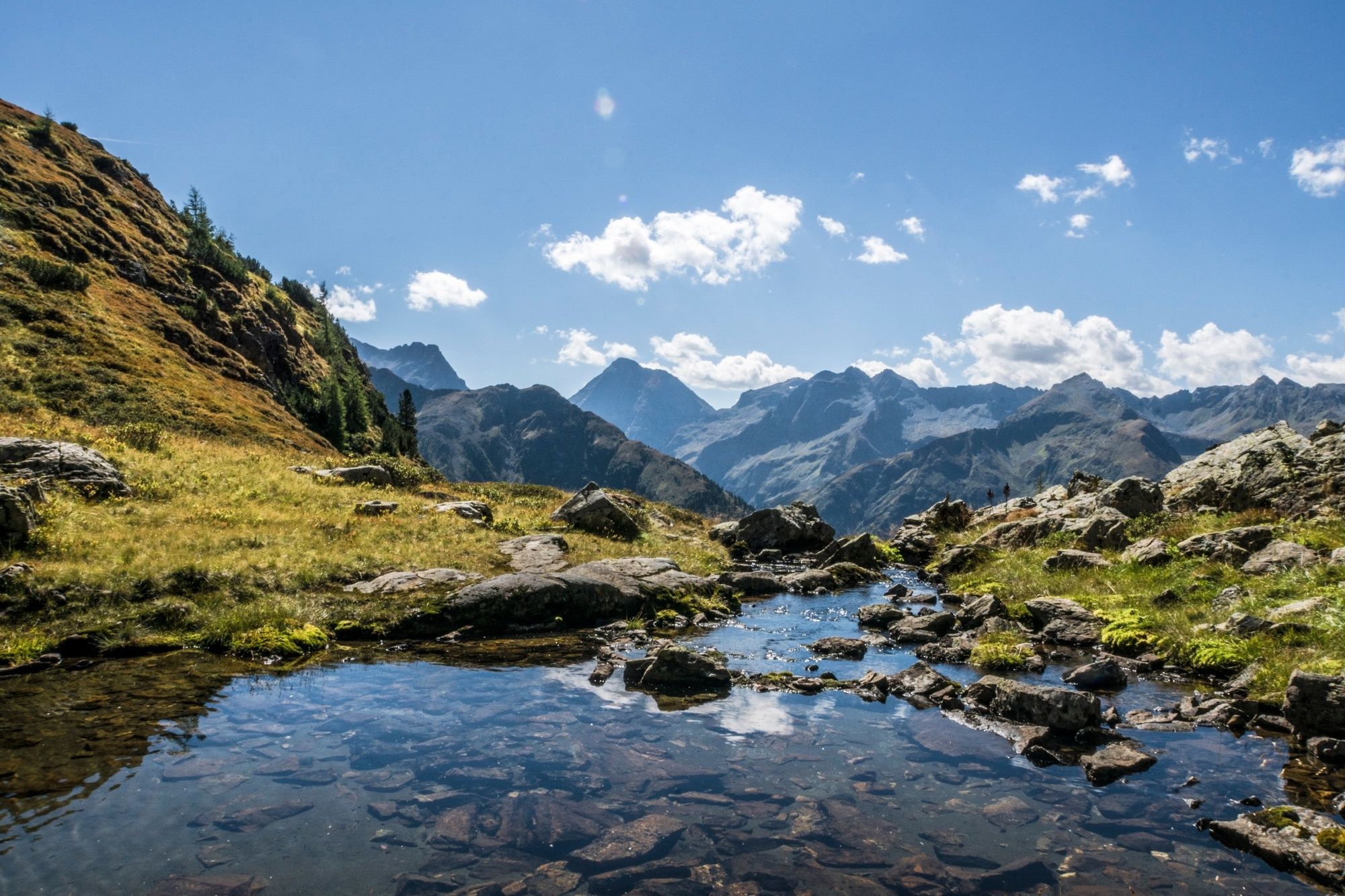
The Planai high trail from Preintalerhütte to Planai offers impressive views to the highest summits of the Schladminger Tauern range, Lake Riesachsee and the Untertal valley.
- Difficulty
-
difficult
- Rating
-
- Starting point
-
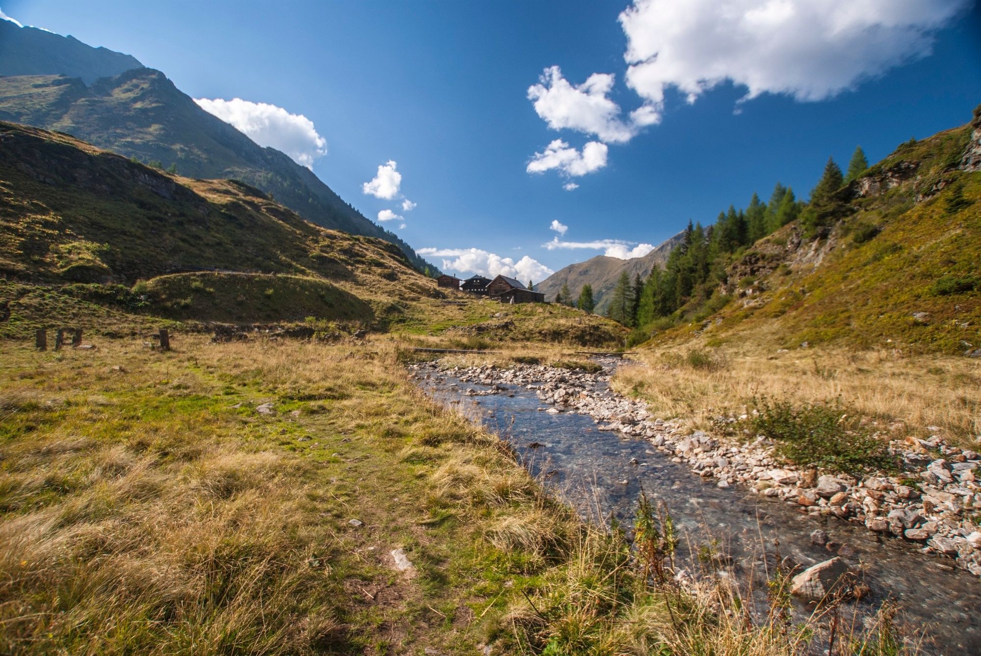
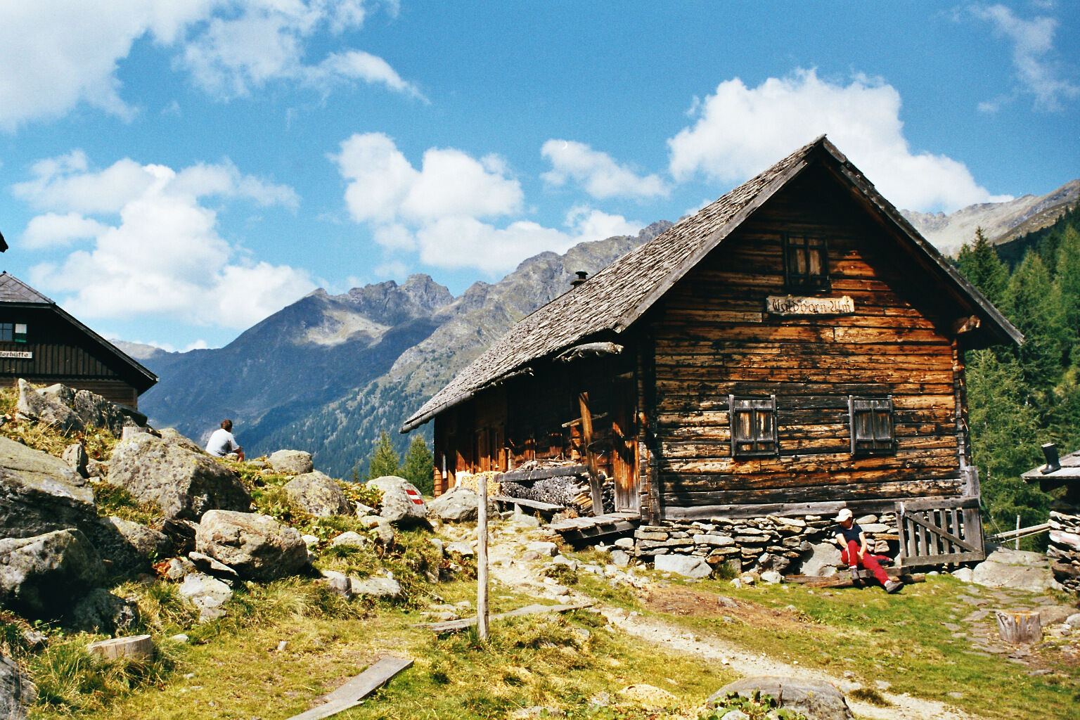
Preintalerhütte
- Route
-
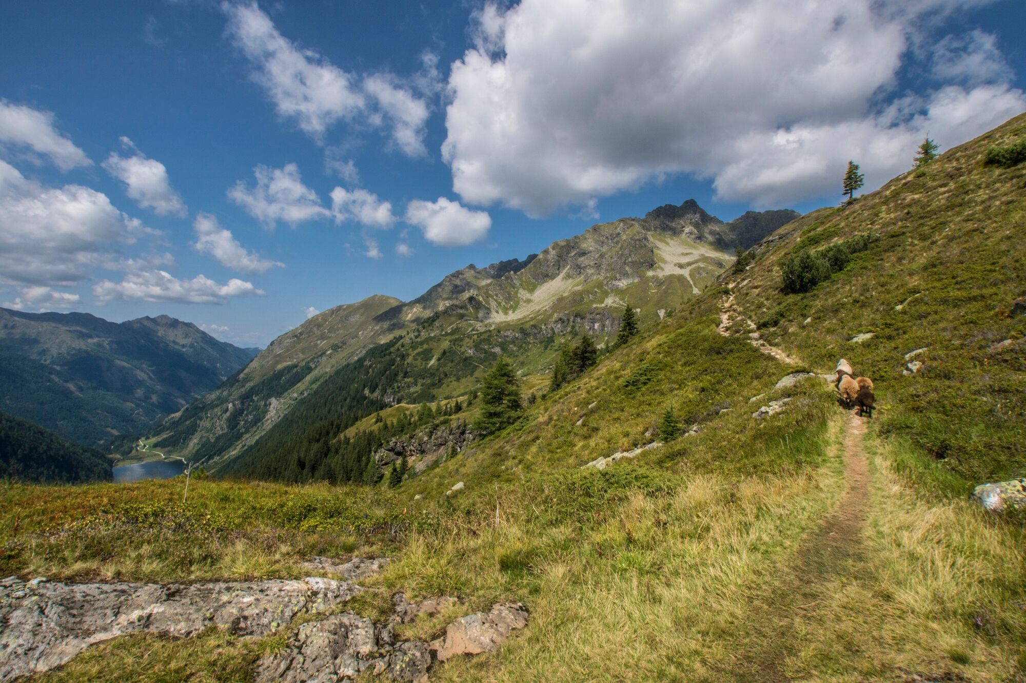
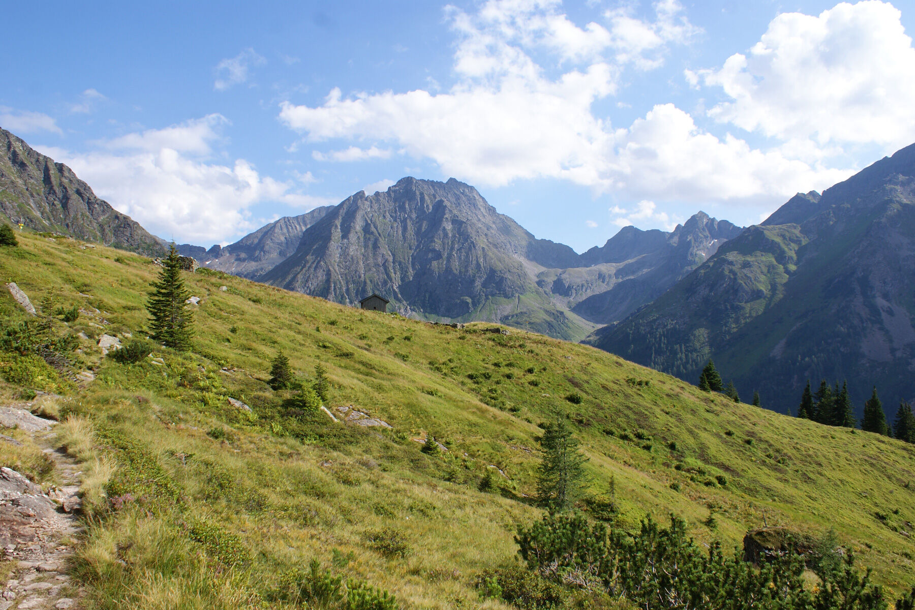
Preintalerhütte (1,657 m)0.0 kmWaldhornalm0.1 kmNeualm2.9 kmHasenkarscharte (2,207 m)6.5 kmTiefentalscharte (2,131 m)7.4 kmSeerieszinken (2,221 m)9.4 kmLärnachscharte (2,057 m)9.7 kmda Sepp11.6 kmKrahbergsattel (1,833 m)11.8 kmPlanai (1,906 m)12.3 km
- Best season
-
JanFebMarAprMayJunJulAugSepOctNovDec
- Description
-
The Planai high trail is an alternative stage 5 for the 5 days tour of the Schladminger Tauern High Trail. It is aimed at experienced hikers.
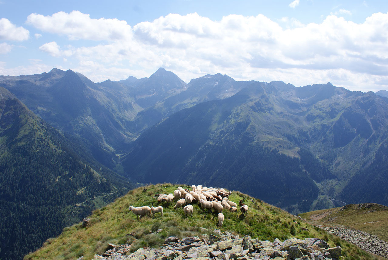
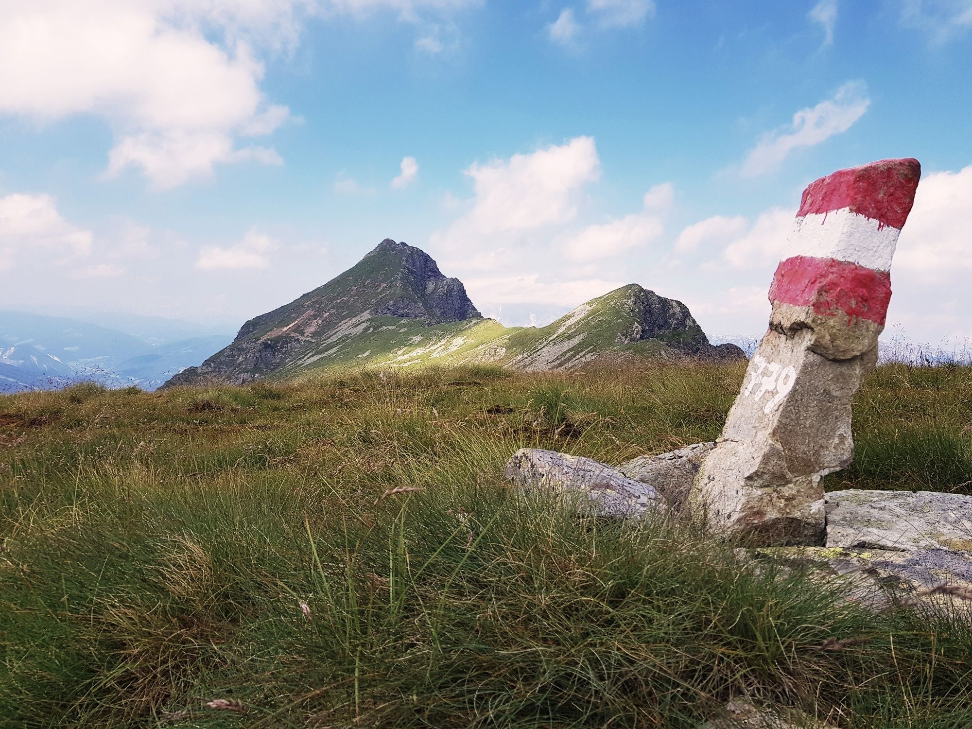
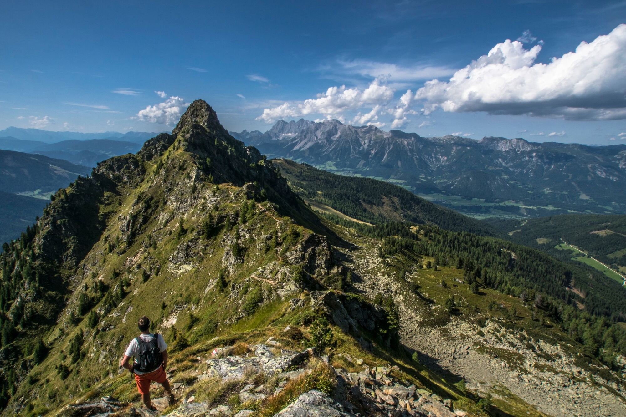
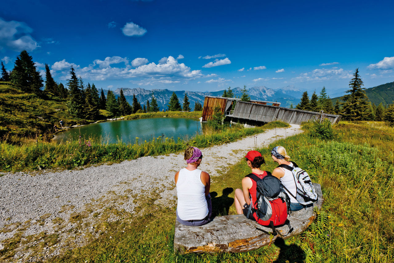
Planai High Trail is a route in high alpine terrain on narrow paths and mostly leading you through rugged and exposed terrain. Between the starting point at Preintalerhütte and Waldhornalm chalets and the endpoint at Schladminger Hütte Planai there are no refreshment stops, so make sure to take along enough drinks and a snack. Along the way, a variety of scenic terrain is waiting to be discovered by you: the scenic alp of Neualm, the headwater area of Kaltenbach or the Hasenkarspitze ridge, which offers great views to Riesachtal and Steinriesental valleys. The last third of the route takes you over the summit of Seerieszinken, from where you enjoy a great view across Krahbergzinken and Planai summits towards the Dachstein massif. This tour is suitable for hikers aged 15 years and older.
- Directions
-
The 5. stage of the tour is an alternative to the classic Schladminger Tauern High Trail. Start for this tour is Preintalerhütte, where you cross the creek and follow Höfertsteig (trail n° 782) towards Neualmscharte and Planai. At the trail junction with n° 781 you make a left and follow n° 781 towards Neualm. Passing Neualm you walk through fields of dwarf pines and continue towards Kaltenbach through steeper terrain. From Kaltenbach you continue to Planai on trail n° 779. You pass by under the summit of Ulmspitze and follow the trail over sparsely vegetated mountain slopes to Hasenkarspitze, from where you enjoy a marvellous view to Hochgolling - the hightest mountain of the Schladminger Tauern mountain range. Passing by the summits of Sonntagerhöhe, Seerieszinken and Krahbergzinken you head towards the famous skiing mountain Planai. At Krahbergsattel you can choose whether to circle the summit of Planai on the panorama trail or if you take the summit of Planai too (only 10 minutes longer).
Descent to the valley:
After 5 challenging days in the mountain we recommend to descent via Planai gondola (open until 5 pm). If you're still fit enough you can also descend on foot via trail n° 779 or n° 55 (an additional 1,000 meters of altitude in descent - 1.5 to 2 hours).
Alternative tour:
As an alternative, much easier tour for the 5th day we recommend the descent to Seeleiten car park in Untertal (about 2.5 hours). From Preintalerhütte you descend via Kotalm to Lake Riesachsee and from there to the car parking at the valley head of Untertal. From there you can take the hiking bus of Planai-Hochwurzen back to Rohrmoos and Schladming.
Bus schedule: www.planaibus.at
- Highest point
- 2,227 m
- Endpoint
-
Planai
- Height profile
-

- Equipment
-
A well-packed backpack is helpful and especially when touring Alpine terrain a tuque, gloves, a windproof jacket and pants are standard equipment. Good, waterproof shoes, sun glasses, sun cream and sufficient beverages are essential too. Torch light, a map of the area, knie and a small first-aid kit should also be in the backpack.
- Safety instructions
-
Changes in weather patterns, quick falls in temperature, thunderstorms, wind, fog and snow are some of the dangers that can be encountered on a hiking tour. Hosts of alpine huts and mountain refuges have a lot of experience in the mountains and can give good advice about weather and the trails. Poor equipment, overestimation of one's own capabilities, carelessness, poor personal constitution and/or wrong judgement can lead to critical situations. In case of thunderstorms: avoid summits, ridges and steel ropes. This tour is suitable for hikers aged 15 years and older.
GPS data and orienteering
Available GPS data - just like hiking maps - is only a guidance for orientation and can never depict a trail exactly with all its details. Especially at dangerous spots it is essential to judge on site how to proceed.
In an emergency please call:
140 - for Alpine emergencies (all over Austria) 112 - European GSM emergency number - Tips
-
Very ambitous, fit and surefooted hikers can add a summit tour to Höchstein (an additional 2 hours). For this you continue on trail n° 781 at Kaltenbach to Höchstein and hike back to Planai High Trail via trail n° 779a.
- Additional information
-
General tourism information: www.schladming.com
Info about buses and ski lifts: www.planai.at
360° drone images
Get yourself an overview with our 360° drone images:
To Planai via Höfertsteig trail: https://vonoben.schladming-dachstein.at/sommer/index.php?S=317 View over Riesachsee Lake: https://vonoben.schladming-dachstein.at/sommer/index.php?S=318 The trail near Rabenköpfl: https://vonoben.schladming-dachstein.at/sommer/index.php?S=327 The trail between Seerieszinken and Krahbergzinken: https://vonoben.schladming-dachstein.at/sommer/index.php?S=328 - Directions
-
We recommend the ascent to Gipfelbahn Hochwurzen via Planai-Hochwurzen hiking bus. Alternatively you can reach the starting point of the 5-day-tour with your car.
1. stage: Hochwurzen High trail to Giglachseen Lakes
2. stage: Via Rotmandlspitze to Keinprechthütte
- Public transportation


-

-
AuthorThe tour Planai high trail to Planai | Stage 05 for passionate hikers of Schladminger Tauern Trail is used by outdooractive.com provided.


General info
-
Schladming - Dachstein
3002
-
Schladming - Rohrmoos
1481
-
Haus im Ennstal
372


