Winter
Summer
Weather
Webcams
Accommodations
Tours
Search history
Search suggestions
No results found
Search
Tours
Home
Summer Österreich
Styria
Tours
Thalerkogel
Regions
Weather
Webcams
Tours
Highlights
Bathing lakes
Accommodations
Offers
Sports provider
Events
Ski resorts
Cross-country skiing
Snow parks
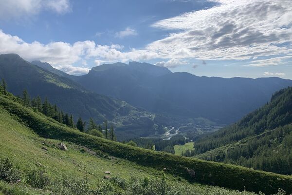
Thalerkogel
Hiking
Bookmark
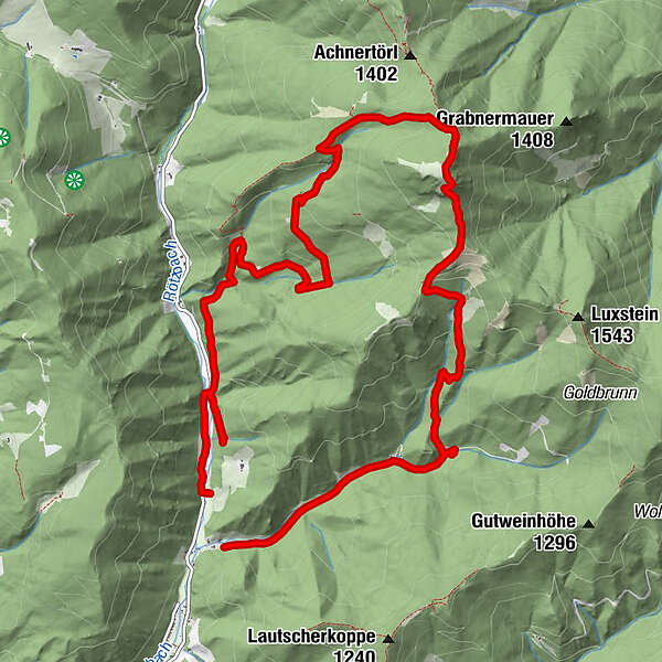
Map
show
hide
Print
Tour data
13.22
km
747 - 1,655
m
Distance
989
hm
991
hm
Ascent
03:50
h
Duration
Hannes Haberl
created am 19.04.2020
7,019
Views
Route
Treffning
hamlet
2.0 km
Thalerkogel
(1,656 m)
peak
5.5 km
Highest point
1,655 m
2,5
Write a review
Overall rating
5
0
%
4
50
%
3
0
%
2
0
%
1
50
%
Reviews
2,5
(2)
0 Comments
Write a review
Error
An error has occurred. Please try again.
Thank you for your review
Rating has been deleted
Report tour
GPS Downloads
GPX
GPS Exchange Format (XML)
KML
Google Earth, Google Maps
QR Download Codes for Mobile Phones
Thalerkogel
QR Codes - tour download for cell phones
GPX
KML
Other tours in the regions
Erzberg Leoben
2527
Hochschwab
1271
Vordernberg
405
Popular tours in the area
Kaiserschild 2.084m, Kaiserwart 2.033m & Hochkogel 2.105m
medium
Hiking
12.6
km |
1363
hm |
06:30
h
Trofaiach: Gößeck
medium
Hiking
11.6
km |
1282
hm |
06:00
h
Hochschwab
difficult
Hiking
20.4
km |
1600
hm |
08:30
h
Eisenerzer Reichenstein
medium
Hiking
8.94
km |
919
hm |
03:26
h
No entries found.
The search is currently not available.
Please refine your search.
Local search results
(<= 25km)
More results
(> 25km)
%count% Search results
%name%
%type%
%elevation%
%population%
%lpButton%


 & Kaiserschild (rechts)")