
- Brief description
-
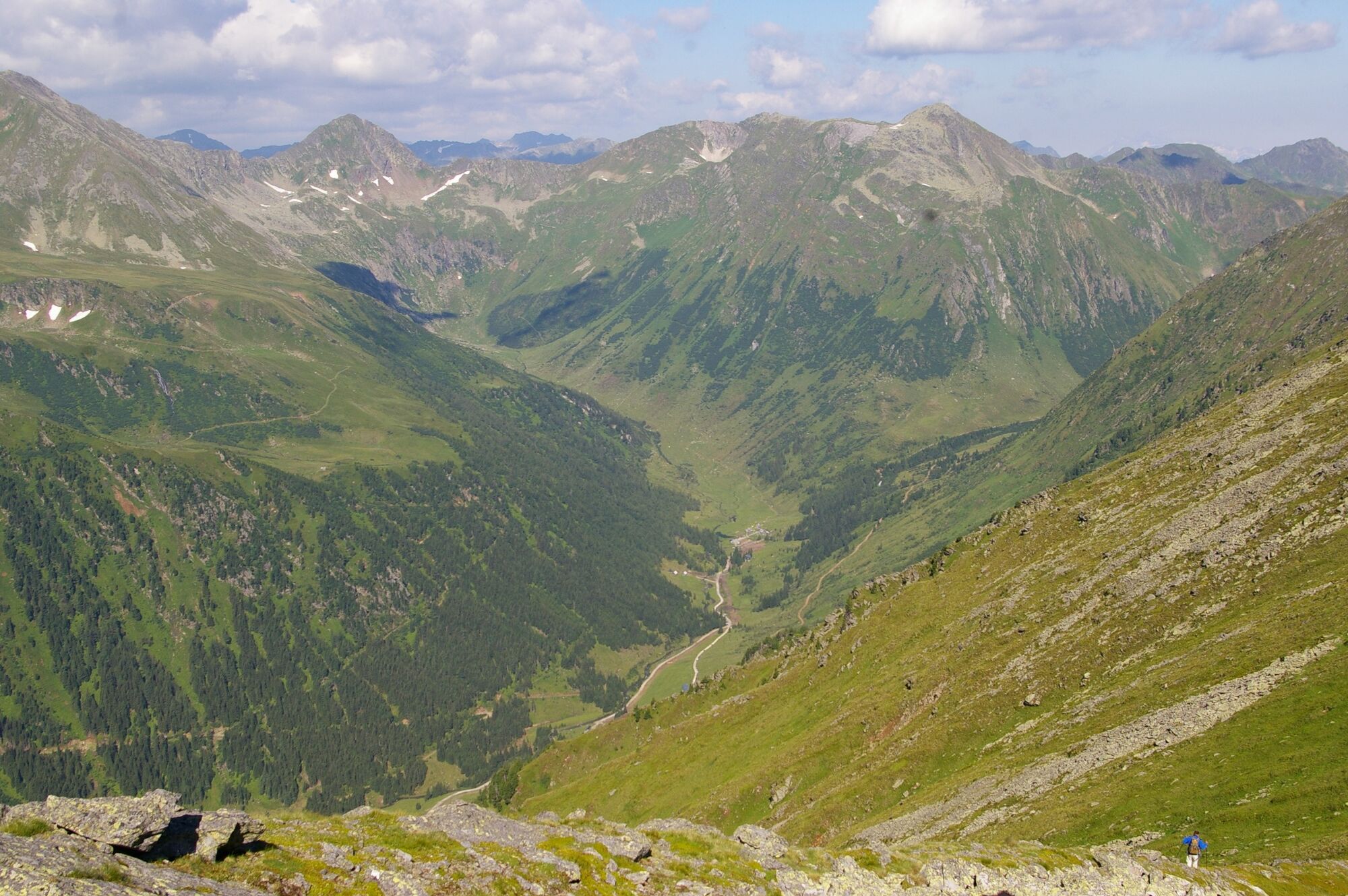
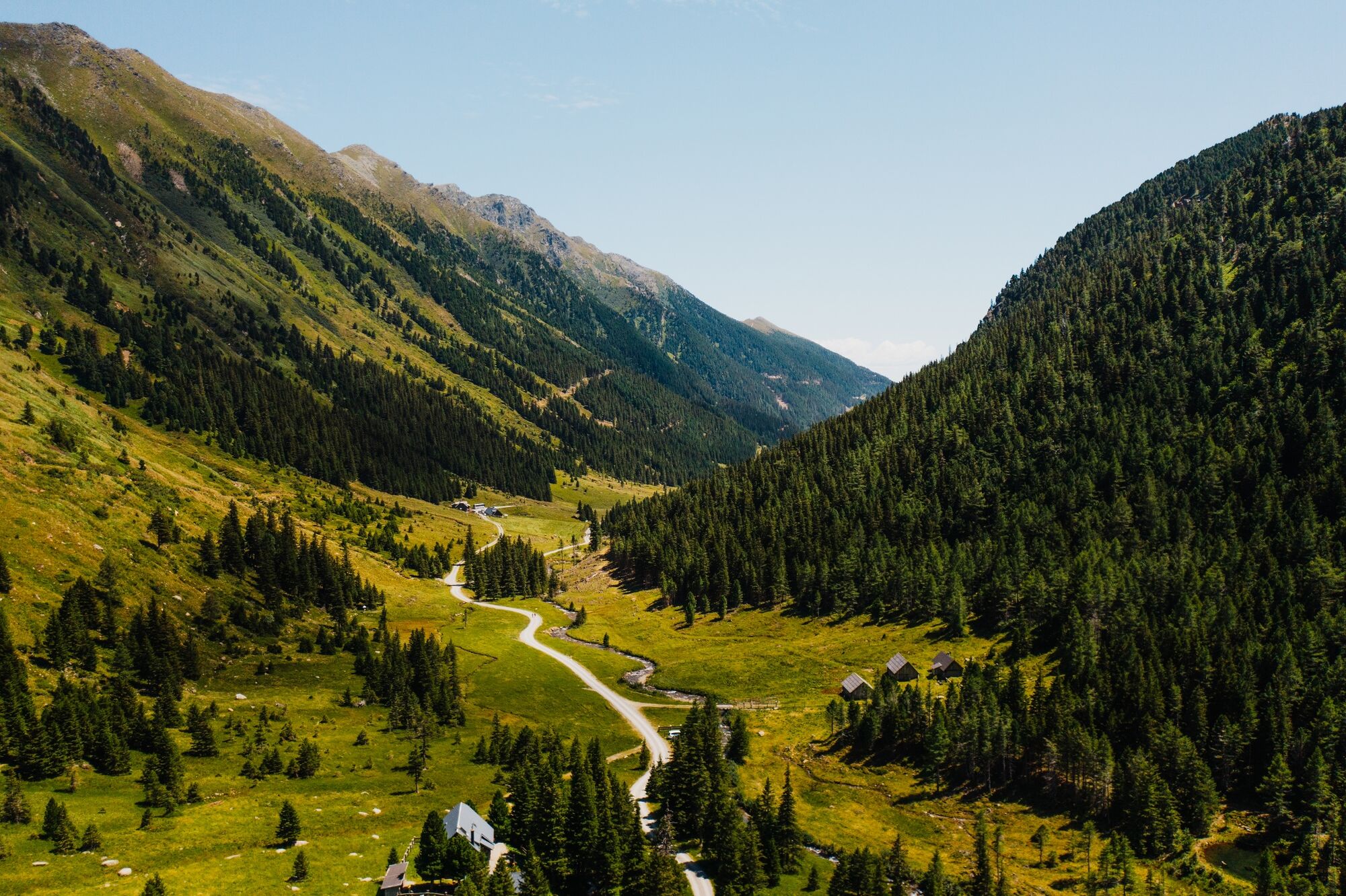
The Hochstubofen impresses from afar and is at the same time an eye-catcher as well as the end of the valley of the Eselsberg.
- Difficulty
-
difficult
- Rating
-
- Starting point
-
Hölzlerhütte
- Route
-
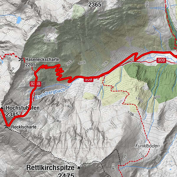
Hölzerhütte0.0 kmEselsbachfall0.1 kmRocklscharte4.3 kmHochstubofen (2,385 m)4.6 km
- Best season
-
JanFebMarAprMayJunJulAugSepOctNovDec
- Description
-
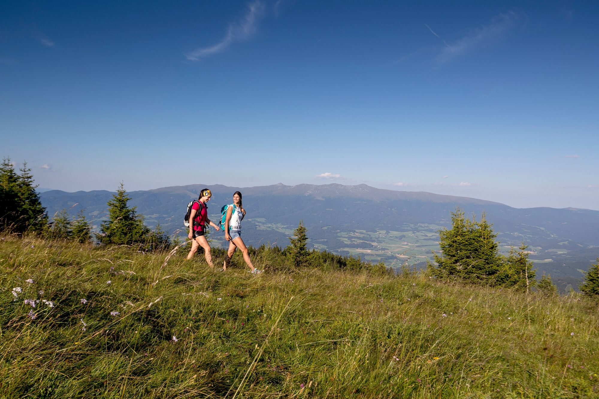
This is a challenging mountain tour that should not be underestimated. A certain level of fitness and endurance is therefore required! Once you reach the summit, all your efforts are rewarded with a picturesque panoramic view.
- Directions
-
From the Hölzlerhütte you walk along the valley floor and follow path no. 926 up to 1674 m. From there, the steeper climb follows path no. 909 to the Haseneckscharte junction. Here you leave path no. 909. From here you follow the red-white-red markings, pass below the Hochstubofen and climb west along the grade to the summit.
The way back is on the same path.
- Highest point
- 2,340 m
- Endpoint
-
Hochstubofen
- Height profile
-

- Equipment
-
Good shoes
Sun protection
Sufficient food - Tips
-
Refreshment options Hölzlerhütte Knollihütte
- Additional information
-
The ideal time for this tour is from May to October.
- Arrival
-
Coming from Judenburg via Unzmarkt to Scheifling. Turn right here and drive towards Murau. In Niederwölz turn right to Oberwölz. Keep left here towards Pöllau am Greim. Turn right and drive along Eselsberger Weg to the Hölzlerhütte.
From Tamsweg via Ranten (or Stadl an der Mur) drive to Murau. Continue to Niederwölz, turn left here towards Oberwölz. In Oberwölz continue to Pöllau am Greim. Turn right and drive along Eselsberger Weg to the Hölzlerhütte.
- Public transportation
-
With the BusBahnBim app from the interconnected line, timetable information is easier than ever before: all bus, train and tram connections in Austria can be queried by entering locations and/or addresses, stops or important points. The app is available as a free app for smartphones (Android, iOS) - on Google Play and in the App Store.
- Parking
-
Public parking spaces are available at the Hölzlerhütte.
- Author
-
The tour Hochstubofen is used by outdooractive.com provided.