- Brief description
-
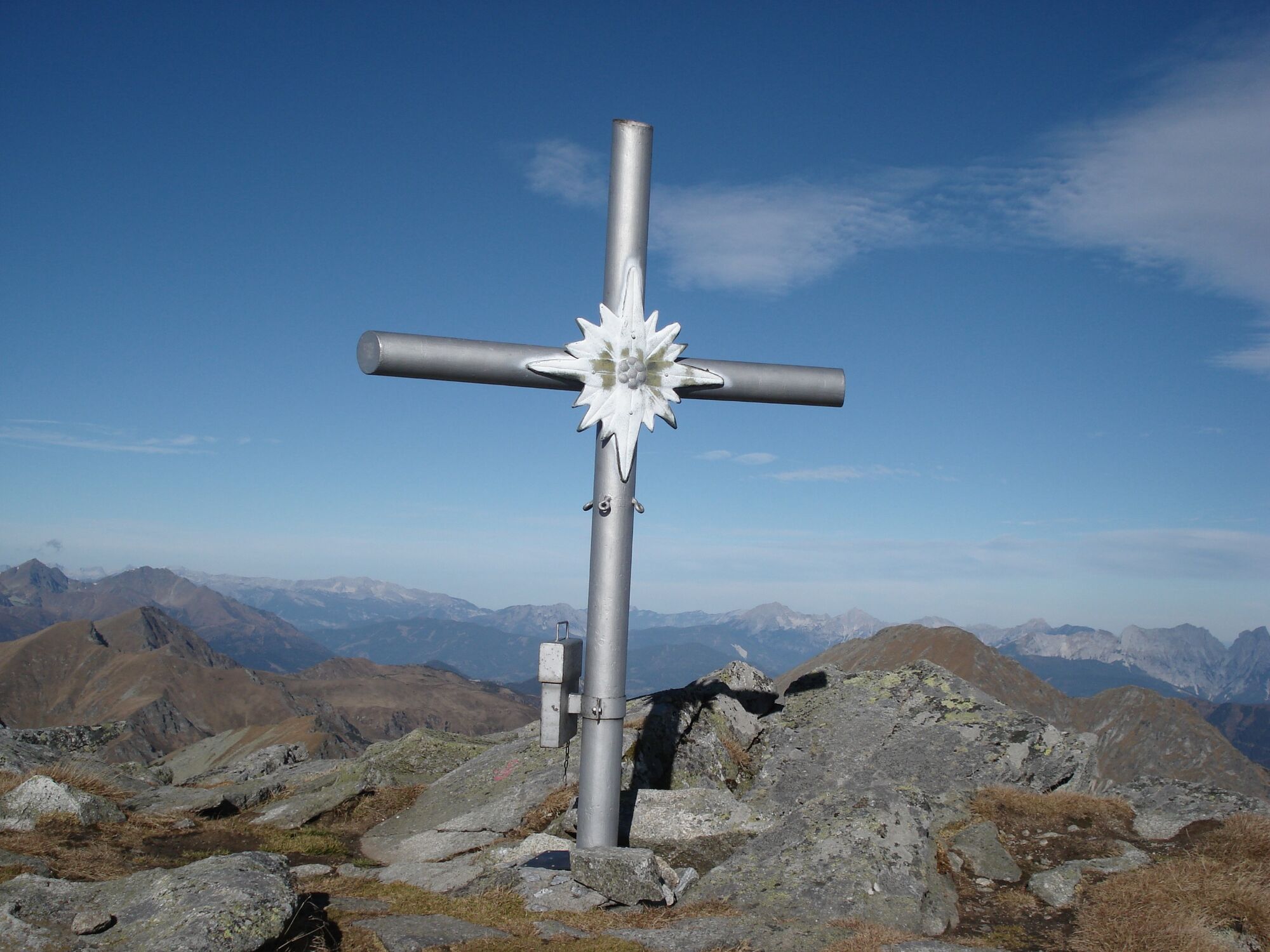
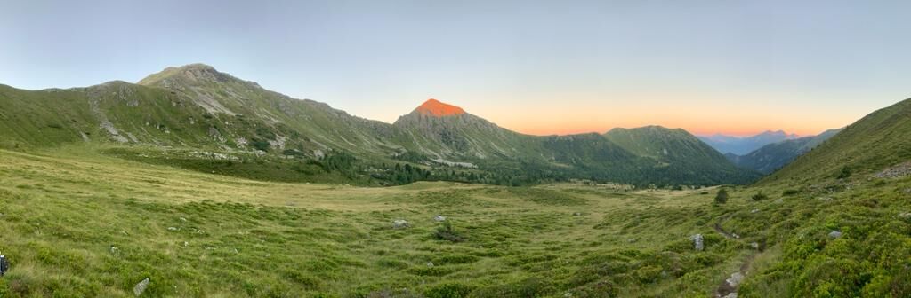
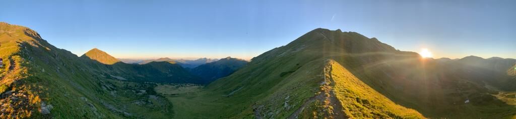
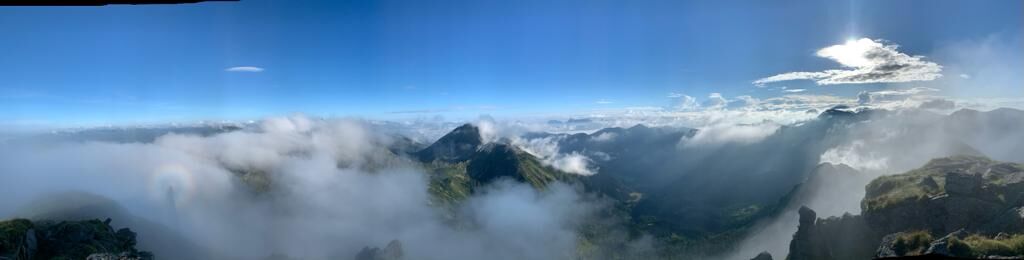
The Gamskögel West summit tour is a more challenging tour and offers breathtaking views at the summit...
- Difficulty
-
medium
- Rating
-
- Starting point
-
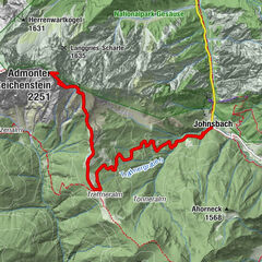
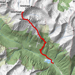
Parkplatz Bärntal
- Route
-
Hochleitenspitze (2,329 m)5.9 km
- Best season
-
JanFebMarAprMayJunJulAugSepOctNovDec
- Description
-
Hiking...With respect for wildlife and the environment!
In the Pölstal, we are particularly concerned about the preservation of unspoiled nature. So that the pleasure of the people does not become a problem for wild animals and nature, it requires consideration measures.
For the sake of nature and the environment, correct behavior in the mountains is the top priority for the hiking enthusiast.
Use the designated parking areas Do not block access roads and please respect local driving regulations Observe information boards at the starting points and stick to the recommended marked routes Avoid approaching wildlife - Directions
-
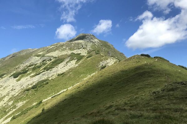
From the Bärntal parking lot, follow the signposts in the direction of "Gamskögel". The hike initially follows the forest path and then turns into a marked trail. After reaching the Gaaler Törl after approx. 2 hours, follow the path to the left in the direction of Gamskögel, with the Amachkogel rising up on the right. Cross the Hochleitenspitze and finally reach the western summit of the Gamskögel.
- Highest point
- 2,370 m
- Endpoint
-
Gamskögel-Westgipfel
- Height profile
-

- Equipment
-
What do I need when hiking?
The equipment is depending on the difficulty, location and duration of the hiking route,
as well as according to your own needs:
sturdy shoes backpack clothes suitable for the season sun protection (glasses, headgear, cream) small first-aid kit (gauze bandage, plaster, scissors and knife) orientation aids (hiking maps) sufficient drinks and provisions cell phone with emergency numberspersonal medication
- Safety instructions
-
Basic rules for hikers in the Pölstal...
Check your personal condition before every mountain tour and estimate your strength correctly. The length of your tour will depend on this. Plan each tour carefully. Pay close attention to the necessary equipment, make sure you have enough provisions and check the local weather forecast. Inform acquaintances about your hiking destination, as well as the planned return time, if necessary. Always stay on the marked trails. Always close fences and pasture gates. Watch out for falling rocks and do not kick any rocks yourself. Doing so will endanger other hikers. In case of bad weather, sudden indisposition or other difficulties, do not take risks and turn back in time. Avoid approaching wild animals. - Observe from a distance. Keep dogs on a leash. Use designated parking areas, please do not block access roads, and observe local driving restrictions.
- Tips
-
Enjoy the wonderful tour!
- Additional information
- Directions
-
From Möderbrugg, drive into the village of St. Johann am Tauern. After the former Gasthaus Bruckenhauser inn, turn right into the Bärental valley. Past the Franzlbauerhütte to the Bärntal parking lot.
- Public transportation
-
This tour is NOT considered "accessible by train and bus" because there is no regular connection.
- Parking
-
You can park your car at the Bärntal parking lot.

-

-
AuthorThe tour Gamskögel west summit is used by outdooractive.com provided.


General info
-
Erlebnisregion Murtal
1783
-
Hohentauern
212


")