


- Brief description
-
From peak to peak in the Wölzer Tauern.
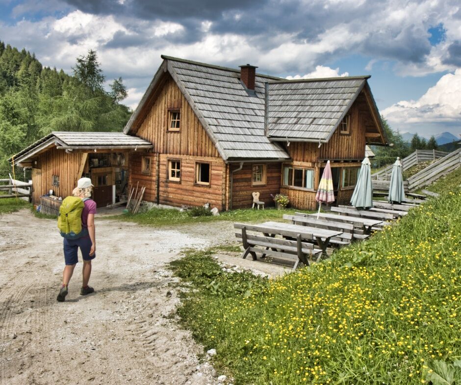
An enjoyable and easy alpine and summit hike with a stop at the Grillerhütte in Pusterwald.
- Difficulty
-
easy
- Rating
-
- Starting point
-
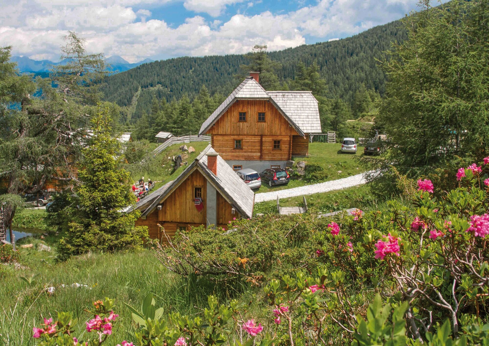
Grillerhütte
- Route
-
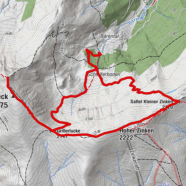
Grillerhütte0.0 kmNiederer Zinken (2,205 m)3.0 kmHoher Zinken (2,222 m)3.2 kmSchießeck (2,275 m)5.0 kmGrillerlucke (2,147 m)6.3 kmGrillerhütte8.6 km
- Best season
-
JanFebMarAprMayJunJulAugSepOctNovDec
- Description
-
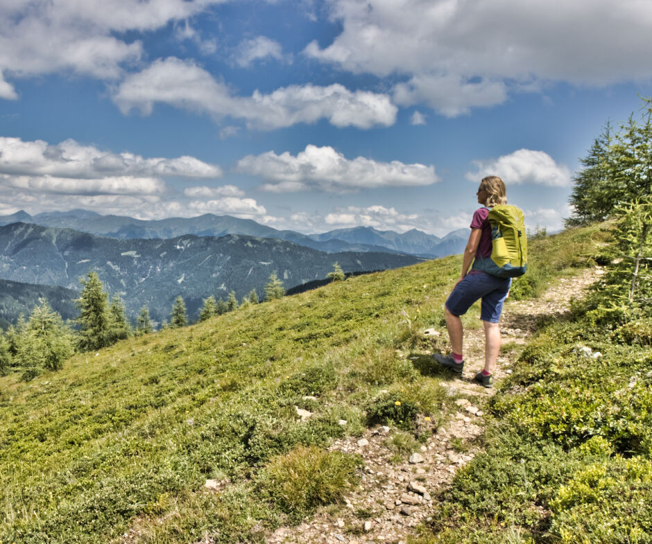
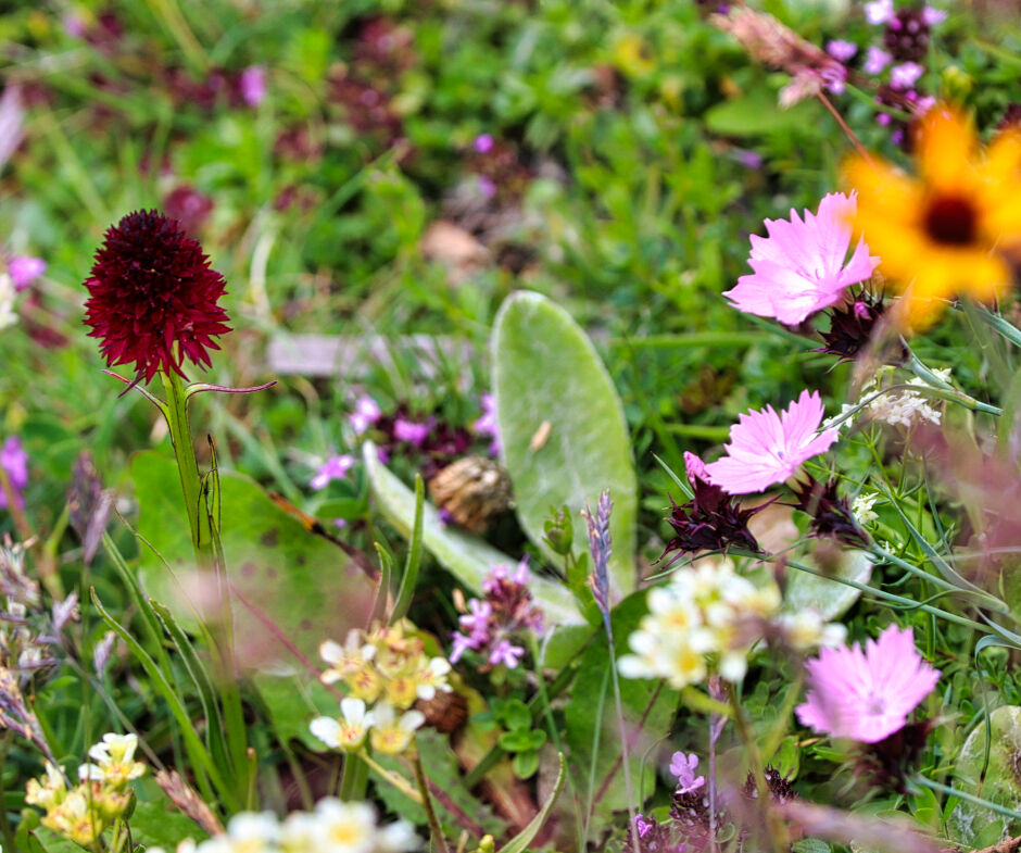
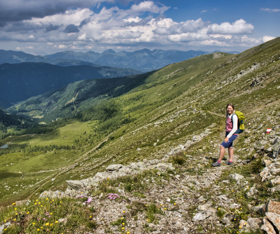
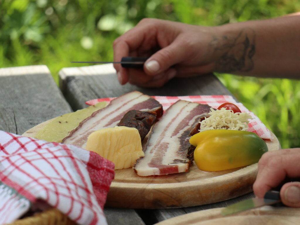
Vast cirques, alpine pastures rich in blossoms and three 2000-meter peaks in one fell swoop: Starting from the Grillerhütte, one of the last alpine dairies in the Murtal region, we get to know the "back side" of the Lachtal hiking and skiing area. "This year the Almrauschblüte was particularly beautiful," Martha, the dairymaid of the Grillerhütte, tells us. If you are out and about now, you will see only a few alpine bushes, but numerous alpine flowers and orchids. After the hike, we recommend stopping at the Grillerhütte, where butter, Murtaler Steirerkäse and Bröselkäse are produced directly - a culinary delight at over 1700 meters above sea level.
- Directions
-
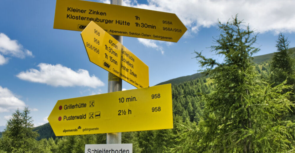
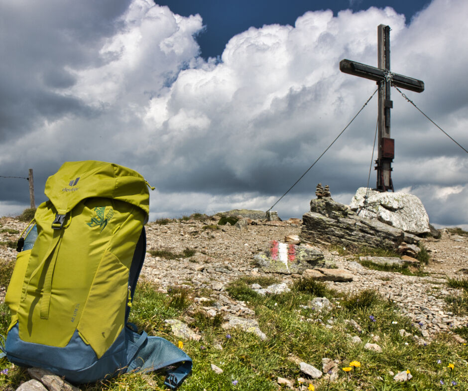
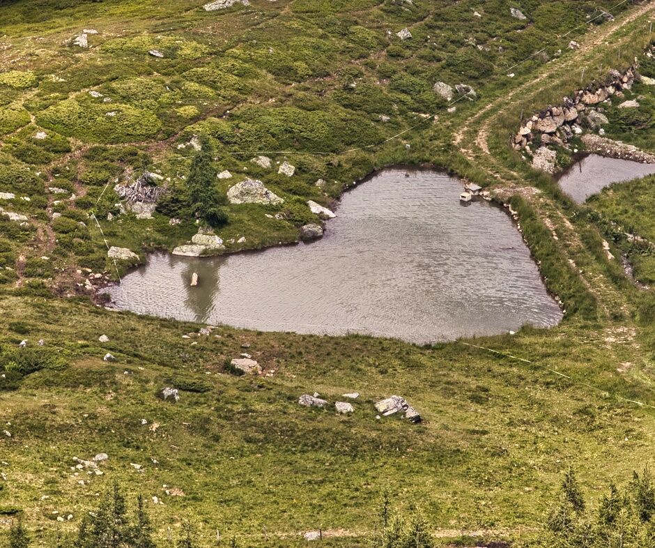
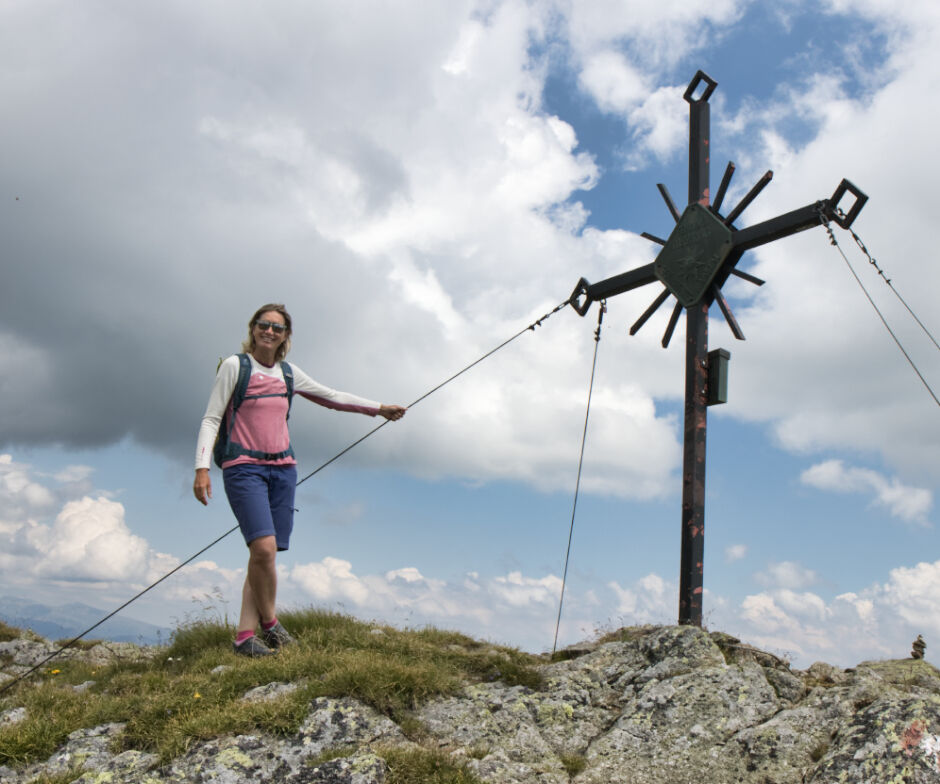
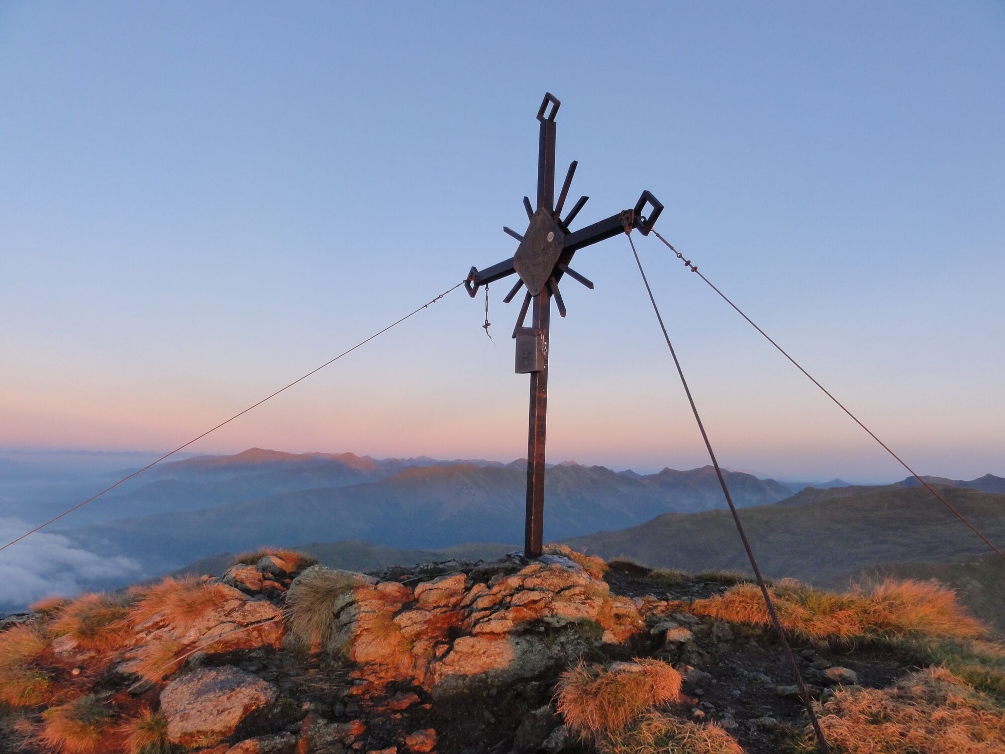
We start at the Grillerhütte (1763 m) and follow the gravel road slightly uphill. At the fork Grillersteig we keep straight on and shortly after reach a pasture gate or the waypoint Schleiferboden (1830 m). The path leads leisurely across the alpine pasture, where numerous grazing animals can be seen. The further ascent is easy and leads in long serpentines through a sea of flowers with a variety of orchids. Arriving at the ridge, we make a short detour to the Kleiner Zinken (2135 m) and look down on the Lachtal hiking and skiing area. The scenic and easily recognizable trail leads us past the lift supports to the Großer Zinken (also found on maps under Hoher Zinken). Slightly downhill we hike to the crossroads Grillerlucke, before it goes uphill again to the third peak, the Schießeck (2275 m). The descent leads over the Grillerlucke to the extensive alpine pasture and over the Bärentalbach back to the Grillerhütte.
- Highest point
- 2,264 m
- Endpoint
-
Schießeck
- Height profile
-

- Equipment
-
Backpack with rain cover Telescopic / hiking poles Mountain / hiking boots Gloves: waterproof and warming Headgear / sunglasses Outerwear: Onion layer system, T-shirt, sweater, jacket and winter jacket with hood Hiking pants Seat pad Drinking bottle / thermos flask (on cooler days a warming drink is pleasant) Snack First aid kit with blister plaster and tick tongs
Other important equipment
Route descriptionDetailed plan of the hike Hiking map: For overview a map in scale 1 : 50 000 of the respective region GPS device cell phone - Safety instructions
-
For a conflict-free coexistence on alpine pastures and meadows it is important to observe a few rules, especially when traveling with dogs. (Source: www.sichere-almen.at - 06/2021) Avoid contact with grazing animals, do not feed them, keep a safe distance! Keep calm, do not frighten grazing animals! Mother cows protect their calves. Avoid encounters between mother cows and dogs! Always keep dogs under control and on a short leash. If an attack by a grazing animal is foreseeable: Immediately unleash! Do not leave hiking trails on alpine pastures and meadows! If grazing animals block the way, avoid them as far as possible! When grazing animals approach: Stay calm, do not turn your back, avoid the animals! Leave the grazing area quickly at the first sign of restlessness of the animals!Fences must be respected! If there is a gate, use it, then close it well and cross the pasture quickly! Treat the people working here, nature and the animals with respect!
A few tips for correct and fair behavior in the forest: (Source: www.bundesforste.at - 6/2021)
Hikers should avoid visits to the forest about 1.5 hours before sunrise and after sunset, as wildlife is especially active during this time. Plastic bottles, handkerchiefs, cigarette butts & Co have no place in the forest! Please make sure that you do not leave any trash in the forest. Camping and making fire - is strictly forbidden in the forest! In principle, each person is allowed to collect 2 kg of mushrooms and berries per day for personal use in the forest. It is only forbidden if the forest owner expressly forbids it.Alpine emergency call:
Mountain rescue emergency number: 140
EU emergency number: 112
Weather service: www.zamg.ac.at
Direct link mountain weather Styria: https://www.zamg.ac.at/cms/de/wetter/produkte-und-services/bergwetter/steiermark
- Tips
-
It's worth stopping by the Grillerhütte!
- Additional information
-
Refreshment and overnight accommodations:
Gasthaus Jagawirt, Tel.: +43 3574 2233, 57 Pusterwald, 8764 Pusterwald
Grillerhütte: Tel.: +43 664 76 20 853
- Directions
-
From Judenburg via the B114 in the direction of Hohentauern, turn left in Möderbrugg to Pusterwald (36 km, approx. 40 minutes).
From Trieben an der Pyhrn freeway A 9 via B114 direction Judenburg in Möderbrugg turn right to Pusterwald (48 km, approx. 50 minutes).
- Public transportation
-
The starting point of the hike is not accessible by public transport.
- Parking
-
Grillerhütte, 7km access via gravel road

- Author
-
The tour Schießeck from Pusterwald is used by outdooractive.com provided.