


- Brief description
-
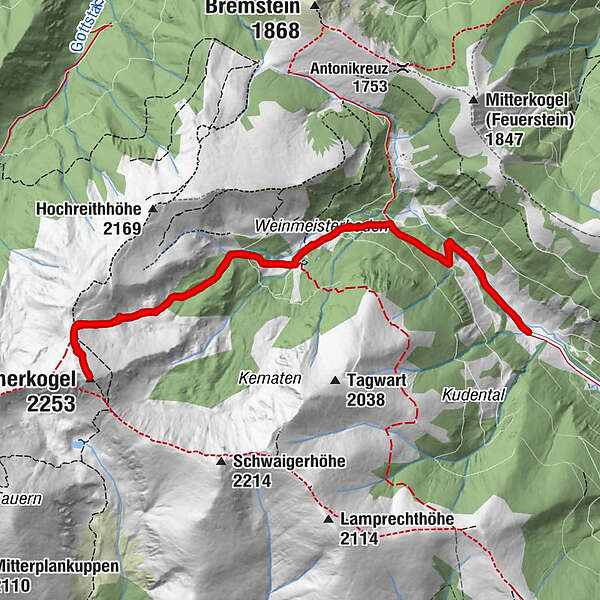
A lonely alpine and summit hike at its best - over the Weinmeisterboden and the Siebenbründltal to the Hämmerkogel.
- Difficulty
-
medium
- Rating
-
- Starting point
-
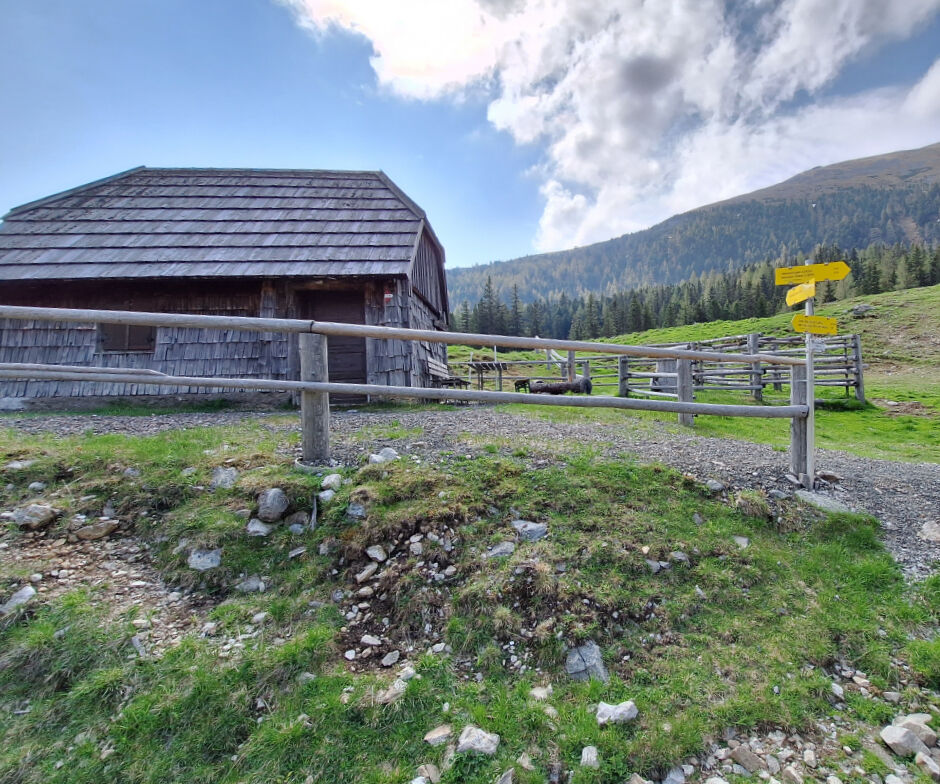
Feistritzgraben, Untere Bodenhütte
- Route
-
Untere Bodenhütte1.2 kmWeinmeisterboden2.5 kmHämmerkogel (2,253 m)5.7 kmWeinmeisterboden8.9 kmUntere Bodenhütte10.2 km
- Best season
-
JanFebMarAprMayJunJulAugSepOctNovDec
- Description
-
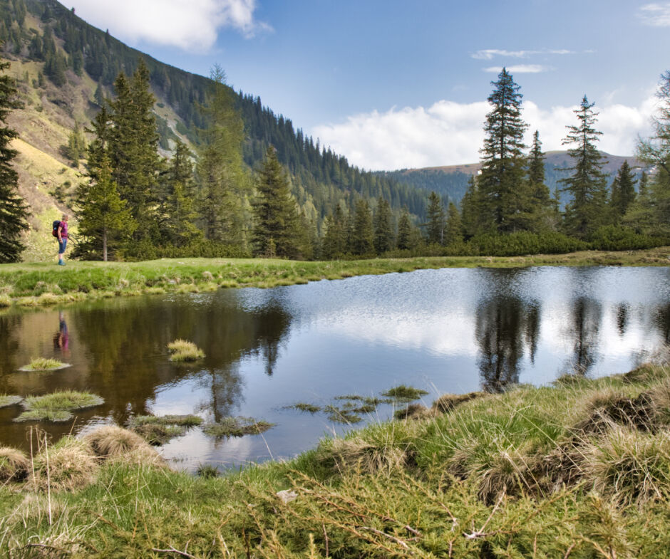
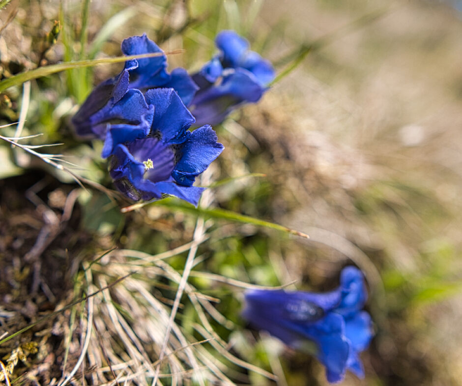
In the Seckauer Tauern, the last snowfields are melting day by day. Right now it is particularly beautiful in the alpine terrain, although the trail conditions can be strenuous at times. Although the paths are mostly dry, there are snow-covered or wet spots that are very slippery. The powerful murmur of the streams and the calm mirror-smooth surface of the lakes exude a special charm. Early summer is slowly beginning in the mountains and with it the alpine bush blossoms. On this long-distance hike we take our time, enjoy the pleasant hiking temperatures, occasionally observe marmots and chamois and see the first alpine flowers. The hiking trail leads over a softly shaped cirque landscape to the Hämmerkogel, which is rich in views. For athletically ambitious mountaineers, the "encore" would be the Seckauer Zinken (2397 m), which can be hiked over a connecting ridge. Conclusion: A powerful mountain tour in the Murtal region.
- Directions
-
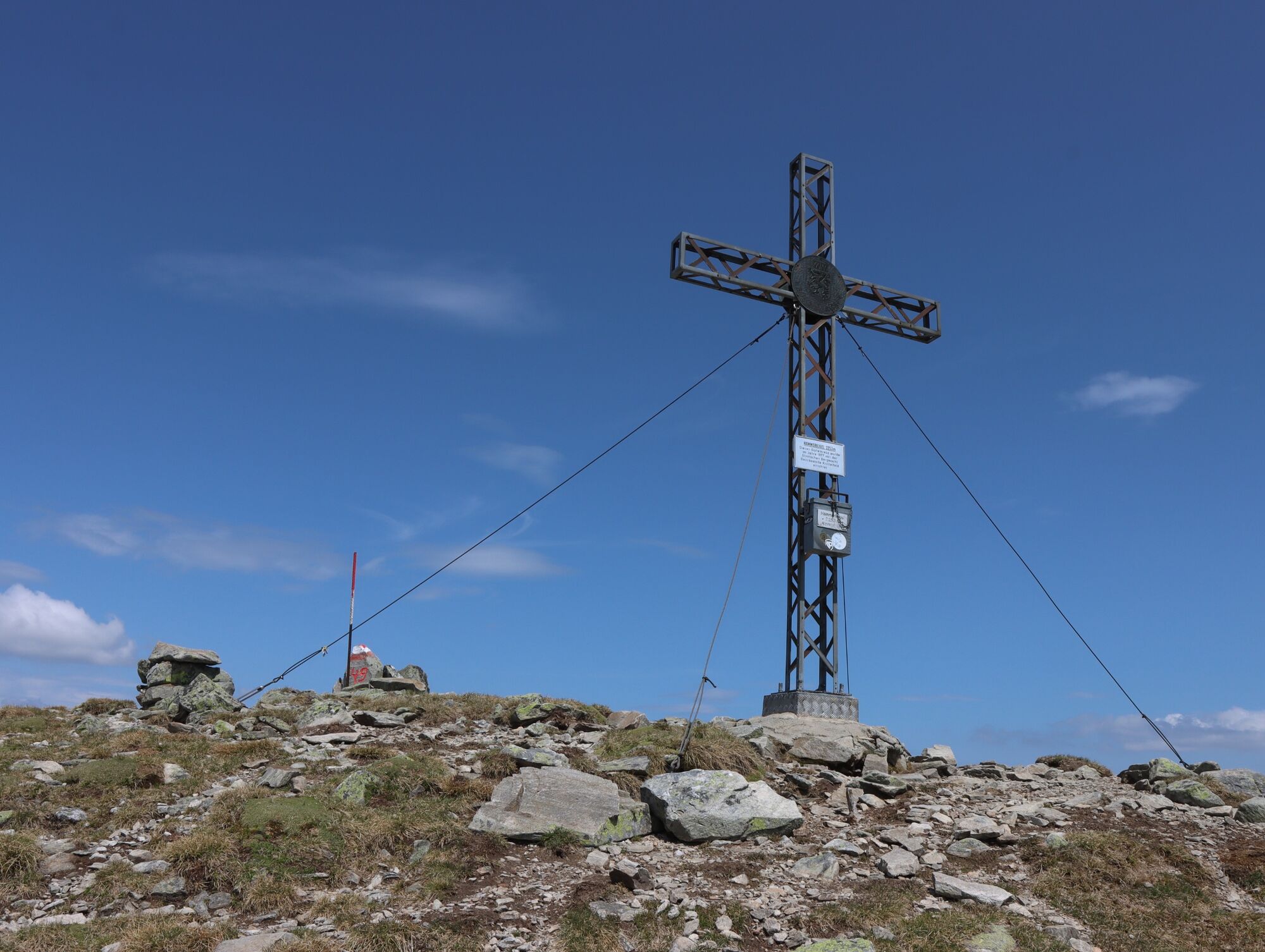
We start at the Untere Bodenhütte (1385 m). Via a forest road we reach the turn-off. A clearly recognisable trail leads uphill through the forest. We cross a forest road and reach the Obere Bodenhütte (not managed) via the Weinmeisterboden. Immediately behind the hut lies - somewhat hidden - the Schwarzlacke (1619 m), a recommendable detour. At the hut we keep to the right and hike uphill following the Feistritzbach stream to the extensive cirque above the Siebenbründl. Once at the ridge, we turn left onto the Hämmerkogel (2253 m), where we enjoy the view of the Goldlacke and the Seckauer Zinken. The descent is via the ascent route.
- Highest point
- 2,238 m
- Endpoint
-
Summit Hämmerkogel
- Height profile
-

- Equipment
-
Backpack with rain cover
Telescopic / hiking poles
Mountain / hiking boots
Gloves: waterproof and warming
Headgear / sunglasses
Outerwear: Onion layer system, T-shirt, sweater, jacket and winter jacket with hood
Hiking pants
Seat pad
Drinking bottle / thermos flask (on cooler days a warming drink is pleasant)
Snack
First aid kit with blister plaster and tick tongs
Other important equipment
Route descriptionDetailed
plan of the hike
Hiking map: For overview a map in scale 1 : 50 000 of the respective region
GPS device
cell phone
- Safety instructions
-
For a conflict-free coexistence on alpine pastures and meadows it is important to observe a few rules, especially when traveling with dogs. (Source: www.sichere-almen.at )
Avoid contact with grazing animals, do not feed them, keep a safe distance!
Keep calm, do not frighten grazing animals!
Mother cows protect their calves. Avoid encounters between mother cows and dogs!
Always keep dogs under control and on a short leash. If an attack by a grazing animal is foreseeable: Immediately unleash!
Do not leave hiking trails on alpine pastures and meadows!
If grazing animals block the way, avoid them as far as possible!
When grazing animals approach: Stay calm, do not turn your back, avoid the animals!
Leave the grazing area quickly at the first sign of restlessness of the animals!Fences must be respected!
If there is a gate, use it, then close it well and cross the pasture quickly!
Treat the people working here, nature and the animals with respect!
A few tips for correct and fair behavior in the forest: (Source: www.bundesforste.at)
Hikers should avoid visits to the forest about 1.5 hours before sunrise and after sunset, as wildlife is especially active during this time.
Plastic bottles, handkerchiefs, cigarette butts & Co have no place in the forest! Please make sure that you do not leave any trash in the forest.
Camping and making fire - is strictly forbidden in the forest!
In principle, each person is allowed to collect 2 kg of mushrooms and berries per day for personal use in the forest. It is only forbidden if the forest owner expressly forbids it.
Alpine emergency call:
Mountain rescue emergency number: 140
EU emergency number: 112
Weather service: www.zamg.ac.at
Direct link mountain weather Styria: https://www.zamg.ac.at/cms/de/wetter/produkte-und-services/bergwetter/steiermark
- Directions
-
Motorway S 36 (exit St. Lorenzen/Feistritz)
or
Murtal side road L 518 to Feistritz or St. Marein
From there away to Wasserleith further into the Feristritzgraben; driving possibility to the car park at Untere Bodenhütte
- Public transportation
-
This tour is not accessible by public transport.
- Parking
-
Car Park Untere Bodenhütte


-

-
AuthorThe tour Hämmerkogel is used by outdooractive.com provided.


General info
-
Erzberg Leoben
2530
-
Mautern - "Der Wilde Berg"
212


