- Brief description
-
Medium-difficulty hike in the beautiful apple country up the Buchkogel
- Difficulty
-
medium
- Rating
-
- Starting point
-
Information board at the crossroads near the Hofer quarry
- Route
-
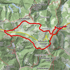
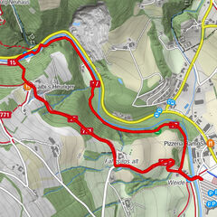
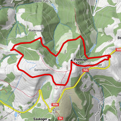
Buchkogel (907 m)3.1 km
- Best season
-
JanFebMarAprMayJunJulAugSepOctNovDec
- Description
-
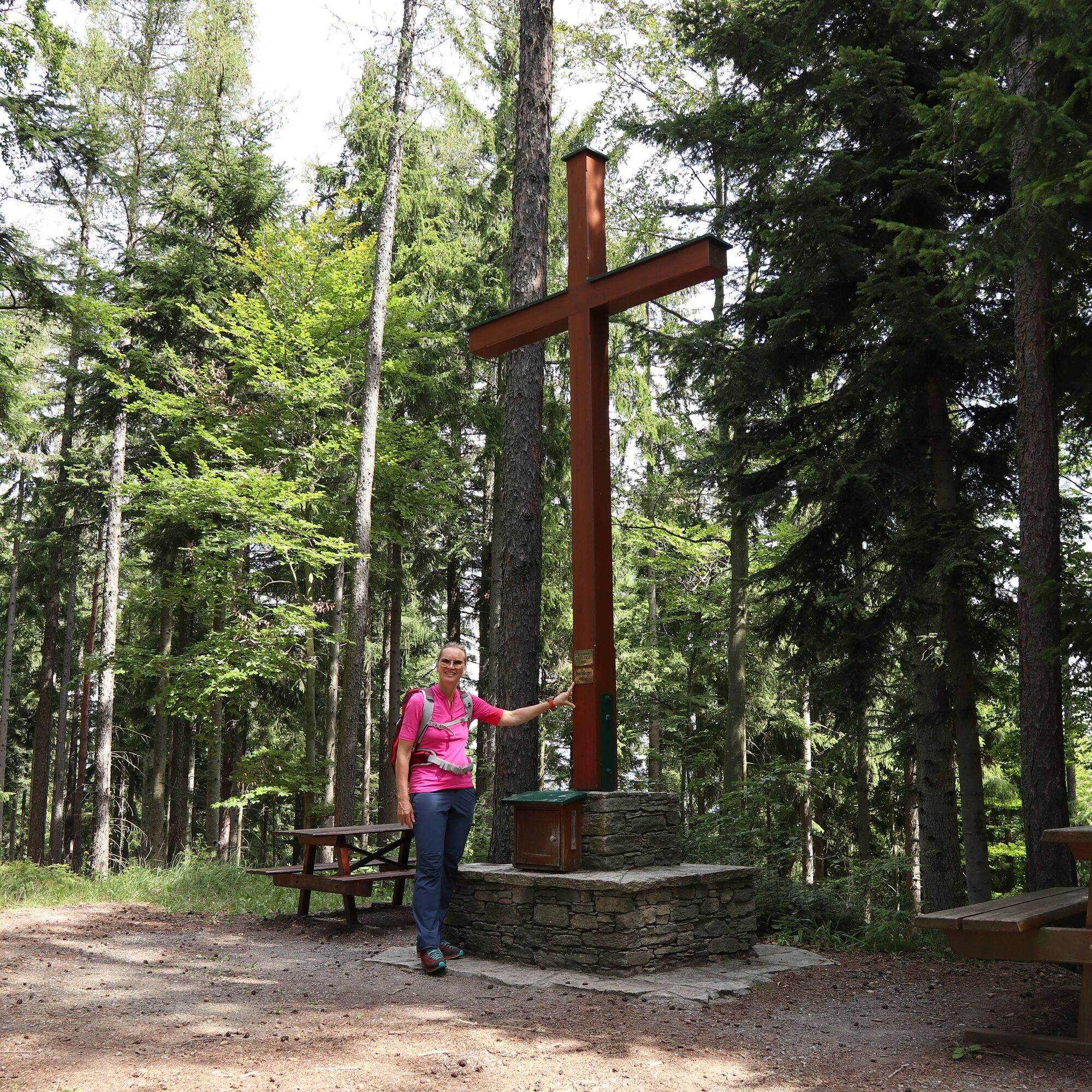
The tour takes you on a high-altitude trail via the Freiberg Wetterkreuz to the summit of the Buchkogel (907 m).
It is ideal on hot summer days, as this wooded and generally less strenuous tour offers plenty of shade.
- Directions
-
The high-level trail initially leads along the edge of the forest past a farm, then at a medium gradient through forests to the Freiberger Wetterkreuz, where it reaches the ridge of the Buchkogel range. It follows this in the forest only moderately ascending until it finally reaches the Buchkogel summit after the Windhaber Tor on a narrow, steep path through a forest. The descent initially leads through woods to a crossroads at the Gaber farmstead. After a short stretch along the edge of the forest, it crosses a larger section of forest. This is followed by a slightly ascending section along meadows and forest edges with short forest passages. The final section crosses a larger wooded area with varying gradients before ending at the saddle at the Goger farmstead.
Refreshment stops: Buschenschank Holzer and at the 1000 m-Stüberl in Rabenwald near the finish.
- Highest point
- 1,012 m
- Endpoint
-
Transmitter at Rabenwald- Goger
- Height profile
-

- Equipment
-
- Backpack with water bottle/thermos flask and provisions- Mountain / hiking boots- Appropriate clothing - preferably several layers - "onion principle" on cool days: long hiking trousers, don't forget gloves: Headgear, sunglasses- Rain protection, seat pad- Hiking poles- cell phone- First aid kit- Directions, detailed plan of the hike/hiking map/GPS device- Before starting the hike, check where to stop for refreshments, including opening times, or pack appropriate food and drink
- Safety instructions
-
Important telephone numbers:
European emergency call: 112
Emergency call mountain rescue: 140 (if possible, please provide GPS data)
Rescue: 144
Fire department: 122
Police: 133
Here you will find the rules of conduct for "Safe handling of grazing livestock" and "Safety on the mountain
A few tips on correct and fair behavior in the forest: (Source: www.bundesforste.at)
Hikers should avoid visiting the forest approx. 1.5 hours before sunrise and after sunset, as wild animals are particularly active at this time.Plastic bottles, handkerchiefs, cigarette butts etc. have no place in the forest! Please make sure that you do not leave any garbage in the forest.Camping and making fires is strictly forbidden in the forest!In principle, every person in the forest is allowed to collect 2 kg of mushrooms and berries per day for their own use. It is only prohibited if the forest owner expressly forbids it.
- Tips
-
We recommend:
Take your time to enjoy the wonderful landscape of ApfelLand in Eastern Styria
- Additional information
- Directions
-
ApfelLand is located in the heart of Eastern Styria, approx. 60 km north-east of Graz and approx. 140 km south of Vienna
By car: Coming from Vienna: Via the Südautobahn (A2) to the Hartberg exit - via the main road (B54) towards Graz - 2 km after Kaindorf towards Graz, turn off towards ApfelLand-Stubenbergsee- Stubenbergsee
Coming from Salzburg/Germany: Take the highway via Salzburg - Pyhrnautobahn (A9) to Graz - continue via the Südautobahn in the direction of Vienna (A2) to the Gleisdorf West exit - federal road (B54) to Kaibing - ApfelLand-Stubenbergsee- Stubenbergsee
- Public transportation
- Parking
-
At the start and end point, Gaber farmstead


-

-
AuthorThe tour Buchkogel high trail, Stubenberg is used by outdooractive.com provided.


-
Oststeiermark
2126
-
ApfelLand - Stubenbergsee
1140
-
Stubenberg am See
321