- Brief description
-
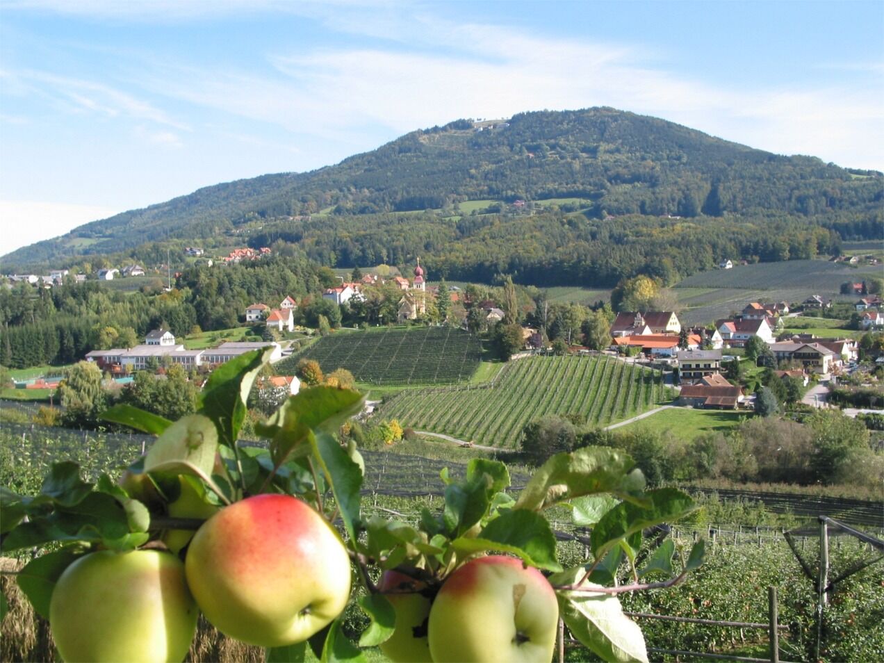
Hiking from the Ulrischskirche on the Külml to the parish church of Puch bei Weiz. For all those who love enjoyable hiking.Cultural tourism - sacred art
- Difficulty
-
easy
- Rating
-
- Starting point
-
St. Ulrich's Church on the Külml
- Route
-
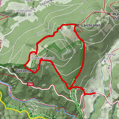
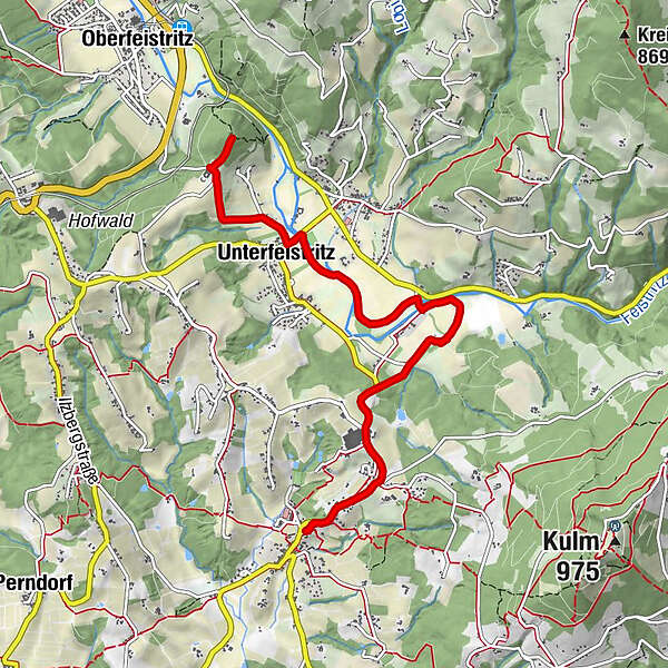
St.Ulrichs KircheGasthaus Stixpeter1.1 kmUnterfeistritz1.3 kmKapelle5.0 kmSt. Pauls Kapelle5.2 kmPuch bei Weiz5.9 kmHofer6.0 kmPfarrkirche Puch6.0 km
- Best season
-
JanFebMarAprMayJunJulAugSepOctNovDec
- Description
-
We would like to invite you to combine your hike in ApfelLand-Stubenbergsee and the Pöllau Valley Nature Park with art and culture and culinary delights.
Download the free "Hearonymus" app, select "Churches in ApfelLand-Stubenbergsee and Pöllau Valley Nature Park" in the "Guides" section and your smartphone will become an audio guide. Churches and their organs and bells are presented and brought to life acoustically, so you can get to know the advantages of an individual tour with the sound of bells and organs.
The individual organ hiking tours can be easily combined with each other and walked in both directions, so that everything is possible, from a short hike to a long-distance hike.
Churches in ApfelLand-Stubenbergsee
- Directions
-
The organ hike begins at Külml
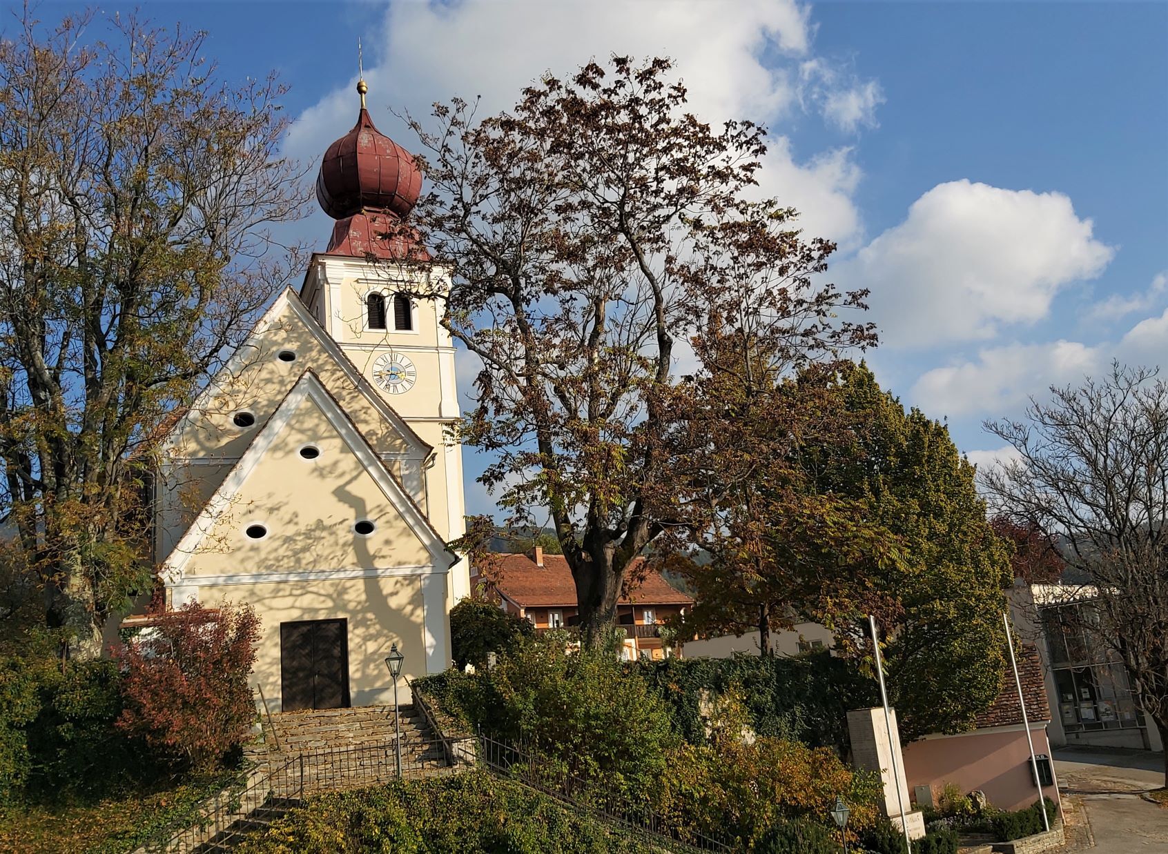
Exactly visavis of Schoss Külml, the slightly ascending path leads to the Ulrichskirche am Küml. Now that you have earned a break, you can enjoy the wonderful sounds of the organ and the bells of the Ulrichskirche with an audio guide.
From the Ulrichskirche am Külml, walk back towards the castle and turn left.After approx. 500m, turn left again and then follow this slightly downhill path. When you come to the crossroads, continue right and you will reach the "Stixpeter" Kulmer inn where you will be spoiled with regional delicacies.
Strengthened, you then continue on the R8 cycle path to the Bauer-Kulmmühle sawmill, after approx. 300 m you turn onto path WZ 16 and follow this to the apple village of Puch bei Weiz, where you can enjoy the unique sounds of the organ and bells of the Puch bei Weiz parish church once again at the end of your organ hike.
- Highest point
- 549 m
- Endpoint
-
Parish church Puch near Weiz
- Height profile
-

- Equipment
-
- Small rucksack with water bottle (+ provisions)- Sturdy shoes- Appropriate clothing - preferably several layers - "onion principle"- Rain and sun protection- Hiking poles as required- Cell phone- Small first aid kit- Route description- Before starting the hike, check where you can stop for refreshments, including opening times, or pack suitable food and drink.
- Safety instructions
-
Important telephone numbers:
European emergency call: 112
Emergency call mountain rescue: 140 (if possible, please provide GPS data)
Rescue: 144
Fire department: 122
Police: 133
A few tips on correct and fair behavior in the forest: (Source: www.bundesforste.at)
Hikers should avoid visiting the forest approx. 1.5 hours before sunrise and after sunset, as wild animals are particularly active at this time.Plastic bottles, handkerchiefs, cigarette butts etc. have no place in the forest! Please make sure that you do not leave any garbage in the forest.Camping and making fires is strictly forbidden in the forest!In principle, every person in the forest is allowed to collect 2 kg of mushrooms and berries per day for their own use. It is only prohibited if the forest owner expressly forbids it.
- Tips
-
We recommend:
Treasures of Eastern Styria - the sacred treasures of the ApfelLand-Stubenbergsee region and the Pöllauer Tal Nature Park are presented in wonderful pictures.
- Additional information
- Directions
-
ApfelLand is located in the heart of Eastern Styria, approx. 60 km north-east of Graz and approx. 140 km south of Vienna
By car: Coming from Vienna: Via the Südautobahn (A2) to the Hartberg exit - via the main road (B54) towards Graz - 2 km after Kaindorf towards Graz, turn off towards ApfelLand-Stubenbergsee- Stubenbergsee- Floing- Anger
Coming from Salzburg/Germany: Highway via Salzburg - Pyhrnautobahn (A9) to Graz - continue on the Südautobahn in the direction of Vienna (A2) to the Gleisdorf West exit - main road (B54) to Kaibing - ApfelLand-Stubenbergsee- Stubenbergsee- Floing- Anger
To Google Maps for the calculation of the journe
- Public transportation
- Parking


-

-
AuthorThe tour Organ Hiking: Stage Külml- Puch near Weiz is used by outdooractive.com provided.


-
Oststeiermark
2126
-
ApfelLand - Stubenbergsee
1140
-
Puch bei Weiz
335