
- Brief description
-
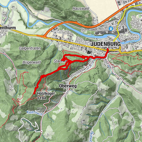
A real mountain feeling on the tour to the Hölzlkogel from the center of Judenburg on hiking trails 313A-313-43-42 with great views of the surrounding valleys and nearby mountains.
- Difficulty
-
medium
- Rating
-
- Starting point
-
Main square Judenburg
- Route
-
JudenburgHölzlkogel (1,194 m)3.9 kmJudenburg8.8 km
- Best season
-
JanFebMarAprMayJunJulAugSepOctNovDec
- Description
-
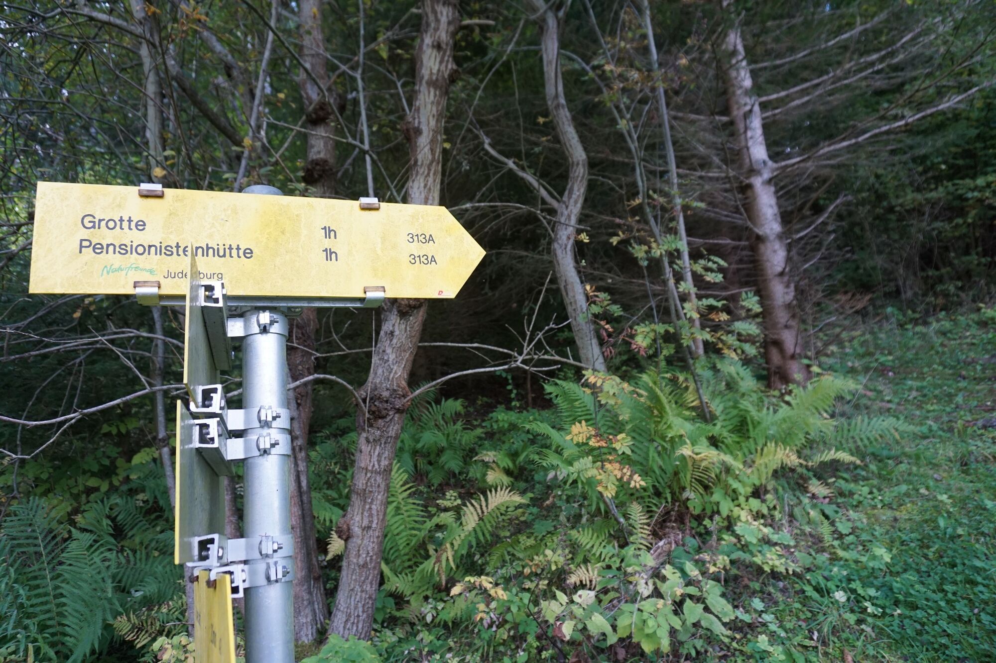
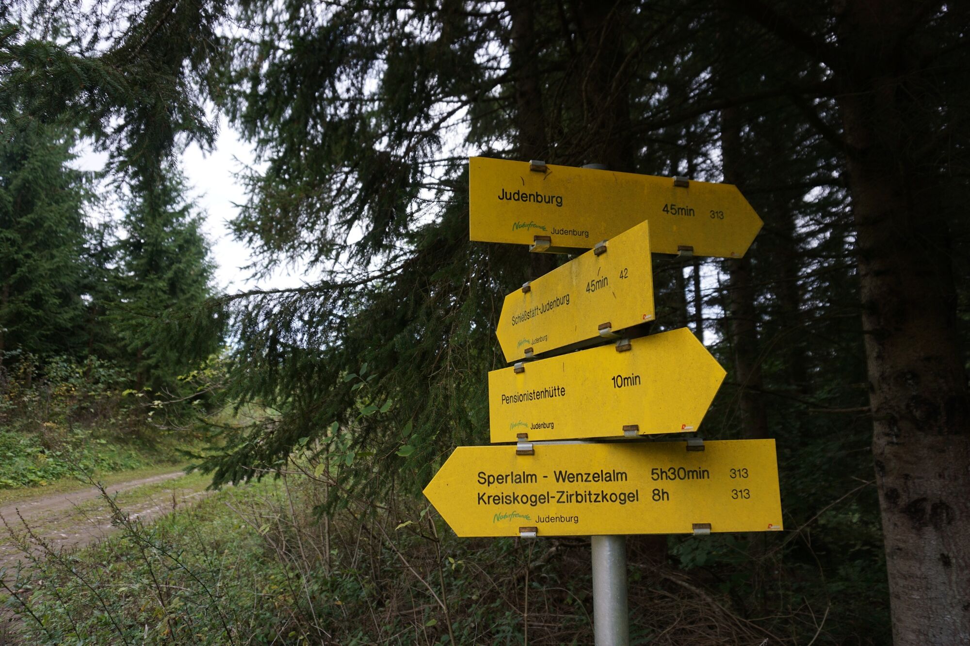
From Judenburg town center, we walk via "Am Gehag" to "Kuhtörl". From here we follow hiking trail 313A. After a short hollow path and a passage on a gravel road, we keep left along the forest path and reach hiking trail 313. A narrow forest path leads upwards to the right. From here, continue along the well-marked forest path to the "Pensionistenhütte", an unmanned hut with numerous resting places.
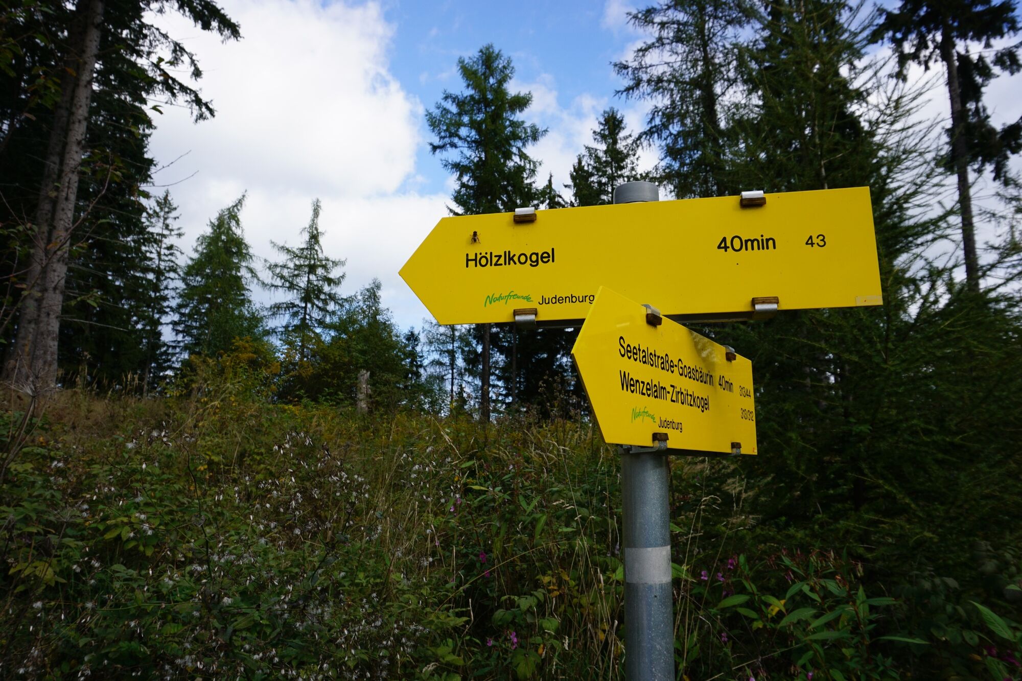
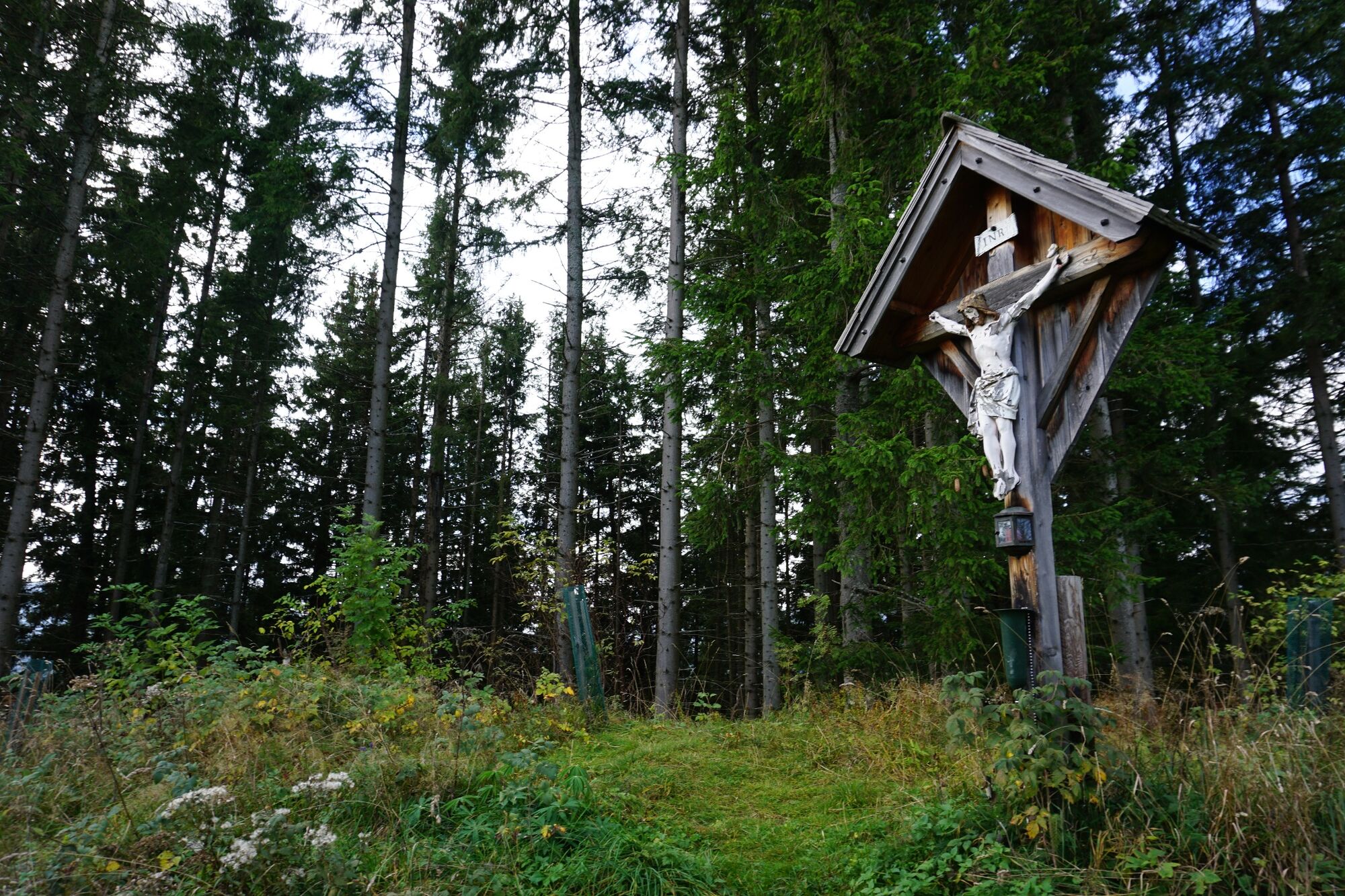
Via hiking trail 313 to hiking trail 43 in the direction of Hölzlkogel. The trail leads through the forest for a short section. Then continue uphill along the forest path. At the next crossroads, it is 10 minutes to the Hölzlkogel, which is inconspicuously located in a beautiful clearing with its wayside shrine.
After the short descent via hiking trail 313, we follow hiking trail 42 to the next junction with the forest road. Take the forest road back to the starting point.
- Directions
-
Directly from Judenburg town center, walk along "Am Gehag", past the Oberweger Kreuz and the state hospital, into Friedhofgasse. At "Kuhtörl", follow the signposted hiking trail 313. The first section of the trail corresponds to the Judenburg circular hiking trails and is very well signposted.
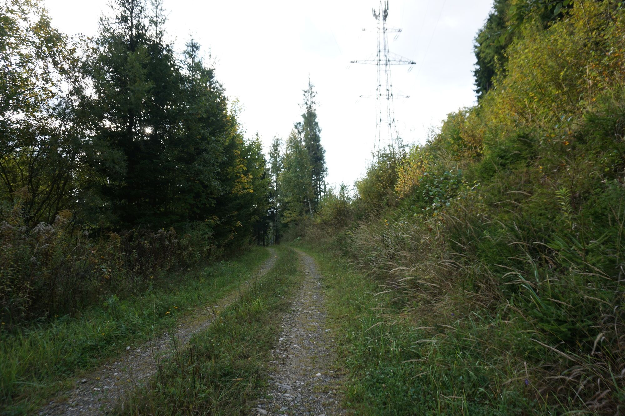
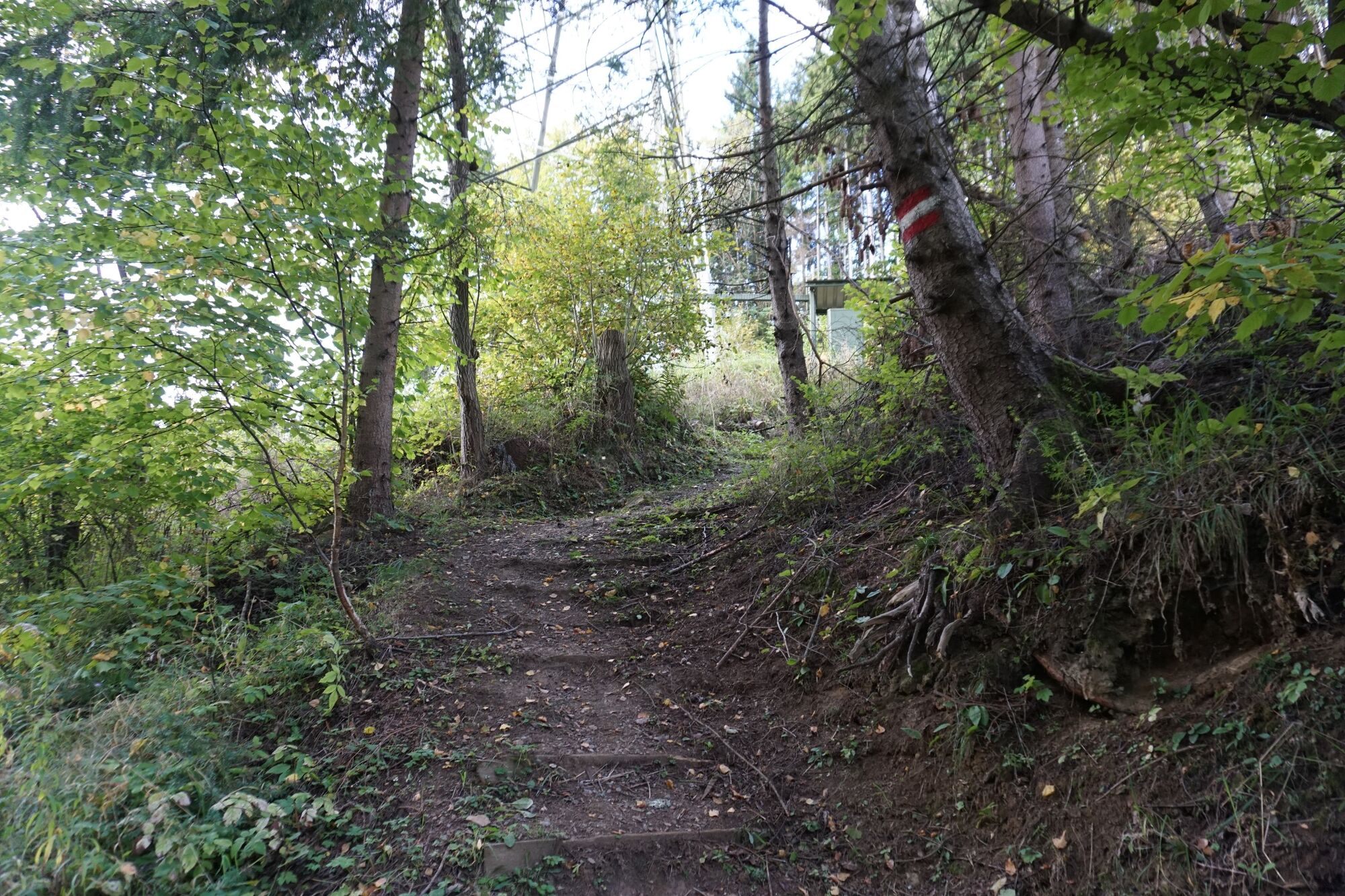
After just a few meters, you can already enjoy an incredibly beautiful view of the town of Judenburg. After a short passage on the gravel road, keep left along the forest path. Continue along hiking trail 313, following the red-white-red markings. Alternatively, you can choose a more leisurely ascent along the forest road via hiking trail 313A.
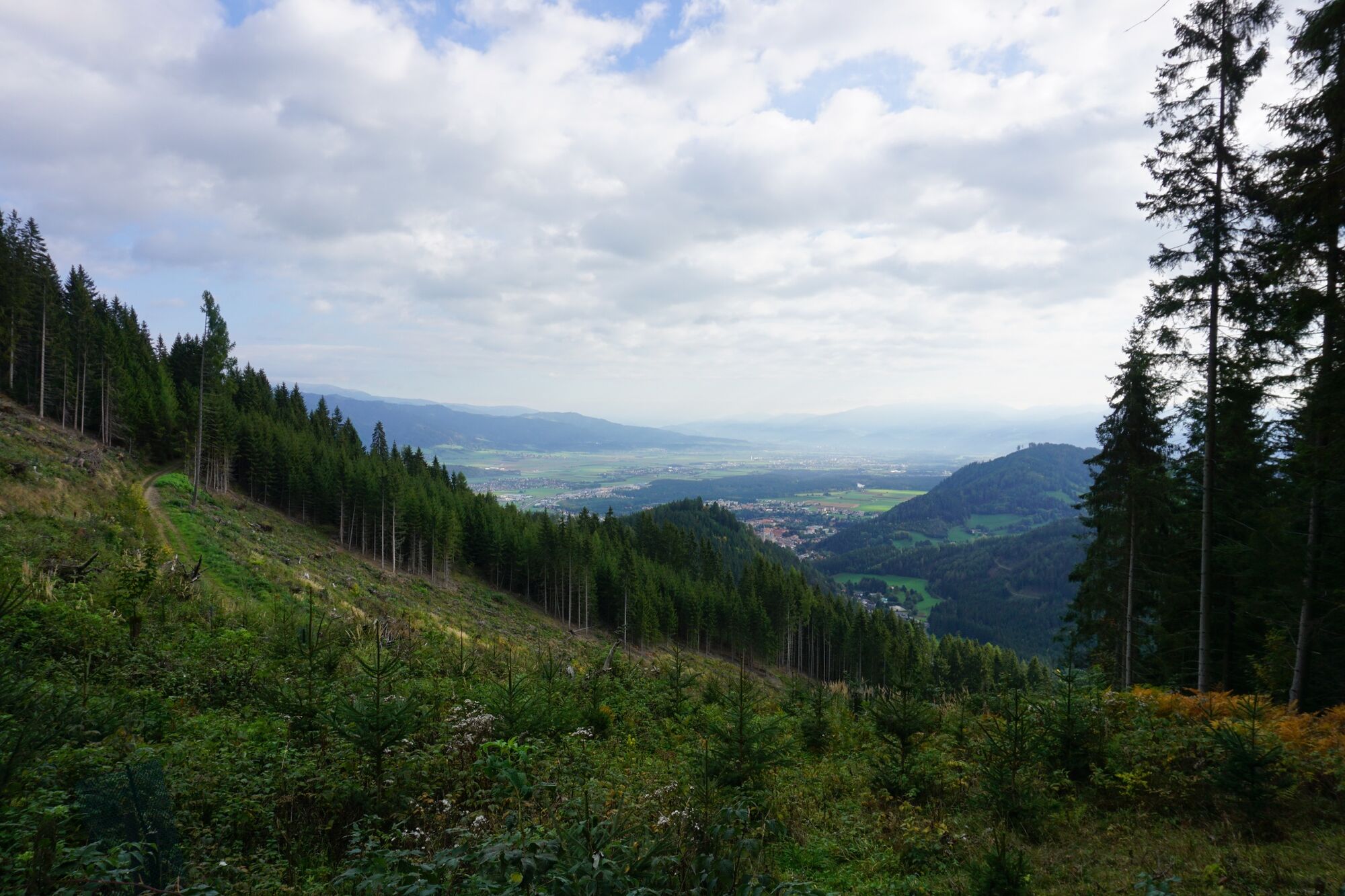
We soon turn right from the forest road up a narrow forest path; we pass a large electricity pylon and have a great view of Oberweg. Continue along the well-marked forest path. As you climb steadily uphill, you quickly cover many meters in altitude and - just a few minutes away from the town of Judenburg - get a real alpine and mountain feeling. Again and again you can enjoy wonderful views all around.
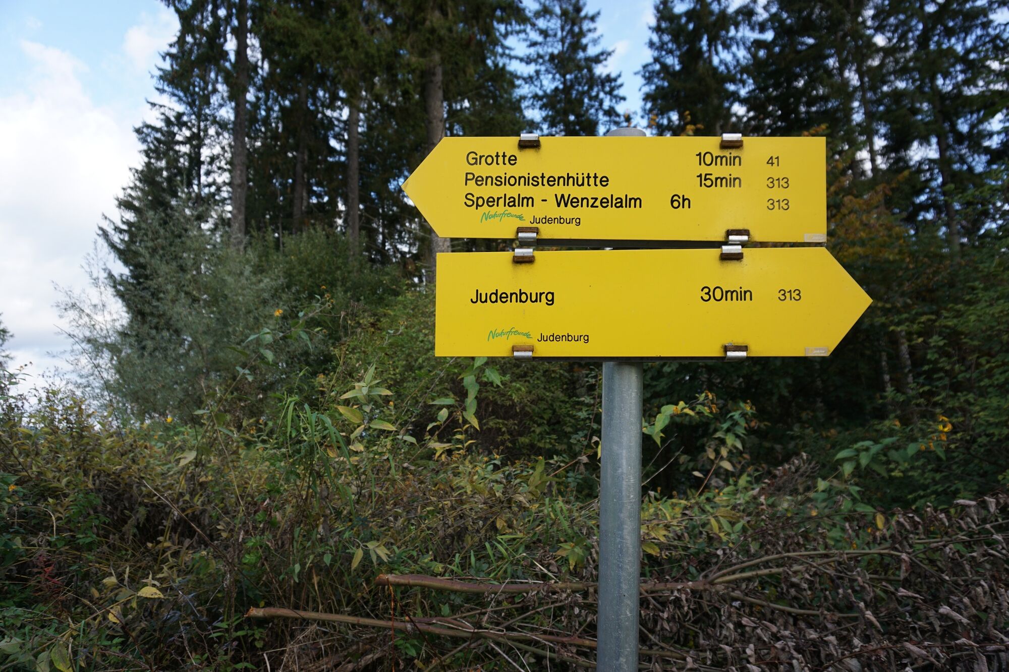
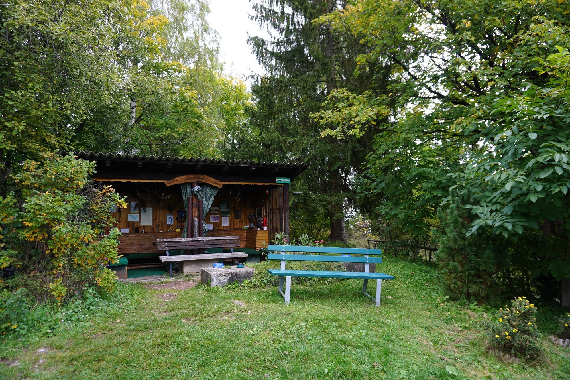
After around 2 km you reach a bench and a wayside shrine, a good opportunity for a first rest. Shortly afterwards, we cross the forest road and continue along the direct ascent to the Pensionistenhütte (hiking trail 313, walking time to the Pensionistenhütte: 15 minutes). At the Pensionistenhütte you can enjoy a great view of the Seetal Alps and take a long rest. It is wonderfully idyllic here.
From the Pensionistenhütte it is a short descent. We cross a forest path and continue along hiking trail 313 and the red-white-red trail markings in this direction, along a narrow path. To the left and right, you can always enjoy great views of the surrounding valleys and the neighboring mountain ranges.
At the next signpost, we keep to hiking trail 43 to the Hölzlkogel, which leads us steadily uphill, first through the forest, then further along a forest path. From the forest path, you can enjoy an incredible view of the Aichfeld - the forest has only recently been felled here. We like to pause here for a few minutes and enjoy the surroundings.
Wir folgen dem Forstweg weiter bergauf, an der nächsten Kreuzung ist der Hölzlkogel mit 10 Minuten Entfernung angeschrieben. Ab hier führt ein schmaler Waldweg bis zum Ziel.
Der Hölzlkogel an sich liegt unscheinbar an einer Lichtung. Direkt beim einfachen Bildstock am Kogel kommt man gut zur Ruhe und kann so richtig in die Natur eintauchen.
Der Abstieg vom Kogel erfolgt zuerst wie der Aufstieg entlang dem Wanderweg 43 und über den Wanderweg 313. An der Kreuzung mit dem Wanderweg 42 wählen wir die gemütlichere ABstiegsvariante und steigen auf dem Wanderweg 42 bis zur nächsten Kreuzung mit der Forstraße ab. Über die Forststraße gelangen wir gemütlich zurück ins Tal und kehren auf dem gewohnten Weg zum Ausgangspunkt zurück.
Hinweis: Die vielen bekannte "Grotte" von Judenburg in der Nähe der Austiegsroute ist gesperrt und nicht mehr zugänglich.
- Highest point
- 1,199 m
- Endpoint
-
Main square Judenburg
- Height profile
-

- Equipment
-
Dress appropriately for a hike:
Wear weather-appropriate, durable clothing. In any case, the clothing should protect you from possible rain and cold or sun and heat.
Even low mountain ranges often hold meteorological surprises. It is not uncommon, even in June, for a cold snap to occur at higher altitudes.
Sandals, bathing slippers, even sneakers are not the appropriate footwear for a hike.
Use hiking boots with ankle protection. Make sure they have a good tread and grip. After rain showers, it can be very slippery in the forest, even in summer, on roots, leaves and stones - Safety instructions
-
In order to really enjoy a hike in the Murtal and relax, please note the following points:
Plan your stages according to your condition and ability. Take your time. Organize your energy very well, take enough breaks. There are very long sections. Not everywhere there are possibilities to stop for refreshments. For a long-distance hiker it goes without saying that he should have enough drinks (and snacks) with him. Adapt your behavior to the respective conditions, both meteorological and ground conditions. Study the weather forecast daily. Pay attention to yourself and other hikers. - Tips
-
Be sure to pack a snack and take advantage of the great viewpoints along the route for a long rest! It's beautiful here!
- Additional information
- Directions
-
Approach to Judenburg via S36 and B77.
- Public transportation
- Parking
-
Paid parking in Judenburg according to the specified parking fees.
Longer parking is possible in the Judenburg Zentrum parking garage. There are only very low parking fees for the entire day. Note: Payment here is only possible with credit or contactless payment by ATM card. (Judenburg parking garage, Schulgasse 7, 8750 Judenburg)


-

-
AuthorThe tour Hike to the Hölzlkogel is used by outdooractive.com provided.


General info
-
Erlebnisregion Murtal
1781
-
Steirisches Zirbenland
711
-
Judenburg
207