


- Brief description
-
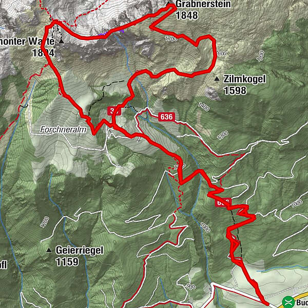
From the Buchauer Sattel over the Grabneralm you climb the Grabnerstein via the normal route.
Ferrata lovers can descend via the Jungfernsteig to the Admonterhaus and make a small round tour.
- Difficulty
-
medium
- Rating
-
- Starting point
-
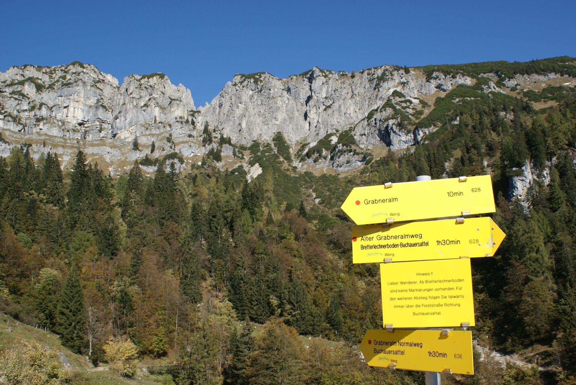
Parkplatz Buchauer Sattel
- Route
-
Grabneralm3.3 kmGrabnerstein (1,848 m)5.8 kmJungfernscharte (1,718 m)6.3 kmAdmonter Haus6.9 kmGrabneralm8.4 km
- Best season
-
JanFebMarAprMayJunJulAugSepOctNovDec
- Description
-
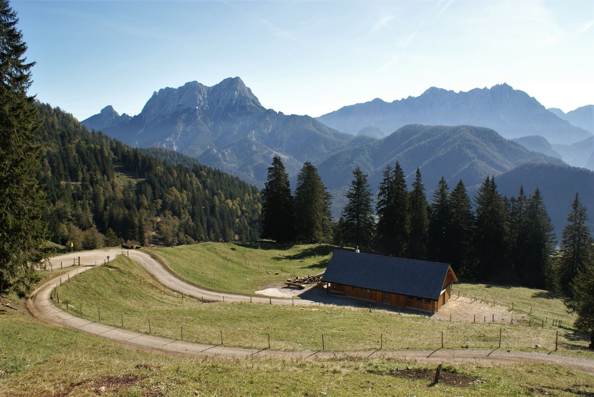
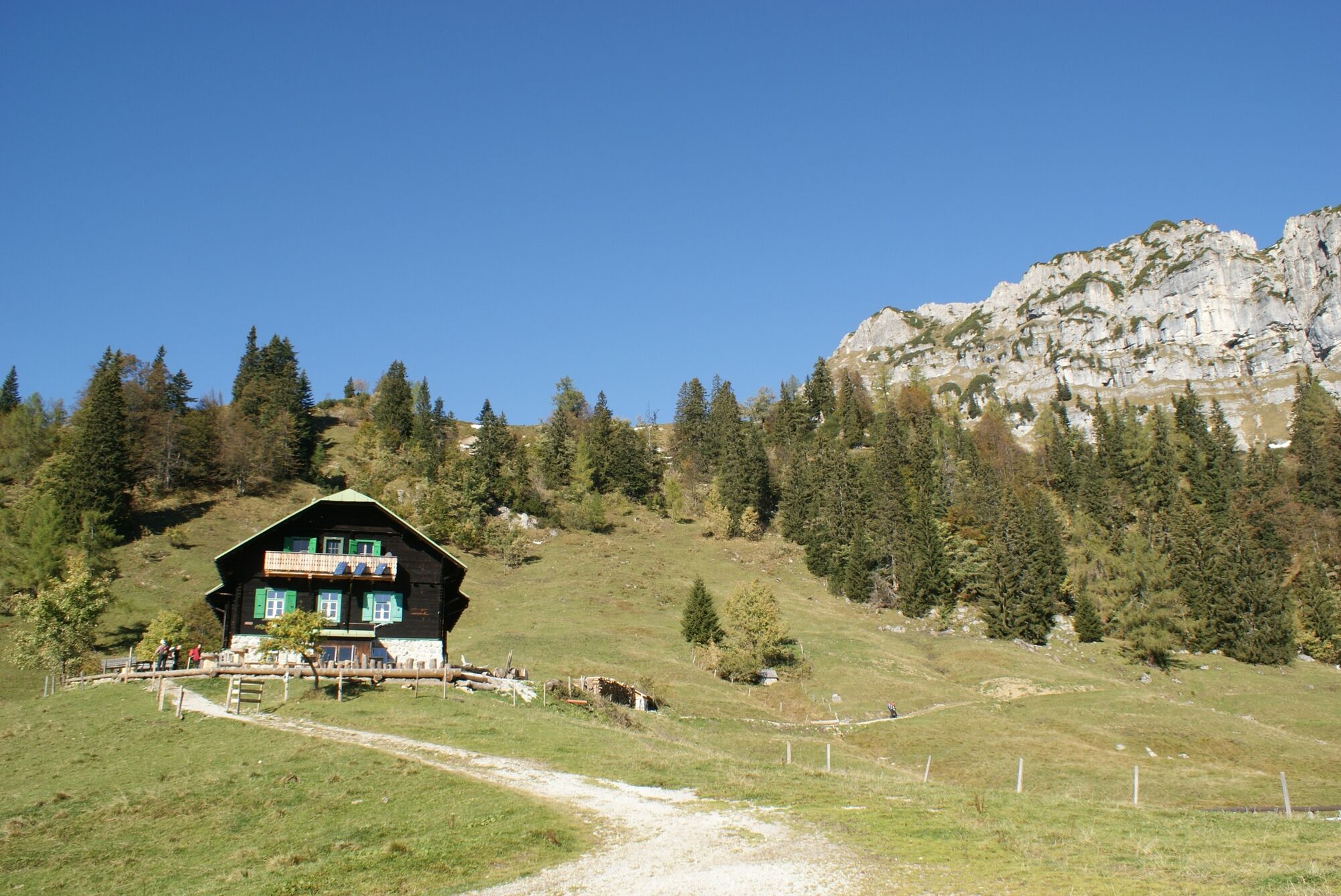
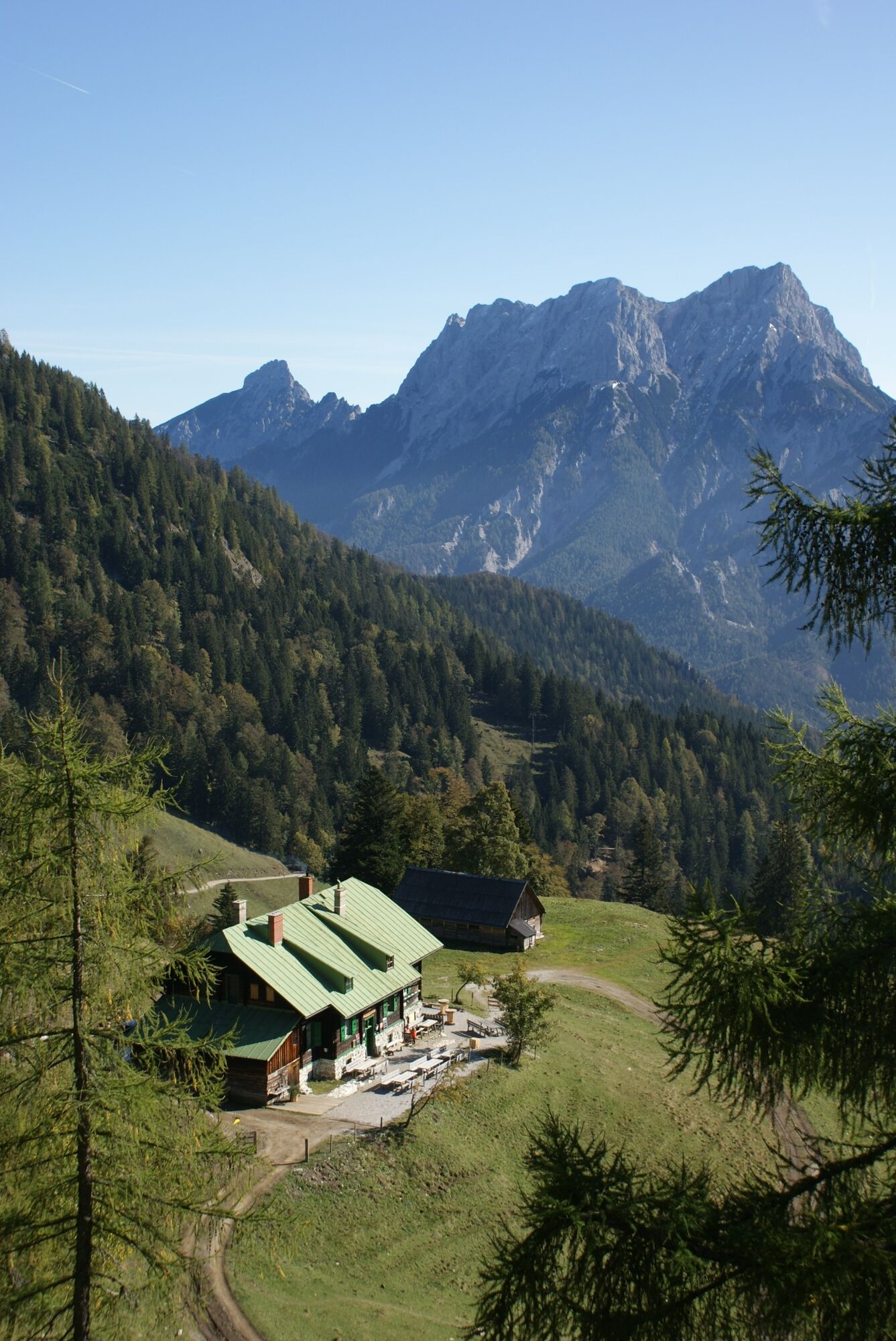
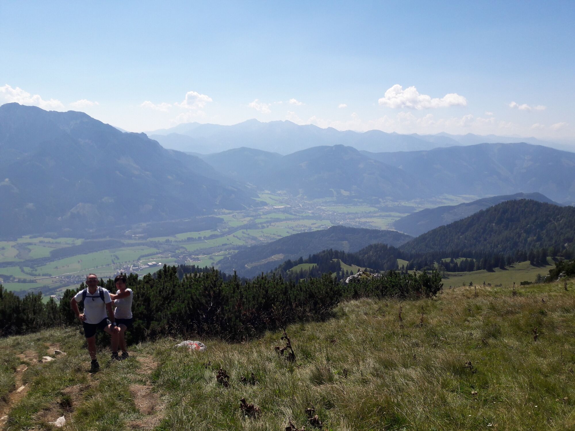
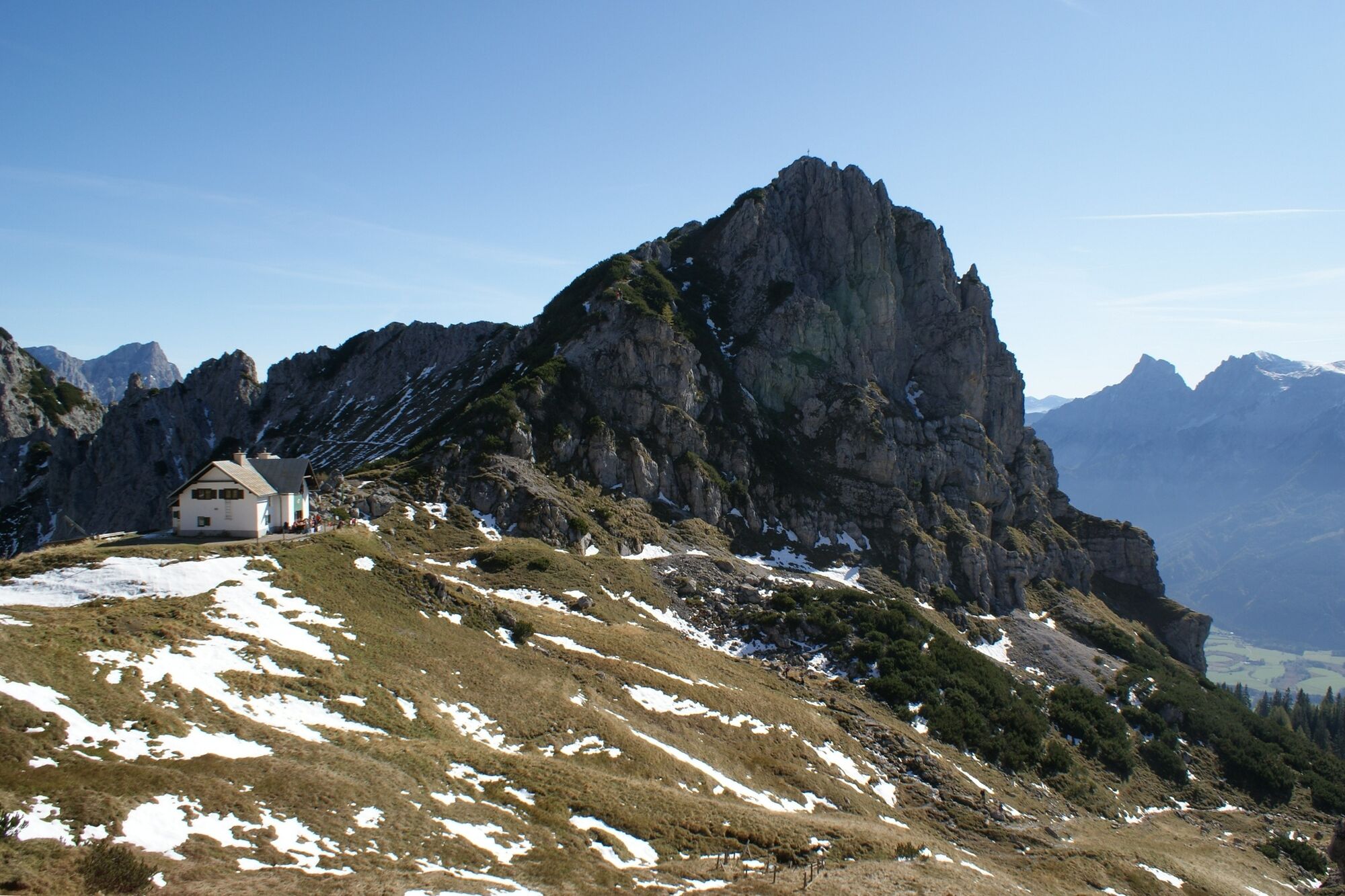
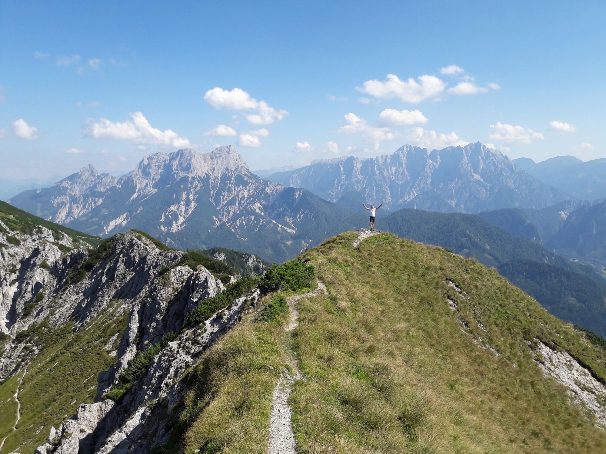
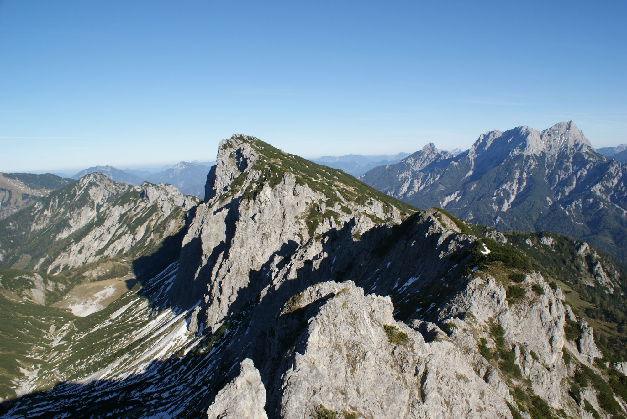
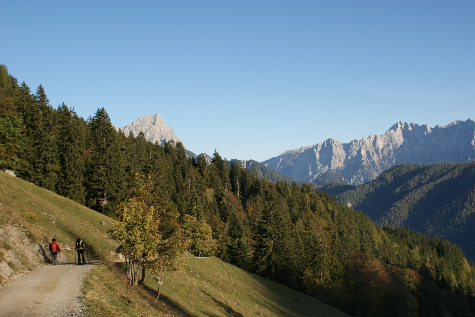
The full splendour of many different flowers - you can only find on the Grabnerstein. From the Buchauer Sattel (861 m) you walk over the Grabneralm to the Grabnerstein, the easternmost peak of the Haller Walls. In May and June you can see countless flowers on this mountain, which can also be experienced by untrained eyes through the information boards. For example, the white alpine daffodils, some of which bloom all over the area, various types of orchids, but also numerous other alpine flowers make not only the heart of botanists beat faster. The Grabneralm, which belongs to the Grabnerhof Agricultural and Forestry College and offers farm products, invites you to enjoy a culinary refreshment before you walk on partly stony footpaths through the mountain pines up to the summit. Throughout the entire tour you will have beautiful views down into the valley, views into the Gesaeuse National Park and views as far as the Hohe Tauern.
- Directions
-
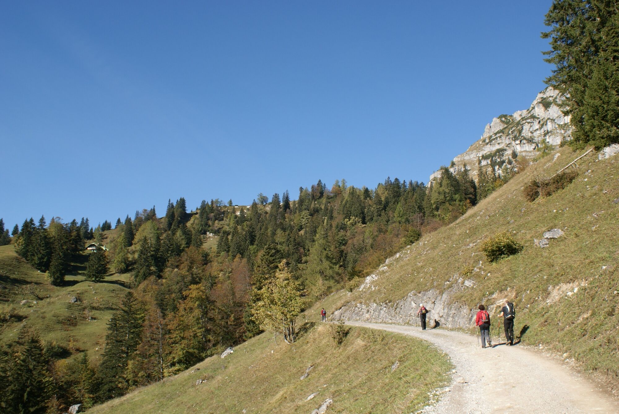
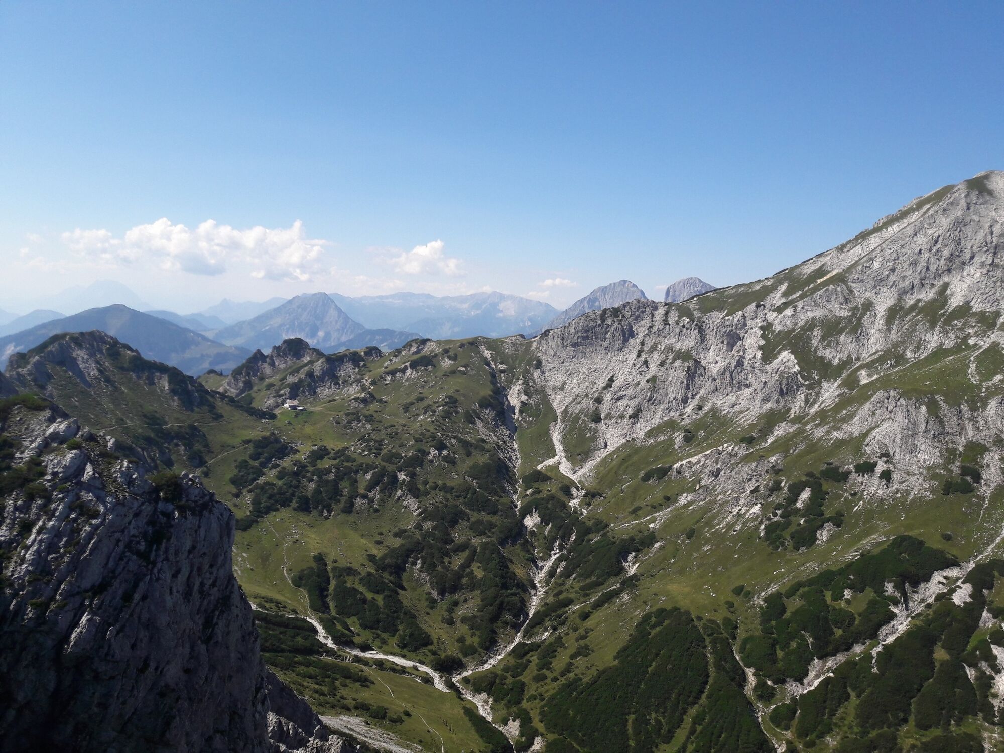
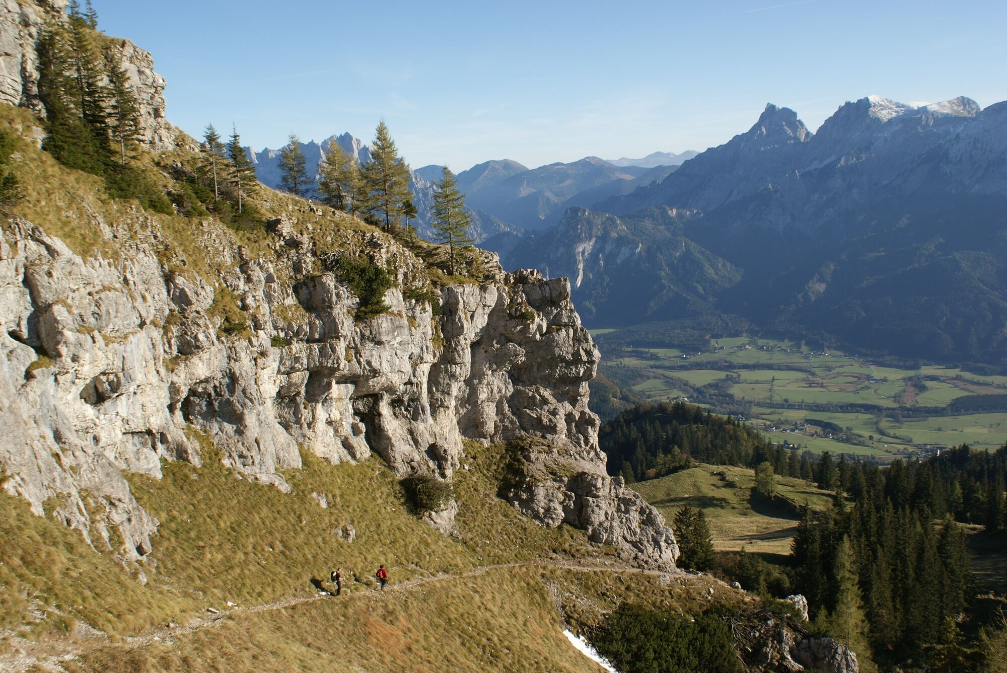
From the car park at the Buchauer Sattel (861m) you walk in a north-westerly direction across the meadow into the forest, from where you follow the markings (No. 636) and shorten the access forest road for the Grabneralm (1395m) again and again and reach it after 2 ½ hours. For the last two kilometres, however, you walk along the forest road. From the Grabneralmhaus the path is first flat, then a little steeper towards the northeast through mountain pines to the saddle at Zilmkogel (1588 m). From here the terrain becomes more alpine until you first come to cow troughs and then to a dilapidated barn. From here you have only a few meters to the summit (1848 m). The descent path is the same as the ascent path, unless you are a via ferrata enthusiast, in which case there is another variant: if you descend via the insured Jungfernsteig (difficulty A/B) to the Jungfernscharte (1718 m) and climb the following counter-ascent, you will reach the Admonterhaus (1724 m), an Alpine Club hut located at Grabnertörl. After refreshments there, you could walk to the summit of the Admonter Warte (1806 m), which is 10 minutes away, before you complete the small loop to the Grabneralm via the very well marked normal path and from there follow the ascent path to the Buchauer Sattel.
- Highest point
- 1,834 m
- Endpoint
-
Parkplatz Buchauer Sattel
- Height profile
-

- Equipment
-
Hiking boots or good trekking shoes, as well as a hiking rucksack with appropriate contents (water bottle, blister plaster, hiking map, snack, etc.). You should also be well prepared for a change of weather.
ad. Via ferrata variant: Via ferrata set and rockfall helmet for the ascent of the Jungfernsteig.
- Safety instructions
-
Absolute surefootedness and complete freedom from vertigo are absolutely necessary. Climbing experience is useful, the Jungfernsteig is a via ferrata with A/B difficulty and the whole tour excluding the via ferrata is technically easy.
Mountain rescue emergency call: 140
- Tips
-
The trail from the Buchauer Sattel to the Grabneralm is a theme trail (theme: "Almen" from the Grabnerhof agricultural school)
- Directions
-
A9 Phyrn motorway to exit Ardning/Admont and from there past Frauenberg, approx. 10 km after Admont. At the roundabout on the left side of the river Enns take the 3rd exit onto the Buchauer Bundesstraße B117 towards Weng and follow this road for about 5 km until you reach the Buchauer Sattel.
Or via Leoben, Vordernberg and Eisenerz to Hieflau and from there via B146 in western direction through the Gesäuse to Admont. After the north-south main road through the village, take the 2nd exit at the roundabout in the direction of Weng and follow this road (B117) for about 5 km until you reach the Buchauer Sattel.
A1 Westautobahn to exit Ybbs and from there in southern direction through Scheibbs, Lunz am See, Göstling an der Ybbs and Palfau to Hieflau. From there via B146 in western direction through the Gesäuse to Admont. After the north-south main road through the village, take the 2nd exit at the roundabout in the direction of Weng and follow this road (B117) for about 5 km, you will find yourself on the Buchauer Sattel.
- Public transportation
-
www.oebb.at
www.busbahnbim.at
- Parking
-
A free parking lot with information boards is located directly at the Buchauer Sattel on the left side of the road (coming from Admont).
-

-
AuthorThe tour Grabneralm with Grabnerstein (1848 m) is used by outdooractive.com provided.


General info
-
Gesäuse
2223
-
Steyr und die Nationalpark Region
1369
-
Admont
293


")


