
- Brief description
-
This is a wonderful, easy hike with a refreshing character.
- Difficulty
-
easy
- Rating
-
- Starting point
-
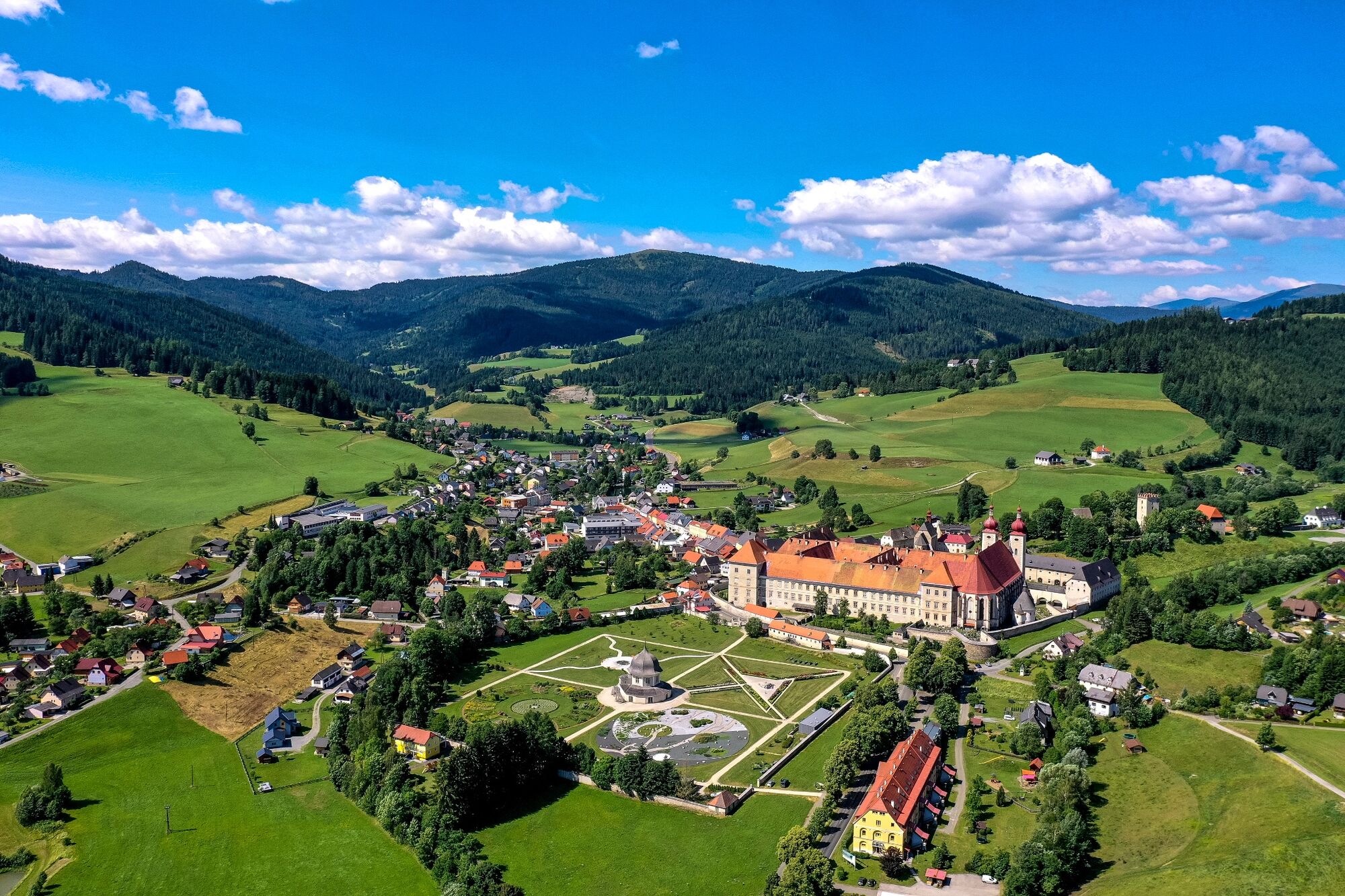
Abbey Gate St. Lambrecht
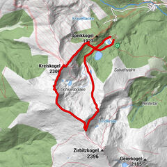
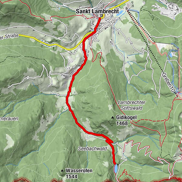
- Route
-
Sankt LambrechtTorwirt0.0 kmMarktcafé0.0 kmStifterl0.0 kmMarktkreuz0.2 kmAuerling4.8 kmMarktkreuz11.0 kmStifterl11.2 kmMarktcafé11.2 kmTorwirt11.3 kmSankt Lambrecht11.3 km
- Best season
-
JanFebMarAprMayJunJulAugSepOctNovDec
- Description
-
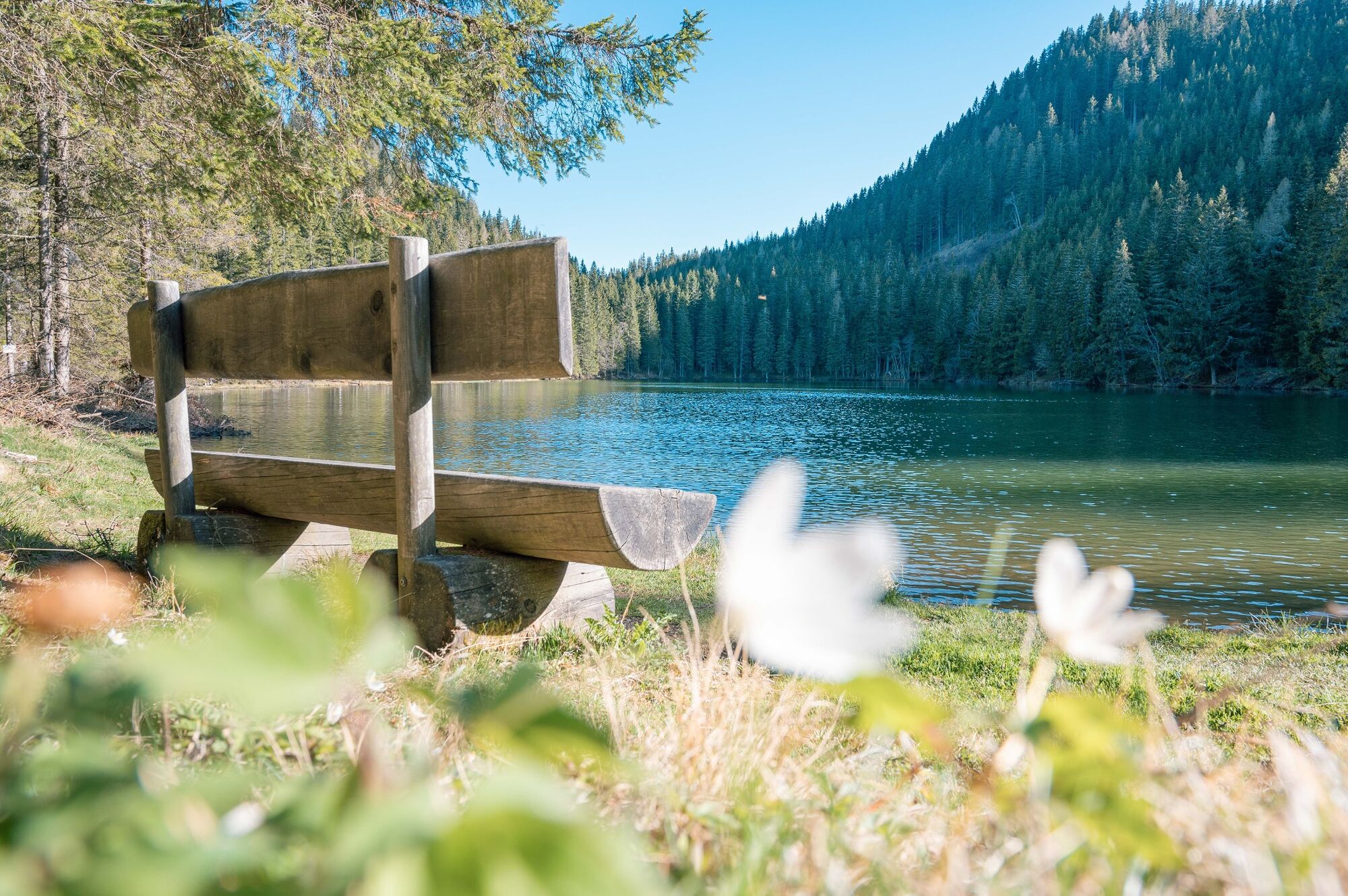
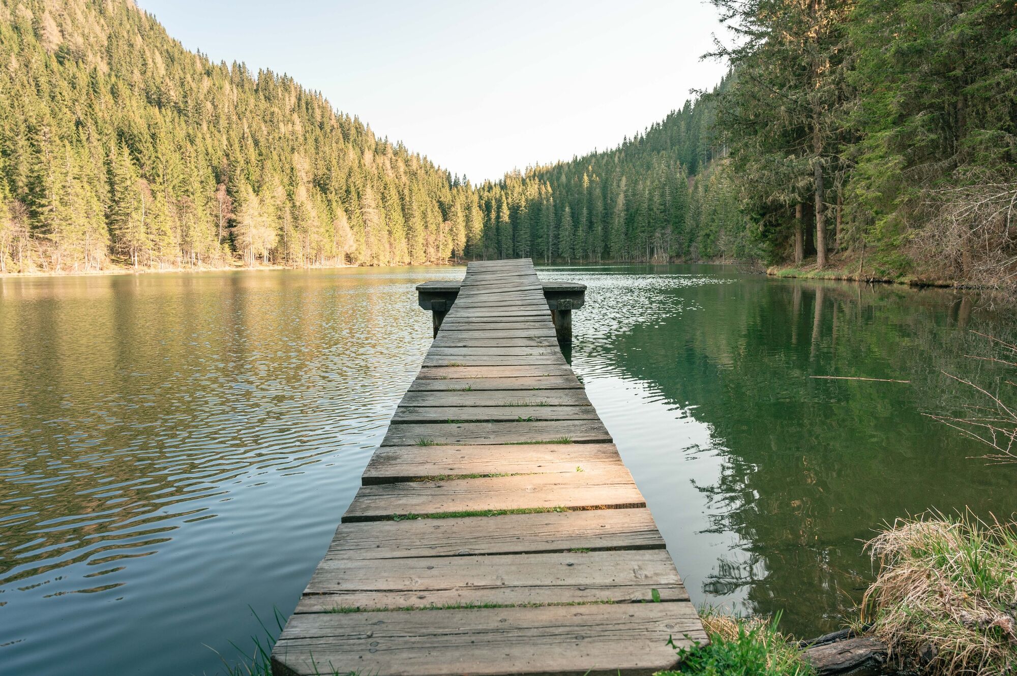
An aura of mystery surrounds the Auerlingsee. Nestled in a wonderful forest location, it is hidden at the foot of the Grebenzen. Formed by the Ice Age, this natural rest area is a romantic starting point for hikes to the Grebenzen.
- Directions
-
This beautiful path runs from St. Lambrecht alongside the Lambrechtbach stream up to the romantic Auerlingsee. After the crossroads at Trattenhof, the path leads off the road onto a shady, quiet hiking trail. Passing trees covered in lichens you reach the Auerlingsee, which was formed by the ice age and is located in the middle of the forest. Once here you can go on a hike around the lake or take a cool swim before heading back down to St. Lambrecht. The lake is particularly popular with anglers. The way back is on the same route as the way there.
- Highest point
- 1,329 m
- Endpoint
-
Abbey Gate St. Lambrecht
- Height profile
-

- Equipment
-
Good shoes
Sun protection
Sufficient food - Tips
-
A picnic by the lake or a refreshing jump into the cool water - don't forget a snack and swimming gear!
- Additional information
-
The ideal time for this tour is from April to October.
- Directions
-
By car from Germany
From Munich via the A8 towards Salzburg. From Salzburg on the A10 Tauernautobahn to St. Michael im Lungau. On the B 96 to Tamsweg, then on the B 95 to Predlitz. The B 97 leads via Stadl/Mur to Murau. There at the roundabout towards St. Lambrecht to Murauer train station and further towards St. Lambrecht. You reach St. Lambrecht via Laßnitz near Murau. The monastery is located in the town center.Arrival from Eastern Austria/Hungary
At the motorway junction in St. Michael near Leoben, take the S 36 towards Klagenfurt. Past Knittelfeld and Judenburg to Scheifling. In Scheifling continue to Teufenbach. Turn left there towards Mariahof and St. Lambrecht. In Mariahof, turn right at the train station towards St. Lambrecht. The monastery is located in the center of St. Lambrecht.Arrival from southern Austria/Italy
Via Klagenfurt on the S 37 past St. Veit/Glan, Treibach and Friesach. In Friesach continue towards Vienna, via Dürnstein and Wildbad to Neumarkt. After the town center of Neumarkt turn left towards Murau, in Mariahof after the railway crossing turn left towards St. Lambrecht. The monastery is located in the center of St. Lambrecht. - Public transportation
-
With the BusBahnBim app from the interconnected line, timetable information is easier than ever before: all bus, train and tram connections in Austria can be queried by entering locations and/or addresses, stops or important points. The app is available as a free app for smartphones (Android, iOS) - on Google Play and in the App Store.
- Parking
-
Public parking spaces are available near the town entrance sign, the monastery entrance and at the market pond.
- Author
-
The tour Auerling Bachway is used by outdooractive.com provided.