
- Brief description
-
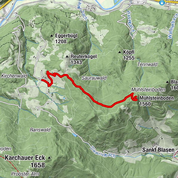
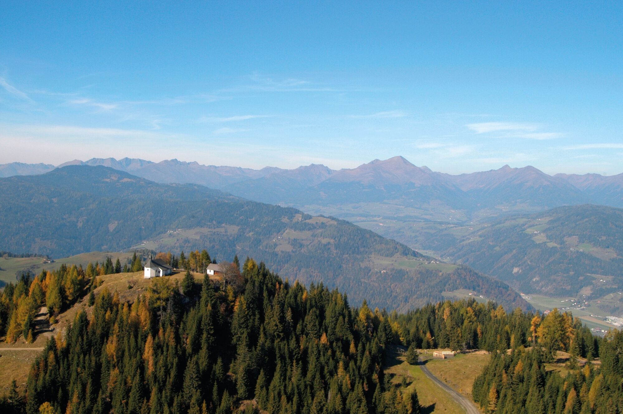
This is a wonderful hike to the idyllic Mühlsteinboden pilgrimage church. From there there is a sensational landscape view.
- Difficulty
-
medium
- Rating
-
- Starting point
-
Alpengasthof Moser, Karchau
- Route
-
Alpengasthof MoserKarchau0.0 kmMühlsteinboden (1,560 m)4.3 kmWallfahrtskirche Mühlsteinboden4.4 km
- Best season
-
JanFebMarAprMayJunJulAugSepOctNovDec
- Description
-
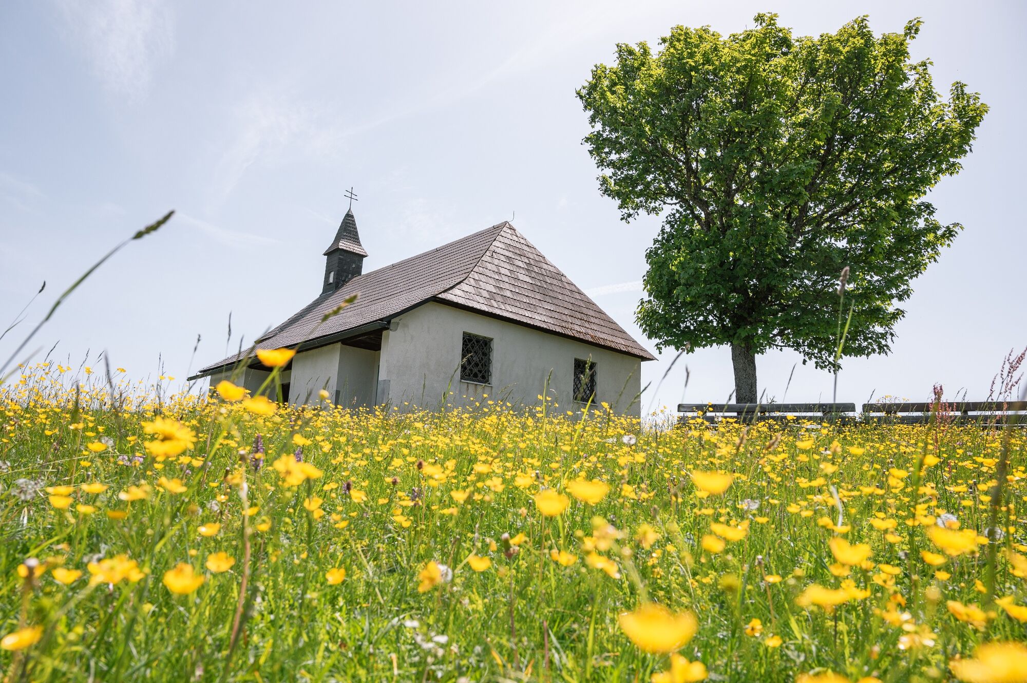
According to legend, Mühlsteinboden was a witch mountain. Bad weather is said to have showered hail every year until a pious farmer put a cross there. Today there is a small pilgrimage church there at 1,544 m above sea level. Locals and guests alike confirm that this is still a special place of power today, where you can find peace and recharge your batteries for everyday life.
- Directions
-
Take the road towards St. Lambrecht, at the beehives on the left you go towards Berger Farm. Before the Berger farm yard, go up the cul-de-sac on the right, then keep left and come to a small plateau. You go behind the gate and up the forest path to the right (signs go up in front of the gate and then come back to the forest path a little further up). From here you always follow the signposts or the forest path uphill until you reach the Mühlsteinboden pilgrimage church.
- Highest point
- 1,531 m
- Endpoint
-
Mühlsteinboden
- Height profile
-

- Equipment
-
Good shoes
Sun protection
Sufficient food - Additional information
-
The ideal time for this tour is from May to October.
- Directions
-
By car from Germany
From Munich via the A8 towards Salzburg. From Salzburg on the A10 Tauernautobahn to St. Michael im Lungau. On the B 96 to Tamsweg, then on the B 95 to Predlitz. The B 97 leads via Stadl/Mur to Murau. There at the roundabout towards St. Lambrecht to Murauer train station and further towards St. Lambrecht. You reach St. Lambrecht via Laßnitz near Murau. Continue straight ahead. Shortly before St. Blase you turn left and drive over the Karchau to the Alpengasthof Moser.Arrival from Eastern Austria/Hungary
At the motorway junction in St. Michael near Leoben, take the S 36 towards Klagenfurt. Past Knittelfeld and Judenburg to Scheifling. In Scheifling continue towards Klagenfurt to Neumarkt, via Unzmarkt and Perchau am Sattel you reach Neumarkt. Turn right there towards Mariahof and St. Lambrecht. In Mariahof, after the railway crossing, turn left towards St. Lambrecht. Shortly after St. Blase you turn right and drive over the Karchau to the Alpengasthof Moser.Arrival from southern Austria/Italy
Via Klagenfurt on the S37 past St. Veit/Glan, Treibach and Friesach. In Friesach continue towards Vienna, via Dürnstein and Wildbad to Neumarkt. After the town center of Neumarkt turn left towards Murau, in Mariahof turn left after the railway crossing towards St. Lambrecht. Shortly after St. Blase you turn right and drive over the Karchau to the Alpengasthof Moser. - Public transportation
-
With the BusBahnBim app from the interconnected line, timetable information is easier than ever before: all bus, train and tram connections in Austria can be queried by entering locations and/or addresses, stops or important points. The app is available as a free app for smartphones (Android, iOS) - on Google Play and in the App Store.
- Parking
-
Public parking spaces are available at the Alpengasthof Moser in Karchau.
- Author
-
The tour Karchau-Mühlsteinboden is used by outdooractive.com provided.