Über den Altenbergersteig auf die Rax im Naturpark Mürzer Oberland


- Brief description
-
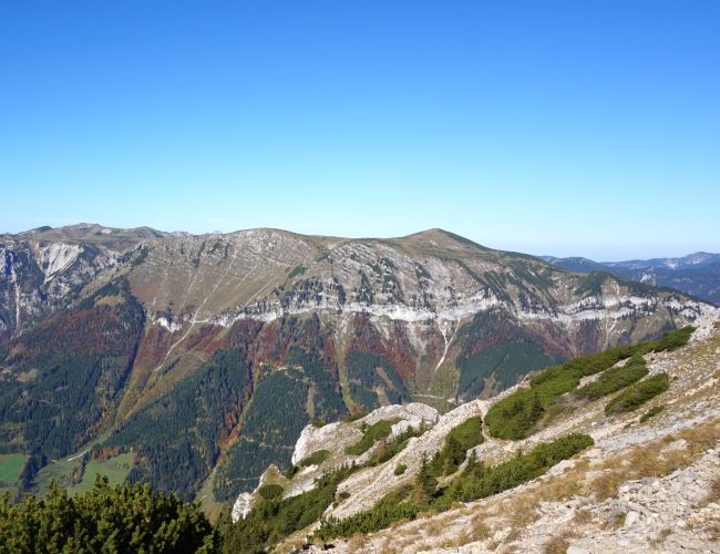
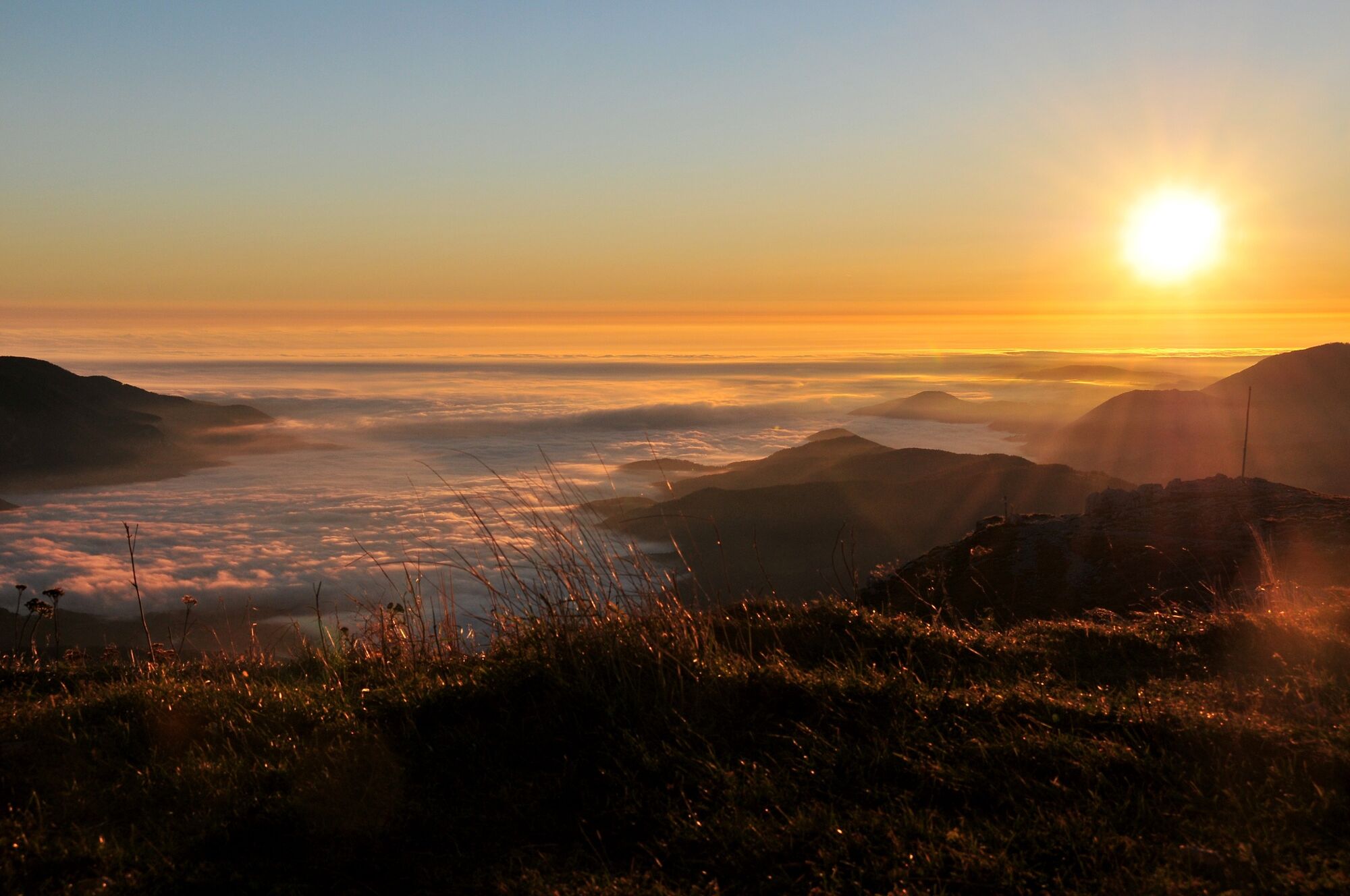
Probably the most beautiful pure hiking tour on the south side of the Rax, without climbing interludes, but with almost guaranteed solitude away from the snake trail and Rax cable car.
- Difficulty
-
medium
- Rating
-
- Route
-
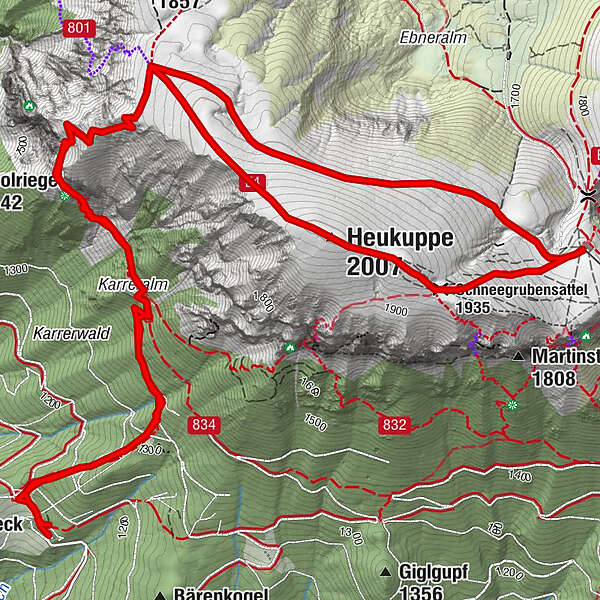
Gasthof MoassaAm Hohen Stein3.2 kmHeukuppe (2,007 m)4.5 kmSchneegrubensattel (1,935 m)5.0 kmKarl-Ludwig-Haus5.8 kmAm Hohen Stein8.1 kmGasthof Moassa11.5 km
- Best season
-
JanFebMarAprMayJunJulAugSepOctNovDec
- Description
-
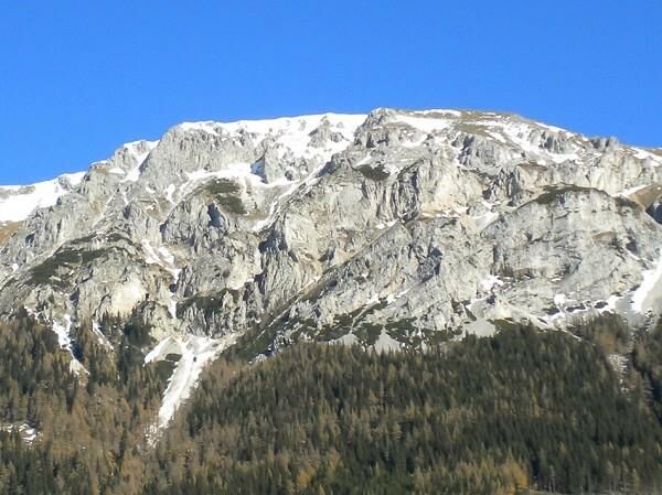
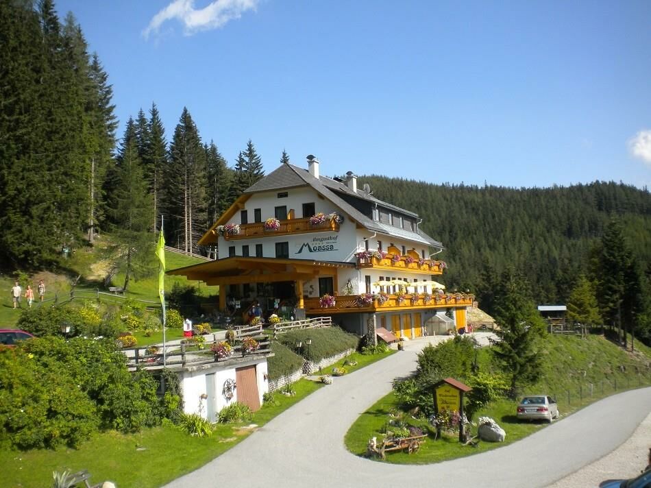
From Gasthof Moassa or, if the access road to it is closed during the week, from the Kohlbachgraben on the southwest side of the Rax in a direct line to the 2,007m high Heukuppe. Without real rock contact or climbing, but via an alpine path, whereby surefootedness is helpful in the upper part.
Interestingly, the Altenbergersteig is quite little frequented even on nice weekends, probably the Preiner Gscheid "catches" the majority of hikers.
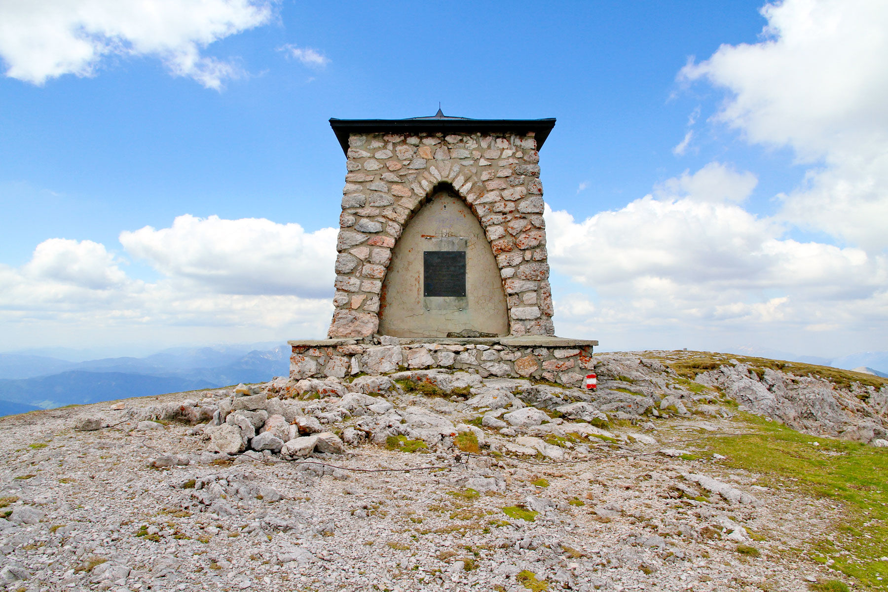
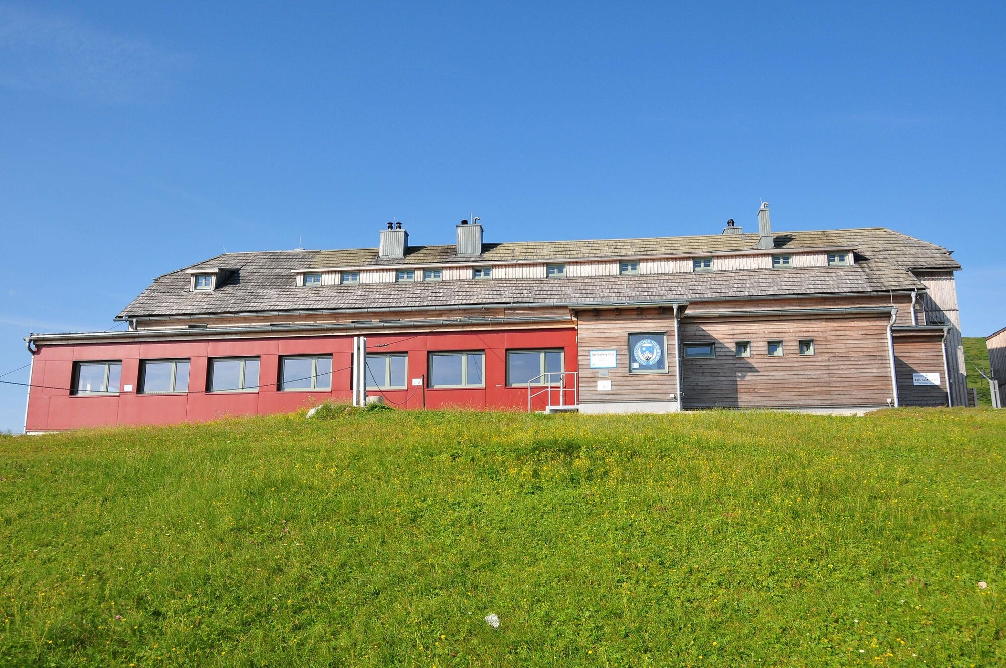
With the Gasthof Moassa and the Karl Ludwig Haus (bio - certified business) there are to the dreamlike summit panorama on the Heukuppe also still dreamlike culinary rest places on the tour.
- Directions
-
From Gasthof Moassa the ascent first leads along the former ski slope to the uninhabited Jahnhütte. There the path turns to the left as a forest path and brings us in about 15 minutes to the also uninhabited Karreralm (stable as shelter).
Here the path divides and we continue to keep to the left upwards, to soon cross numerous scree fields in a traverse.
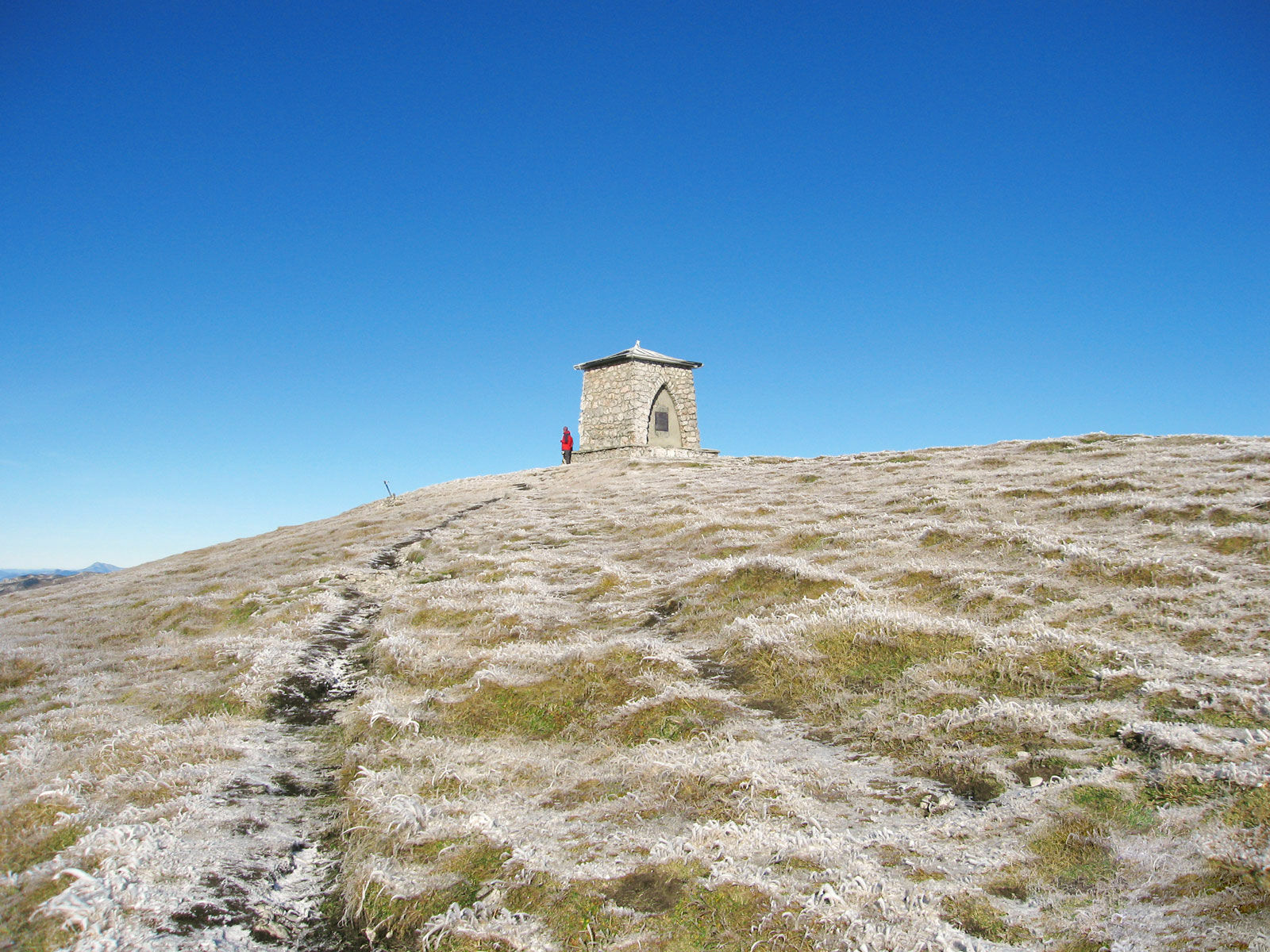
Now the trail begins to climb upwards to the right and takes us, past the "Steinernen Manndln", in a few hairpin bends to the Rax plateau not far from the Gamseck peak.
Now we turn right again and ascend the Heukuppe on an alpine path. After a short panoramic break, we hike downhill in an easterly direction to the Karl Ludwig Haus, which is soon visible.
There we have a good rest, before we return north of the already climbed Heukuppe on a blue marked path almost flat to the Gamseck summit and from there on the ascent path back to the Moassa inn.
In fog, the Rax plateau is not recommended, difficult orientation and usually strong wind make it quickly uncomfortable there!
- Highest point
- 2,003 m
- Endpoint
-
P beim GH Moassa bzw. im Kohlbachgraben
- Height profile
-

- Equipment
-
Proper backpacking makes a lot of things easier:
Pack heavy things first. The water bottle (ideally: 1 liter or more) should always be within easy reach. All things that are often needed such as sunglasses, camera, cell phone or hiking map belong on top.
An emergency kit including blister plaster belongs in every backpack and a clothing according to the "onion system" is always recommended! For alpine tours, never forget rain protection!
- Safety instructions
-
Most hiking and mountain tours in the Mürzer Oberland Nature Park are in alpine terrain. Especially for longer hiking and mountain tours, a good physical condition as well as surefootedness and a head for heights are recommended. On the plateaus of Rax, Schneealm and Veitsch orientation can be difficult in fog or bad weather. In winter always pay attention to avalanche danger!
Absolute surefootedness is necessary on this tour!
Mountain rescue emergency call: 140, operation centers in Neuberg an der Mürz and Mürzzuschlag.
- Tips
-
After the tour still to the bathing pond Urani. Of course, the Neuberg monastery with the glassblowing workshop and the nature museum are also worth seeing.
- Additional information
-
If you want to entrust yourself to a tour operator, simply book with Steiermark Touristik, the official travel agency of Steiermark Tourismus: Tel. +43 316 4003 450, www.steiermark-touristik.com
Mürzer Oberland Nature Park Office, Tel. +43 3857 8321, www.muerzeroberland.at , open Mon. - Fri. from 8:00 a.m. - 12:00 p.m.
Styria Tourism, Tel. +43 316 4003, www.steiermark.com
TRV Hochsteiermark, tel. +43 3862 55020, www.hochsteiermark.at
Tip: the Styria Tours app, available for free on Google Play and in the App Store (Android, iOS), offers detailed first-hand information: short facts (length, duration, difficulty, ascent and descent in altitude meters, ratings), map, route descriptions, altimeter, compass, summit finder, navigation along the tour. In addition, you can create your personal favorites list of favorite tours and points, save tours and destinations offline, play social media channels and more.
Mountain, hiking and nature park guides: Information at the Nature Park Office Mürzer Oberland, Tel.: +43 3857 8321.
By the way, get your personal summit pins with the Summit Lynx App: www.summitlynx.com
- Public transportation
-
Nature Park Taxi in the Mürzer Oberland Nature Park: Tel.: +43 3857 20170, www.naturparktaxi.at
ÖBB www.oebb.at or Verbundlinie Steiermark www.busbahnbim.at.
With the BusBahnBim app of the Verbundlinie, timetable information is easier than ever: all connections by bus, train and streetcar in Austria can be queried by entering places and / or addresses, stops or important points. The app is available as a free app for smartphones (Android, iOS) - on Google Play and in the App Store.
- Parking
-
P at Gasthof Moassa, follow parking regulations. On weekdays few P at the barrier in Kohlbachgraben, then about 30 minutes extra walking time to Moassa.

-

-
AuthorThe tour Über den Altenbergersteig auf die Rax im Naturpark Mürzer Oberland is used by outdooractive.com provided.


General info
-
Hochsteiermark
4067
-
Waldheimat
2182
-
Altenberg an der Rax
564


