- Brief description
- Difficulty
-
medium
- Rating
-
- Starting point
-
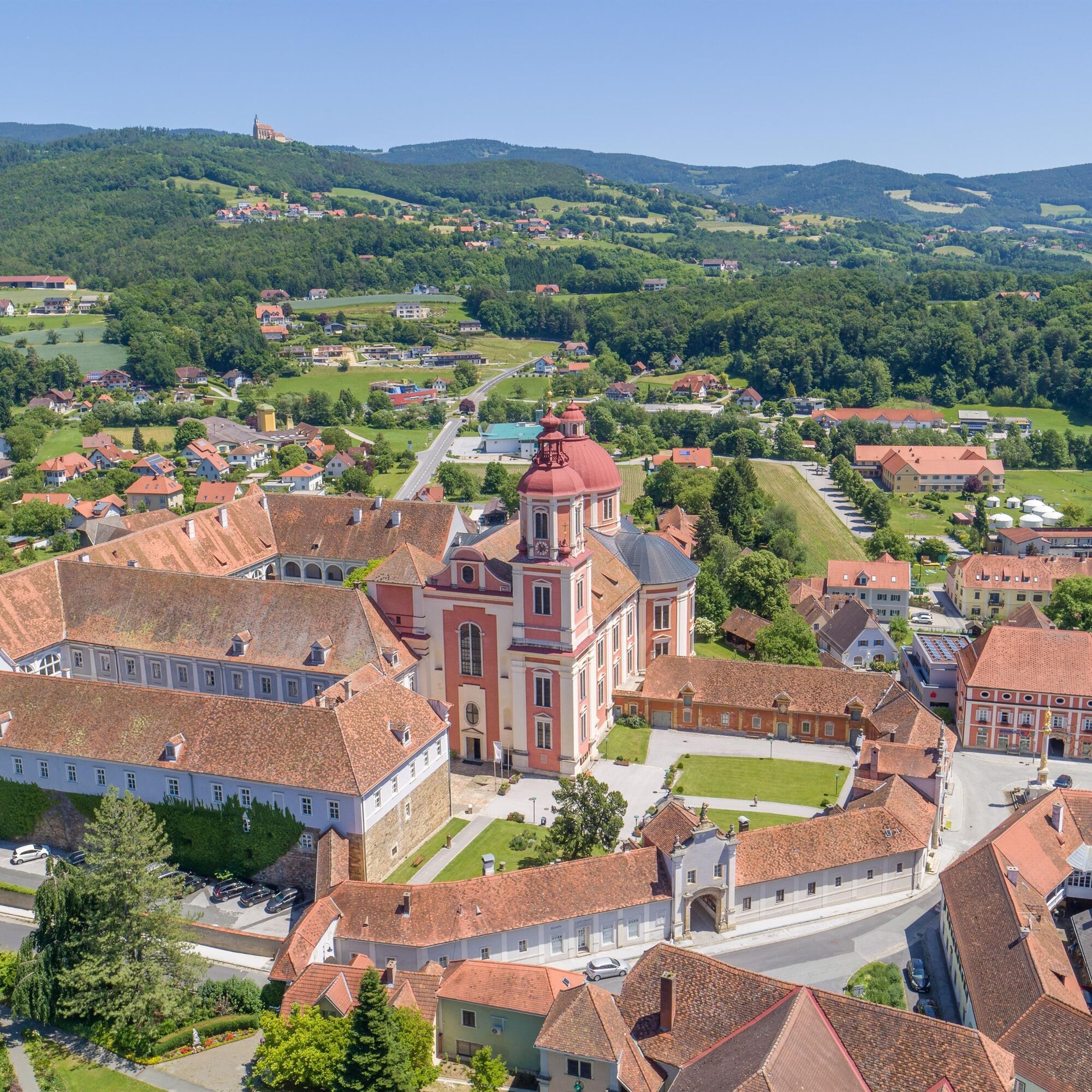
Pöllau, Castle park
- Route
-
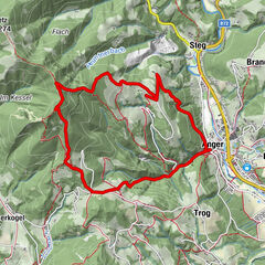
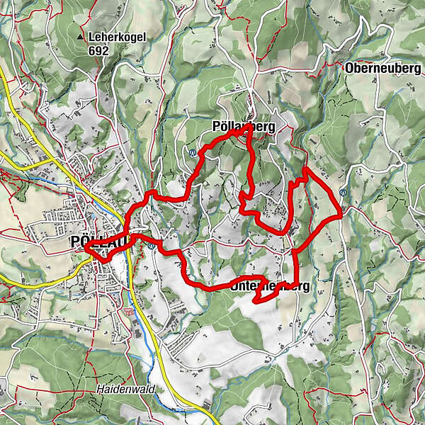
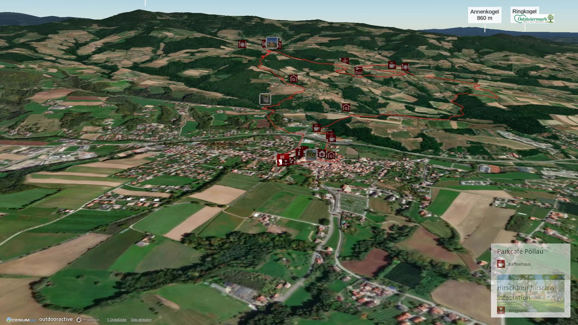
Pöllau0.2 kmKalvarienbergkirche1.3 kmGoldsberghof2.0 kmGoldsberg2.0 kmWallfahrtskirche Maria Pöllauberg3.3 kmPöllauberg3.3 kmFilialkirche St. Anna3.4 kmBerggasthof König3.5 kmGasthof Goger "Zum Jagawirt"3.6 kmBuschenschank Haubenwaller4.8 kmObersalberg5.0 kmHolzhöf5.7 kmMuggental7.3 kmPoint7.7 kmUnterneuberg8.8 kmBreitenbach10.9 kmGasthaus Ritter12.3 kmPöllau12.4 km
- Best season
-
JanFebMarAprMayJunJulAugSepOctNovDec
- Description
-
The classic hike for pilgrims
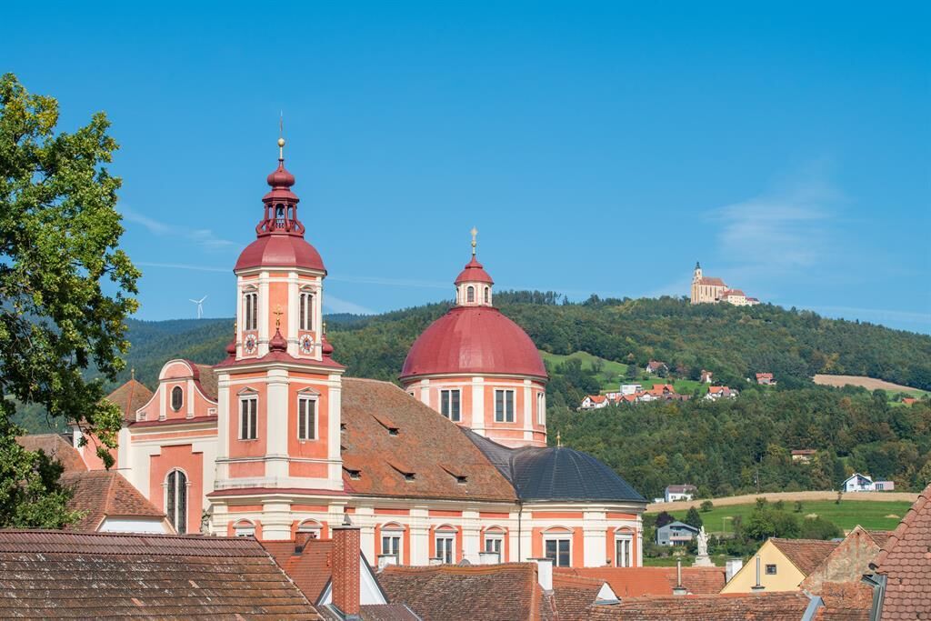
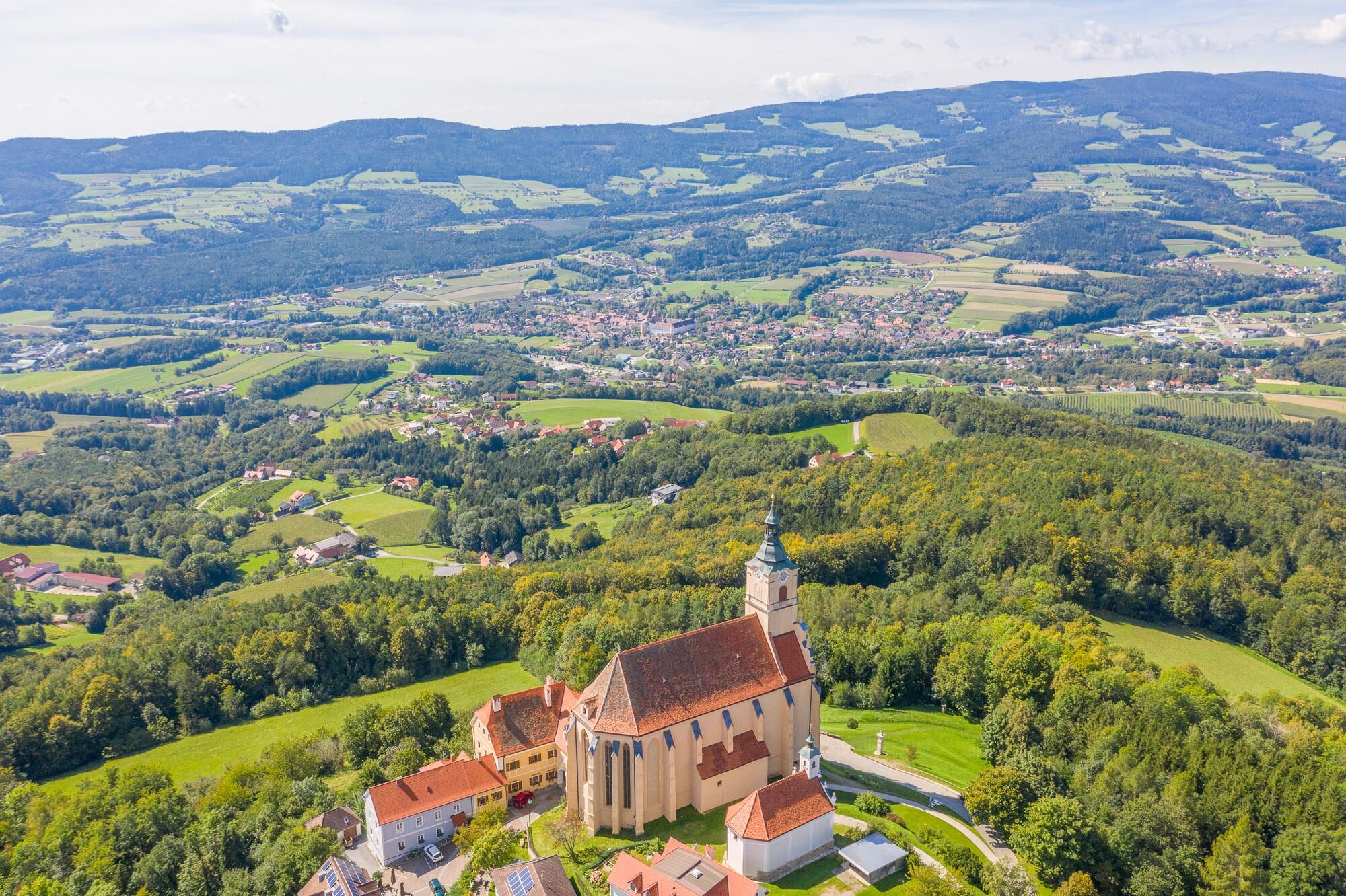
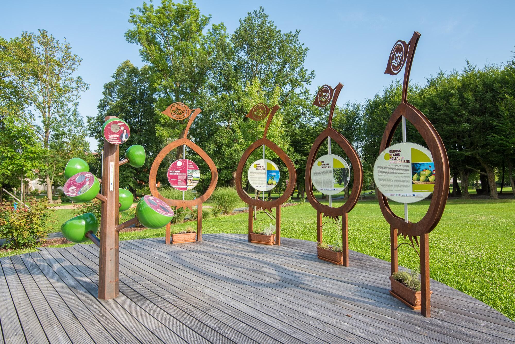
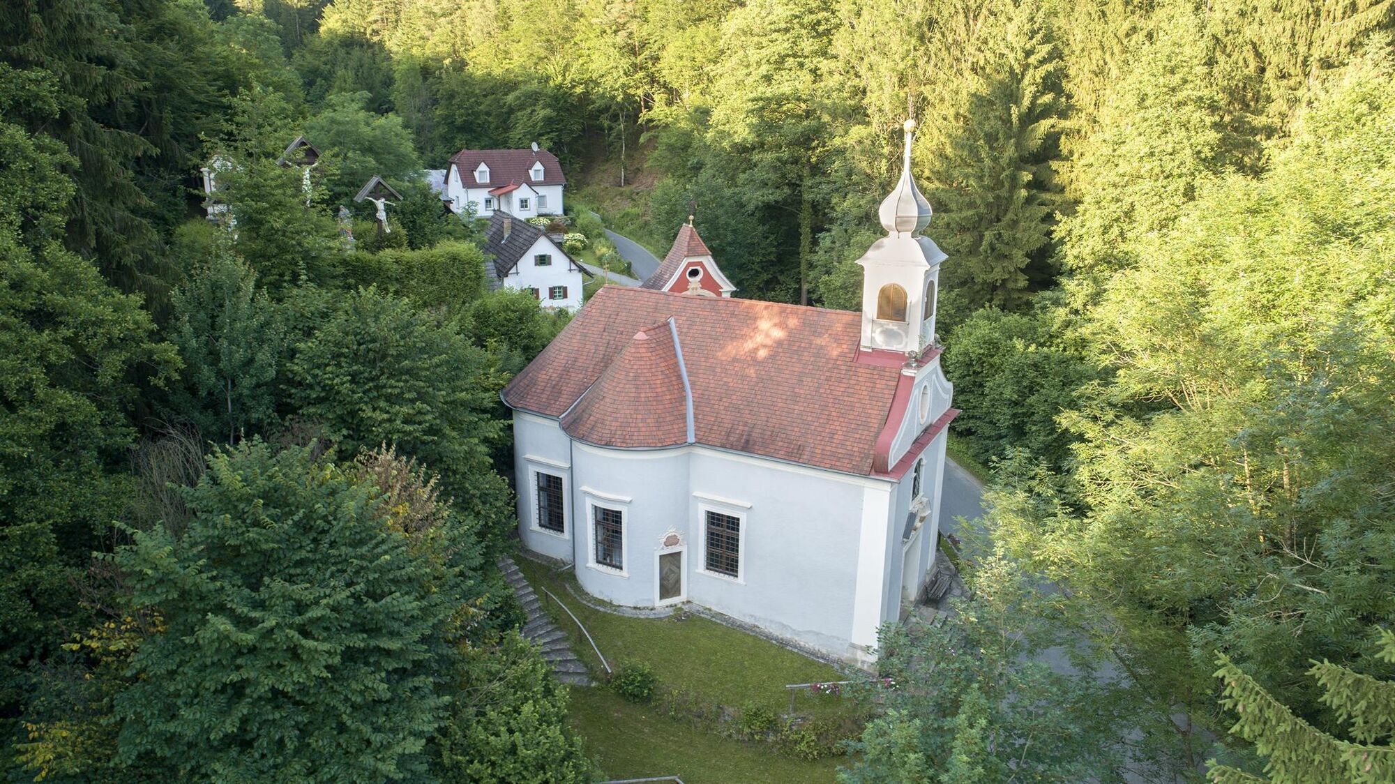
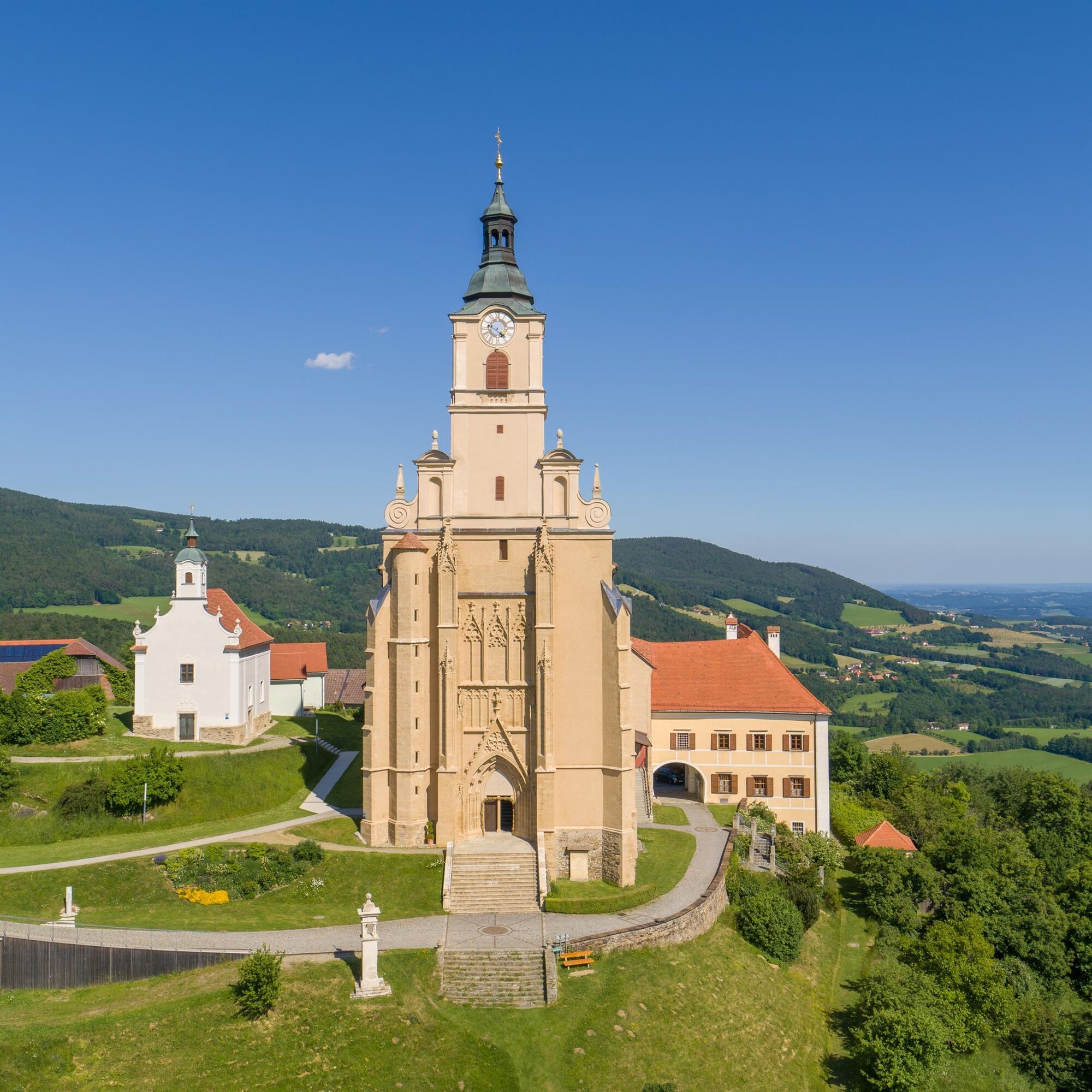
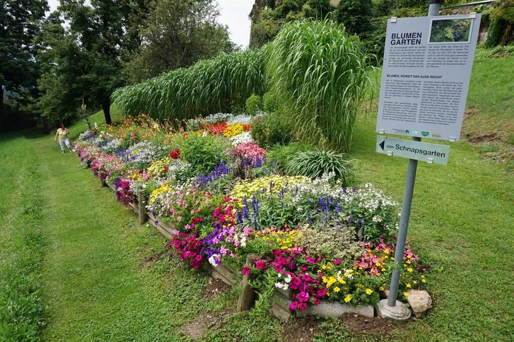
The Hirschbirnenweg or pilgrimage trail starts in Pöllau castle park and leads up to the pilgrimage site of Pöllauberg. Follow hiking trail 942 in the direction of the Kalvarienberg church. The path leads over the Goldsberg to the pilgrimage site of Pöllauberg. Both communities are highly decorated for their flower arrangements and both villages have well-known churches that are well worth seeing. Of course, the views along the way and especially in front of the pilgrimage church of Pöllauberg also speak in favour of this trail. The various themed gardens laid out below the church are highly recommended.
The way back then leads down to the Rauschbach stream, a leisurely route, always accompanied by the babbling of the stream.
The path is easy to walk and therefore suitable for the whole family.
- Directions
-
The tour is marked throughout with Hirschbirnweg Pöllauberg, or Pöllauberg -Masenberg, trail 942.
Please check the refreshment stops and opening times BEFORE starting the hike.
The route can be shortened at Hotel Retter:
Before the hotel, turn right downhill along the parking lot and continue straight ahead at the next crossroads.
For a possible return journey, you can order a SAM shared cab to Pöllauberg Ort (station Hf5809).
Start: Schlosspark, signpost in front of the Parkcafe
Pöllau- Calvary
Follow the signpost to the right until you reach the park gate. There we cross the road and walk towards Pöllau Castle. Now we continue straight ahead, over the bridge to the traffic circle. At the traffic circle, we keep left, cross the main road and continue left in front of the Raiffeisenbank. After just a few steps, we turn right uphill onto the pilgrims' pathAt the next junction, we keep left and continue in the direction of Masenberg/942. We continue to the right, bypass the barrier and climb the steps. At the top of the asphalt road, we keep right and walk out to the red and white wayside shrine. We cross the main road and continue straight ahead. We now walk downhill for a while. We now pass the Herz Jesu-Kirche/Kalvarienbergkirche church and then turn right. Cross the bridge over the stream to reach the forest and soon keep left, following the red-white-red markings. At the top of the asphalt road, we keep to the right and continue in the direction of "Goldsberghof".Goldsberghof - themed gardens
Only a short stretch on the asphalt road before we turn left uphill and then continue immediately to the right. When we reach the meadow, we keep to the right and walk out towards the beautiful stele. Back on the tarmac road, we continue left, passing the Goldsberghof farm on the right and then continue immediately right along the hiking trail. We go straight on through the farm and turn right at the crossroads onto the forest path. We keep left at the bench and then continue right uphill. We leave the asphalt path and continue to the right First at the edge of the forest, we turn left back up into the forest and continue uphill. At the fork in the path in the forest, continue straight ahead (middle path). At the next fork in the path, we turn left out onto the meadow. Here we now have a beautiful view of the landscape, including a bench for a rest. We continue to the right and then left again, up the footbridge, and we can already see the church of Pöllauberg in front of us. We take the last few steps across the meadow up to the church. We turn left in front of the church towards the main square and turn right after the fountain down to the elementary school.Direction Pöllau - BIO-nature-resort RETTER
Before the entrance to the nature park school, we turn right down to the theme gardens. Along the meadow path, we now pass the flower beds and themed gardens. At the next fork in the path, we turn left downhill.At the oil cross, we continue straight ahead in the direction of "Pöllau". At the fork in the path in the forest, we keep right and continue downhill. We leave the forest and continue downhill to the right along the asphalt path. We immediately turn right down onto the meadow and continue in the direction of "Pöllau via Hotel Retter". A few steps down and we are back on the asphalt path. We turn right and after a short stretch of path we go down to the left, always along the embankment. Watch out: Halfway up, turn left through the hedge and down to the tarmac road. At the road junction, continue left in the direction of "Pöllau via Hotel Retter". We have now reached the Haubenwallner wine tavern and turn left across the parking lot. We reach the forest again via the vineyard. We cross the stream at the bridge and soon reach the Lang farmstead with its honey store. We continue past the house along the asphalt path and past an enclosure. We soon see the Hotel Retter ahead of us.The route can be shortened at the BIO- Nature- Resort RETTER:Before the hotel, turn right downhill along the parking lot and continue straight ahead at the next crossroads.
BIO-natuer-resort RETTER - Pöllau
Turn left in front of the hotel and walk uphill a little Immediately after the Biogut Retter, we turn right downhill and then immediately left onto the themed trail. We first walk through the forest and then on the meadow until we come to a fork. There we turn right downhill, then keep left and walk to the forest. Turn right and walk parallel to the Rauschbach stream until the next crossroads. Turn left again at the next crossroads. At the small bridge, we cross the Rauschbach and continue uphill to the left. We now walk across the meadow up to the asphalt path, where we keep right, leave the Rauschbach and pass a small chapel. At the fork in the path, we keep right and continue along the asphalt path. Immediately after the house or the Oberneuberg bus stop, we turn right onto the meadow path. We now walk along an avenue of trees down the meadow to the asphalt road.We cross the road and continue straight ahead along the farm track. We are now back at the Rauschbach stream, walk all the way down and cross the stream at the bridge. Immediately after the bridge, we turn left and continue half-left at the fork in the path. We walk uphill along the farm track and when we reach the road junction, we can see the Hotel Retter again at the top right.BIO-Natur- Resort- RETTER- GH Kerschhofer- Pöllau
Our path leads downhill to the left, soon we reach the farm track and continue straight ahead. Shortly before the house, we turn right out onto the meadow until we reach the road. We continue on the asphalt road to the right and after a short distance turn left downhill onto the asphalt path. We pass the house and continue down the meadow path to the right. We turn right and walk across the meadow and along the edge of the forest into the forest and soon pass a farmstead. Once we reach the country road (by the stream), we keep left and walk uphill along the road, accompanied by the Breitenbach stream, which we cross again. Passing a few houses, we reach the crossroads where we turn left.Shortly before the end of the hill, we turn right into the meadow and then continue through the forest. As soon as we reach the asphalt road, we turn right and see Gasthof Kerschhofer ahead of us. Shortly before the GH Kerschofer, we turn left downhill. We are now back in the forest and follow the white and red markings steeply down to Pöllau. We now turn left into Bergwaldstraße and walk behind the SPAR supermarket down to the main road and cross it. We cross the parking lot and the bridge and reach the market square of Pöllau via Marktstraße. Turn right up to the church and then turn left into the park to return to our starting point. - Highest point
- 750 m
- Endpoint
-
Pöllau, Castle park
- Height profile
-

- Equipment
-
Small backpack with water bottle (+ provisions) Sturdy shoes Appropriate clothing preferably several layers - "onion principle" Rain and sun protection Hiking poles as required Cell phone Small first aid kit Route description
Before starting the hike, check where to stop for refreshments, including opening times, or pack appropriate food and drink
- Safety instructions
-
Important telephone numbers: European emergency call: 112 Mountain rescue emergency call: 140 (please provide GPS data if possible) Rescue: 144 Fire department: 122 Police: 133
Tips for even more hiking fun: Rules of conduct when hiking
A few tips on correct and fair behavior in the forest:
Avoid visiting the forest approx. 1.5 hours before sunrise and sunset, as wild animals are particularly active at this time. Plastic bottles, handkerchiefs, cigarette butts etc. have no place in the forest, please do not leave any garbage in the forest! Making fires and camping is strictly forbidden in the forest! In principle, 2 kilos of mushrooms and berries per person may be collected for personal consumption, unless expressly prohibited by the forest owner (signs!). - Tips
-
If you are a flower lover, visit the “Flower of the Year Street” and the Pöllauberg themed gardens.
- Additional information
-
Information about the region, places to stop and stay, excursion destinations etc. can be found here:
Eastern Styria Tourist Board
Nature Park Pöllauer Valley office
Schloss 1
8225 Pöllau, Austria
- Directions
- Public transportation
- Parking
-

-
AuthorThe tour Hirschbirnweg, direction Pöllauberg is used by outdooractive.com provided.


General info
-
Oststeiermark
2124
-
Naturpark Pöllauer Tal
1095
-
Pöllauberg
353