
- Brief description
- Difficulty
-
difficult
- Rating
-
- Starting point
-
Jacobi Cross
- Route
-
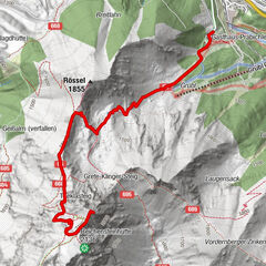
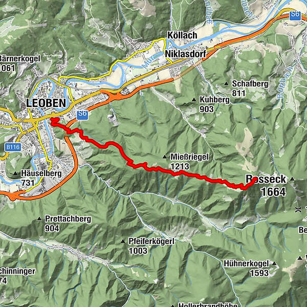
LeobenSpitz Christi4.3 kmMugel (1,630 m)9.9 kmMugelschutzhaus9.9 km
- Best season
-
JanFebMarAprMayJunJulAugSepOctNovDec
- Description
-
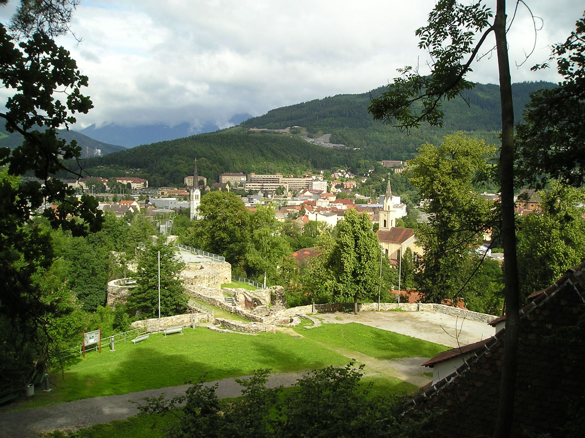
Visible from afar in the Mur Valley, the Mugel is considered the local mountain of the people of Leoben and Niklasdorf. The Mugel shelter is also a base for many long-distance hikers who are on their way from Nebelstein to Eibiswald. We have explored a route for you, which is definitely worth following just because of the great views.
Via the Massenburg, the NSWW 505 leads past the "Spitz Christi" or via the "Moritzhöhe" to the Schmollhube and further on to the "Gstattmoaralm" - from here we climb the Kienzle Weg up to the Mugel (1632).
- Directions
-
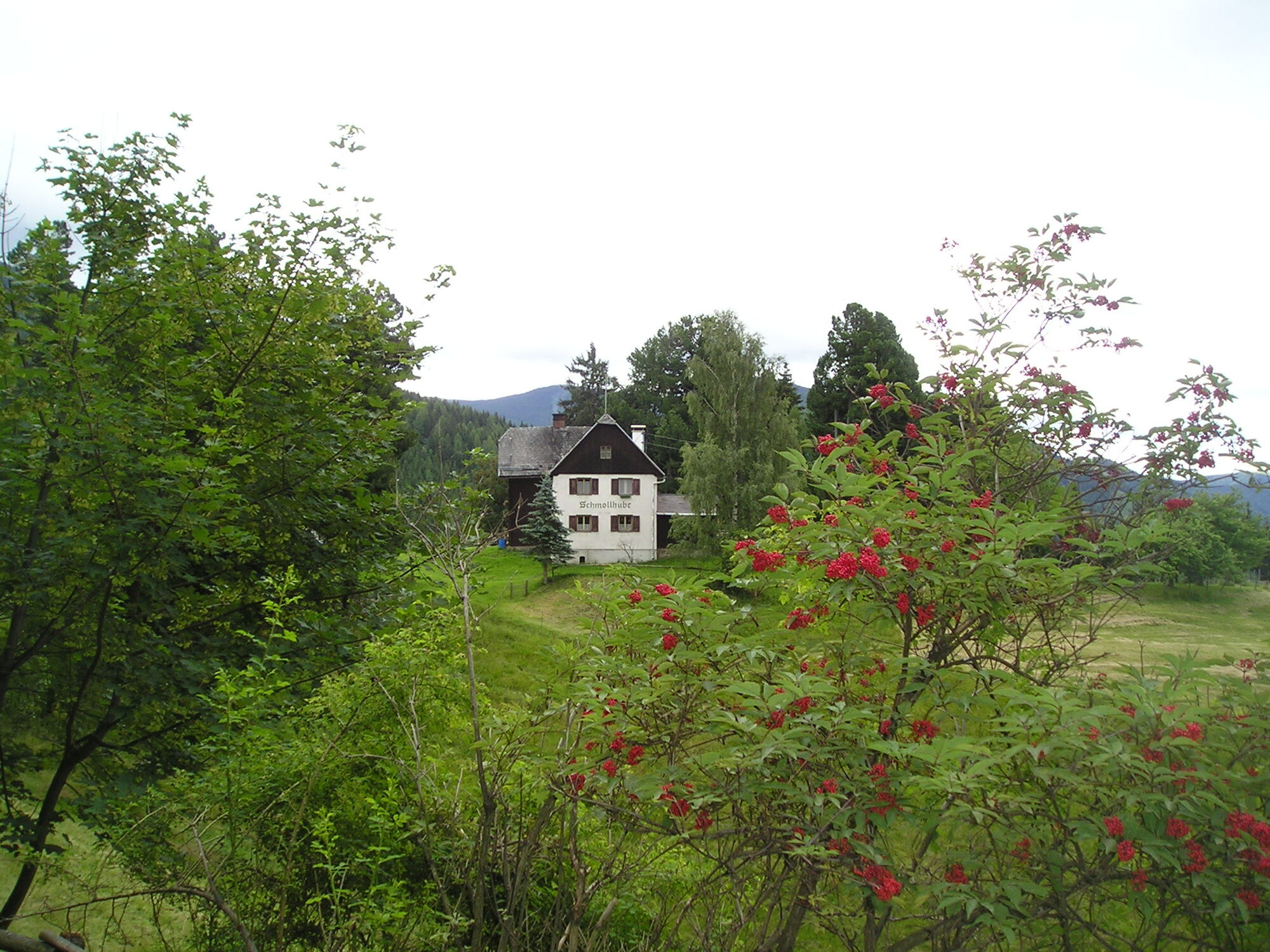
From Leoben we first go to Massenburg and then continue along a forest nature trail to Pampichlerwarte (popular excursion destination and snack station). From there we follow the marked hiking trail 505 to the junction Spitz Christi/Moritzhöhe.If we continue in the direction of Moritzhöhe, the forest path soon joins the flat, beautiful Zirbenweg. After about 1.5 hours we then reach the Schmollhube inn, which is no longer open.
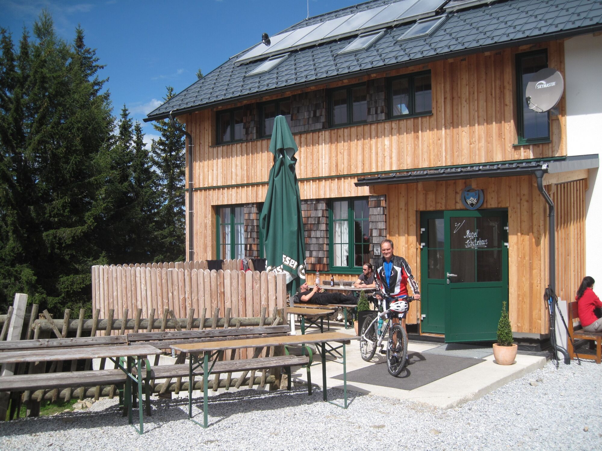
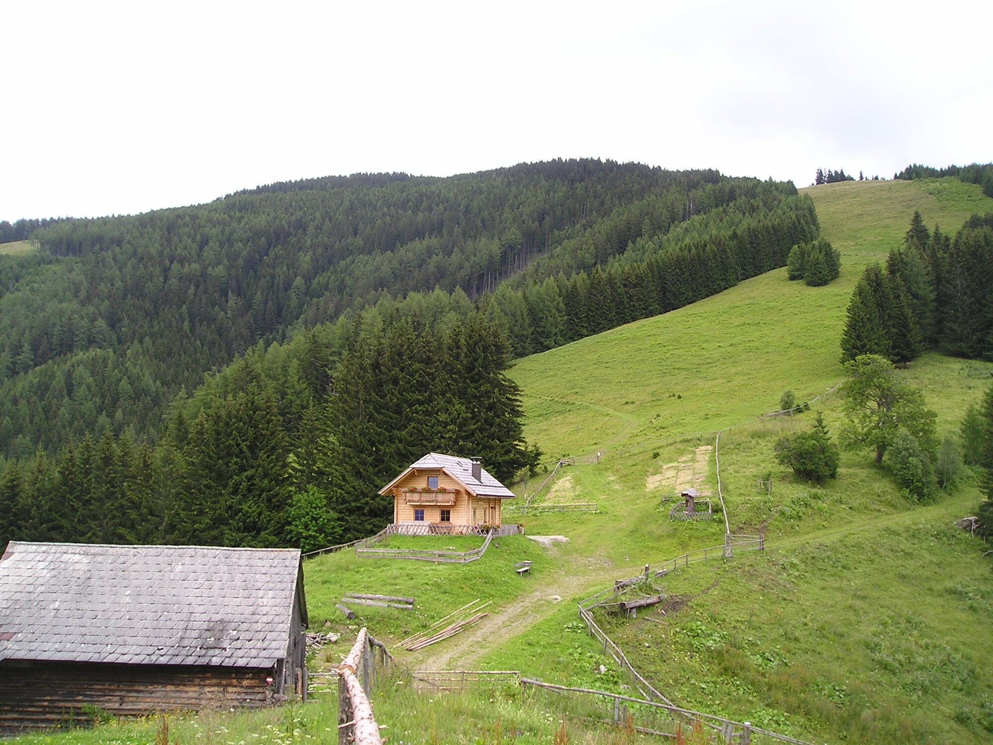
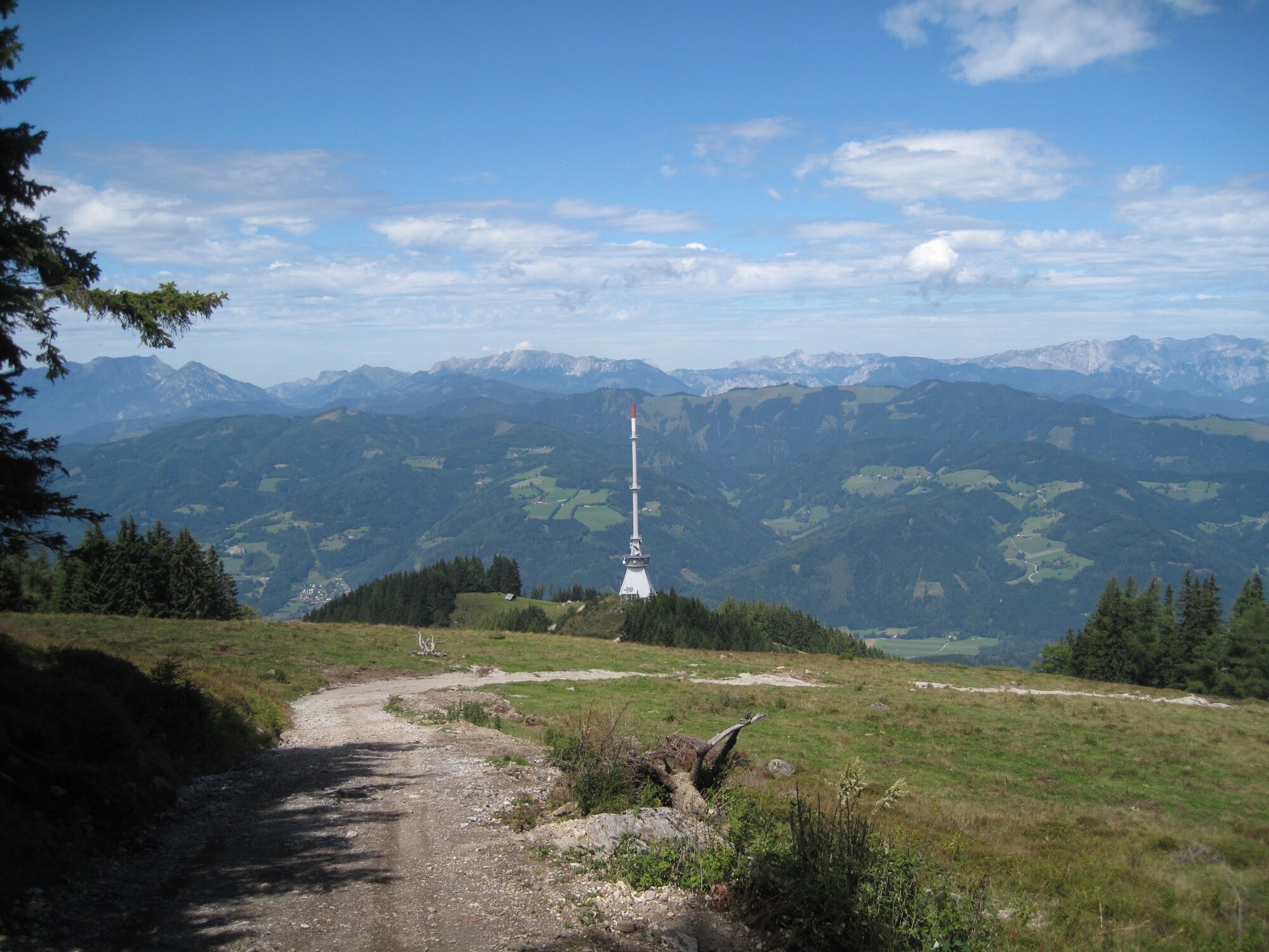
We continue to the Gstattmoaralm, where we are already in the open alpine pasture area. Above the Gstattmoaralm we can choose, either we follow the marked hiking trail through the forest or climb over the open meadow area to the Hans Prosl shelter of the ÖTK section Leoben-Niklasdorf and enjoy a great view. After about 3 hours we should have reached our destination at 1,632m above sea level. The new tenant on the Mugel offers the hikers a hearty snack, so that we can start the return march strengthened.
As a descent route variant we leave the Mugel via the Trasattel. We take the path in the direction of Trasattel, where we reach the Troger Alm on the new forest road as well as on forest paths after about 1 hour 15 minutes. This is a popular destination for mountain bikers, who are rewarded for their efforts with a good snack and a beautiful view of the valley. Through the Klein-Gößgraben downhill you reach the pilgrimage church Maria Kaltenbrunn, whose spring water behind the church is said to have a healing effect. After a refreshing sip, head back to the starting point via Göss or the Pampichlerwarte.
Alternative:By car to the parking lot Klein-Gößgraben. Hike approx. ¾ hr. to the Schmollhube, continue to the Gstattmoaralm-Mugel shelter - Troger Alm - downhill - road Klein-Gößgraben to the parking lot.
- Highest point
- 1,615 m
- Endpoint
-
Mugelschutzhaus
- Height profile
-

- Equipment
-
Good footwear, due to the length hiking poles are recommended.
Proper backpacking makes many things easier: pack heavy things first. The water bottle should always be within easy reach in a side pocket. All things that are often needed such as sunglasses, camera or hiking map belong on top. An emergency kit including blister plaster belongs in every backpack and a clothing according to the "onion system" is always recommended!
- Safety instructions
-
Proper planning is a must before any tour
Emergency call rescue: 144 Tip to report an emergency - give answers to the six W-questions: What happened? How many injured? Where did the accident happen (possibly GPS coordinates)? Who is reporting (callback number)? When did the accident happen? Weather at the accident site?
- Tips
-
At the height of the Schmollhube in the direction of the Gstattmoaralm, the path leads through a Swiss stone pine avenue!
- Additional information
- Directions
-
Coming from Graz on the A9 exit St. Michael ob Leoben and on the S 35 to Leoben > direction Zentrum/Asia SpaComing from Vienna on the S 6 to Bruck an der Mur and Leoben > direction Zentrum/Asia Spa
- Public transportation
-
ÖBB train station Leoben. Return from Hieflau with ÖBB trains; via Selzthal in the direction of Leoben.
Timetables and travel information can be found directly at: Österreichischen Bundesbahnen (ÖBB), Steiermärkischen Landesbahnen (STLB), www.busbahnbim.at
With the BusBahnBim app of the Verbundlinie, timetable information has never been easier: all bus, train and tram connections in Austria can be queried by entering locations and/or addresses, stops or important points. The app is available as a free app for smartphones (Android, iOS) - on Google Play and in the
- Parking
-
Free parking: parts of the Gösserstrasse (connecting road to the center of Göss) or Dirnböckweg.
- Author
-
The tour Mountain hiking trail from Leoben to the Mugel is used by outdooractive.com provided.


General info
-
Erzberg Leoben
2530
-
Bruckmur-Kapfenberg
1500
-
Niklasdorf
286