


- Brief description
-
Relaxing stroll through nature, passing by cozy chalets and inns and lush green meadows.
- Difficulty
-
easy
- Rating
-
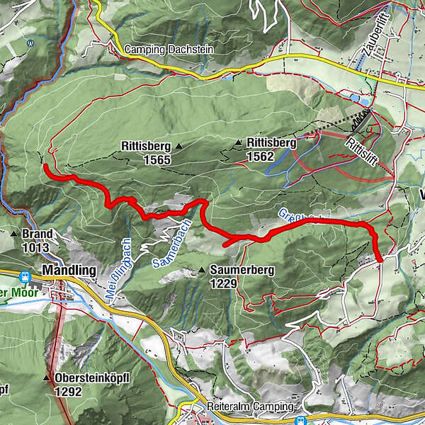
- Starting point
-
Hiking trail head Vorberg-Arnika
- Route
-
Halseralm2.3 km
- Best season
-
JanFebMarAprMayJunJulAugSepOctNovDec
- Description
-
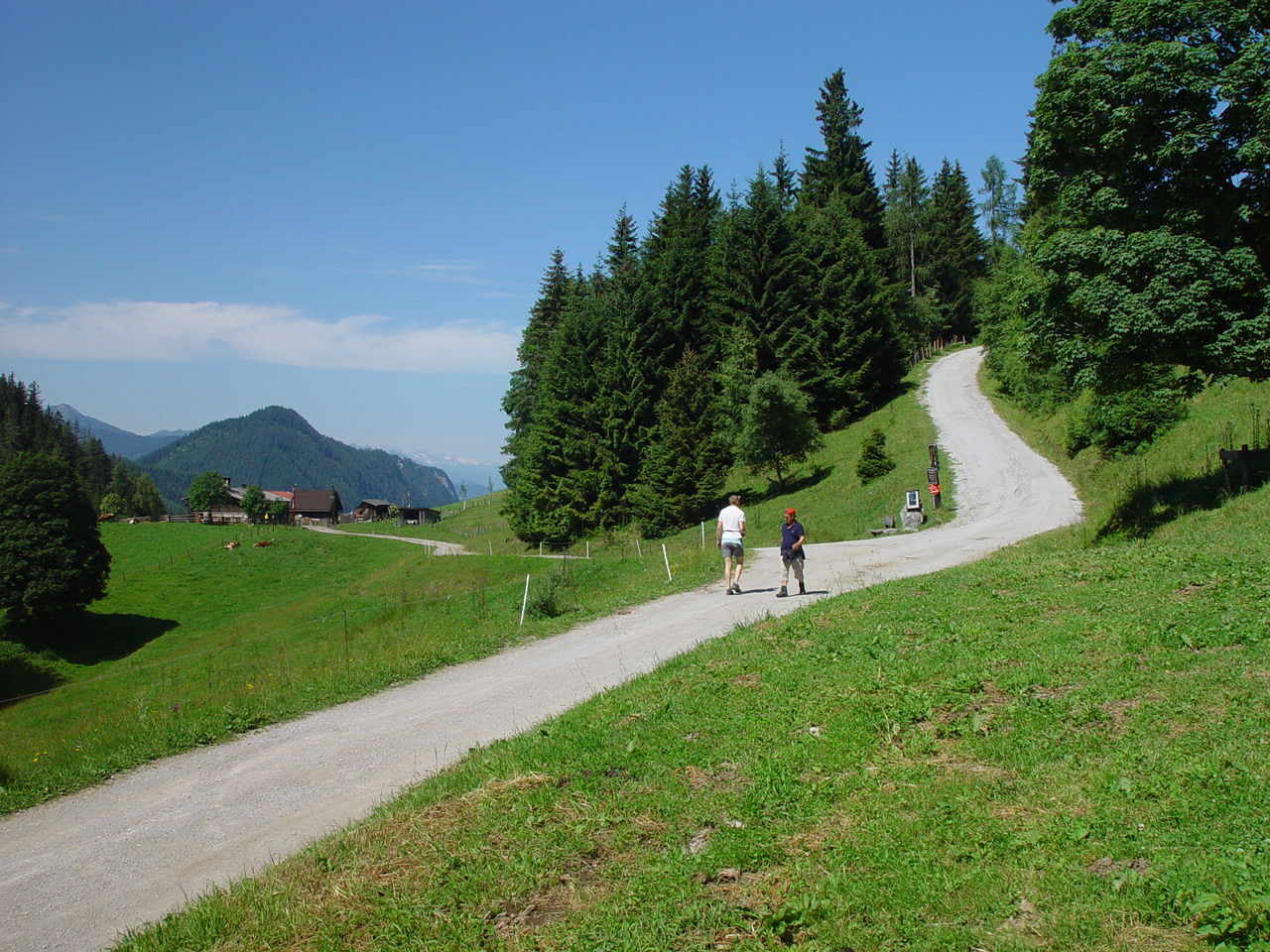
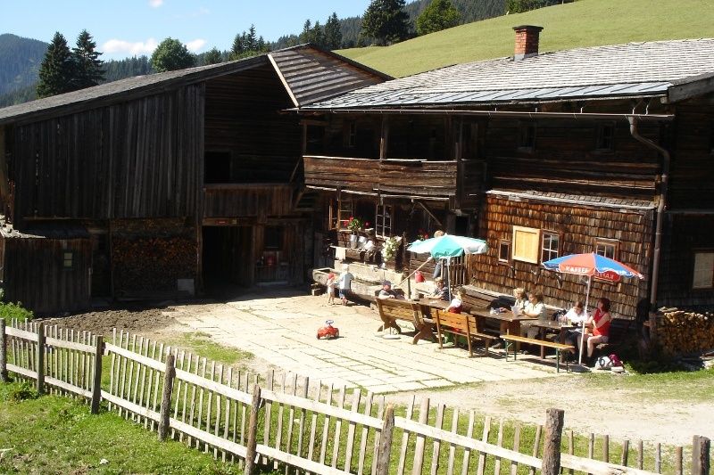
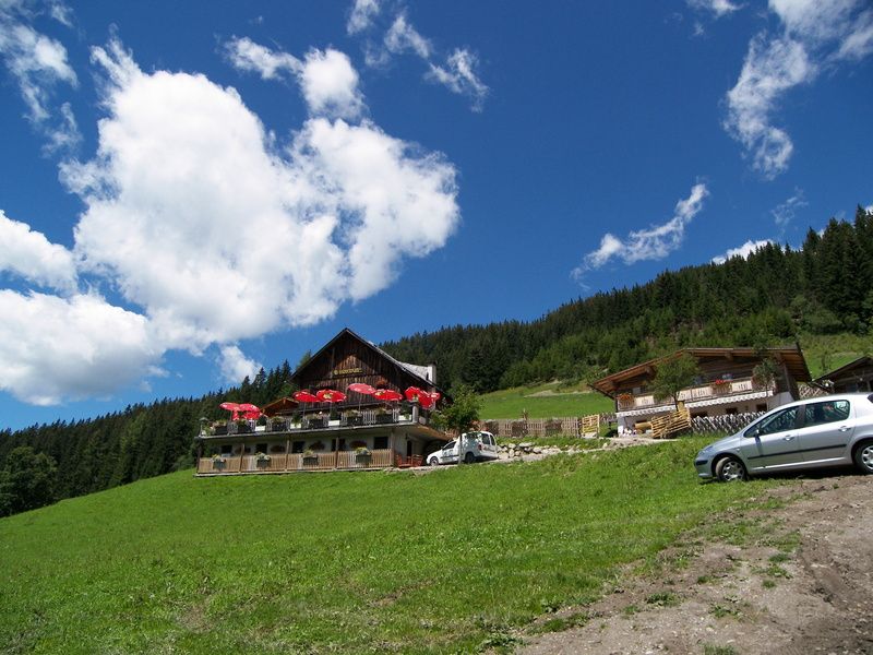
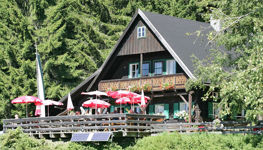
Rittisberg and Halserberg are two of the most wooded hiking areas in front of the south face of the Dachstein. The trail is also suitable for prams (the section from Sonnenalm to Ochsenalm Inn is a bit more difficult, but is also possible with pram). The comfortable huts Halseralm, Sonnenalm and Ochsenalm offer tasty delicacies of the region. The flambéed Kaiserschmarren, the free-range animals to pet, the huge children's playground, where children can climb, jump, drive with a go-kart, … and the nature hunters trail are an experience for all ages!
- Directions
-
From the hiking trail head Vorberg-Arnika follow the forestry road to the North. After a couple of minutes walk through the forest you reach a trail junction where you make a left towards the chalets and inns. The trail now runs along the edge of the forest to the inns. At first you reach Halseralm Inn, shortly after Sonnenalm Inn, and finally Ochsenalm Inn. Also walkable when the weather is bad.
Alternative route for the way back:
This hike can be extended at will, for example across the Höhenweg to the Rittisstadel (not suitable for prams).
- Highest point
- 1,291 m
- Endpoint
-
Halseralm, Sonnenalm or Ochsenalm
- Height profile
-

- Equipment
-
A well-packed backpack is helpful and especially when touring Alpine terrain a tuque, gloves, a windproof jacket and pants are standard equipment. Good, waterproof shoes, sun glasses, sun cream and sufficient beverages are essential too. Torch light, a map of the area, knie and a small first-aid kit should also be in the backpack.
- Safety instructions
-
Changes in weather patterns, quick falls in temperature, thunderstorms, wind, fog and snow are some of the dangers that can be encountered on a hiking tour. Hosts of alpine huts and mountain refuges have a lot of experience in the mountains and can give good advice about weather and the trails. Poor equipment, overestimation of one's own capabilities, carelessness, poor personal constitution and/or wrong judgement can lead to critical situations. In case of thunderstorms: avoid summits, ridges and steel ropes.
GPS data and orienteering
Available GPS data - just like hiking maps - is only a guidance for orientation and can never depict a trail exactly with all its details. Especially at dangerous spots it is essential to judge on site how to proceed.
In an emergency please call:
140 - for Alpine emergencies (all over Austria) 112 - European GSM emergency number - Tips
-
Jägersteig and Sonnenalm Panorama Trail start at Sonnenalm Inn. The nature trail invites kids to play and explore.
- Additional information
- Directions
-
Exit from federal highway B320 at Pichl (approximately 4 kms West of Schladming) and continue towards Vorberg. Pass by Hotel Steirerhof and continue to Pension Arnika, where the hiking trail head Vorberg-Arnika is located.
- Public transportation
- Parking
-
Parking is available at the hiking trail head Vorberg-Arnika.

-

-
AuthorThe tour Hiking and chalet experience Halserberg-Rittisberg is used by outdooractive.com provided.


General info
-
Schladming - Dachstein
3015
-
Ramsau am Dachstein
1705
-
Pichl
526


