- Brief description
- Difficulty
-
medium
- Rating
-
- Starting point
-
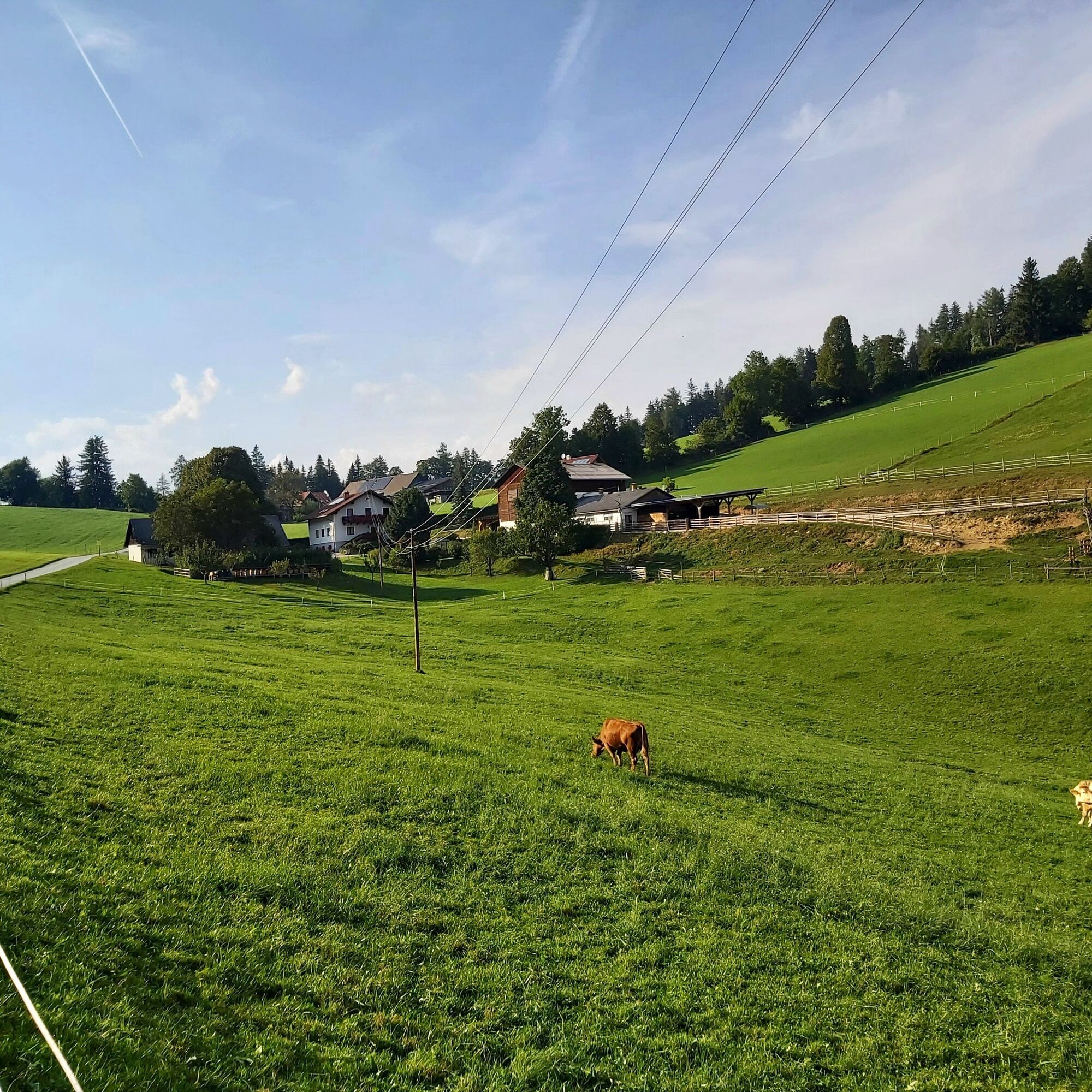
GH Jägerwirt, Semriach
- Route
-
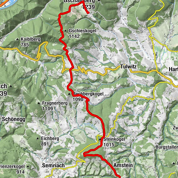
Jägerwirt0.1 kmWindhofkogel (1,064 m)1.9 kmUlrichsbrunn2.8 kmSteinkogel (1,015 m)4.3 kmGasthof Angerwirt Ferdinand Prügger4.4 kmHochschwabblick9.1 kmRechbergdorf9.3 kmBrandlhof10.0 kmRechberg10.2 kmNechnitz14.7 kmGasthof Frankenhof15.6 kmGasthof Haider16.7 km
- Best season
-
JanFebMarAprMayJunJulAugSepOctNovDec
- Description
-
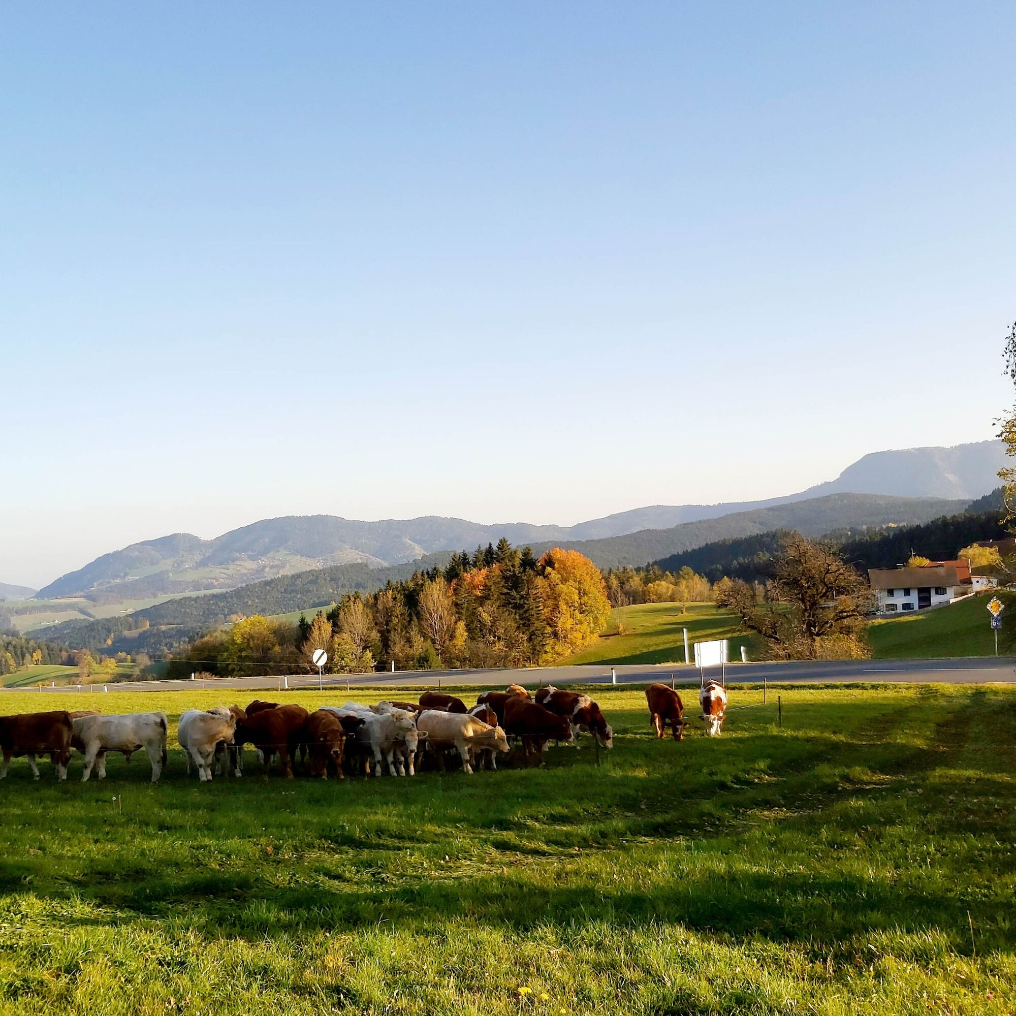
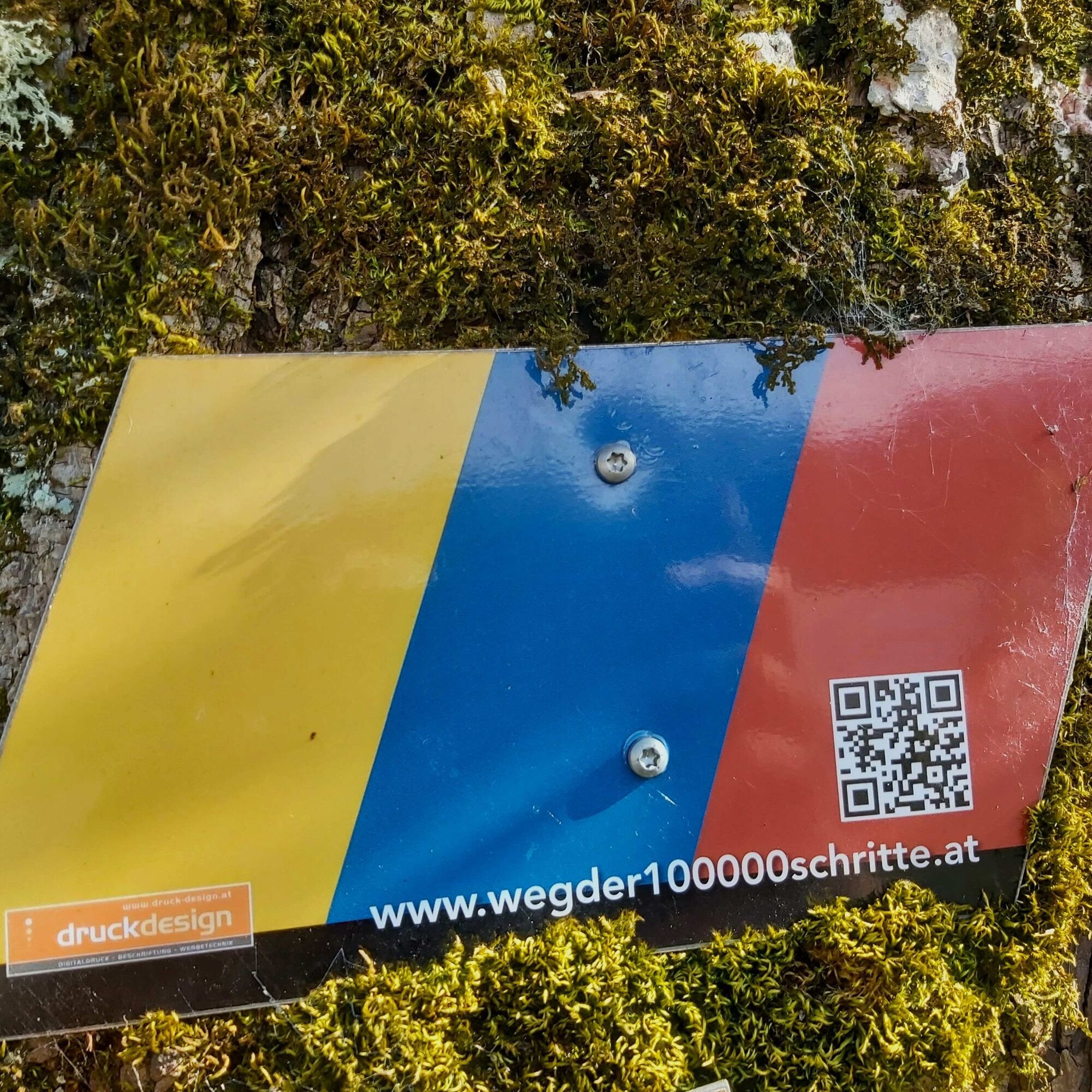
This hike around the "Passailer Kessel" is an idea of the Kath. Männerbewegung Passail and was also planned and implemented by them. The six sections are designed in such a way that after each day's stage there is an opportunity to stop for a break or overnight stay. The stages run mainly along designated Alpine Club paths and were also marked with their own signposts. The small boards represent the colours of the hiked communities Fladnitz an der Teichalm (gold), Passail (blue) and St. Kathrein am Offenegg (red).
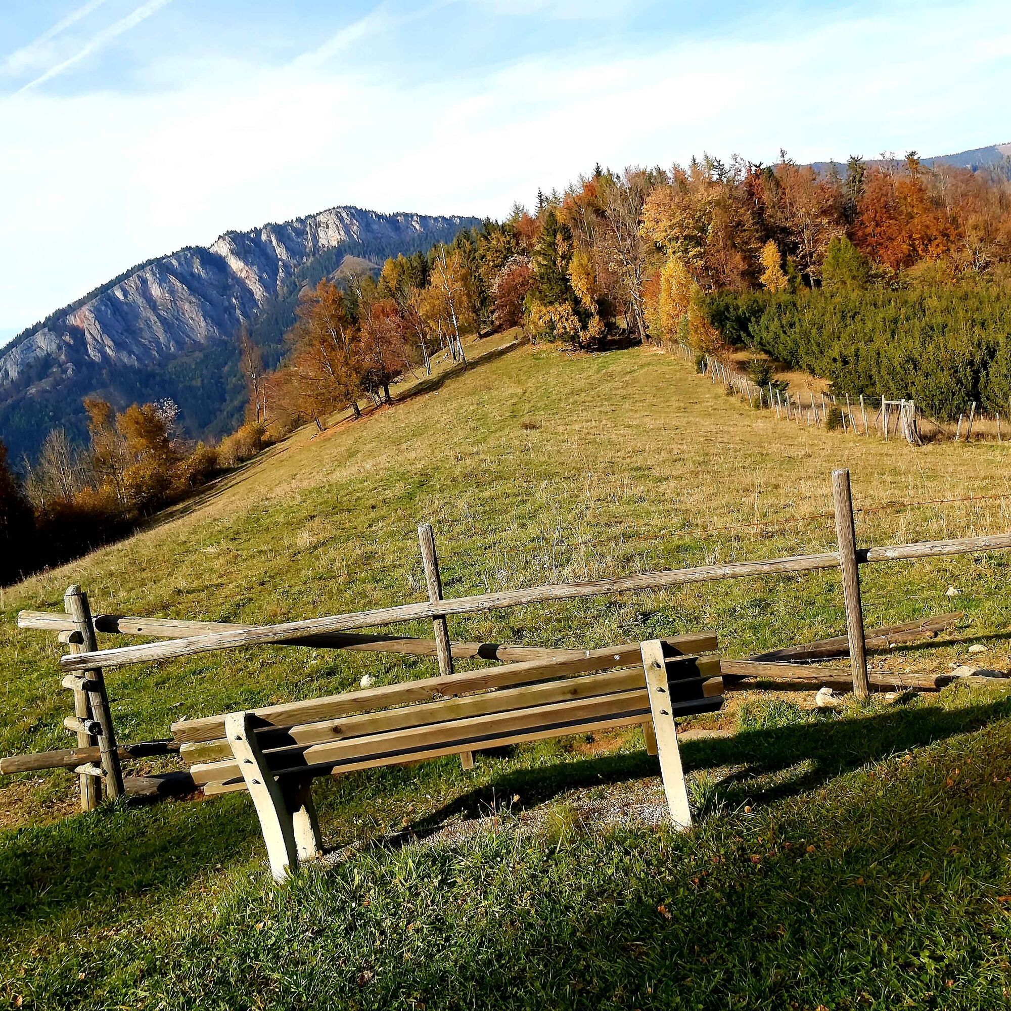
The trail starts in Arzberg, leads up to the Schöckl and on to the Rechberg. From there it goes via the Nechnitz up to the Teichalm, via the Osser up to the Sommeralm and via the Brandlucken to St. Kathrein am Offenegg. The last two stages then lead over the Patscha down into the Weizklamm gorge before returning to Arzberg via the Gösser and Große Raabklamm gorges.
The second stage leads from the foot of the Schöckl over the Rechberg very gently to the Nechnitz plateau, which lies exactly between the Rote Wand and the Schöckl. There are good places to stop for refreshments.
- Directions
-
Start: Jägerwirt Inn, Amstein
From the Jägerwirt Inn (Pucherwirt) walk west along the municipal road for 800 m until you reach a road junction. After 20 m turn right into the forest, walk along a cart track for 300 m to the next junction Alternative route: From here, you can continue hiking on the left on trail no. 15 to the little church of Ulrichsbrunn and on to Anger. This route is about ½ hour longer than the direct route to Anger, the walking time to Anger is about ¾ hour. If you do not want to walk to Ulrichsbrunn, you can take trail no. 18 directly to Anger and enjoy the beautiful views of the Passailer Kessel. In Anger you have the option of stopping off at the Kappel Inn.Cross the road at the Kappel Inn and continue along the main road in the direction of Rechberg. After approx. 2 km turn right towards KambeggAfter 500 m, turn left again directly at the Fröaler/Family Zottler farm, pass the house and walk up to the Fröalerhöhe, where you rejoin the main road. Now turn right along the main road for approx. 200 m Before the Karner farmhouse turn left and immediately right along the meadow path towards the forest (short ascent) Walk approx. 500 m through the forest until you reach the municipal road to Semriach, here you have a beautiful view at the plague cross Continue to the right along the municipal road in the direction of Rechberg until you reach the "Brandlhof" (approx. 700 m), where you can stop for refreshments at weekends. At Rechberg cross the main road and follow the road (trail no. 740) in the direction of Nechnitz until you reach the Pölz farmstead/the Eibisberger family. Then continue on a gravel road (the so-called "Flaschbachweg") to the "Roter Kreuz". Alternative route: here you have the possibility to make a detour to the Hoaterberg at 1036 m above sea level with a beautiful view (additional walking time there and back approx. 1 hour). Otherwise, continue to the right in the direction of "Nechnitz", where you rejoin the asphalted municipal road in Schöngrund. At the Hahnbauer farmstead, turn left along the asphalt road to the Frankenhof Inn, from here it is another 10 minutes to the Haider Inn, where the next stage begins. - Highest point
- 1,057 m
- Endpoint
-
Nechnitz
- Height profile
-

- Equipment
-
Closed shoes, jacket, rain protection and a water bottle are sufficient.
- Safety instructions
- Tips
-
Both inns on the Nechnitz are known for their good cuisine: the Haider Inn serves steaks from Styria Beef, the Frankenhof dishes from fallow deer!
- Additional information
-
All info about the trail: www.wegder100000schritte.at
More info about the region, where to stop for a bite to eat, where to find rooms and descriptions of the excursion destinations and businesses:
Tourismusverband Oststeiermark
Almenland Nature Park Office
Fladnitz 100
8163 Fladnitz/Teichalm
Tel: +43 3179 23000
Mail: almenland@oststeiermark.com
www.almenland.at | www.oststeiermark.com - Directions
- Public transportation
- Parking
-
Parking Spaces at the GH Jägerwirt.


-

-
AuthorThe tour Stage 2: Path of 100,000 Steps, Semriach - Nechnitz is used by outdooractive.com provided.