- Brief description
-
Suitable for Nordic walking, running, or as a larger walking trail.
- Difficulty
-
medium
- Rating
-
- Route
-
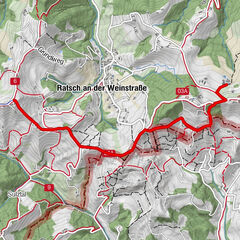
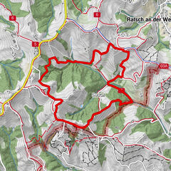
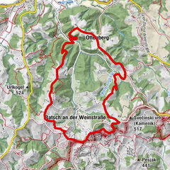
Gamlitz0.1 kmSkoff Weingut und Buschenschank3.2 kmGamlitz4.7 kmParish church Saint Peter and Paul4.7 kmKreuzkapelle4.7 km
- Best season
-
JanFebMarAprMayJunJulAugSepOctNovDec
- Description
-
For active people, athletes or just to stretch your legs: the new walking & running trail through Gamlitz is asphalted throughout and therefore ideally suited for sports activities. Ideally suited for strollers, wheelchair users or people with limited mobility!
- Directions
-
Starting from the parking lot behind the church in the direction of the sports field, continue along Retzneier Strasse to the intersection with Weinleitenhöhenstrasse. There continue to the Prossyweg, then down the Weinleitengasse to the field cross. Then along the B69, back through the village center to the Raiffeisenbank and back to the starting point.
- Highest point
- 342 m
- Endpoint
-
Parkplatz hinter Kirche
- Height profile
-

- Equipment
-
Sports/running shoes, route asphalted throughout!
- Safety instructions
-
The trail is passable all year round. Sturdy shoes are recommended, but not necessary. Please keep to the marked paths and keep them clean. Out of consideration for the forest animals, we ask you not to make noise and to keep dogs on a leash.
- Tips
-
Tour can be extended via the motor park (see local hiking trail Gamlitz)
- Additional information
-
Suitable for strollers.
- Directions
-
Coming from the south, north, east and west on the A9 Phyrnautobahn - exit Vogau - continue in the direction of Ehrenhausen - Gamlitz.
- Public transportation
-
By train to Ehrenhausen, you can find the current schedules at www.oebb.at.Cab company:
Cab Petra 0664 20 7 02 07
Cab Schimautz 0664 43 52 736
- Parking
-
Parking lot behind the church.


-

-
AuthorThe tour Walking - & running track Gamlitz is used by outdooractive.com provided.


General info
-
Südsteiermark
1135
-
Maribor-Pohorje
263
-
Gamlitz
290