- Brief description
-
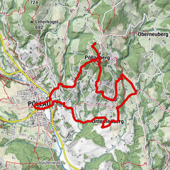
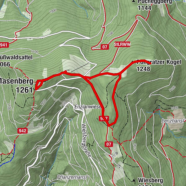
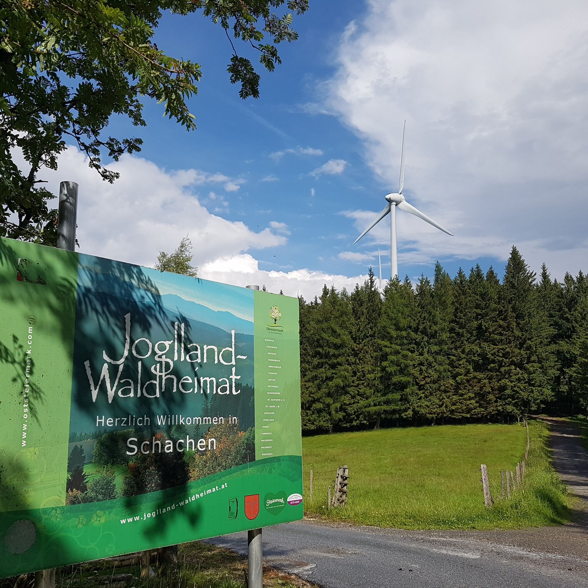
We walk to the wind turbines on the Pongratzer Kogel.
- Difficulty
-
easy
- Rating
-
- Starting point
-
Pöllauberg, Masenberg Olmstoll
- Route
-
Olmstoll0.1 kmPongratzer Kogel (1,248 m)1.0 kmGlückskapelle3.9 kmMasenberg (1,261 m)4.0 kmSchutzhaus Masenberg4.3 kmOlmstoll4.6 km
- Best season
-
JanFebMarAprMayJunJulAugSepOctNovDec
- Description
-
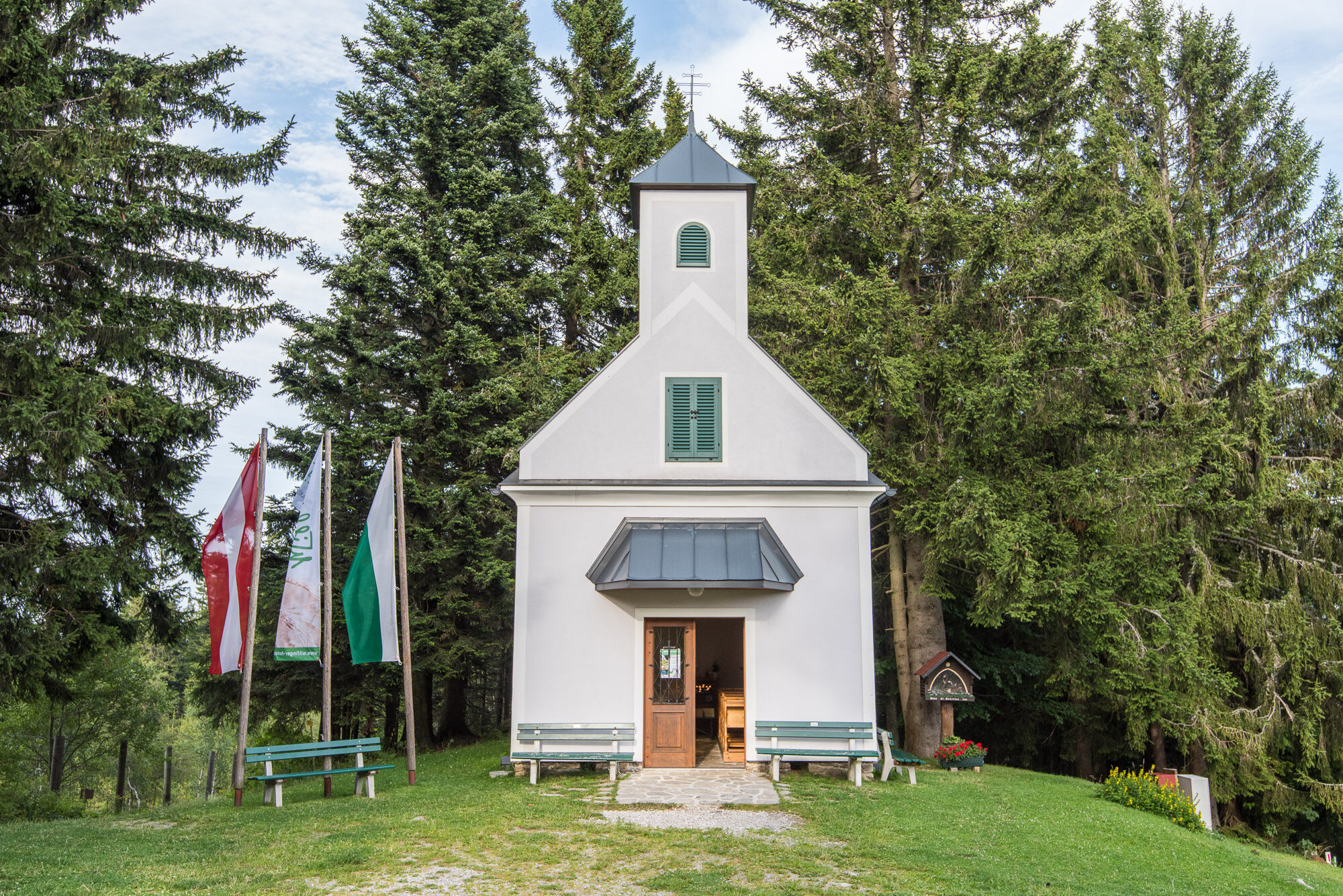
And "climb" the summit cross on the Masenberg at the end of the hike.
- Directions
-
We start from the Olmstoll on the forest road to the wind turbines. We hike to the last wind turbine and turn back via the turning path and walk to the 3rd wind turbine. There is a turn-off on the left marked Rundweg 1 - which we now follow. We walk past a new high seat and then follow the markings twice to the right at the fork in the forest path. We reach hiking trail no. 950, which we follow past the Olmstoll to the summit cross on the Masenberg. We return to the starting point at Olmstoll along the same route.
Be careful with wind turbines in winter: Danger of ice and snow!
- Highest point
- 1,254 m
- Endpoint
-
Pöllauberg, Masenberg Olmstoll
- Height profile
-

- Equipment
-
small rucksack with water bottle (+ provisions)
Sturdy shoes
Appropriate clothing - preferably several layers - "onion principle"
Rain and sun protection
Hiking poles as required
Mobile phone
Small first aid kit
Route description
Before starting the hike, check where you can stop for refreshments, including opening times, or pack suitable provisions. - Safety instructions
-
European emergency call: 112
Emergency call mountain rescue: 140 (if possible, please
provide GPS data)
Rescue: 144
Fire brigade: 122 '
Police: 133The trail is easy to walk and therefore suitable for the whole family.
Correct behaviour when hiking: Rules of behaviour when hikingA few tips on correct and fair behaviour in the forest: (Source: Bundesforste https://www.bundesforste.at/english.html)
Hikers should avoid visiting the forest approx. 1.5 hours before sunrise and after sunset, as wild animals are particularly active at this time. Plastic bottles, handkerchiefs, cigarette butts etc. have no place in the forest! Please make sure that you do not leave any rubbish in the forest. Camping and making fires is strictly forbidden in the forest! - Tips
-
Be careful with wind turbines in winter: Danger of ice and snow!
- Additional information
-
Information about the region, places to stop for refreshments and overnight accommodation, excursion destinations etc. can be found here:
Tourism region Eastern Styria Nature
Park Pöllauer Valley office
Schloss 1, 8225 Pöllau, Austria
Phone: +43 3335 4210
www.naturpark-poellauertal.at
www.oststeiermark.comCurrent weather
Mobility Eastern Styria with shared taxi SAM - Directions
-
Pöllauberg, Masenberg Olmstoll
The Pöllau Valley Nature Park is located in the heart of Eastern Styria, the garden of Austria, approx. 60 km north-east of Graz and approx. 150 km south of Vienna
By car from Vienna
If you are driving from Vienna to Pöllau bei Hartberg, take the A2 towards Graz and drive about 110 kilometres until you reach the Hartberg exit. From there, follow the B54 in the direction of Pöllau.By car from Graz
To get to Pöllau bei Hartberg from Graz, take the A2 motorway in the direction of Vienna. After about 30 kilometres, take the Gleisdorf West exit and then take the B54 towards Hartberg/Pöllau. Follow the B54 for about 25 kilometres until you reach Pöllau.By car from Salzburg
To get to Pöllau bei Hartberg from Salzburg, take the A1 motorway towards Vienna. Drive about 110 kilometres to exit 109 (Salzburg junction). There change to the A9 motorway in the direction of Graz. At St. Michael, follow the S6 towards Kapfenberg. Continue on the S6 until the Krieglach exit. From there, take the B72 and then the L405 to Pöllau. - Public transportation
- Parking


-

-
AuthorThe tour Circular trail on the Masenberg is used by outdooractive.com provided.


General info
-
Thermen- & Vulkanland
1324
-
Naturpark Pöllauer Tal
1095
-
Pöllauberg
353