From hut to hut in the National park Gesäuse Stage 05B Weidendom - Admonterhaus


- Brief description
-
Best chance: From the Weidendom adventure centre with the Gesäuse shared taxi to the Buchauer Sattel and ascent to the best vantage point above Admont - the Admonterhaus.
- Difficulty
-
medium
- Rating
-
- Route
-
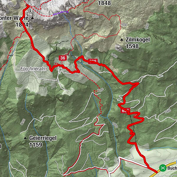
Grabneralm4.0 kmAdmonter Haus5.5 km
- Best season
-
JanFebMarAprMayJunJulAugSepOctNovDec
- Description
-
Of course there is always an easier way on every mountain. With more than 500 km of hiking trails and one of the highest densities of mountain huts in the Eastern Alps, nothing stands in the way of a hiking experience lasting several days in the only Styrian National Park. The whole Gesäuse in one go is best experienced on the Gesäuse Hut Tour. From hut to hut and even completely flexible (no fixed places to stay overnight, numerous variations and completely mobile without your own car), the alpine Gesäuse is more beautiful than ever to hike.
- Directions
-
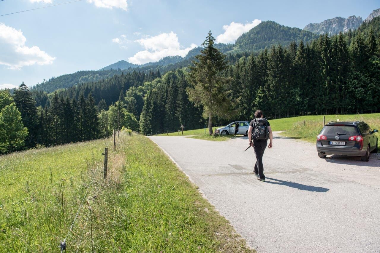
From the Weidendom you simply order a taxi (Taxi Herrak 0664-344 42 35), which will take you in 15 minutes to the starting point of the second part of today's stage: the ascent from the Buchauer Sattel via the Granberalm to the Admonterhaus.
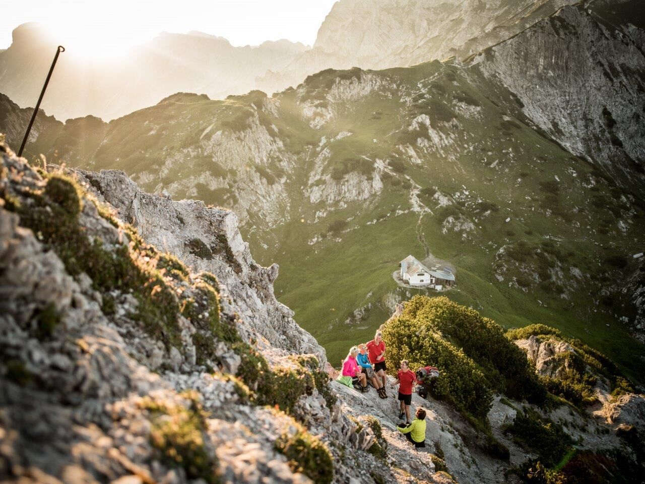
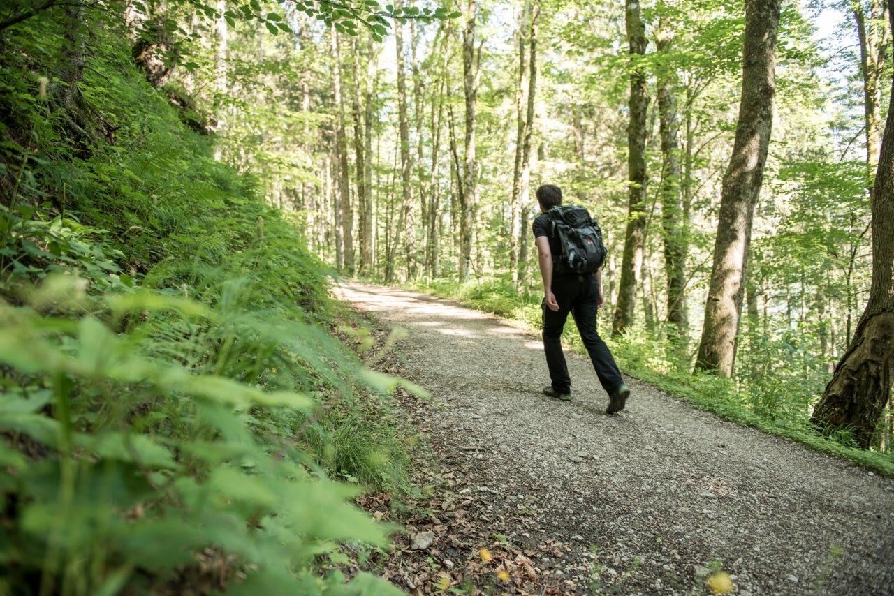
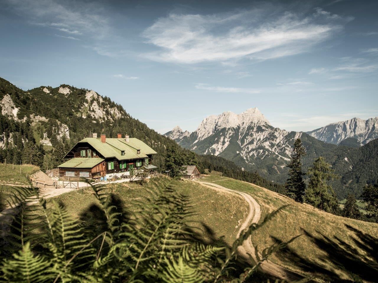
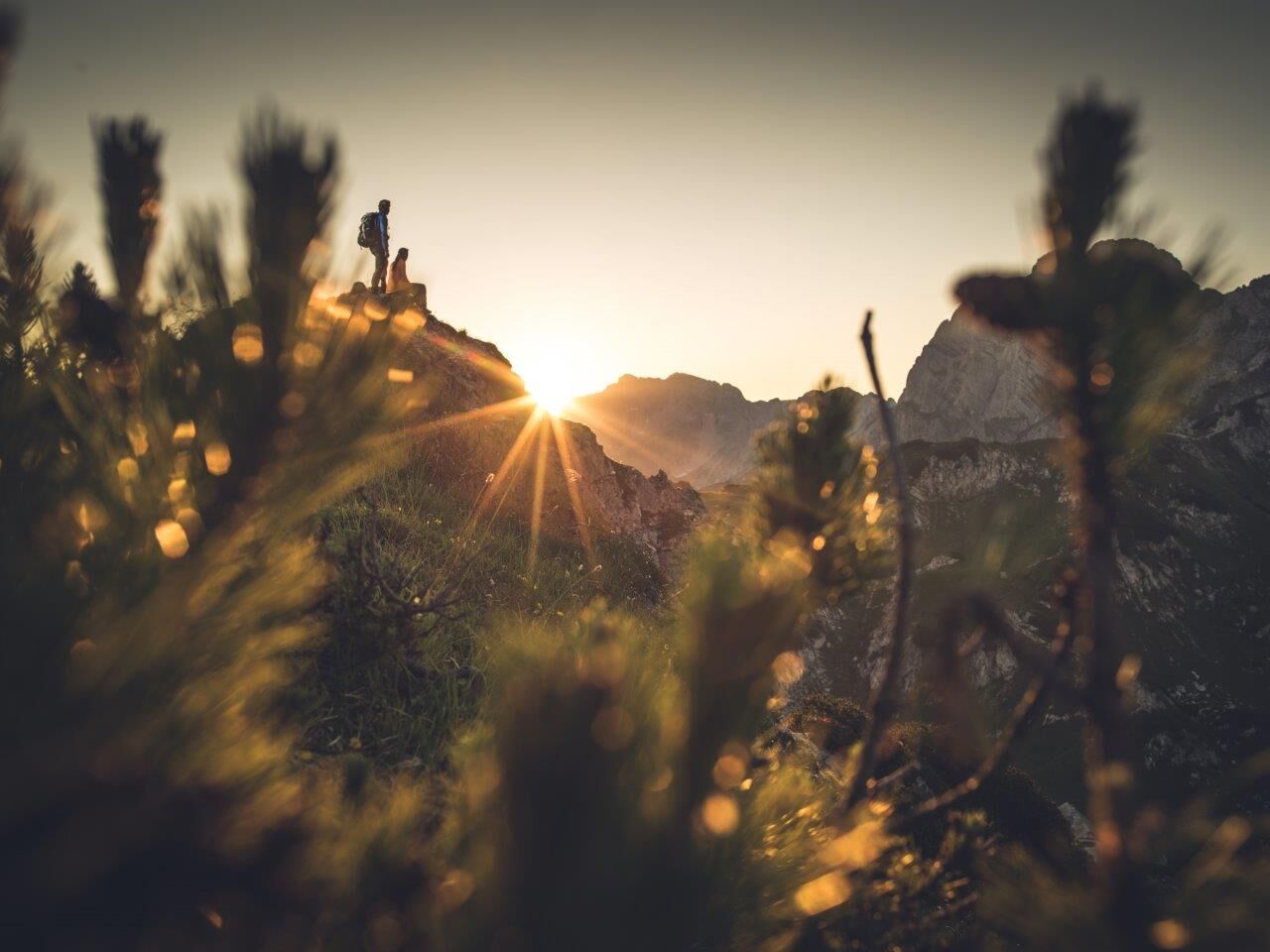
From the car park at the Buchauer Sattel you follow path no. 636 over a meadow to a forest. Now partly on a good forest path, partly on the forest road - always following the mark 636 - first in the forest, then on the treeless, panoramic alpine pasture and later on a steeper ridge to the beautifully situated Grabneralmhaus (1.395m). If you need some refreshment before the last ascent to the Admonter Haus, you've come to the right place!To the west of the Grabneralm, you now climb a ridge (Gesäuse-, Dachstein- and Glocknerblick) and from there turn left to the junction with the ascent of Mühlau (path no. 633). Now steeper under the rocks of the Admonter Warte to the soon visible Admonter Haus, situated at 1.723m above sea level and thus the highest refuge of the Gesäuse. And - nomen est omen - you have the best view of Admont: enjoy it!
- Highest point
- 1,709 m
- Endpoint
-
Admonterhaus
- Height profile
-

- Equipment
-
For the Gesäuse hut tour, "normal" equipment for alpine hikes on unpaved paths is completely sufficient. In any case, we recommend sturdy shoes and telescopic walking sticks to take the strain off the knees on the sometimes longer descents. For all refuges along the trail you should also bring a sleeping bag and a towel. Since the huts where you will be staying overnight on your trail trip are very remote and high up in the mountains and cannot be reached by the luggage shuttle, we cannot offer any luggage transport for the Gesäuse Hut Tour. We therefore recommend that you pack your rucksack sparingly and only take what is really necessary with you to the Gesäuse Hüttenrunde. It can be quite liberating to be on the way without luxury!
- Safety instructions
-
Mountain rescue emergency call: 140
From a technical point of view, the Gesäuse hut circuit has moderate difficulties, which are no problem for the sure-footed and experienced mountain hiker. All the stages run on mountain paths with red dots, which means that they are classified as moderately difficult hiking trails according to the classification of the Austrian Alpine Club. However, you should have a certain amount of mountain experience for the Gesäuse Hüttenrunde, as you will be hiking in mountains with altitudes up to 1,850 m.
- Tips
-
It is recommended to contact the Trail Info & Booking Centre before booking.
Offers at: bookyourtrail.com
- Additional information
-
www.bookyourtrail.com/trail/gesaeuse-huettenrundwanderweg
www.gesaeuse.at
- Directions
- Public transportation
- Parking
-
Parking facilities are available at the respective starting points, which are subject to a charge, especially in the Gesäuse National Park area.
Tip: Please leave a note in your car with your telephone number and the date of your return together with a note that you are on the Gesäuse Hüttenrunde for several days. The mountain rescue service will thank you!


-

-
AuthorThe tour From hut to hut in the National park Gesäuse Stage 05B Weidendom - Admonterhaus is used by outdooractive.com provided.


General info
-
Gesäuse
2225
-
Steyr und die Nationalpark Region
1371
-
Admont
293


")


