- Brief description
-
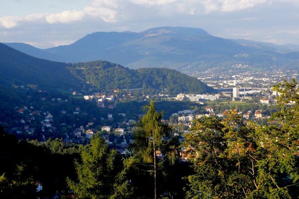
With its 1,445 m, the Schöckl is one of the highest elevations in the Almenland Nature Park in Styria. The easy tour leads from the Schöckl cross up to the summit plateau.
- Difficulty
-
easy
- Rating
-
- Starting point
-
Schöckl Cross, at the Radegunderstraße, L319 (Coordinates: 47.204093, 15.484951)
- Route
-
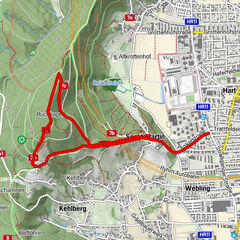
Schöckl (1,445 m)2.6 kmGipfelkreuz Schöckl2.8 kmStoawandhütte3.0 kmStubenberghaus3.7 kmSchöckl3.8 kmSchöneben4.9 kmSchöcklkreuz (1,125 m)7.8 km
- Best season
-
JanFebMarAprMayJunJulAugSepOctNovDec
- Description
-
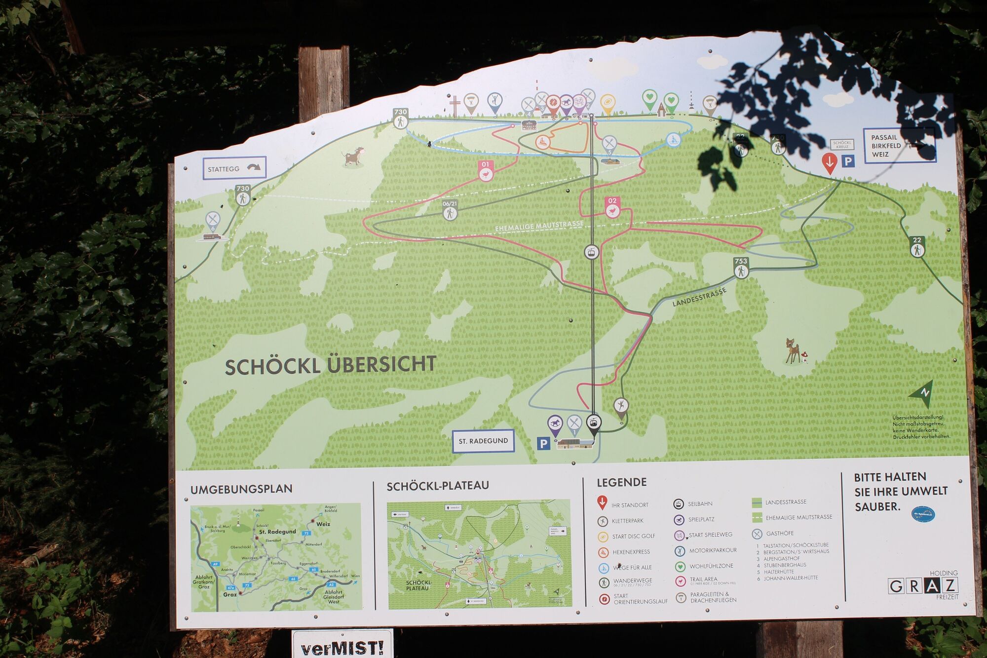
The Schöckl is part of the Grazer Bergland and the local mountain of the people of Graz. But the Schöckl is also part of the Almenland Nature Park, the municipality of Passail reaches up to the summit plateau! This easy hike for the whole family starts at the Schöckl cross, leads up to the summit plateau and in a wide arc back to the starting point. A wide variety of activities await you at Schöckl, including a motor skills park, a disc golf course and a nature play trail for younger guests.
Less mobile guests can simply "conquer" the Schöckl by cable car, which brings guests up the mountain all year round. The valley station is in St. Radegund and has plenty of parking spaces.
Guests are catered for on the summit plateau by several inns and huts.
- Directions
-
Directly at the "Schöcklkreuz", a brick road cross, trail no. 730 leads up to the plateau on the right. After a few hundred metres, keep to the right and take a small diversions, but you will be rewarded with a particularly beautiful view of the Almenland mountains. From the "Alpengasthof" or the top station of the cable car, several paths lead across the plateau (with its many leisure activities) to the summit cross. If you haven't already stopped off at one of the inns, you're sure to find a nice spot for a picnic here. The way back now leads down, past the Stubenberghaus inn and the summer toboggan run on the left, until we meet the toll road. We now keep to the left and walk along the toll road past the Halterhütte inn. After a sharp right turn, we soon branch off to the left onto hiking trail no. 21 "Seilbahn Talstation", which leads down to St. Radegund. After about 1.5 km we meet the toll road again. Now we go left along the toll road in the direction of "Schöcklkreuz", we cross the lift line of the Schöckl cable car and have beautiful views down to St. Radegund. After another 2.5 km we are back at the starting point at the "Schöcklkreuz".
- Highest point
- 1,442 m
- Endpoint
-
Schöckl Cross
- Height profile
-

- Equipment
-
Closed shoes, jacket, rain protection and a water bottle are sufficient.
- Safety instructions
- Tips
-
The terrace of the "Stubenberghaus" offers a great view over the Graz basin.
- Additional information
-
More info about the region, where to stop for a bite to eat, where to find rooms and descriptions of the excursion destinations and businesses:
Tourismusverband Oststeiermark
Almenland Nature Park Office
Fladnitz 100
8163 Fladnitz/Teichalm
Tel: +43 3179 23000
Mail: almenland@oststeiermark.com
www.almenland.at | www.oststeiermark.com - Directions
- Public transportation
- Parking
-
There are parking spaces around the Schöcklkreuz.


-

-
AuthorThe tour Schöckl Round from Schöcklkreuz (Plenzengreith) is used by outdooractive.com provided.


General info
-
Erlebnisregion Graz
2782
-
Grazer Bergland - Schöcklland
1702
-
Schöckl
622