


- Brief description
-
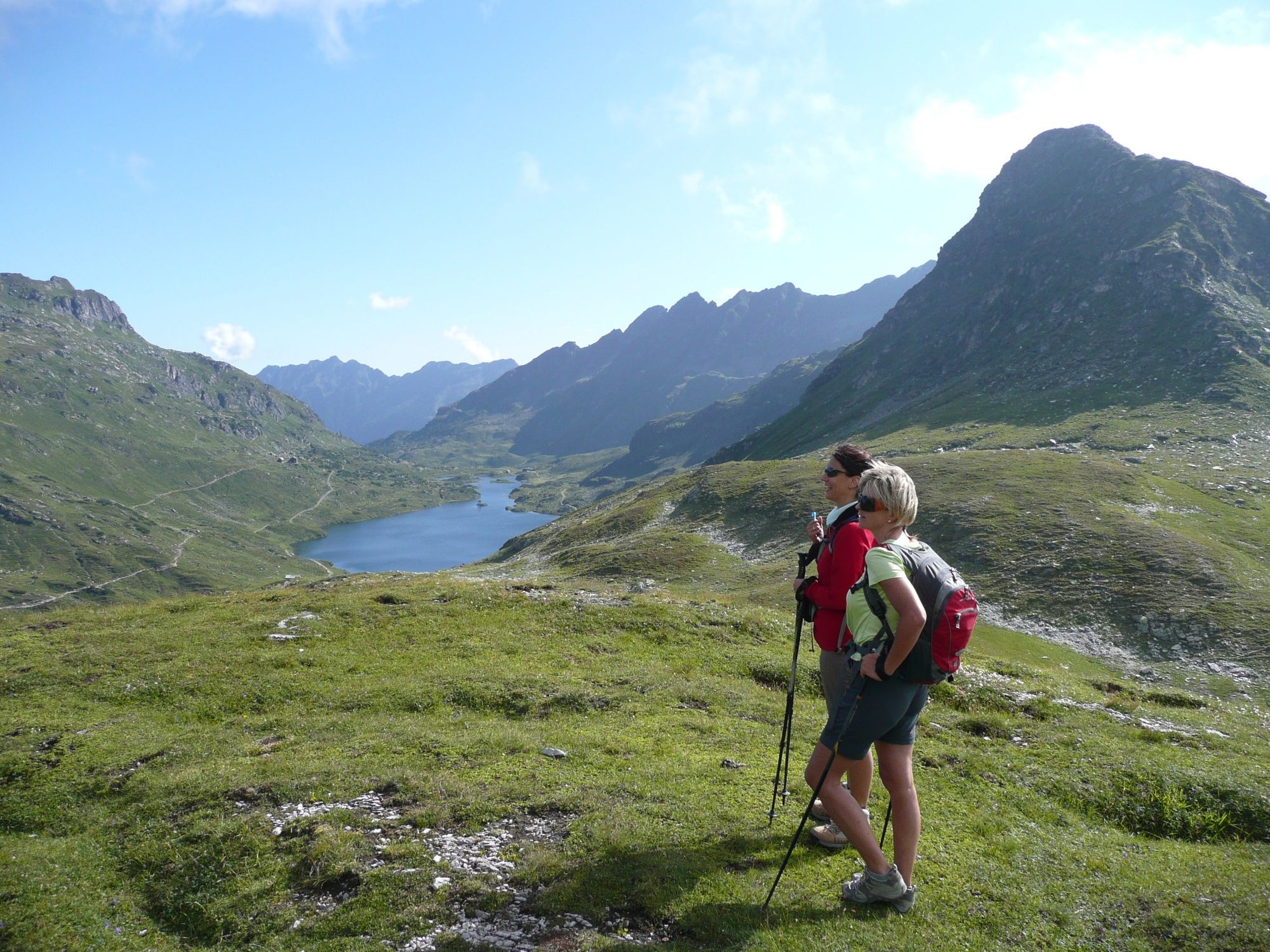
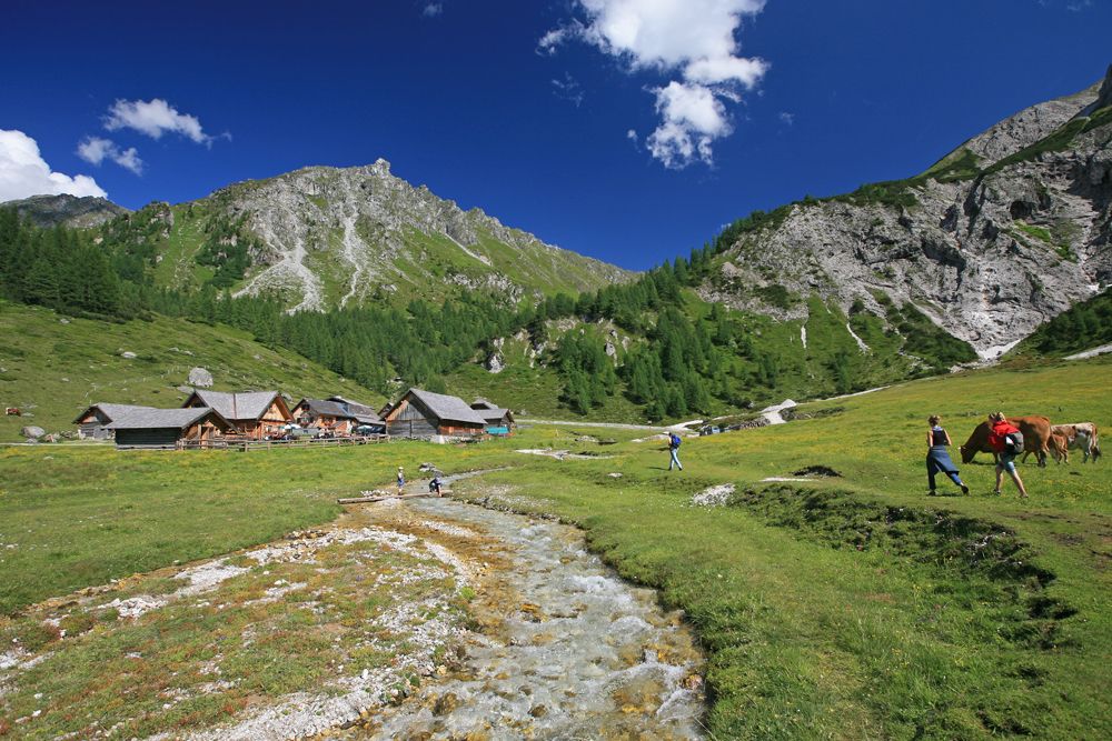
Rewarding walk around Steirische Kalkspitze summit with 3 lakes, 3 chalets and manifold beautiful views.
- Difficulty
-
medium
- Rating
-
- Starting point
-
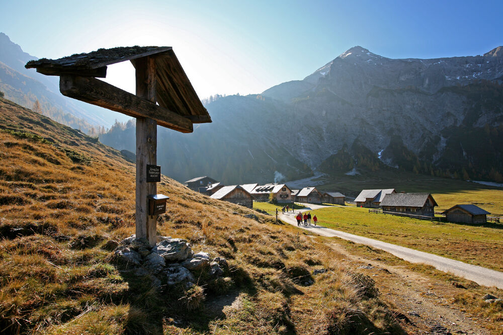
Hiking trail head Ursprungalm
- Route
-
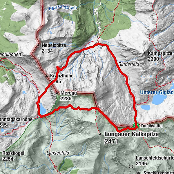
Ursprungalm0.0 kmGiglachsee Hütte (1,955 m)2.4 kmOberhütte am See7.3 kmOberhütte7.4 kmUrsprungalm10.4 km
- Best season
-
JanFebMarAprMayJunJulAugSepOctNovDec
- Description
-
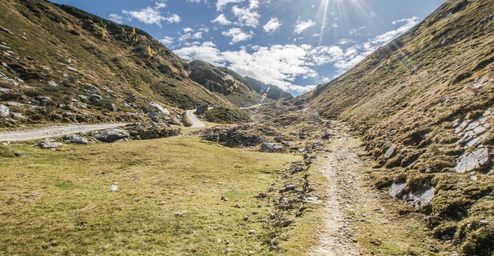
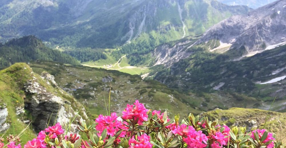
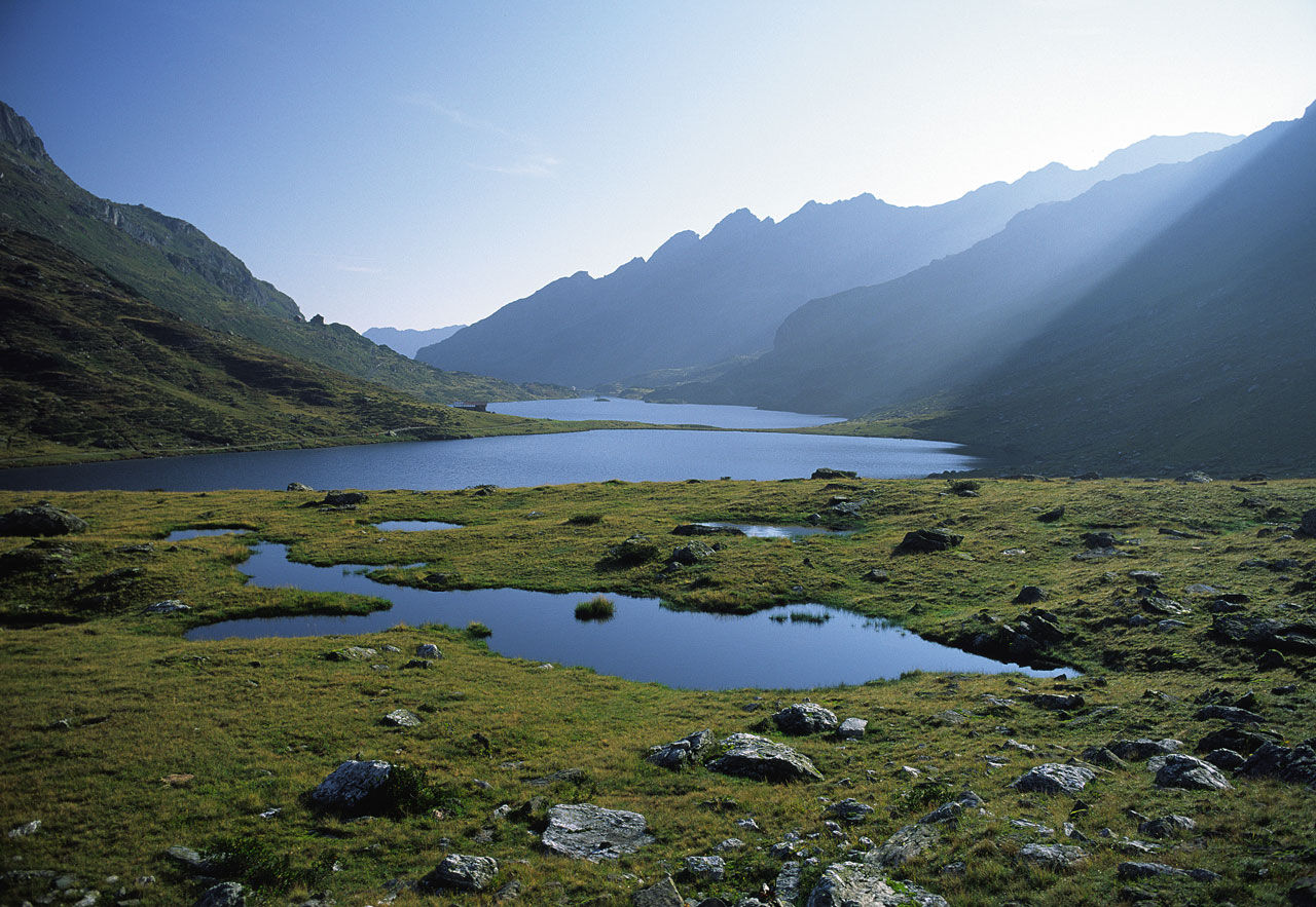
Beautiful hike around the summits of Steirische and Lungauer Kalkspitze. The limestone of these 2 mountains lies inmidst the primitive rock of the Schladming Tauern range and gives a special feature to this hike. Along the route you encounter Giglachseen Lakes and Oberhüttensee Lake as well as Giglachsee Hütte, Oberhütte and Ursprungalm chalets as refreshment stops.
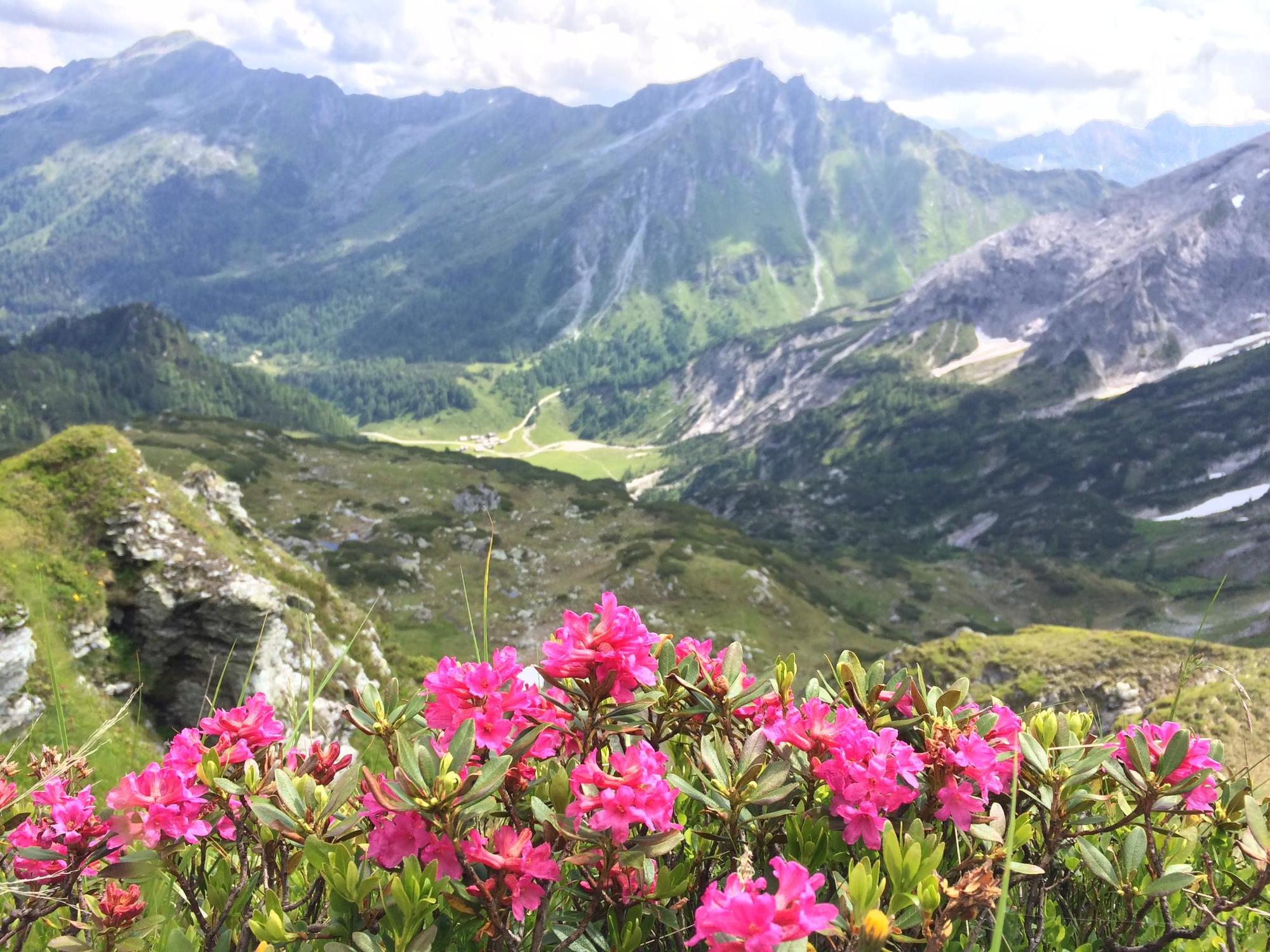
The landscape is characterised by limestone and dolines (typical karst phenomena), which bring along unique flora. Moreover, the Giglachseen Lakes and Oberhüttensee Lake give the special appeal to this tour.
- Directions
-
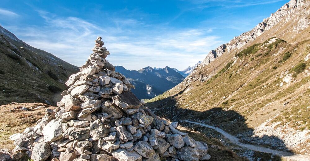
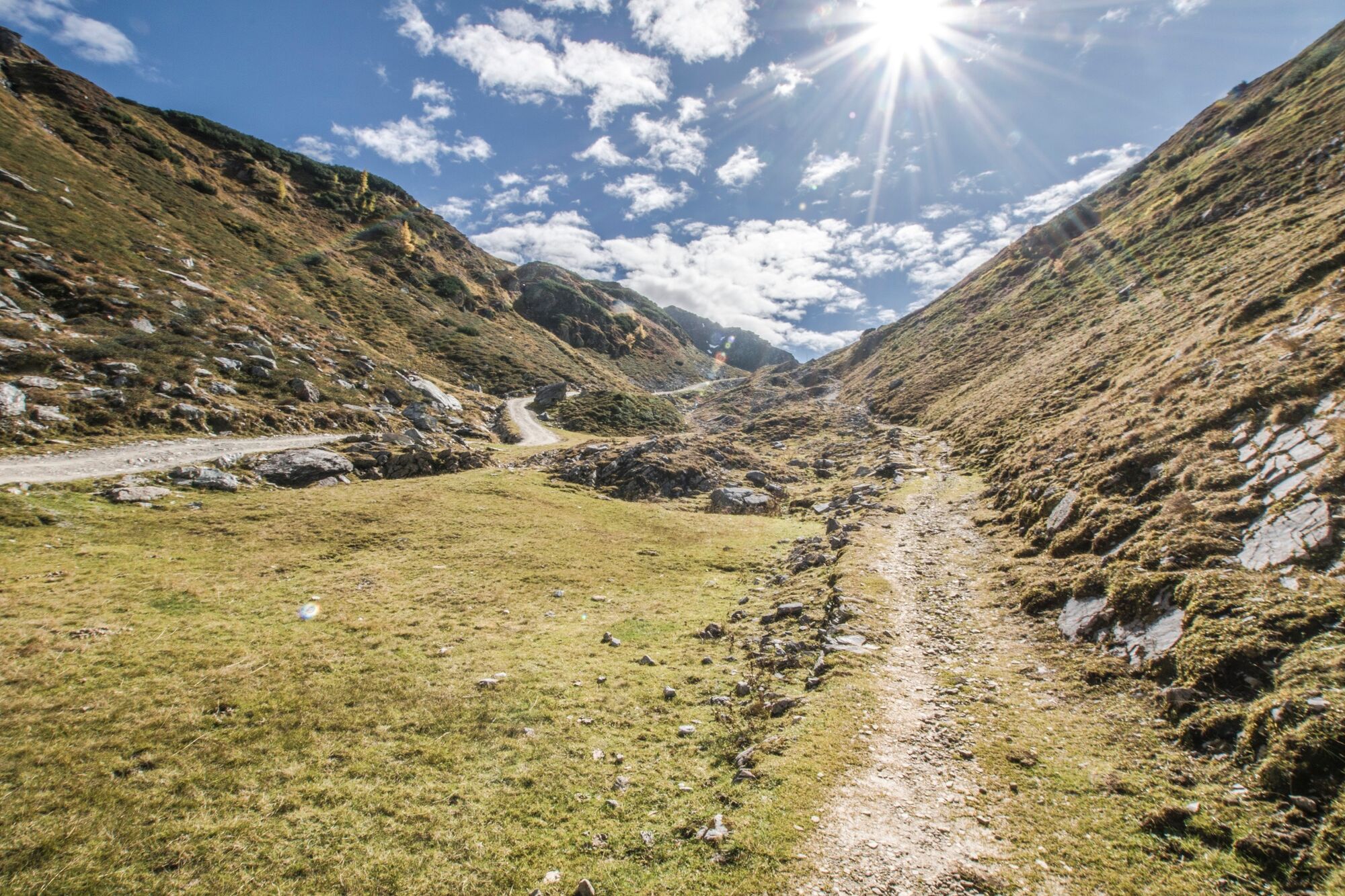
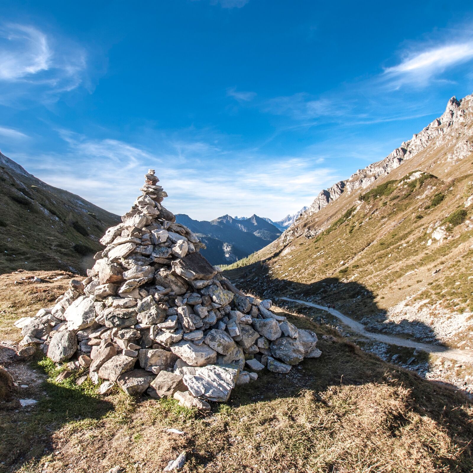
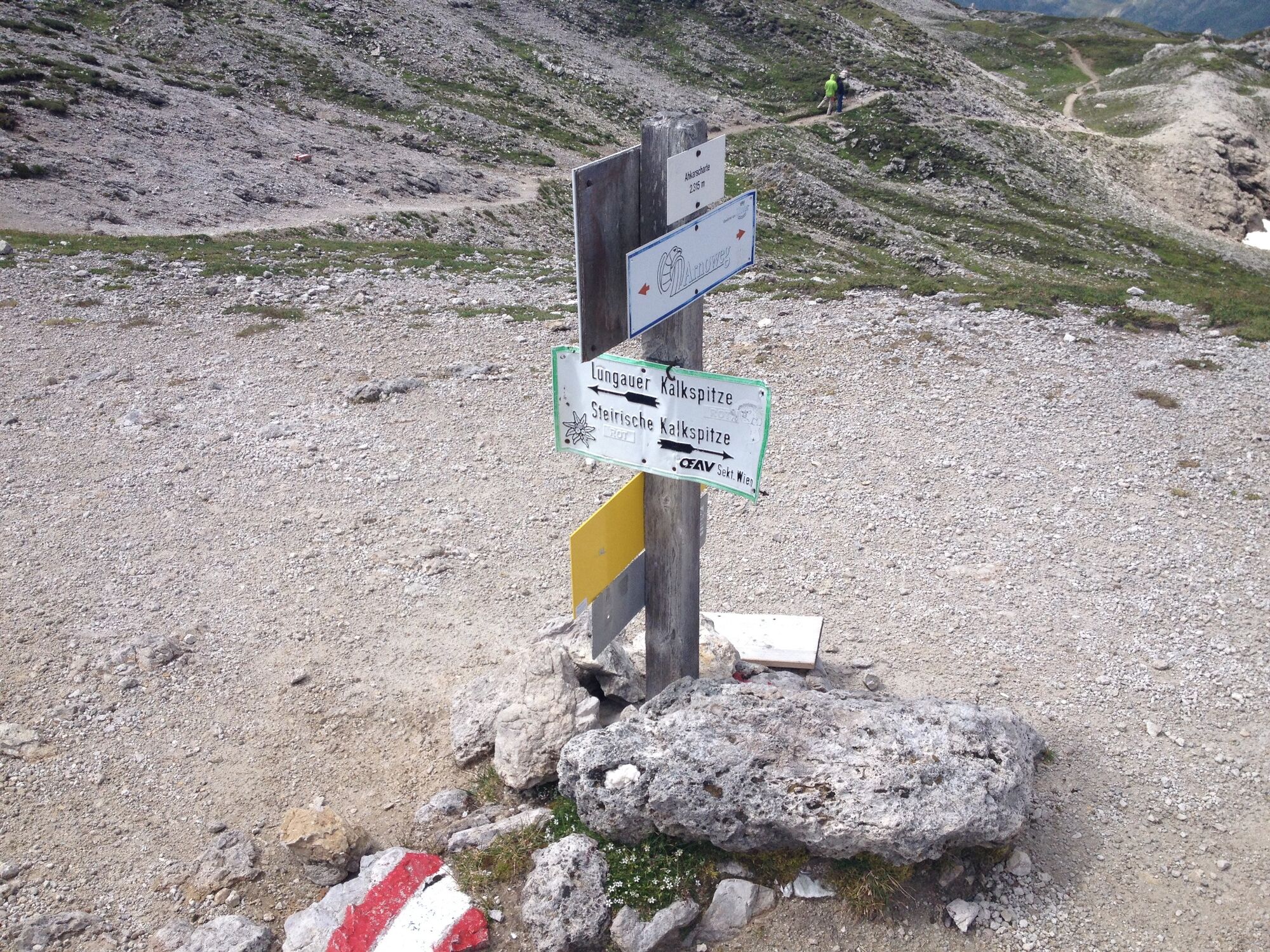
From the Ursprungalm chalets you take trail n° 711 via Rinderfeld and Preuneggsattel mountain saddle to Giglachsee Hütte chalet at the Giglachseen Lakes. From here you follow trail n° 702 in wide bends to the Znachsattel mountain saddle and further on to the Akarscharte ridge. From here you can make an ascent to Steirische or Lungauer Kalkspitze (additional walking time approx. 1 hour for each).
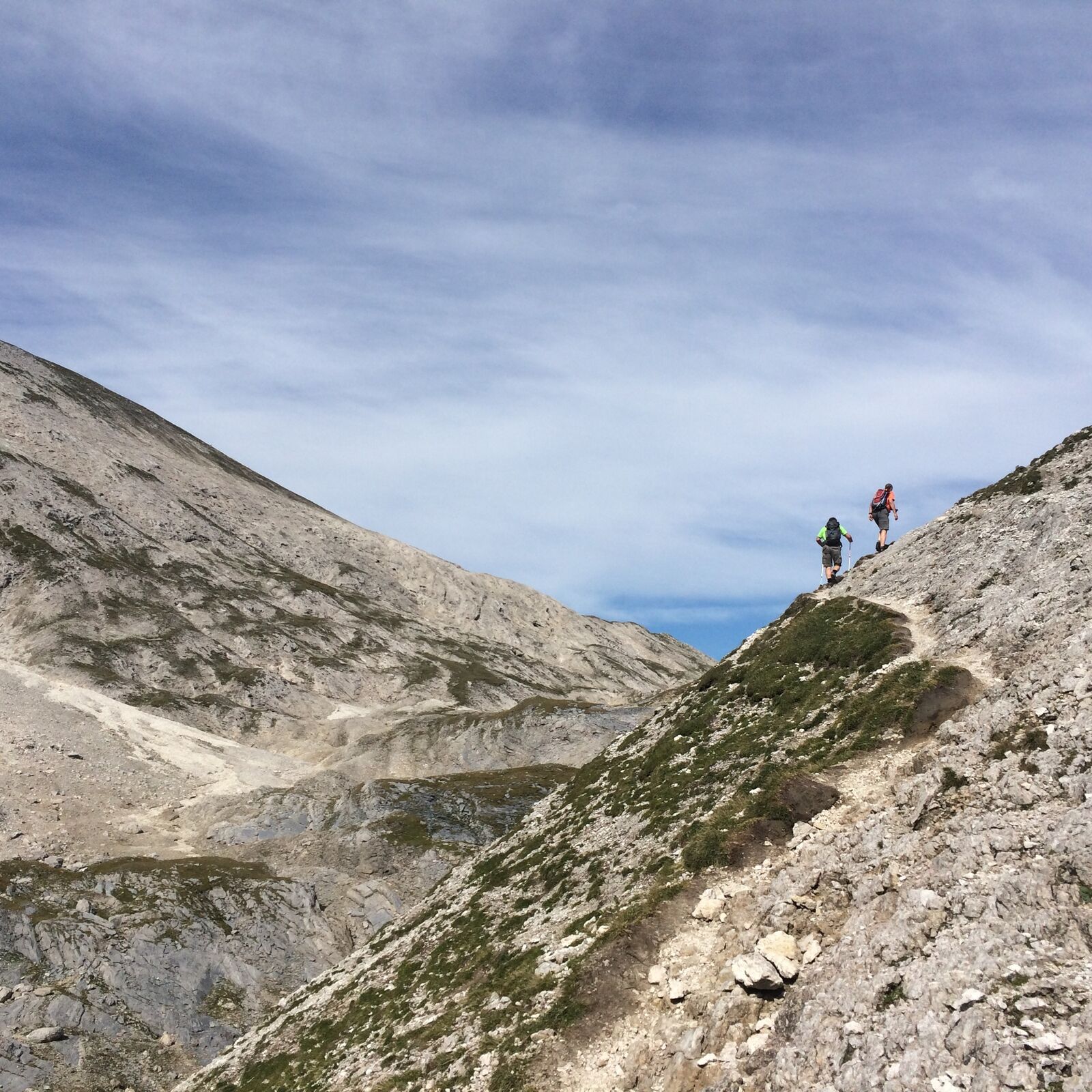
From Akarscharte you follow trail n° 702 downhill to Oberhütte chalet. Follow the route no. 702 downhill from the Akarscharte to Oberhüttensee Lake. After the Akarscharte you walk through an interesting landscape: crevasses, rounded hunchbacks line up and the light rock in the middle of the primary rock forms the surrounding mountains shows a “limestone-window” in the prehistoric rocks. You descend for approximately 500 meters (altitude level).
Oberhüttensee Lake and its hut make a lovely resting place, before you continue to Ursprungalm chalets via Brotrinnl and a 200 m ascent (steady-footing) and then descend via the Kranzlhöhe heights on a narrow path through the charming landscape to the Ursprungalm.
- Highest point
- 2,302 m
- Endpoint
-
Hiking trail head Ursprungalm
- Height profile
-

- Equipment
-
A well-packed backpack is helpful and especially when touring Alpine terrain a tuque, gloves, a windproof jacket and pants are standard equipment. Good, waterproof shoes, sun glasses, sun cream and sufficient beverages are essential too. Torch light, a map of the area, knie and a small first-aid kit should also be in the backpack.
- Safety instructions
-
Be careful on the ascent to Brotrinnl - lose rocks and soil. Surefootedness, a head for heights and alpine experience required!
Changes in weather patterns, quick falls in temperature, thunderstorms, wind, fog and snow are some of the dangers that can be encountered on a hiking tour. Hosts of alpine huts and mountain refuges have a lot of experience in the mountains and can give good advice about weather and the trails. Poor equipment, overestimation of one's own capabilities, carelessness, poor personal constitution and/or wrong judgement can lead to critical situations. In case of thunderstorms: avoid summits, ridges and steel ropes.
GPS data and orienteering
Available GPS data - just like hiking maps - is only a guidance for orientation and can never depict a trail exactly with all its details. Especially at dangerous spots it is essential to judge on site how to proceed.
In an emergency please call:
140 - for Alpine emergencies (all over Austria) 112 - European GSM emergency number - Additional information
-
Tourist information: www.schladming.com
Information about bus schedules:
360° drone images
Get yourself an overview with our 360° drone images:
View over Giglachkar cirque: https://vonoben.schladming-dachstein.at/sommer/index.php?S=307 Giglachseen and Kalkspitzen summits: https://vonoben.schladming-dachstein.at/sommer/index.php?S=308 - Directions
-
Turn-off from federal highway B320 in Pichl and continue on Preuneggstraße road towards Ursprungalm/Reiteralm. Pass by the valley terminal of Preungg-Jet and you will reach the toll station at Strickbrücke bridge. You continue on the toll road (dirt road), passing by Moarhofalm chalet until you reach the car parking at Ursprungalm at an altitude of 1,600 m.
Alternatively you can drive into Preuneggtal valley from Schladming via Rohrmoos. From Schladming you take provincial highway L722 through Rohrmoos and after about 6 kms you turn off right into Hohenbergstraße road. This road will also take you to Strickbrücke road. From here follow the directions as described above.
- Public transportation
- Parking
-
The best way to the starting point is via Planai buses. You can park your car at Planet Planai in Schladming or in the center of Rohrmoos where parking is available. There is also parking available near Ursprungalm in Preuneggtal valley.


-

-
AuthorThe tour Around the summit of Steirische Kalkspitze is used by outdooractive.com provided.


General info
-
Schladming - Dachstein
3002
-
Obertauern
1643
-
Tweng
308


