


- Brief description
-
Increase: * from Gstatterboden, first on "Rauchbodenweg", then trail nr.641 in 2,5 h to Buchsteinhaus
* Gr. Buchstein (2.224 m) via Westschlucht in 2,5 h
or via Wengerweg 2,25 h, via Südwand-Klettersteig (A+B) 2 h
*From St. Gallen/Eisenzieher in 5 hours to the summit, same route number
- Difficulty
-
difficult
- Rating
-
- Starting point
-
Gstatterboden or St. Gallen / Eisenzieher
- Route
-
GstatterbodenBrucksattel (1,117 m)4.0 kmBuchsteinhaus (1,571 m)6.2 kmGroßer Buchstein (2,224 m)8.4 kmGriesbach15.9 km
- Best season
-
JanFebMarAprMayJunJulAugSepOctNovDec
- Description
-
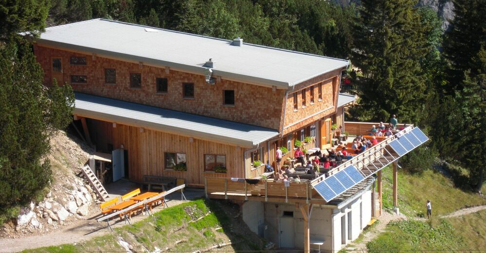
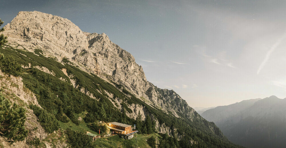
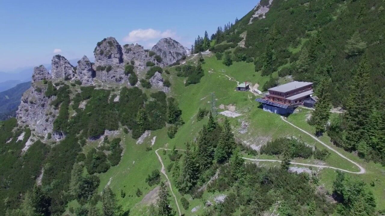
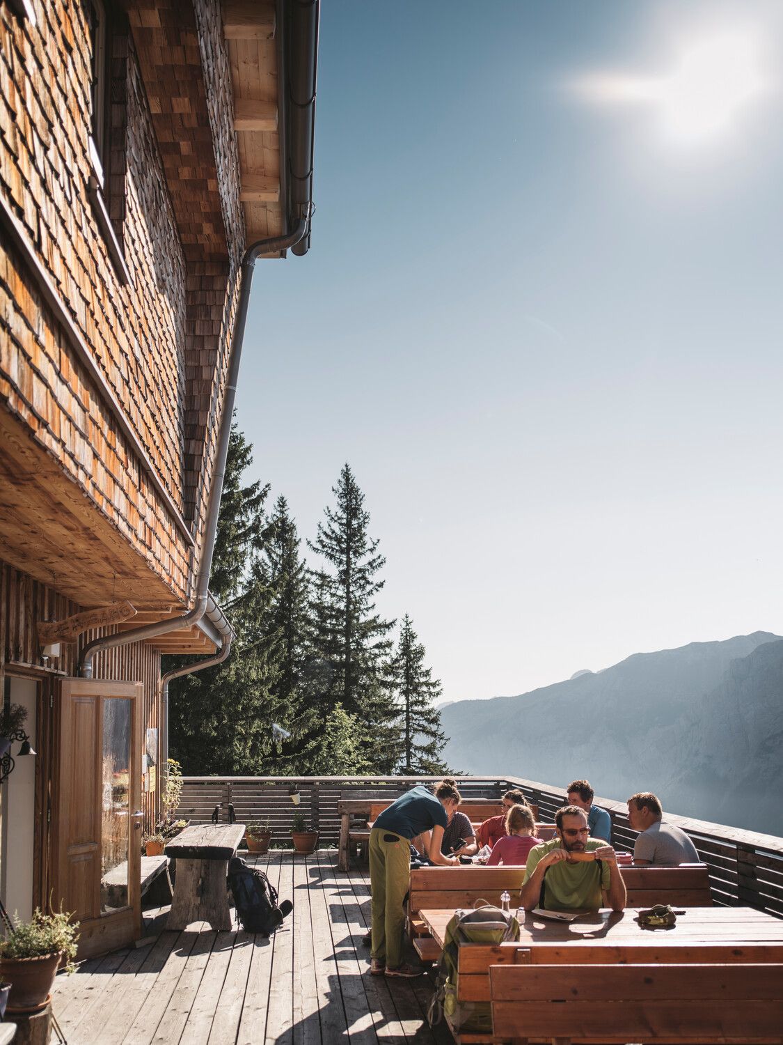
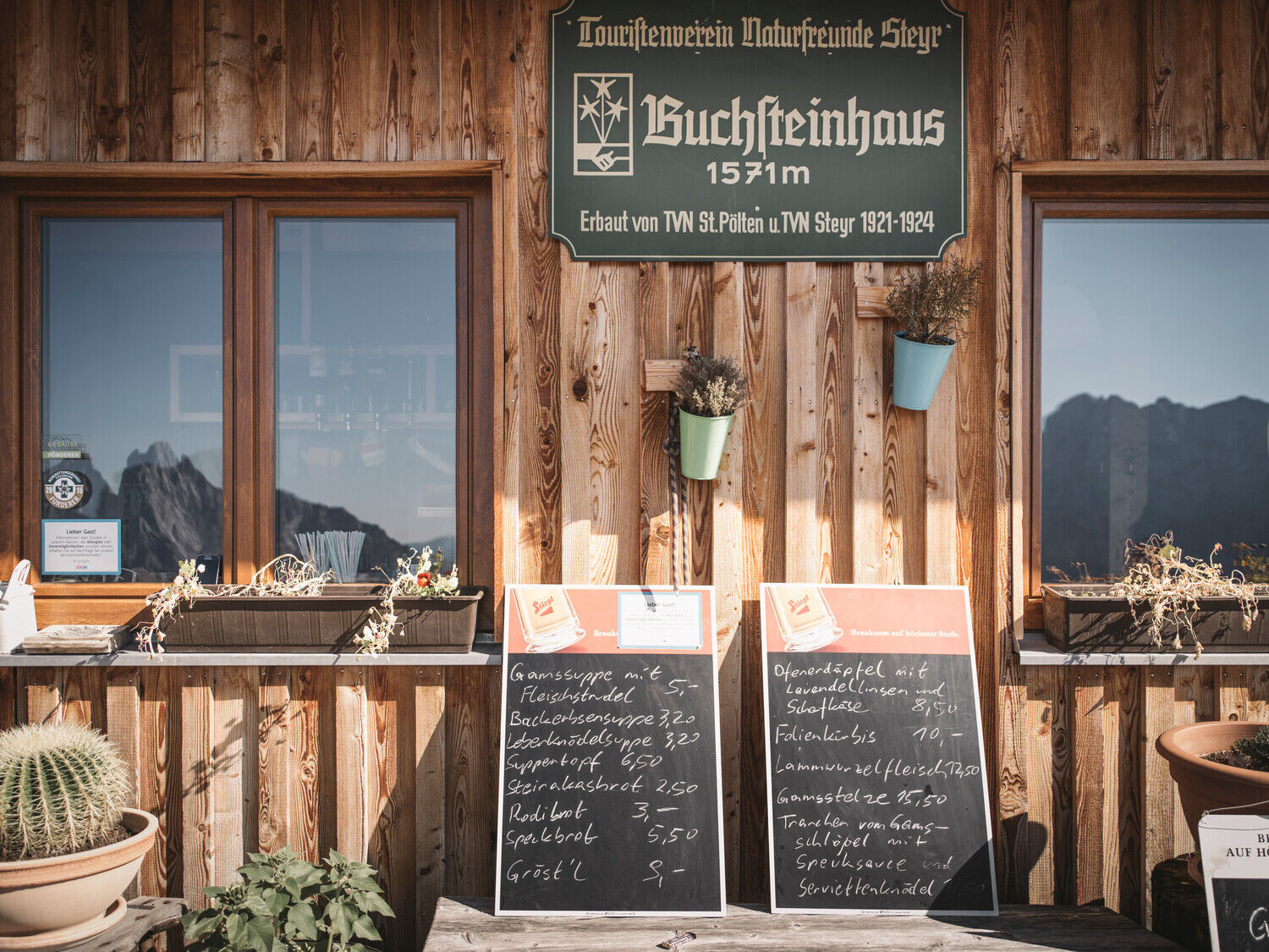
Base for hiking and climbing tours on the Buchstein: Buchsteinhaus at 1,546 m with a spacious sun terrace and magnificent view of the Gesaeuse mountains
- Directions
-
From the NP-Pavillon Gstatterboden we first march a few hundred meters on a path next to the main road until we reach the entrance to the Rauchbodenweg. We follow this path, passing a few theme stations and with wonderful views of the Enns and the Hochtor Group on the opposite side.
Soon the path to the Buchsteinhaus branches off to the right. At the beginning a forest road, the path becomes narrower and stonier and ends after a hilltop in a dried out stream bed, which we cross. Some often sweaty sections of the path follow, past a small cave, through a fairytale beech forest, often with short views of the opposite group of high gates. Several times we cross a forest road until we finally arrive at the Brucksattel. Now the Buchstein shows itself majestically to us for the first time. Soon we see the material cable car on the left, which has made the work of the hut keeper much easier for some years now.
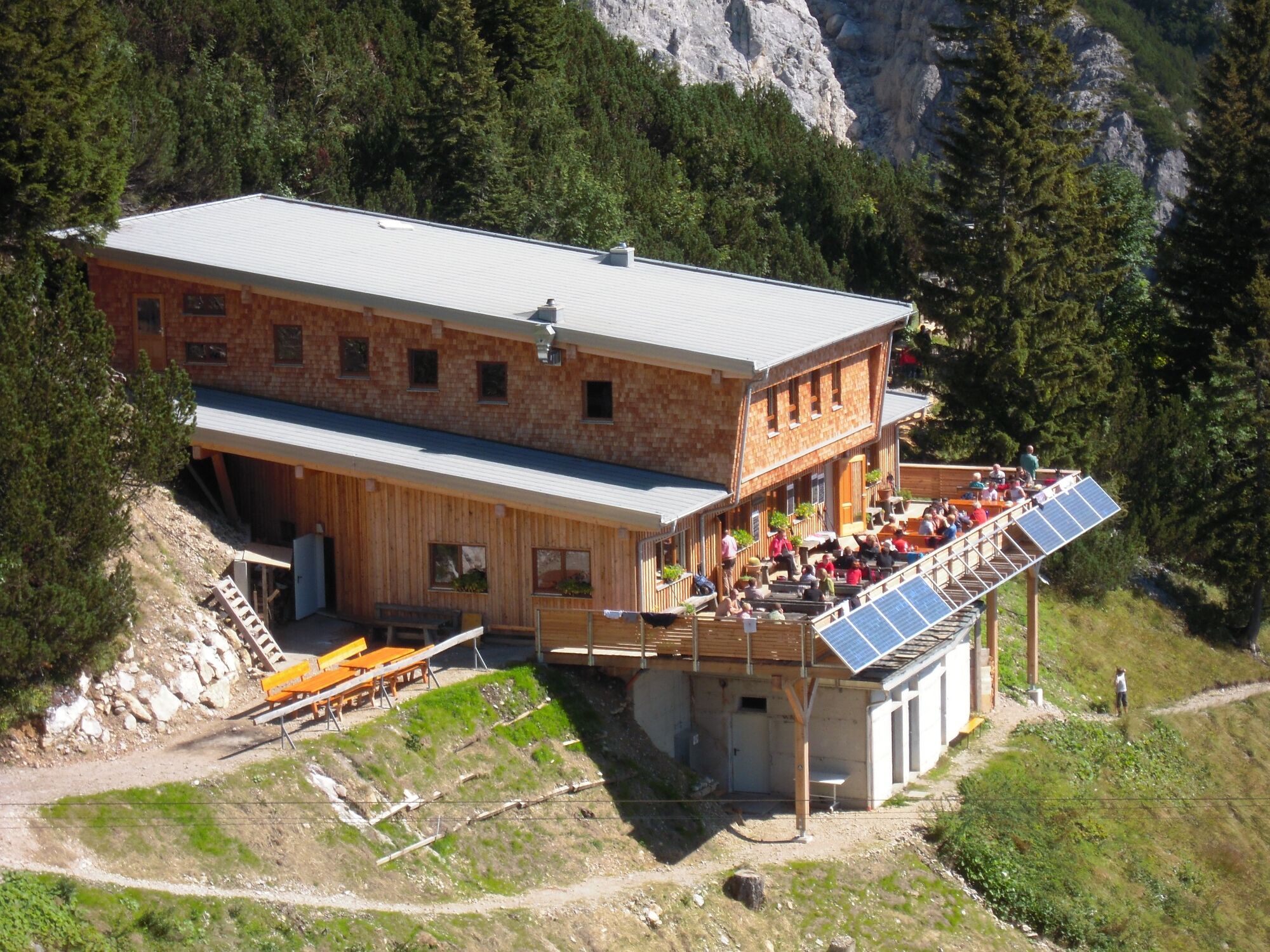
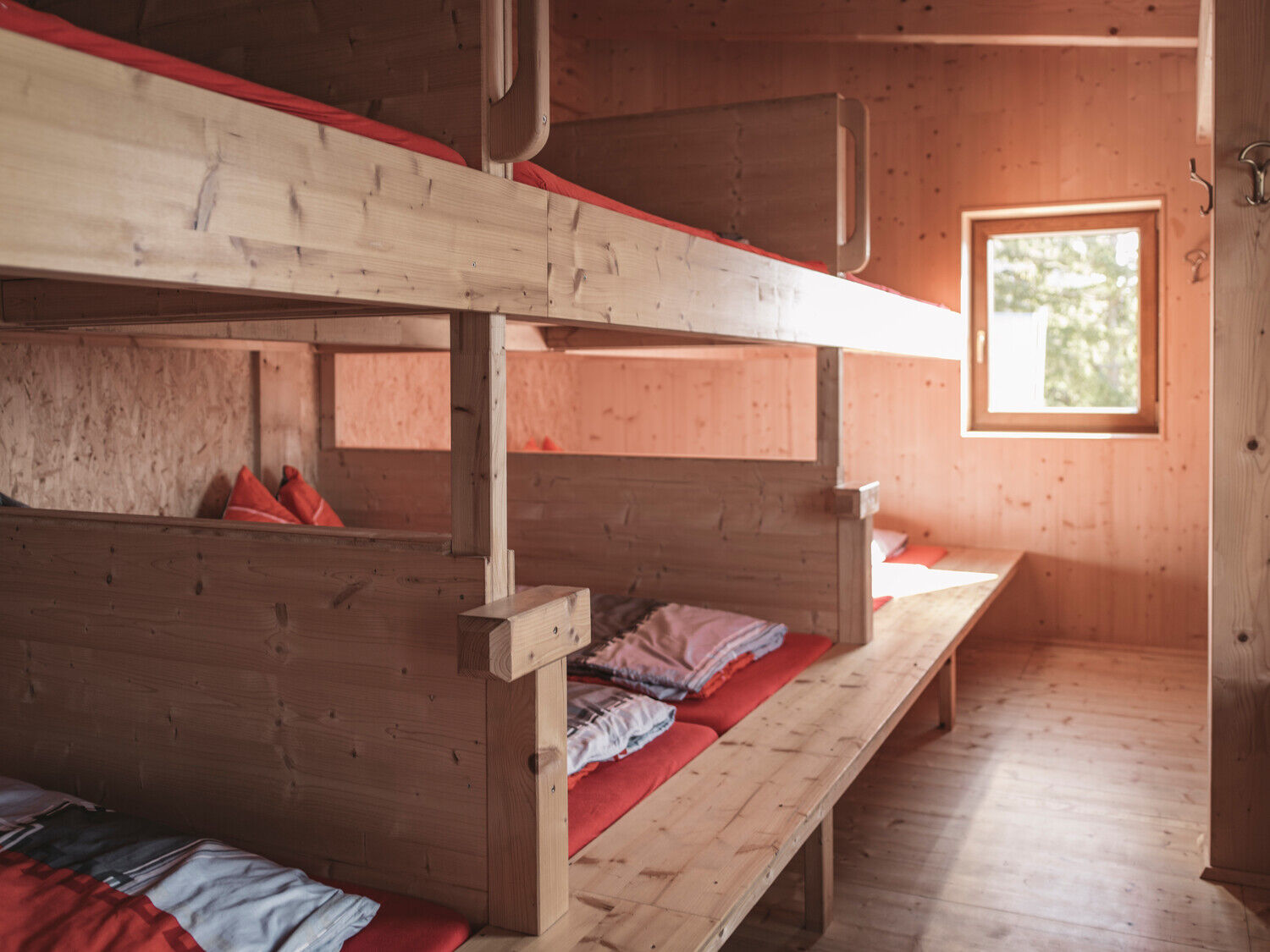
Now our forest path leads in 20 serpentines to the Buchsteinhaus. The refuge was completely rebuilt in 2009 and reopened in 2010. In addition to very attractive storage rooms, the Buchsteinhaus offers above all a large panoramic terrace, which presents the north walls of the high gate group as if on a serving tray. An unforgettable experience if we are lucky enough to sit here in the late afternoon or early evening, when the alpenglow bathes the white limestone walls of the Hochtor Group in a golden red light. As we now have almost 1,000 metres of altitude difference in our legs, it is advisable to stay overnight at the hut and postpone the summit storm to the next day. Those who are in good shape can of course manage it in one day.
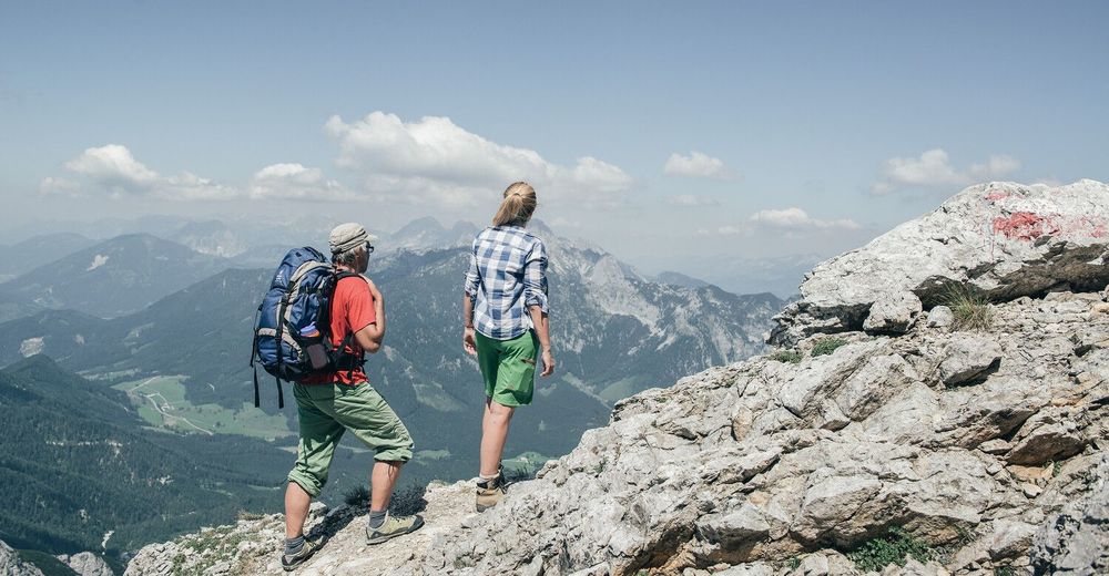
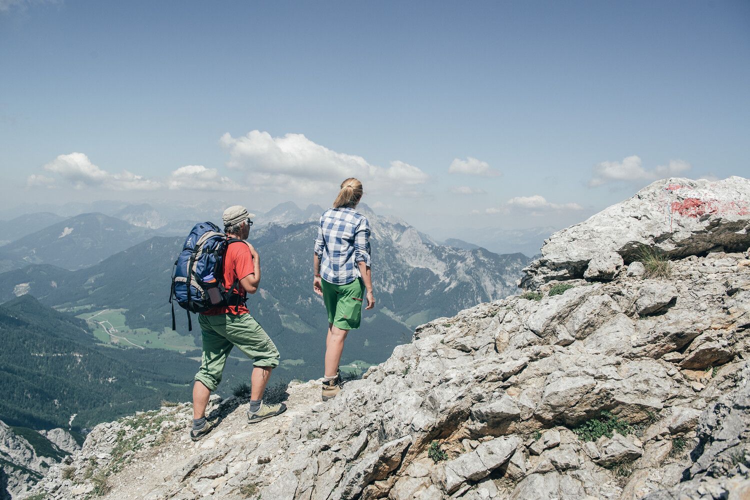
From the Buchsteinhaus we reach a viewing point in 5 minutes on foot, from where the Admont valley basin lies at our feet - especially romantic, when in autumn often until midday the white cotton wool beads of fog block the view of the valley. Now our path leads on rocky terrain in a steady zigzag uphill until we reach the start of the via ferrata "Buchstein Südwandband" in a little more than 1 hour. But we continue along the path and reach the turnoff "Wenger Weg", which is secured with steel pins and is an easy climb, so please only take it if you are sure-footed and free from giddiness. Otherwise continue towards the western gorge. Here we climb over a funnel-like scree and rocky terrain until we surprisingly reach a high plateau from where we easily reach the summit cross.
Ascent or descent over the north side from/to St. Gallen/Eisenzieher is possible, but the terrain is very steep and through the rubble and boulders strenuous to walk on - special caution!
- Highest point
- 2,182 m
- Endpoint
-
Buchsteinhaus
- Height profile
-

- Equipment
-
Sturdy hiking boots or good trekking shoes, as well as a hiking rucksack with appropriate contents (water bottle, blister plaster, hiking map, snack, etc.).
You should also be well prepared for a change of weather.
for the via ferrata: via ferrata set and rockfall helmet.
- Safety instructions
-
relatively easy to walk up to the start of the via ferrata, then narrow path in rubble terrain - danger of slipping! Also when ascending and descending in the Western Gorge take special care, especially when it is wet!Only use a via ferrata set and a rockfall helmet on the via ferrata!
- Tips
-
at the starting point Gstatterboden visit the National Park Pavilion with the exhibition " Planspitze - the mountain of contrasts" and restaurant
- Additional information
- Directions
-
B 146 Gesäuse-Bundesstraße aus Richtung Admont oder Hieflau bis Gstatterboden
- Public transportation
-
Postbus Line 912 Haltestelle Bahnhof Gstatterboden (www.busbahnbim.at) on SA and SO also by Train to Haltestelle Gstatterboden (www.oebb.at)
- Parking
-
Parking at Gstatterboden railway station or at the Gstatterboden National Park Pavilion


- Author
-
The tour Großer Buchstein Crossing is used by outdooractive.com provided.


General info
-
Gesäuse
2223
-
Steyr und die Nationalpark Region
1369
-
St. Gallen
174


