

© Erlebnisregion Schladming-Dachstein - Schladming Dachstein - TVB Grimming-Donnersbachtal
- Brief description
-
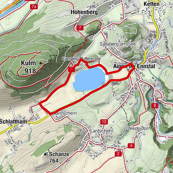
Entlang des Sees zum Campingplatz und weiter Richtung Schlattham. Entlang des Geh- bzw. Radwegs wieder zurück zum Putterersee.
- Difficulty
-
easy
- Rating
-
- Route
-
Aigen im Ennstal0.0 kmSchlattham1.8 km
- Best season
-
JanFebMarAprMayJunJulAugSepOctNovDec
- Highest point
- 662 m
- Height profile
-


-

-
AuthorThe tour Puttererseerunde is used by outdooractive.com provided.
GPS Downloads


General info
Refreshment stop
Flora
A lot of view
Other tours in the regions


