


- Brief description
-
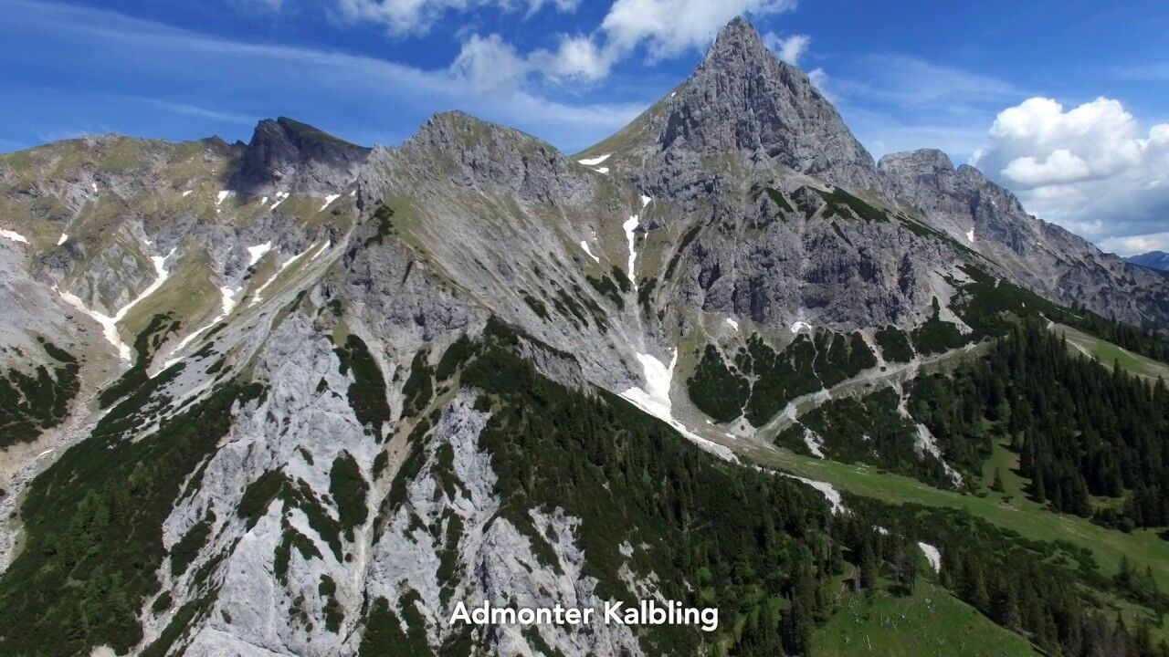
Hike from Admont over the Hahnstein to the Klinkehütte at the foot of the Admonter Kalbling.
- Difficulty
-
medium
- Rating
-
- Starting point
-
Admont
- Route
-
Kematen0.1 kmKematengraben1.0 kmSteinerner Wirt3.0 kmHahnstein (1,697 m)4.9 kmOberst Klinke Hütte9.4 kmSieglalm11.8 kmKematen15.9 km
- Best season
-
JanFebMarAprMayJunJulAugSepOctNovDec
- Description
-
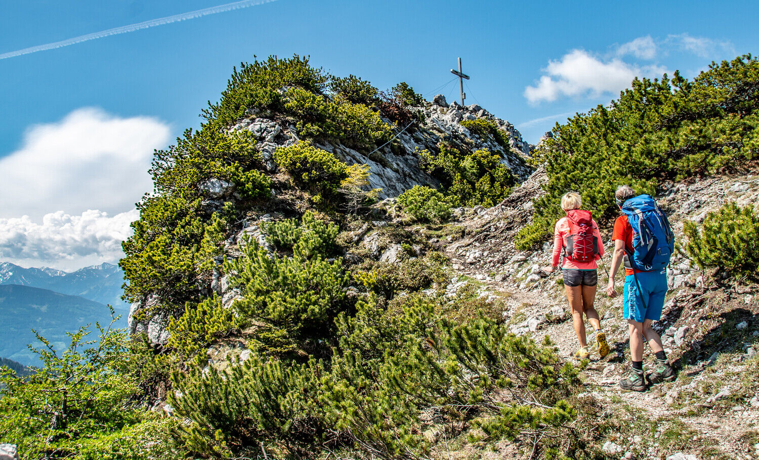
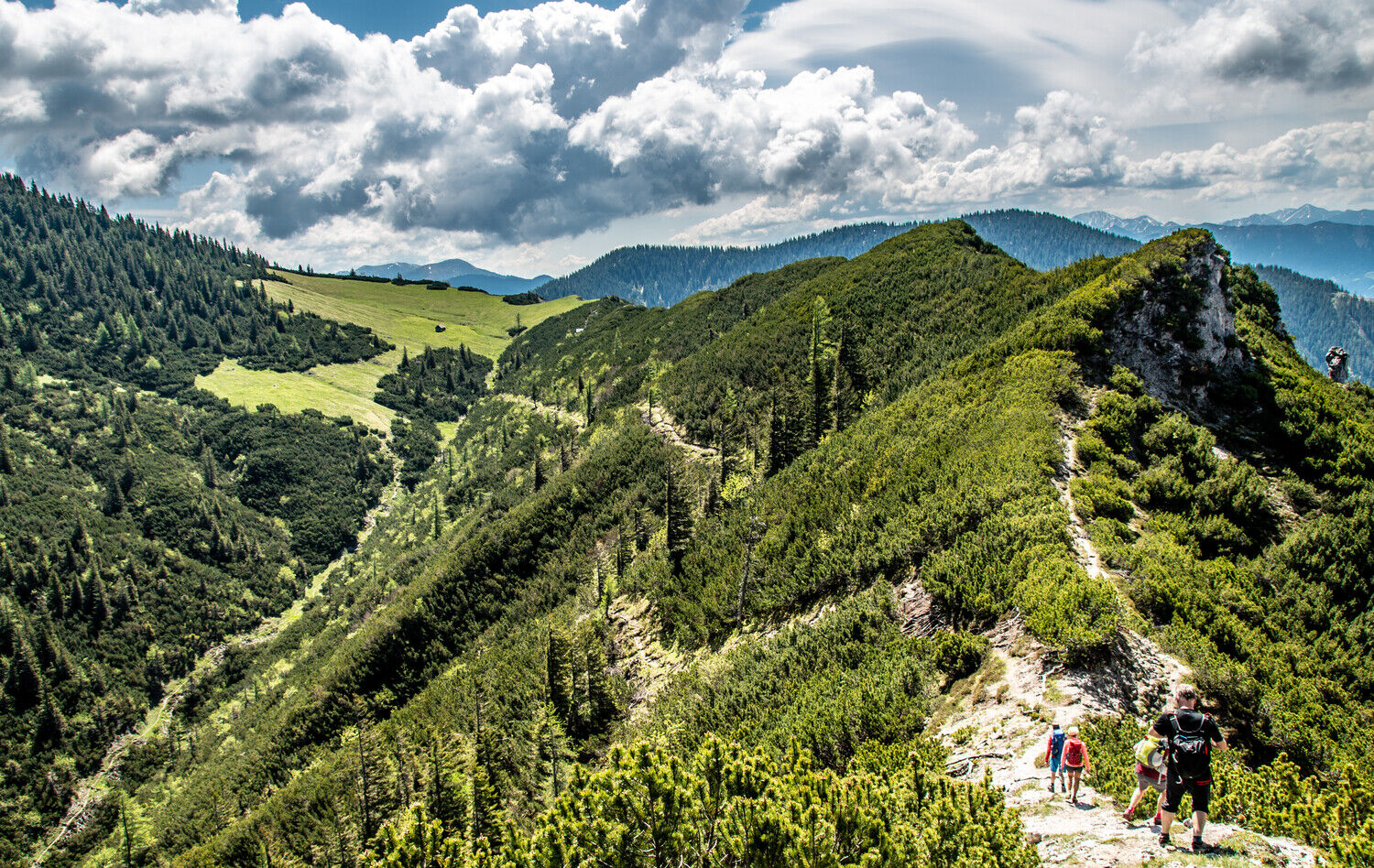
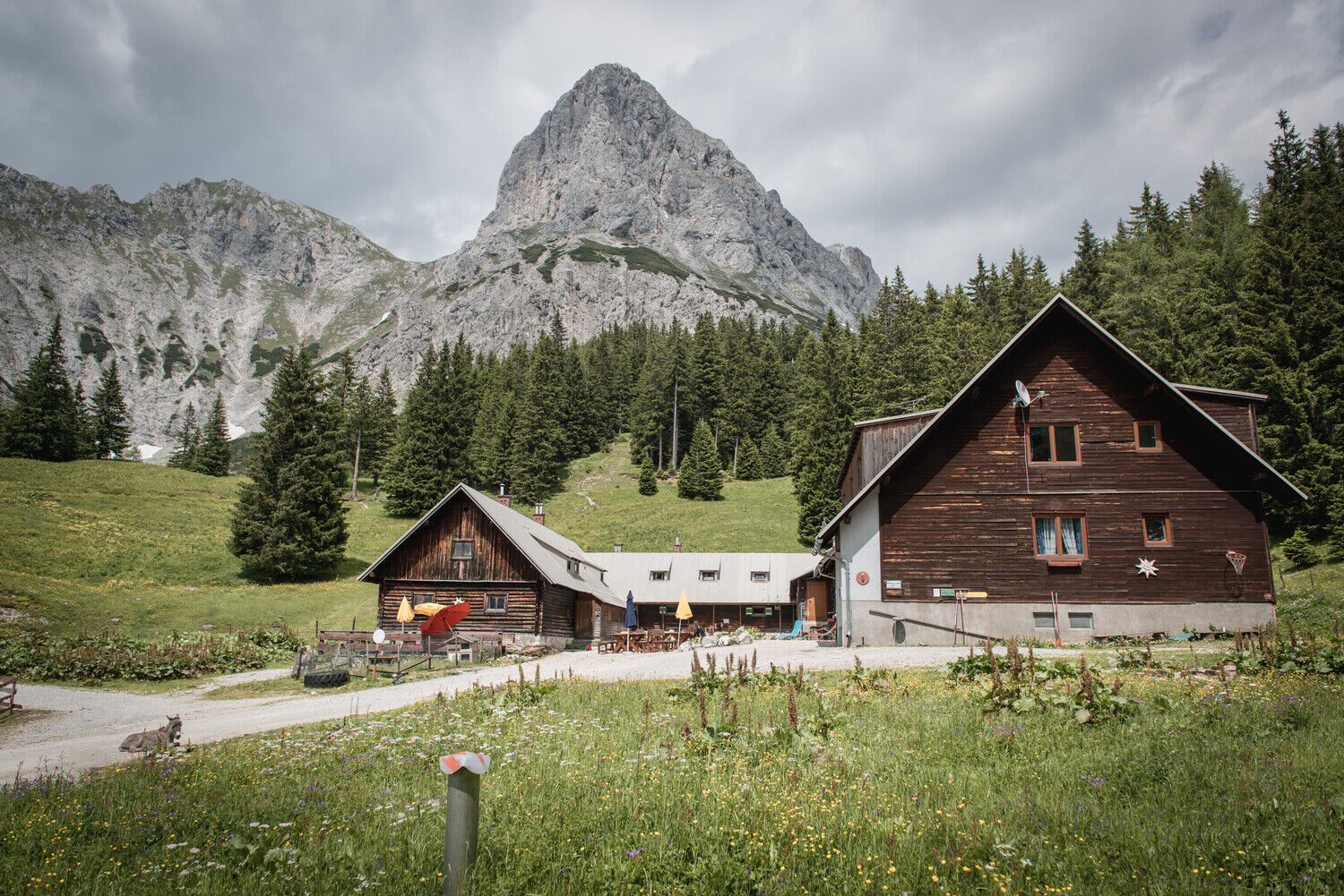
We start the tour in the centre of Admont and hike first through an avenue, then a short stretch on the main road and finally through a romantic forest path to the Hahnsteig via the Scheibleggerhochalm down over the Alpsteig to the Sieglalm to finally tackle the last ascent to the Klinkehütte at the foot of the Admonter Kalbling.
- Directions
-
In Kematen we follow trail nr. 601, trail nr. 601A, which soon branches off, we stay left along the Luchstrail. The path leads us steeply uphill until we meet the turnoff to Hahnstein. A short stretch and we are at the summit. Going down the same way we follow the Luchstrail again. At the Scheibleggerhochalm we can't miss the turn off to the right towards Sieglalm (Alpsteig). The somewhat more difficult path leads us steeply downhill and we cross the forest road 3 times. Now we turn left towards Klinkehütte. We follow the well signposted path for about 1 hour.
On the way back we walk at the beginning like we did on the ascent, but we walk directly to the Sieglalm (the Sieglalm is only visible as a clearing in the forest) along trail 601 to the main road. Now we walk along the road for a few km. until we turn right again into the forest and the last part through the forest to our starting point:
Refreshment stops: Klinke hut, Sportalm Kaiserau, inns in Admont
Translated with www.DeepL.com/Translator (free version)
- Highest point
- 1,682 m
- Endpoint
-
Admont
- Height profile
-

- Equipment
-
Sturdy hiking boots or good trekking shoes, as well as a hiking rucksack with appropriate contents (water bottle, first aid, hiking map, sun protection, snack, etc.). You should also be well prepared for a change of weather. Mobile phone for emergency call. Do not forget your sleeping bag for the overnight stay in the huts! As little as possible, as much as necessary.
- Safety instructions
-
Mountain rescue emergency call: 140
Tip for emergency message - give answers to the six W questions: What happened? How many injured? Where did the accident happen (possibly GPS coordinates)? Who is reporting (callback number)? When did the accident happen? Weather at the scene of the accident?
- Tips
-
in Admont at the beginning or end of the tour, visit the Benedictine Abbey of Admont with the largest monastic library in the world.
Opening hours: April to October: daily 10.00 - 17.00 hrs
www.stiftadmont.at
- Additional information
-
www.gesaeuse.atwww.klinkehuette.atwww.sportalm-kaiserau.atwww.stiftadmont.atwww.admont.at
- Arrival
-
A9 Pyhrn motorway exit Ardning/Admont, continue towards Admont 12 km B146 Gesaeuse main road to Admont, centre
- Public transportation
-
SA and SO by train from direction Selzthal or from direction Hieflau, station Admont.
from direction Liezen and Hieflau: post bus line 910 or 912, bus stop Admont - Kasteneck
- Parking
-
Parking behind the town hall Admont
- Author
-
The tour Admont -Hahnstein- Klinkehütte is used by outdooractive.com provided.


General info
-
Gesäuse
2223
-
Urlaubsregion Pyhrn - Priel
1440
-
Kaiserau
293


")
