


- Brief description
-
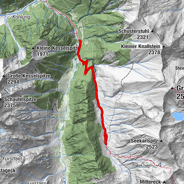
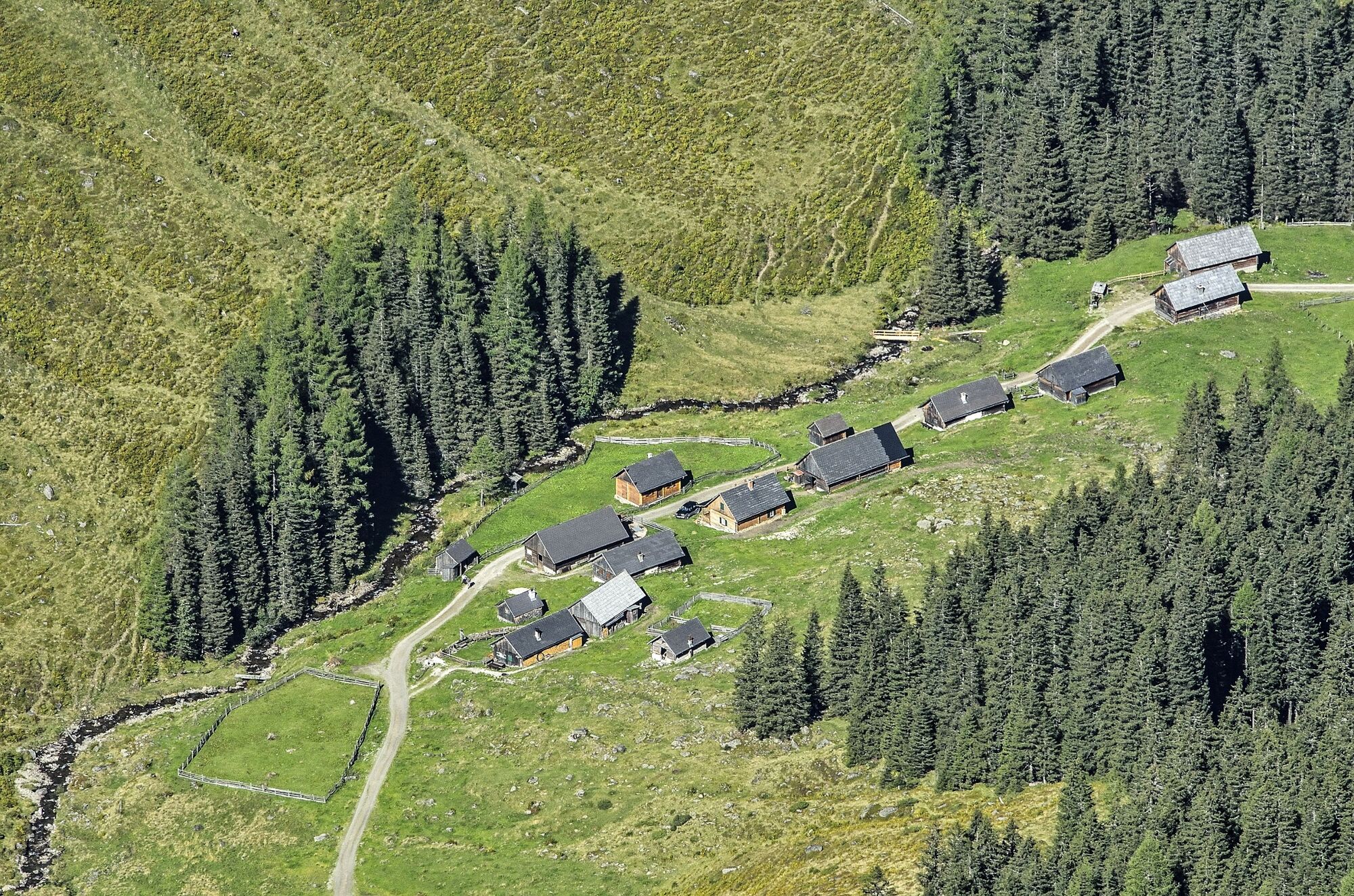
Short hike to the beautiful hut village in Tuchmoar.
- Difficulty
-
easy
- Rating
-
- Starting point
-
Kleinsölktal at the Striegleralm trail crossing - Tuchmoar Alm - small car park
- Best season
-
JanFebMarAprMayJunJulAugSepOctNovDec
- Description
-
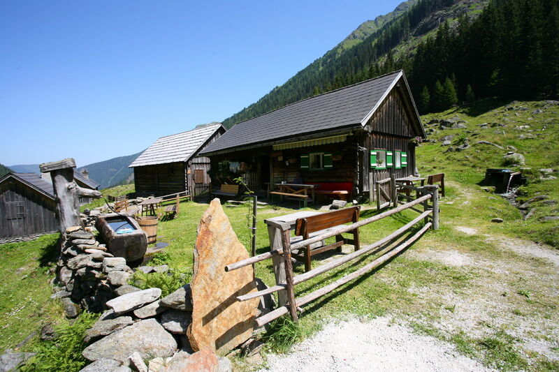
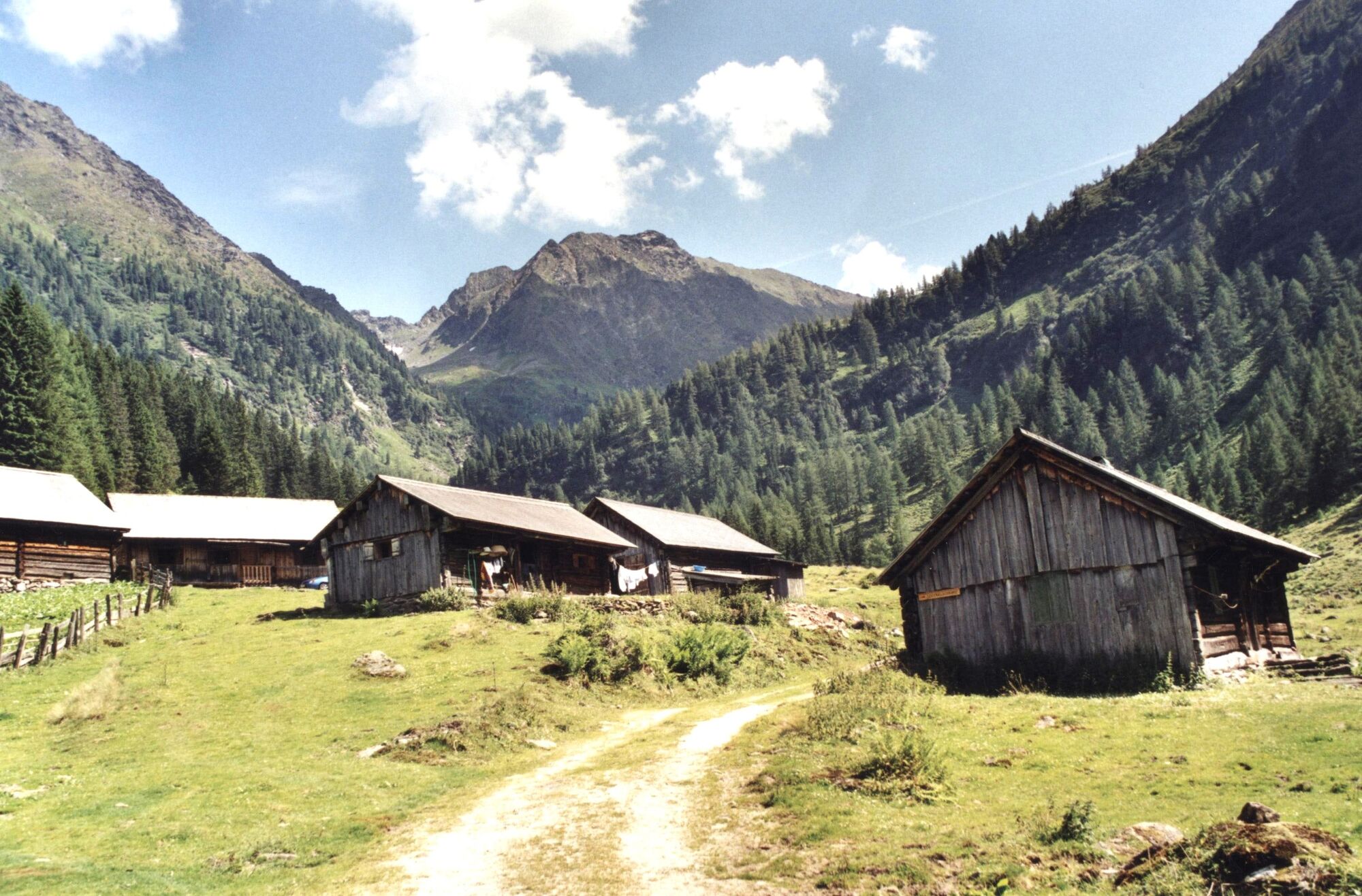
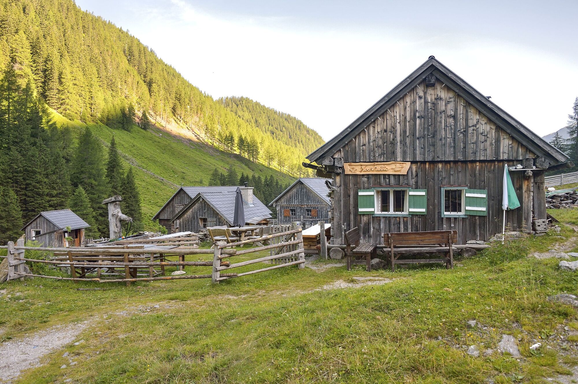
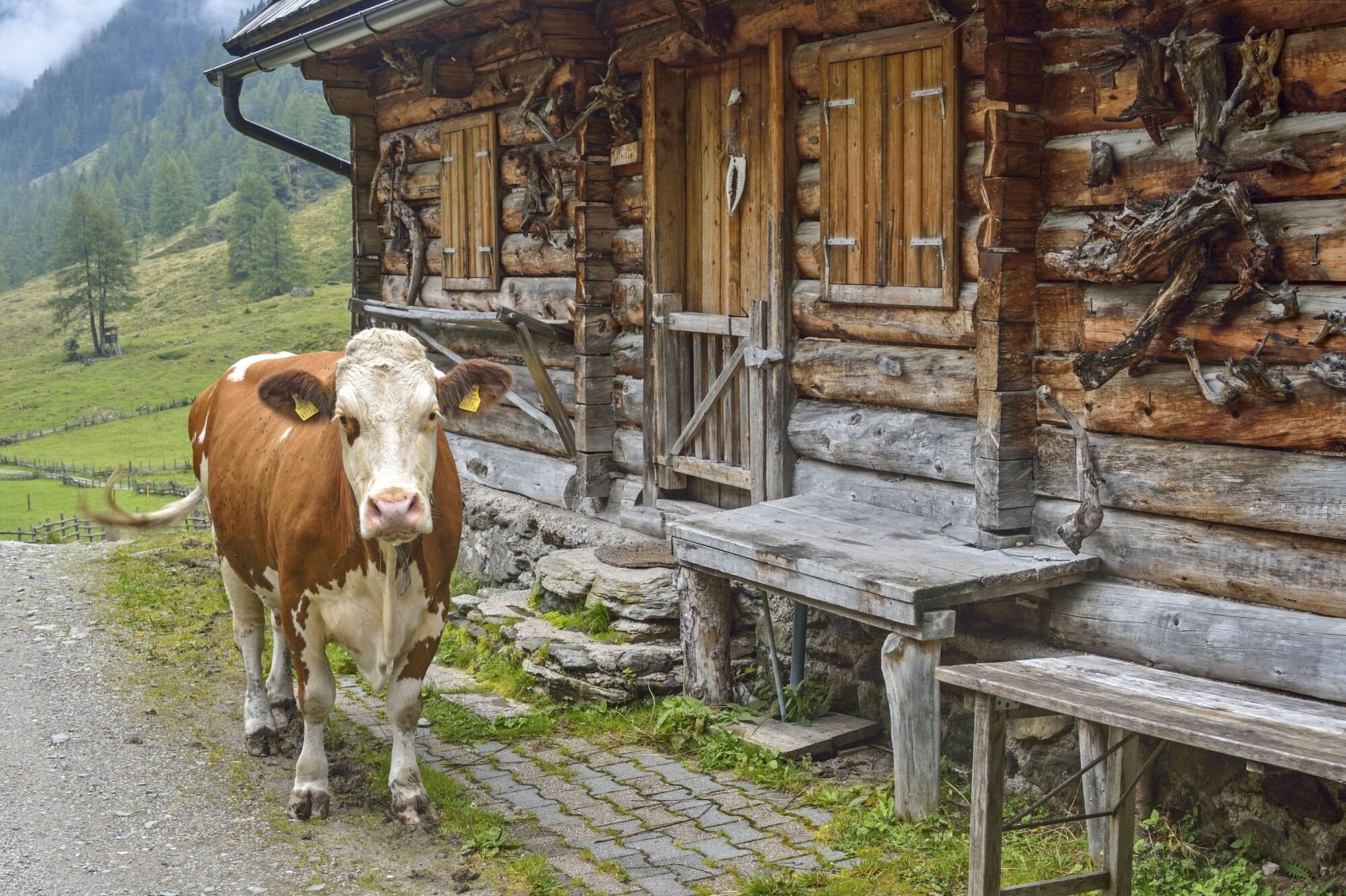
The real attraction of this not-too-far hike is the hill-country lifestyle led at the
Tuchmoaralm, where traditional alpine huts are still staffed, and milk is turned into butter and cheese. The forest path is new and wide, leading us initially along forested hillsides and up the mountain. Only in the last third do we hike on an old cart path through the forest, coming to the first areas of alpine pastures, dotted with mountain huts.
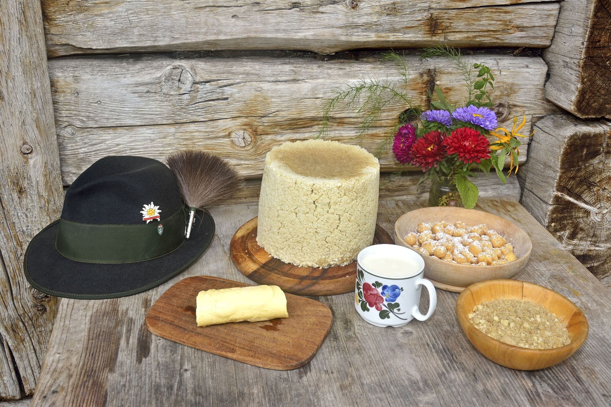
Some years ago, I experienced a memorable Almabtrieb celebration here, when, in the early morning, the beautifully decked-out cows were almost impossible to restrain. Once things get underway, they can barely wait to return home to their barns in the valley! During the summertime, the sound of cowbells fills the pastures, the cows are milked early morning and late afternoon, the power of the stream helps turn the cream into butter, which is then pressed into decorative moulds, Bread spread with fresh butter and Styrian cheese is a true treat! You should also definitely try the rye doughnuts with Styrian cheese, which are the No. 1 specialty of the Sölktäler and Ennstaler Almen! - Directions
-
Starting from the parking lot, hike along the marked forest path to the Tuchmoaralm.
- Highest point
- 1,506 m
- Endpoint
-
The Hut Village Tuchmoar Alm
- Height profile
-

- Equipment
-
Take rainproof and warm clothes and enough water, possibly also a snack, wear shoes with non-slip profile soles. A first aid kit should also be in your backpack.
- Safety instructions
-
In the area of the Tuchmoaralm you can meet free-roaming grazing cattle. Caution is required, especially with dogs.
Weather changes, rapid drop in temperature, thunderstorms, wind, fog and snow fields are objective dangers and require the right behavior on the way. Hut keepers are experienced mountain connoisseurs, they can give good tips on the weather and the course of the trail. Lack of equipment, overestimation of one's own abilities, carelessness, poor physical condition and a wrong assessment can lead to critical situations. During thunderstorms: avoid peaks, ridges and rope belays at all costs.
GPS data and orientation aids:
Available GPS data - as well as hiking maps - are only an orientation aid, since they can never represent an exact image or the richness of detail of a path in reality. Especially in the case of danger spots, it must therefore always be decided in the end on the basis of the conditions on site whether and how the further course of the path looks like.In case of emergency, please dial the following emergency numbers:
140 - for alpine emergencies - Austria-wideNo.
112 - Euro emergency call GSM emergency call service - Tips
-
SummitLynx - Your digital summit and hut book - available worldwide and always with you!
- Additional information
- Directions
-
Branch off from the Ennstalbundesstraße B320 at Pruggern to Sölktäler. From Stein an der Enns to the Kleinsölktal until the wayside cross Striegleralm.
- Public transportation
-
Valley shuttle Naturpark Sölktäler
- Parking
-
Parking area at the wayside cross
- Author
-
The tour To a Hut Village in the Tuchmoar Alm is used by outdooractive.com provided.


General info
-
Schladming - Dachstein
3001
-
Naturpark Sölktäler
927
-
Kleinsölktal
235


