
- Brief description
-
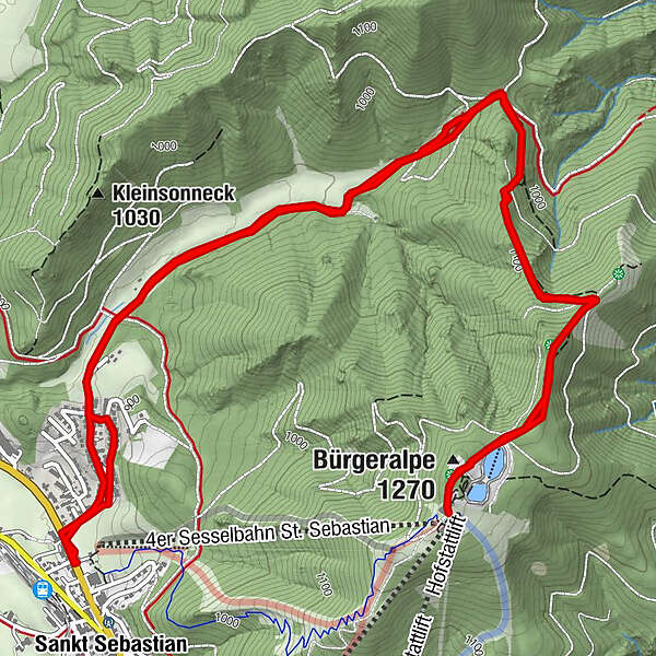
Hike to the Mariazell Bürgeralpe - this time we start in St. Sebastian and hike via the Habertheuersattel to the Bürgeralpe.
- Difficulty
-
medium
- Rating
-
- Starting point
-
Spar-Supermarket in St. Sebastian
- Route
-
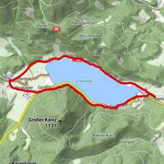
Sankt SebastianBartelbauer0.1 kmBartelbauer-Kapelle0.1 kmHabertheurersattel (1,015 m)2.9 kmErlaufseeblick4.3 kmEdelweißhütte4.9 kmBürgeralpe (1,270 m)5.1 kmBerggasthof5.2 kmHabertheurersattel (1,015 m)7.4 kmBartelbauer10.4 kmBartelbauer-Kapelle10.4 kmSankt Sebastian10.5 km
- Best season
-
JanFebMarAprMayJunJulAugSepOctNovDec
- Description
-
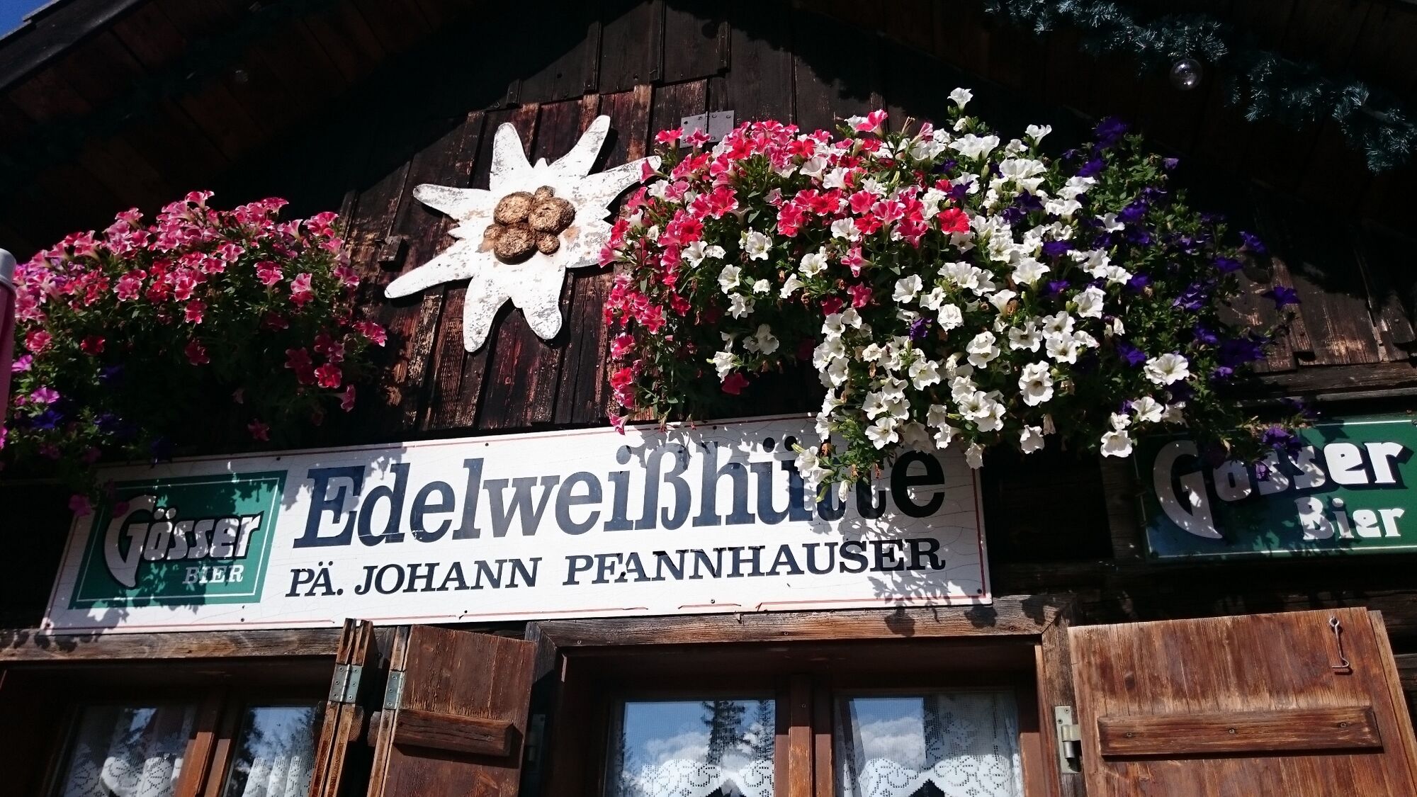
We start in St. Sebastian and hike through the Habertheuer past the settlement to the Mitterbach/Mariazell turnoff. Here straight on in the direction of Habertheuersattel, there keep right and follow the signpost. Along the Drei-Seenblick hiking trail we reach the Kristallsee and the Edelweißhütte and a little further on the mountain inn.
In winter, this hike is recommended as a snowshoe hike!
Return on the same path or along the FIS bypass to St. Sebastian.
- Directions
-
From the parking lot of the chairlift in St. Sebastian (you can also park at the parking lot of the supermarket), turn right after the Dietl inn into Habertheuerstraße. Follow this road until you reach the Mitterbach/Mariazell turn-off and follow the signpost 692 along a forest road until you reach the Habertheuer saddle (1015m). Here, turn right onto trail 694 and walk a short distance along the Drei-Seen-Blick trail to the Edelweißhütte and then to the mountain inn.
We reach the valley either by foot (on trail 694 directly to Mariazell) or we keep to the right after the mountain inn and hike along the forest road (in winter bypass FIS 1, in summer mountain bike trail to the Bürgeralpe) down to the valley again to St. Sebastian. Or we take the cable car to Mariazell and then hike along the Rosary Trail out to St. Sebastian.
- Highest point
- 1,261 m
- Endpoint
-
Berggasthof Bürgeralpe
- Height profile
-

- Equipment
-
Proper backpacking makes many things easier: pack heavy things first. The water bottle should always be within easy reach in a side pocket. All things that are often needed, such as sunglasses, camera or hiking map, belong on top. An emergency kit including blister plaster belongs in every backpack and a clothing according to the "onion system" is always recommended!
- Safety instructions
-
Emergency call mountain rescue: 140Emergency reporting tip - provide answers to the six W questions: What happened? How many injured? Where did the accident happen (possibly GPS coordinates)? Who is reporting (callback number)? When did the accident happen? Weather at the accident site?
- Tips
-
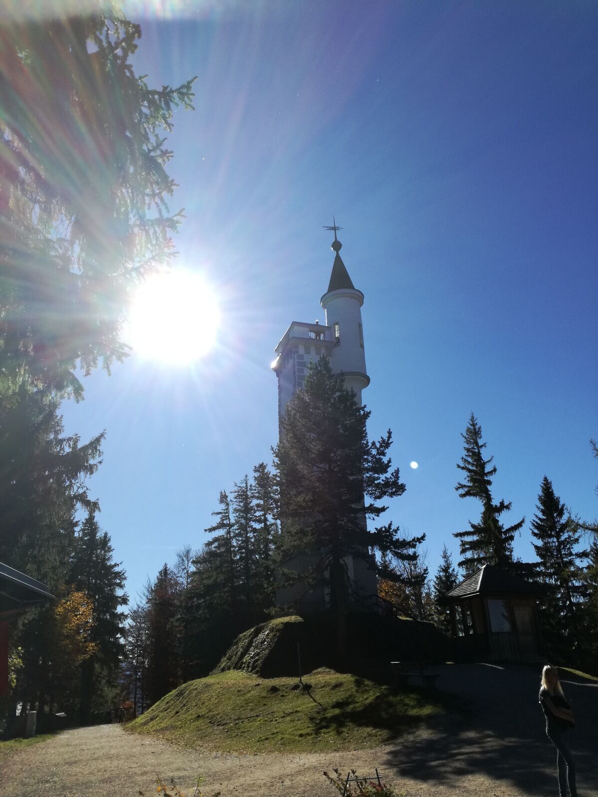
Erzherzog Johann Warte - the ascent with the many steps is rewarded with a wonderful panoramic view of the surrounding mountains!
- Additional information
- Directions
-
via the Westautobahn (A1 from Salzburg or Vienna) to the exit Ybbs or St. Pölten/Süd, then B 20 to Mariazeller Land
from the south to Bruck/Mur - Kapfenberg, then B 20 over the Seebergpass into Mariazeller Land
- Public transportation
- Parking


- Author
-
The tour From St. Sebastian over the Habertheuersattel to the Bürgeralpe is used by outdooractive.com provided.


General info
-
Mostviertel
2453
-
Mariazellerland
1503
-
Mariazeller Bürgeralpe
380