
- Brief description
- Difficulty
-
medium
- Rating
-
- Starting point
-
main square
- Route
-
Kammern im Liesingtal0.0 kmLeims4.1 kmPfarrkirche hl. Johannes der Täufer13.9 kmRestaurant Purgar14.1 kmGasthof Judmayer14.1 kmKammern im Liesingtal14.3 km
- Best season
-
JanFebMarAprMayJunJulAugSepOctNovDec
- Description
-
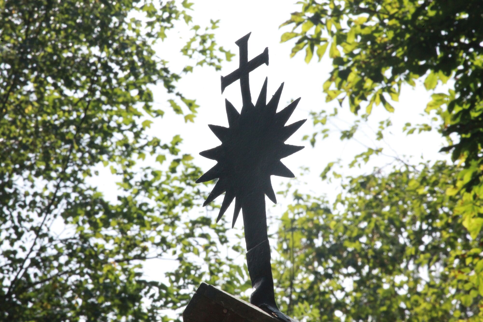
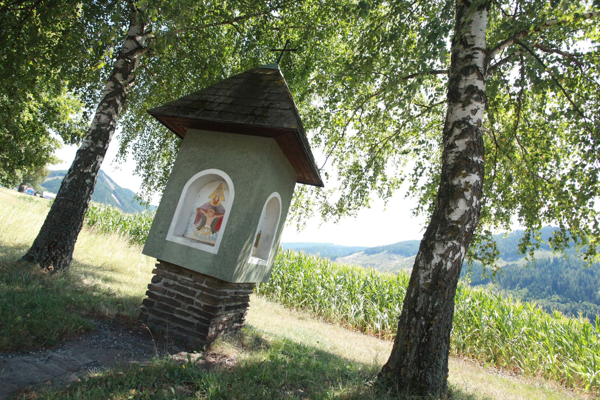
The Marterlweg in the municipality of Kammern im Liesingtal, Styria, is extremely interesting from both a scenic and a cultural point of view.
Each wayside shrine tells its own story and is usually located along the path or on private property. The wayside shrines are lovingly tended by their owners throughout the year.
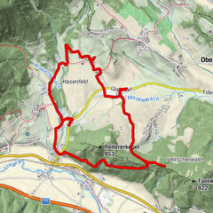
Tour 1 (green) is probably the most demanding and leads through the centre of Kammern im Liesingtal via the Fadelgraben, the Leims and back via Kammern - Unterdorf back to the village.
A detailed description of the wayside shrines/crosses can be found in the Marterlweg map, which is also available online or can be taken free of charge at the market square.
Description of the wayside shrines and wayside shrines
- Directions
-
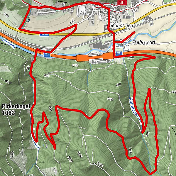
From the market square, the path leads along the Karl-im-Hofweg. The signposting is clearly recognisable along the entire Marterlweg trail. Past the first wayside shrines, the path leads through the forest and at the first bend back down into the valley towards the main road. There you will find the St. John's Cross. Here we cross the main road along the stream across the meadow to the R15 cycle path and then turn right. Continuing across the Fadelgraben, the trail extends along the forest road up to the Marienkapelle (5) and down again into the beachbarten Graben into the Leims. Following the signposts, the trail then leads up to Franz Marchler's memorial. The path then winds slowly downhill again in serpentine form towards Kammern - Unterdorf. From here it goes under the motorway again and before the railway station another 300m to the right to the most famous of them all, the Gstottmoar Chapel, which is also included during the church processions.
Back towards the station, the path then leads through the subway and we stop at the Kammern parish church, whose historical roots go back to 1196. From there we walk up Kirchgasse, past the large, distinctive wooden crosses that are part of the Stations of the Cross, to the market square.
- Highest point
- 1,036 m
- Endpoint
-
main square
- Height profile
-

- Equipment
-
Proper backpacking makes many things easier: Pack heavy things first. The water bottle should always be within easy reach in a side pocket. All things that are often needed, such as sunglasses, camera or hiking map, belong on top. An emergency kit including blister plasters belongs in every rucksack and it is always advisable to put on different layers of clothing.
- Safety instructions
-
Planning your desired tour properly in advance is a must.
Emergency call rescue: 144
Emergency reporting tip - give answers to six important questions: What happened? How many injured? Where did the accident happen (possibly GPS coordinates)? Who reported the accident (call-back number)? When did the accident happen? Weather at the accident site?
- Tips
-
Travelling to Kammern by train or by bike (Rastlandradweg R15) is the environmentally friendly and stress-free alternative to travelling by car.
- Additional information
- Directions
- Public transportation
-
With the BusBahnBim app of the Verbundlinie, timetable information has never been easier: all bus, train and tram connections in Austria can be queried by entering locations and/or addresses, stops or important points. The app is available as a free app for smartphones (Android, iOS) - on Google Play and in the App Store.
- Parking


- Author
-
The tour Marterlweg Route 1 (green) is used by outdooractive.com provided.


General info
-
Erzberg Leoben
2522
-
Kammern im Liesingtal
221