- Brief description
-
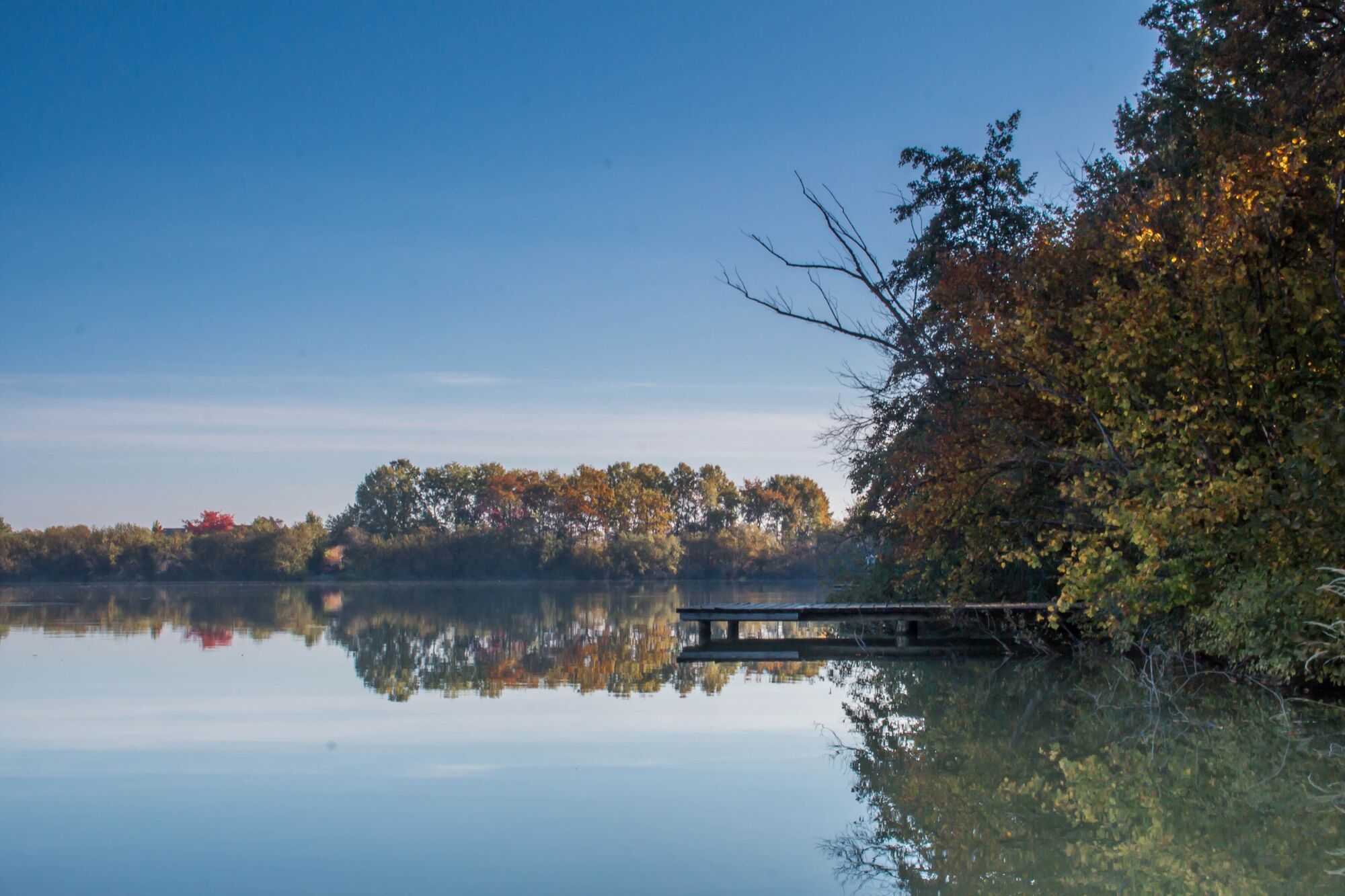
A hike that has a lot to offer. You will pass a pond, a lookout, a chapel and many small villages.
- Difficulty
-
medium
- Rating
-
- Starting point
-
In the center of Auffen
- Route
-
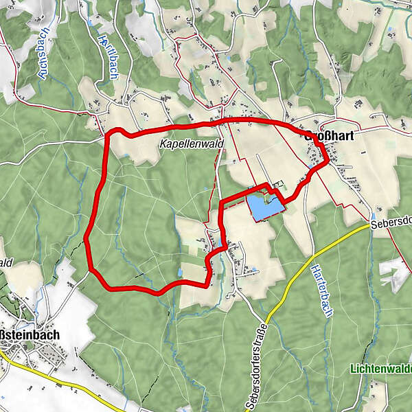
Lindenhof Straußenwirt0.0 kmAuffen0.1 kmKapelle Auffen0.1 kmBackhendlstation Gasthof Schneider0.1 kmNeusiedl5.4 kmHolzboot5.4 kmTeichschenke7.0 kmGroßhart8.0 kmAuffen9.1 kmLindenhof Straußenwirt9.4 km
- Best season
-
JanFebMarAprMayJunJulAugSepOctNovDec
- Description
-
The starting point of the hiking tour is the center of Auffen. The 9.5 km long circular route has a lot to offer. Not only culinary, but also in terms of experience, there is a lot on offer.
- Directions
-
Start the tour in the center of Auffen. Walk in the direction of Großsteinbach along the Hofwaldstraße. At the crossroads you have to keep left. Continue in the direction of Neusiedl. At the wayside shrine turn left to the center of the small village and then left again into the forest. Keep the direction until you come to the crossroads and keep right towards Großharter Teich. From here the path continues to the center of Großhart and finally you come back to the starting point in Auffen.
1.start center of Auffen
2.direction Großsteinbach
3.along the Hofwaldstraße
4.turn left at the crossing
5.continue in the direction of Neusiedl
6.at the wayside shrine left to the village center, then left again into the forest
7.continue to the crossroads, then turn right towards the pond
8.continue to the center of Großhart
9.and back to the starting point in the center of Auffen - Highest point
- 448 m
- Endpoint
-
In the center of Auffen
- Height profile
-

- Equipment
-
Proper backpack packing makes many things easier: Pack heavy things first. The water bottle should always be within reach in a side pocket. All the things that are often needed, such as sunglasses, camera or hiking map, belong on top. An emergency kit, including blister plasters, belongs in every rucksack and it is always advisable to dress in layers.
- Safety instructions
-
Emergency call mountain rescue: 140
ambulance: 144
European emergency call: 112
firefighters: 122
police: 133Tips when reporting an emergency – Answer these six WH questions: What happened? How many people are injured? Where did the accident happen (are there GPS coordinates)? Who is reporting the incident (callback number)? When did the accident happen? What is the weather like at the site of the incident?
- Tips
-
Urlaub so ganz wie ich will in 4 Regionen der Steiermark. 365 Tage Urlaubsfreude mit der GenussCard.
- Additional information
-
Die Steiermark Touren App , die gratis auf Google Play und im App Store zur Verfügung steht (Android, iOS), bietet detaillierte Informationen aus erster Hand: Shortfacts (Länge, Dauer, Schwierigkeit, Aufstieg und Abstieg in Höhenmetern, Bewertungen), Karte, Wegbeschreibungen, Höhenmesser, Kompass, Gipfelfinder, Navigation entlang der Tour.
Tourist office Thermen- & Vulkanland
Gästeinfo Bad Waltersdorf
Hauptplatz 90
8271 Bad Waltersdorf
Tel: +43 3382 55 100-71
badwaltersdorf@thermen-vulkanland.at
www.thermen-vulkanland.at - Directions
-
From direction Vienna:
A2 freeway in the direction of Graz - you take the Sebersdorf/ Bad Waltersdorf exit, then in the direction of Auffen.From direction Graz:
Freeway A2 direction Vienna - you take the exit Sebersdorf/ Bad Waltersdorf, then direction Auffen. - Public transportation
-
Detailed information about arriving by ÖBB (Austrian Federal Railways) can be found at www.oebb.at or on the Verbundlinie Steiermark website www.busbahnbim.at
With Verbundlinie’s BusBahnBim route planner app, planning your journey has never been easier: simply enter towns and/or addresses, stop names or points of interest to check all bus, train and tram connections in Austria. The app is available free of charge for smartphones – on Google Play and in the App Store
- Parking


-

-
AuthorThe tour Hofwald trail (Hofwald-Weg) is used by outdooractive.com provided.


General info
-
Thermen- & Vulkanland
1323
-
Bad Waltersdorf
624
-
Hartl
182