- Brief description
-
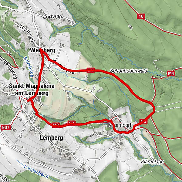
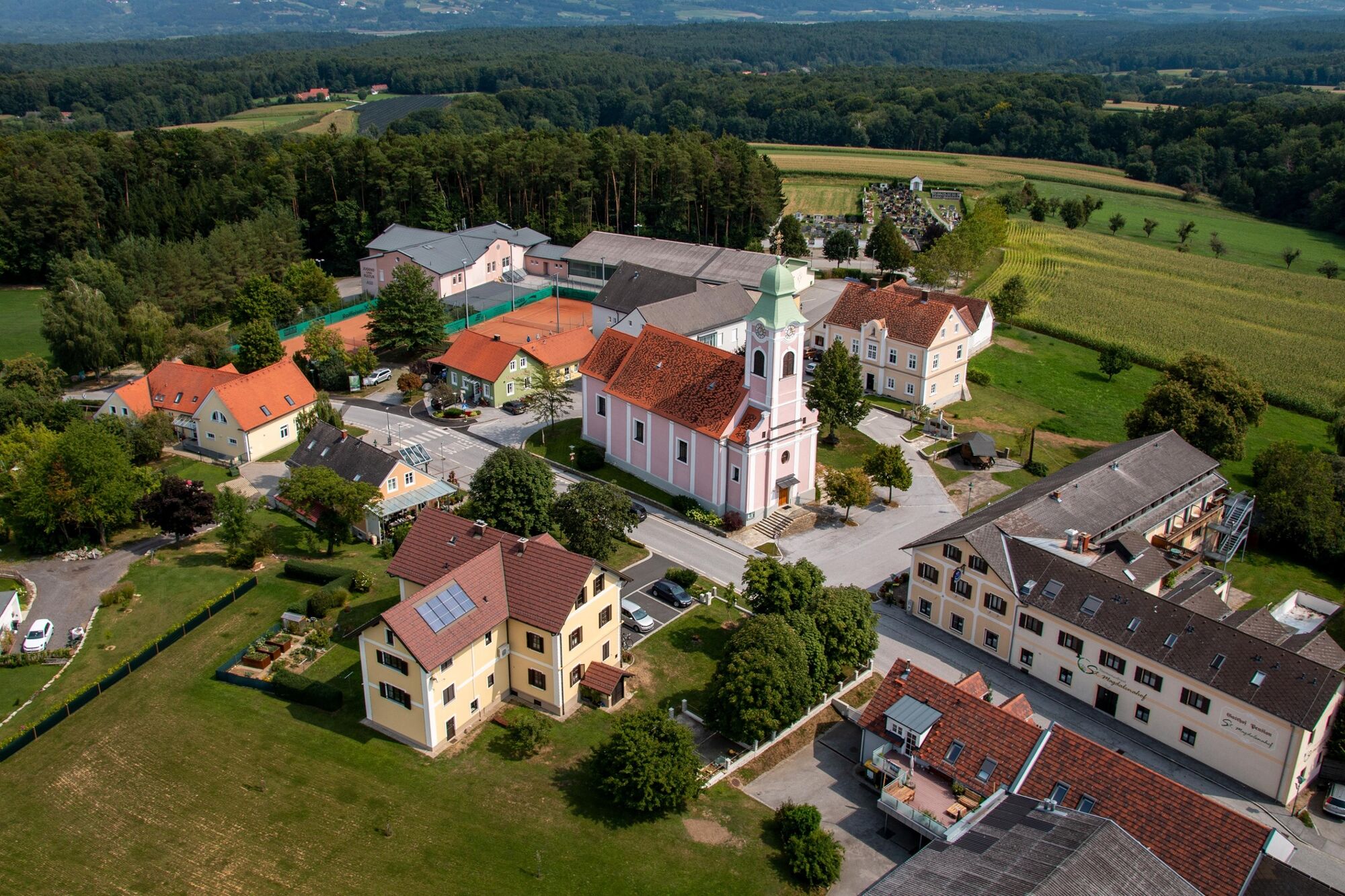
Short circular trail leading from the center of St. Magdalena through forests and small villages.
- Difficulty
-
easy
- Rating
-
- Starting point
-
In the center of St. Magdalena
- Route
-
Kirche St. Magdalena am Lemberg0.1 kmSankt Magdalena am Lemberg0.1 kmWeinberg0.8 kmMitterndorf3.4 kmLemberg4.4 kmKirche St. Magdalena am Lemberg5.0 kmSankt Magdalena am Lemberg5.0 km
- Best season
-
JanFebMarAprMayJunJulAugSepOctNovDec
- Description
-
The starting point of the hiking tour is the center of St. Magdalena. During the 5 km long hike you will pass through villages that are located in the vicinity of the village. During the tour you can enjoy the fresh forest air and get enough oxygen.
- Directions
-
The start of the hike is in the center of St. Magdalena. From here you walk along the main road in the direction of Weinberg. In Weinberg turn right and walk through the Schönboden forest to Mitterndorf. From here the Gassl circular hiking trail joins the M4. Finally, walk a short distance along an asphalt road, then continue to the right and back to St. Magdalena to the starting point.
1.start: St. Magdalena village center
2.along the provincial road in the direction of Weinberg
3.in Weinberg turn right, through the Schönboden forest to Mitterndorf
4.M3 joins M4
5.short stretch on asphalt road, then continue right, back to St. Magdalena to the starting point - Highest point
- 450 m
- Endpoint
-
In the center of St. Magdalena
- Height profile
-

- Equipment
-
Proper backpack packing makes many things easier: Pack heavy things first. The water bottle should always be within reach in a side pocket. All the things that are often needed, such as sunglasses, camera or hiking map, belong on top. An emergency kit, including blister plasters, belongs in every rucksack and it is always advisable to dress in layers.
- Safety instructions
-
Emergency call mountain rescue: 140
ambulance: 144
European emergency call: 112
firefighters: 122
police: 133Tips when reporting an emergency – Answer these six WH questions: What happened? How many people are injured? Where did the accident happen (are there GPS coordinates)? Who is reporting the incident (callback number)? When did the accident happen? What is the weather like at the site of the incident?
- Tips
-
-GenussCard
-Visit to the local museum - Additional information
-
Tourist office Thermen- & Vulkanland
Gästeinfo Bad Waltersdorf
Hauptplatz 90
8271 Bad Waltersdorf
Tel: +43 3382 55 100-71
badwaltersdorf@thermen-vulkanland.at
www.thermen-vulkanland.atThe Styria Tours App, available for free on Google Play and in the App Store (Android, iOS), offers detailed first-hand information: short facts (length, duration, difficulty, ascent and descent in altitude meters, ratings), map, route descriptions, altimeter, compass, summit finder, navigation along the tour.
- Directions
-
From direction Vienna:
A2 freeway in the direction of Graz - you take the Sebersdorf/ Bad Waltersdorf exit, then in the direction of St. Magdalena.From direction Graz:
Freeway A2 direction Vienna - you take the exit Sebersdorf/ Bad Waltersdorf, then direction St. Magdalena. - Public transportation
-
Detailed information about arriving by ÖBB (Austrian Federal Railways) can be found at www.oebb.at or on the Verbundlinie Steiermark website www.busbahnbim.at
With Verbundlinie’s BusBahnBim route planner app, planning your journey has never been easier: simply enter towns and/or addresses, stop names or points of interest to check all bus, train and tram connections in Austria. The app is available free of charge for smartphones – on Google Play and in the App Store
- Parking


-

-
AuthorThe tour Alley circular trail (Gassl-Rundwanderweg) is used by outdooractive.com provided.


General info
-
Thermen- & Vulkanland
1324
-
Bad Waltersdorf
624
-
Buch-St. Magdalena
143