
- Brief description
-
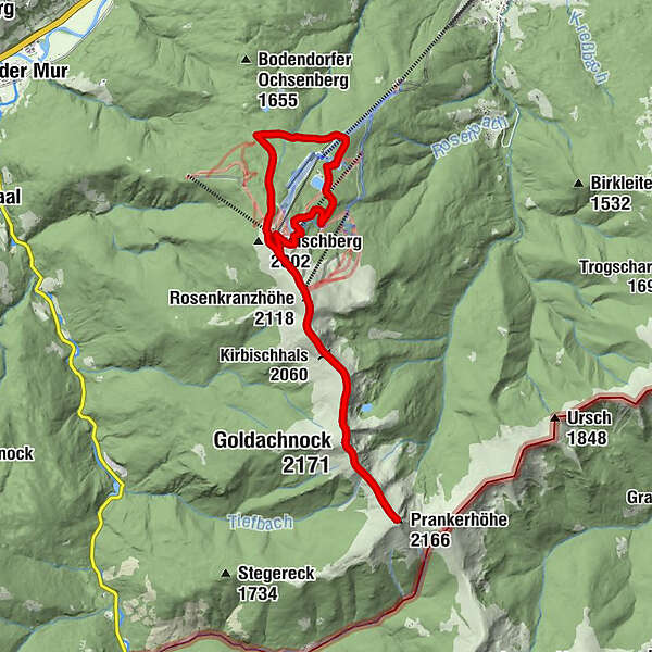
A refreshing hike in the Gurktaler Alpen, guaranteeing rest and relaxation, is to be found south of the Kreischberg ski resort.
- Difficulty
-
medium
- Rating
-
- Starting point
-
St. Lorenzen am Kreischberg
- Route
-
Rieglerhütte0.1 kmEsebeckhütte (1,747 m)1.7 kmRosenkranzhöhe (2,118 m)4.8 kmKirbisch (2,140 m)5.5 kmKirbischhals (2,060 m)5.7 kmGoldachnock (2,171 m)7.4 kmSchattloch (2,033 m)8.1 kmPrankerhöhe (2,166 m)8.9 kmGoldachnock (2,171 m)10.6 kmKirbischhals (2,060 m)12.1 kmKirbisch (2,140 m)12.4 kmRosenkranzhöhe (2,118 m)13.1 km
- Best season
-
JanFebMarAprMayJunJulAugSepOctNovDec
- Description
-
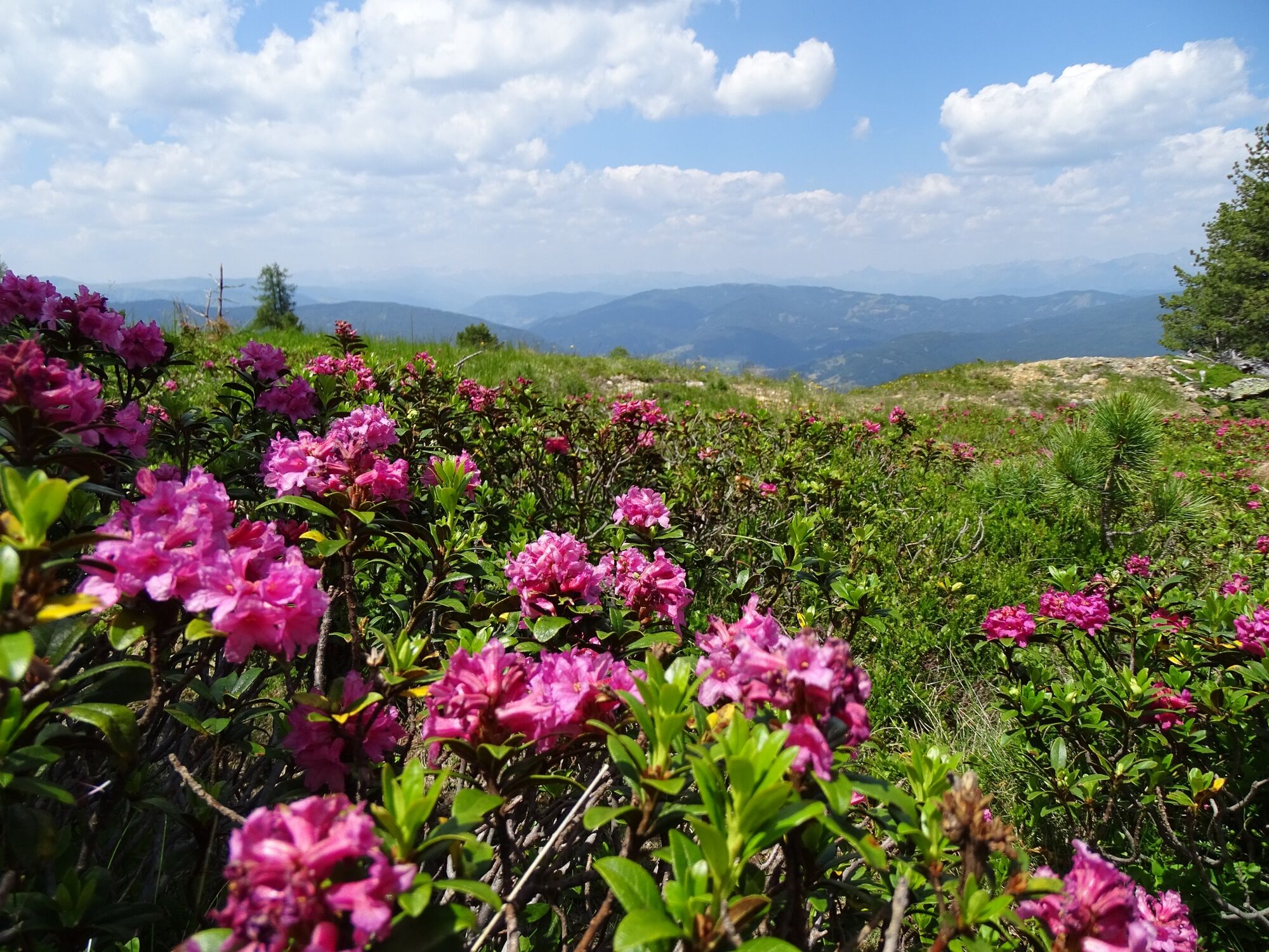
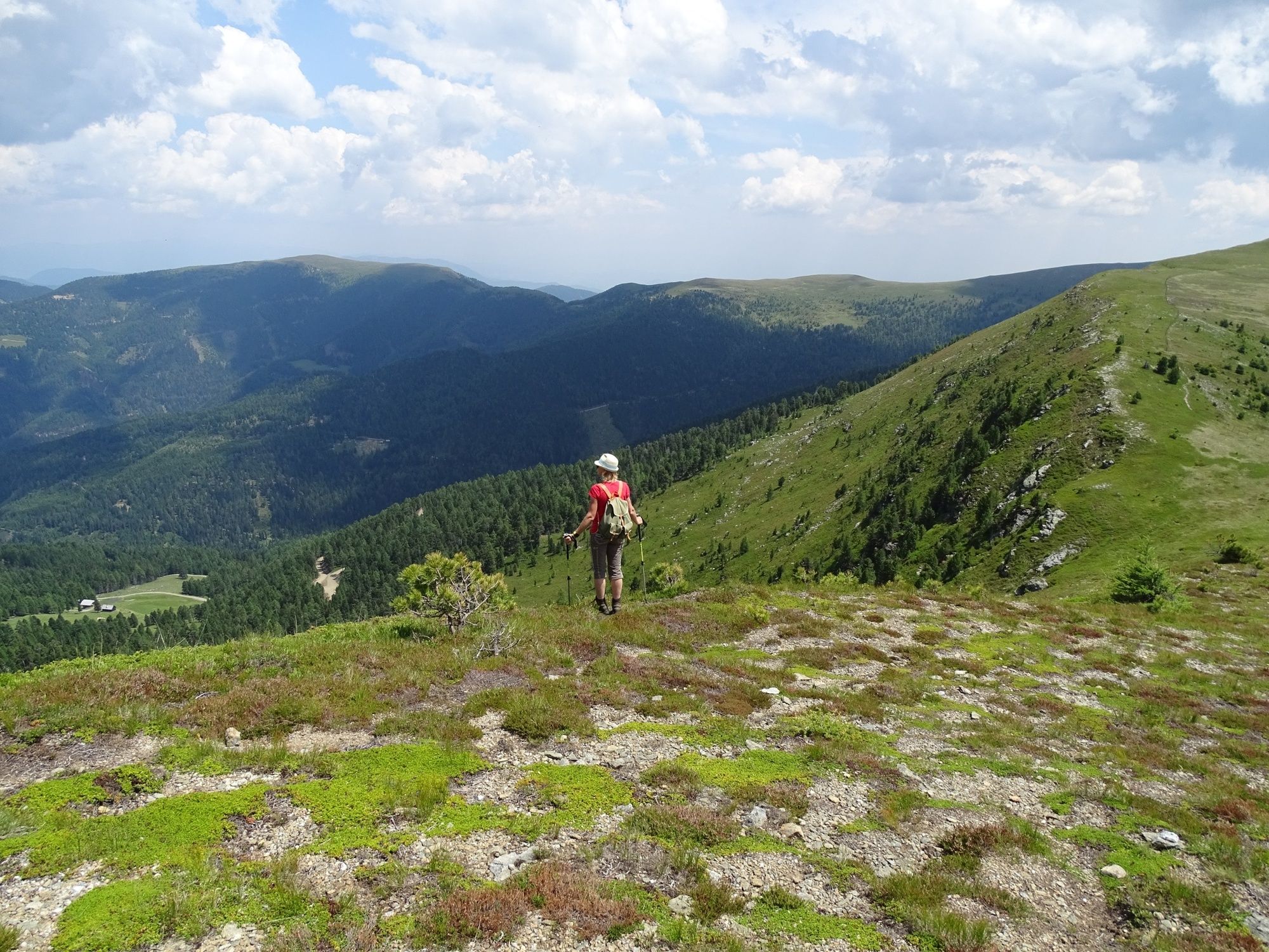
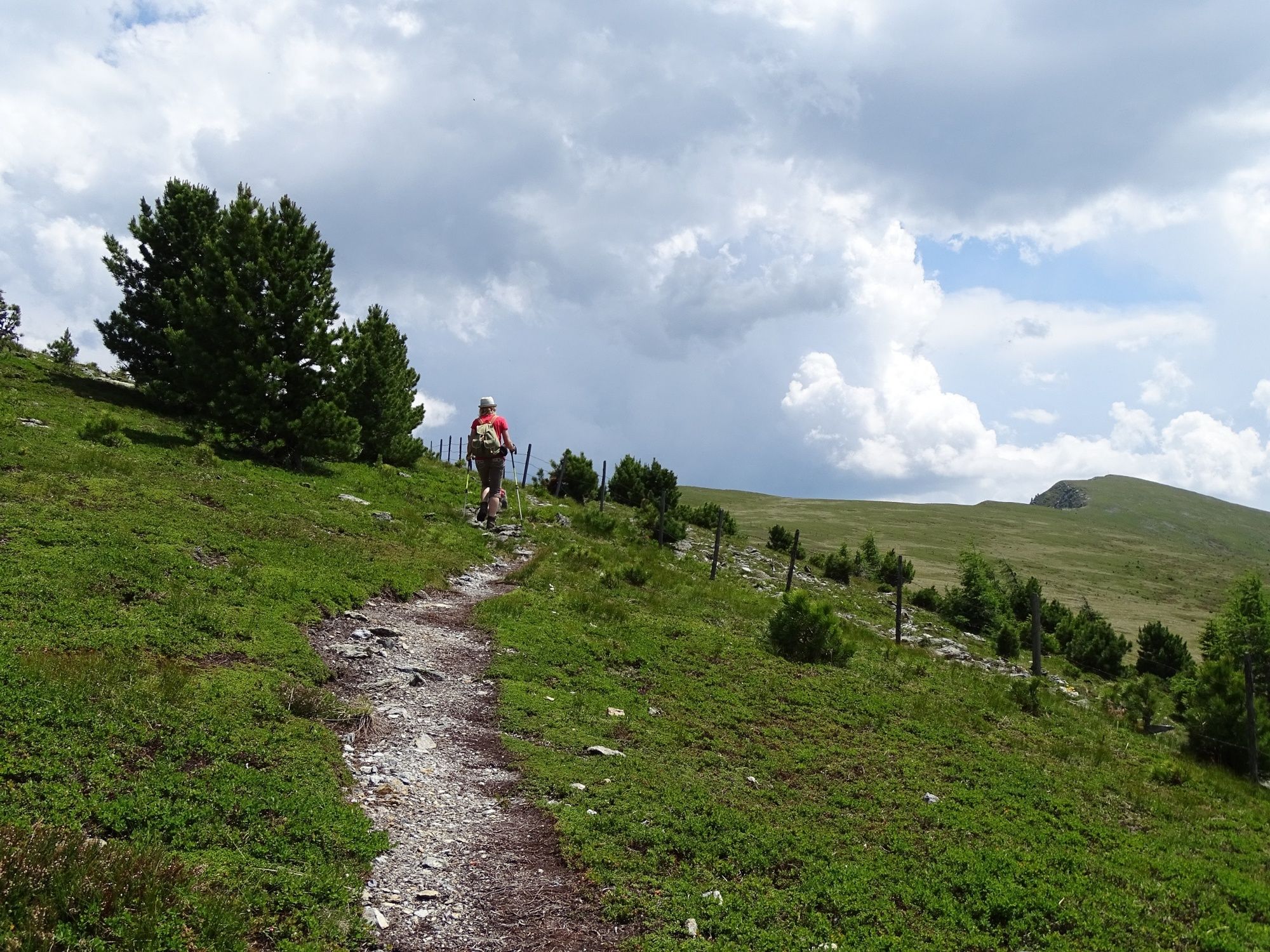
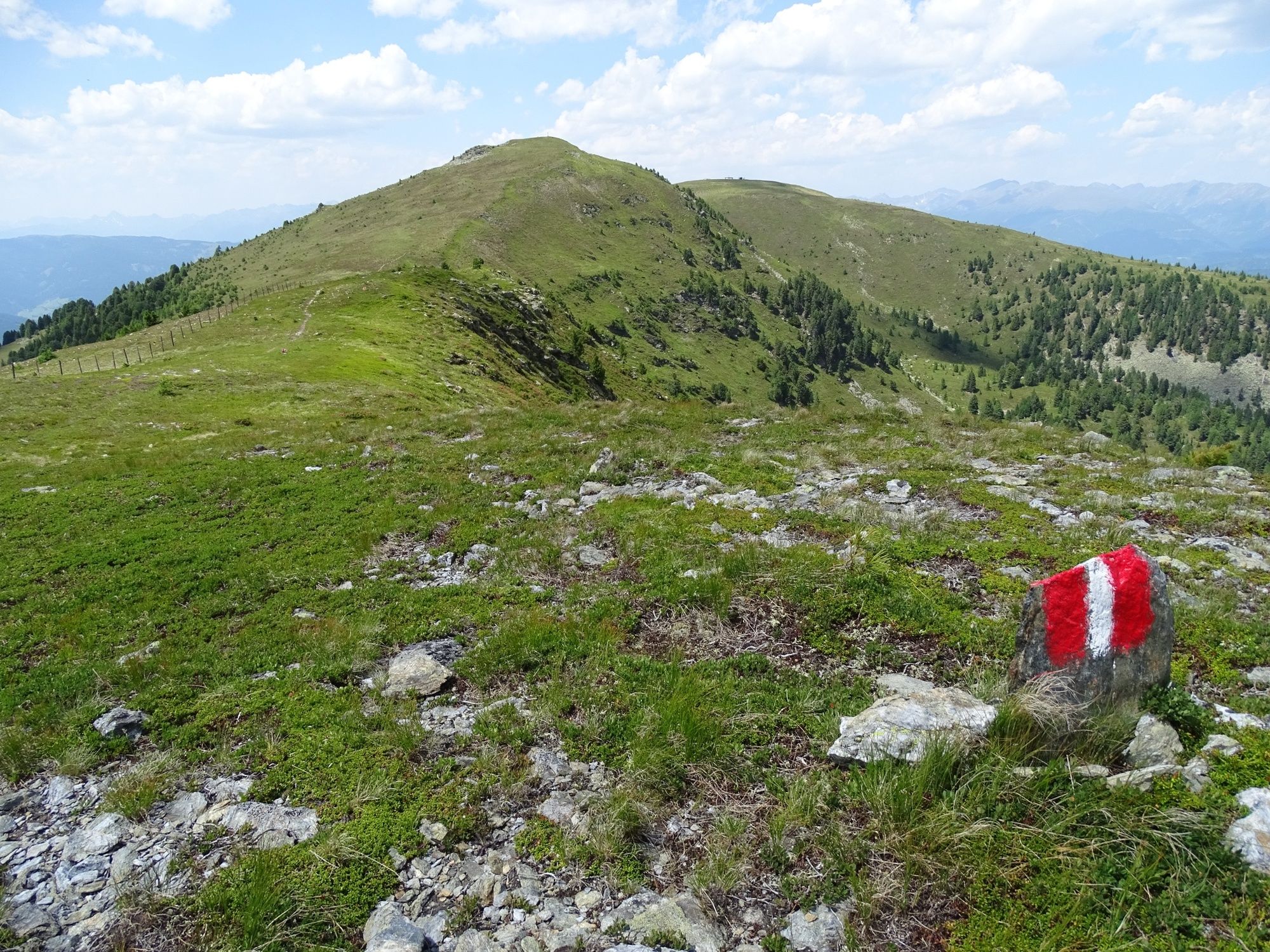
Leisure hikers will love the fact that many summits can be conquered in a route that features easy ascents and descents. A stunning ridge hike starting from the Kreischberg is particularly recommended during alpenrose season, when the blossoms are out. The route runs along the ridge, where we can enjoy not only the views but also blooming meadows of alpenrose (from about mid/end June). On this hike, you just want to keep going. Complete the first, steep part of the ascent in comfort on the Kreischberg gondola lift (please note the opening times), and start your hike at the tree line. Delight in the glorious local alpine flora, marvel at the breathtaking panoramic views of the Tauern and the Nockberge, and of course experience the relaxing atmosphere of the down-to-earth mountain huts and guest houses.
- Directions
-
Driving up to the Rieglerhütte via the Grabenstraße is only possible on days when the Rieglerhütte is open (June to October, Wednesday to Sunday). Otherwise, you can take the Kreischberg gondola lift up to the mountain station (every Sunday in June; Wednesday, Friday and Sunday in July and August). Set off below the meadow at the Rieglerhütte mountain hut. We follow the orange markers (Riegler Rundwanderweg ‒ Circular Hiking Trail), which can be found on the gently ascending logging road that winds through the forest. Cross the ski slope to get back onto a logging road. Trail 130 runs west to the Esebeckhütte, a self-catering mountain hut situated in a forest. Hiking trail 131 now runs very sedately through the Zirbenwald to the Schirmbar near the Kreischberg summit (1,981m). Continue uphill. On the return journey, an idyllic view of the Schladminger Tauern und Wölzer Tauern accompanies us. Shortly before the Schirmbar, we fork right through the underpass and follow the logging road and the orange markers back to where we started. An attractive ridge hike from the Kreischberg (1,981m) to the Prankerhöhe (2,166m).
- Highest point
- 2,164 m
- Endpoint
-
St. Lorenzen am Kreischberg
- Height profile
-

- Equipment
-
Sturdy footwear with high-grip soles, protection against the rain, the cold and the sun, enough drink, hiking maps, emergency equipment (dressings, blister pads, etc.)
Packing your rucksack properly makes things much easier: pack heavy items first. Your water bottle should always be stored within reach in a side pocket. Items used often, such as sun glasses, camera, maps, etc., go on top.
- Safety instructions
-
Plan your tours carefully & stay flexible.
Bring the right equipment.
Check current weather information.
Cancel your trip in the event of poor weather.
If there is an accident, remain calm. Emergency mountain rescue number: 140
Take your rubbish with you.
Act calmly when encountering animals on the mountain pastures (alps).
Always keep dogs on a lead. - Tips
-
Take a ride on the Kreischberg GondolaGondola operating times: www.kreischberg.at
Please note the opening times!
- Additional information
-
- Directions
-
From D, NL, B, F: Via Munich, Salzburg, Tauernautobahn to St. Michael/Lungau (or Radstätter Tauernpaß), turn off to Tamsweg - continue towards Murau.
From H: Via St. Gotthard, Graz – Packautobahn (Twimberg exit) – Judenburg – Scheifling – Murau – Kreischberg.
From CH: Via Arlberg, Innsbruck, Bischofshofen, Tauernautobahn.
From I: Via Tarvis, Villach, St. Veit/Glan, Scheifling, Murau, Kreischberg.
By car from Vienna: Via Semmering, Bruck/Mur, Judenburg, Scheifling, Murau, Kreischberg.
- Public transportation
-
With the BusBahnBim app from the interconnected line, timetable information is easier than ever before: all bus, train and tram connections in Austria can be queried by entering locations and/or addresses, stops or important points. The app is available as a free app for smartphones (Android, iOS) - on Google Play and in the App Store.
- Parking
-
There are enough parking spaces at the Kreischberg valley station.


- Author
-
The tour Prankerhöhe ridge hike is used by outdooractive.com provided.


General info
-
TourismusRegion Murau
1746
-
Nockberge
881
-
Murau - Kreischberg
118