- Brief description
-
This beautiful hike to Jungfernsprung and past the ruins of Gösting Castle to the popular Thalersee lake offers many highlights for the whole family!
- Difficulty
-
medium
- Rating
-
- Starting point
-
Graz Gösting final stop bus line 40
- Route
-
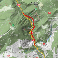
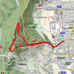
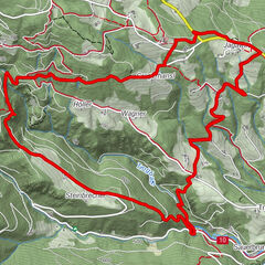
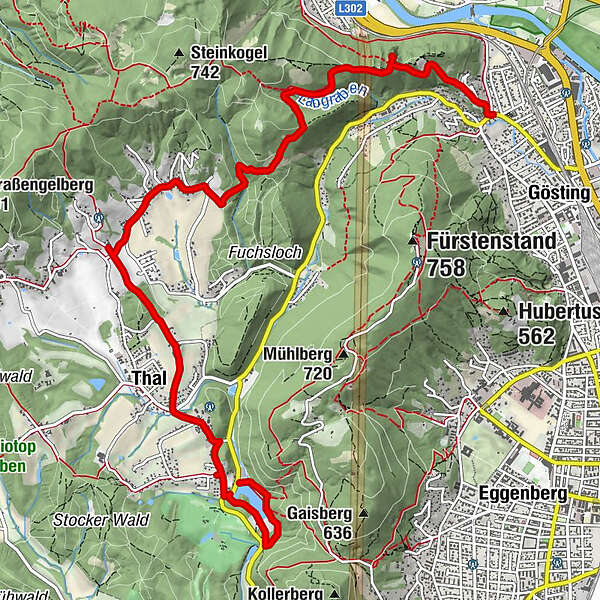
LöseranlageJungfernsprung1.2 kmGöstinger Ruinenberg (574 m)1.5 kmSt.Annen Bründl2.4 kmOberbichl4.4 kmWinkel4.9 kmKreuzwirt5.5 kmKötschberg5.6 kmUnterbichl6.6 kmThal7.0 kmKirchberg7.4 kmWaldcafe Thalersee9.7 km
- Best season
-
JanFebMarAprMayJunJulAugSepOctNovDec
- Description
-
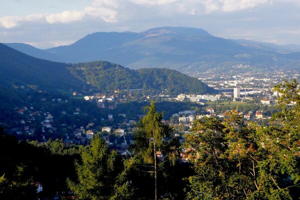
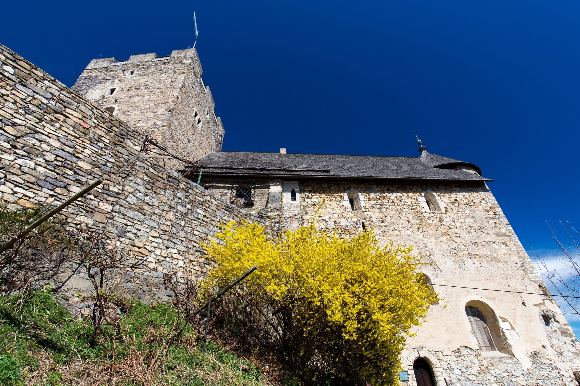
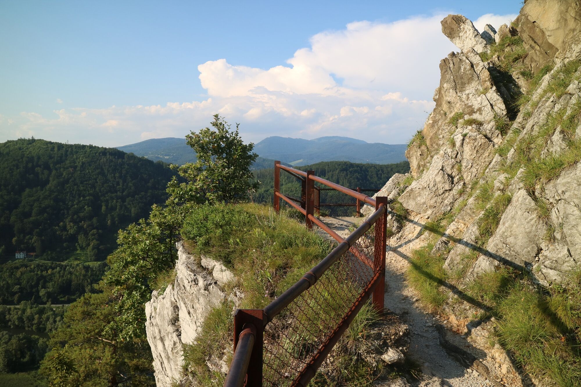
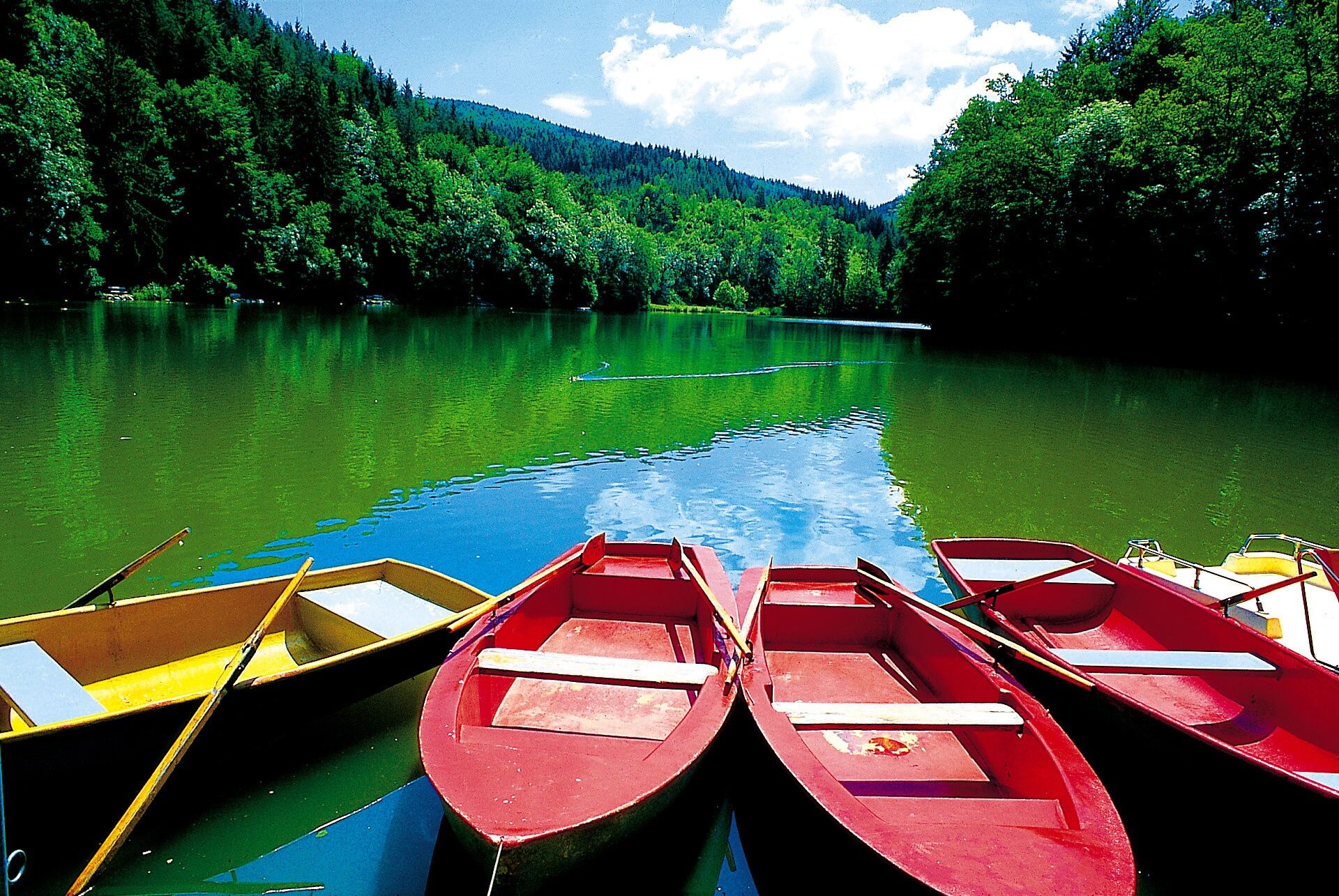
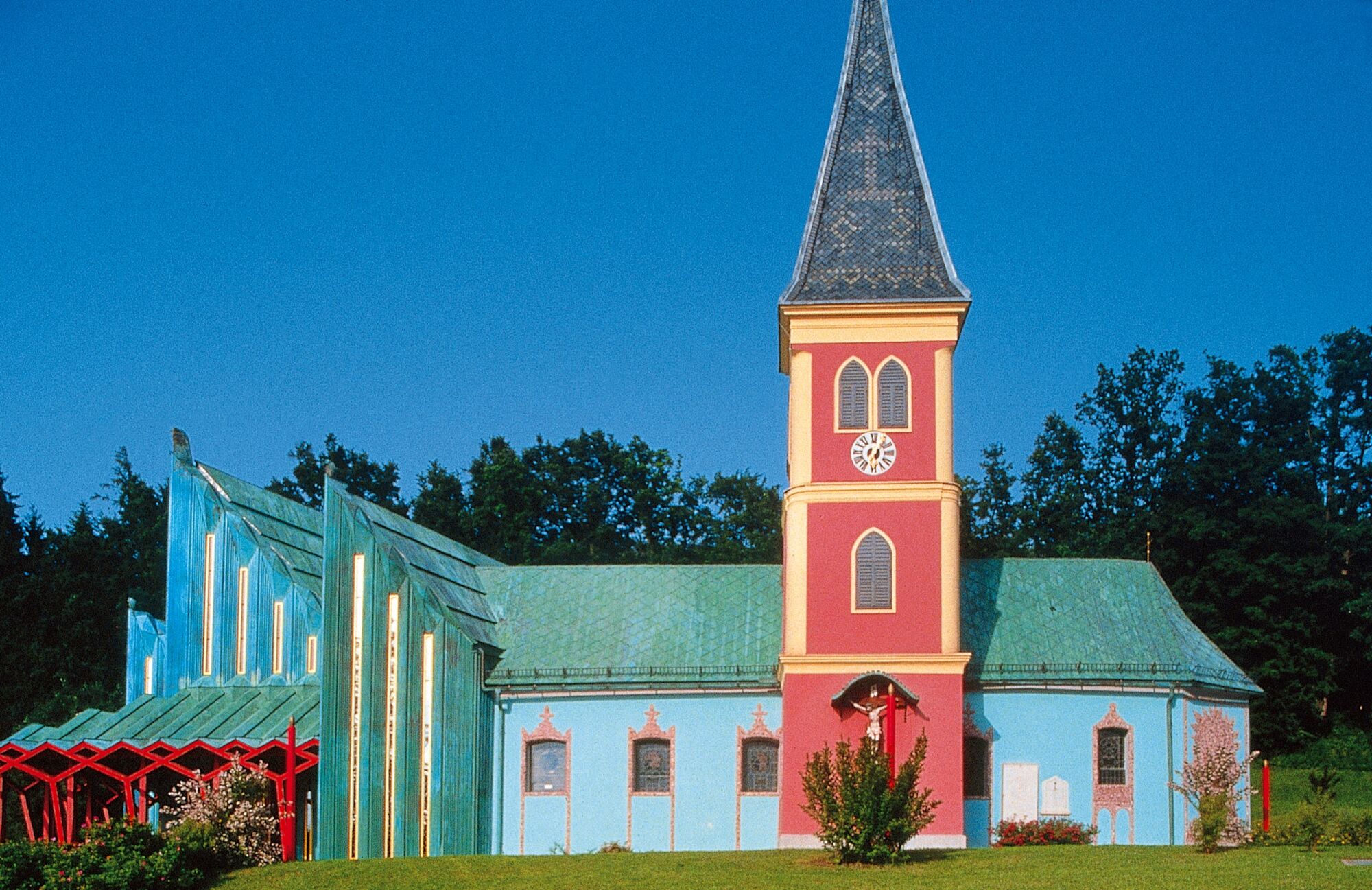
The legendary Jungfernsprung on a dolomite rock offers spectacular views of the Graz mountains and the important Gösting castle ruins should soon be open to hikers again. A historic fountain, a forest stream and the Thalersee lake offer the opportunity to cool off and the Kreuzwirt is an excellent restaurant for excursions. The Jakobuskirche church in Thal, also known as the Ernst-Fuchs-Kirche, is definitely worth a visit inside, and for all Arnold Schwarzenegger fans, a visit to the home and museum of Thal's most famous son is an absolute must.The end of this varied hike is Lake Thal with boat hire and a newly built restaurant and terrace right on the lake.
- Directions
-
Graz Gösting (path 563) - Jungfernsprung - Gösting ruins - St. Annen Bründl (path 31) - Thal Oberbichl - Kreuzwirt (path 30) - Ernst Fuchs Church - Arnold Schwarzenegger Museum - Thalersee
At the Graz Gösting bus terminus, the signposted path (563) initially leads quite steeply uphill, after a short time you enter the forest and can already see vineyards in the urban area. Don't miss the short climb to Jungfernsprung on the right before you reach the ruins of Gösting Castle. The views are quite spectacular. You then pass the castle ruins, which are currently being renovated for visitors and will soon be open to the public again.
From here there are many beautiful hiking options, but we stay on the wide forest path towards Thal/Kreuzwirt (563) as far as St. Annen Bründl and then continue along path (31). We then turn right off the gravel path onto a forest path (there is no sign here, follow the markings) and stay on hiking trail 31, descending to a stream and then turning right towards Thal Oberbichl. After crossing the farm, we follow the small road to the Kreuzwirt.After a refreshment stop, we follow trail no. 30 straight on across meadows and woods through Thal until we cross the main road past the horse stud farm to the clearly visible Ernst Fuchs church.
Passing the parish and elementary school, we head back up the other side to Burgrunie Thal and the Arnold Schwarzenegger Museum.
Then down to Lake Thalersee via the road and once around the small lake to the restaurant and the bus stop. Bus no. 48 takes us back to Graz Gösting.
- Highest point
- 587 m
- Endpoint
-
Graz Gösting final stop bus line 48
- Height profile
-

- Equipment
-
Sturdy and good shoes are recommended for the tour. Don't forget a water bottle, rain protection, money for the bus, entrance fees and refreshments.
- Safety instructions
-
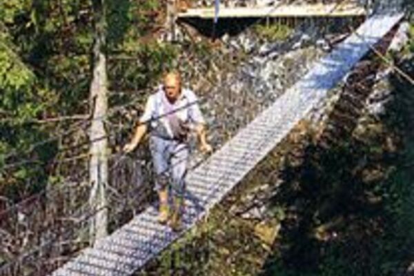
The Jungfernsprung is safe and well secured.
- Tips
-
View from the Jungfernsprung, visit the Ernst Fuchs church in Thal from the inside, photo with Arnie statue, a rowing trip on Lake Thaler!

-

-
AuthorThe tour From the Gösting castle ruins to Lake Thalersee is used by outdooractive.com provided.


General info
-
Erlebnisregion Graz
2773
-
Graz und Region Graz
1525
-
Thal
689