Tieflimauer, durch den Mühlgraben und über den Teufelsteig zurück über die Ennstaler Hütte


- Brief description
-
In addition to a varied route, good views and a refuge, this lonely circular tour also offers some altitude loss and a via ferrata (B/C), which is why especially sporty, ambitious nature lovers will get their money's worth.
- Difficulty
-
difficult
- Rating
-
- Starting point
-
Parkplatz Ennstaler Hütte Mühlbach
- Route
-
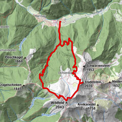
Tieflimauer (1,820 m)6.7 kmEnnstaler Hütte9.4 km
- Best season
-
JanFebMarAprMayJunJulAugSepOctNovDec
- Description
-
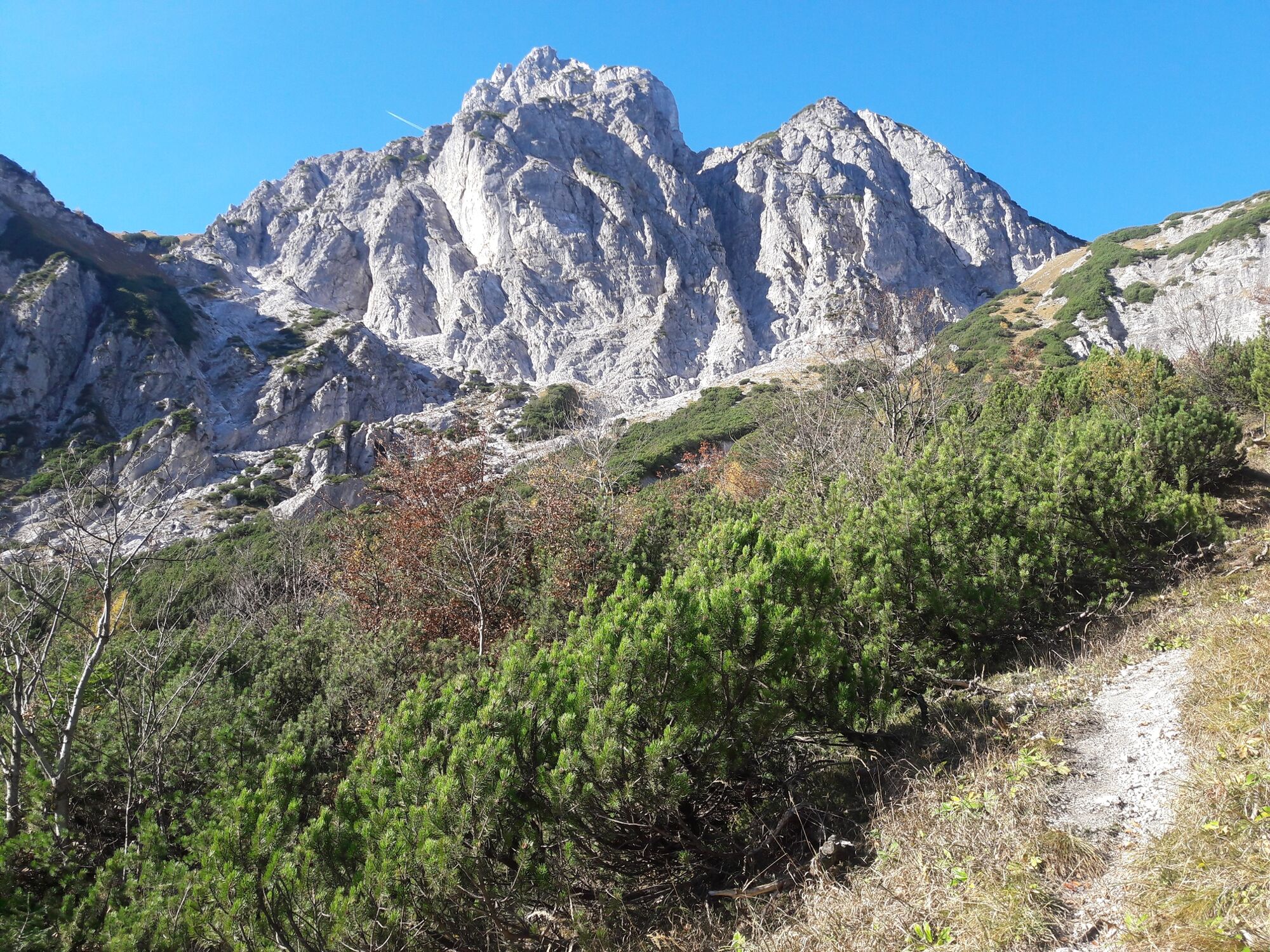
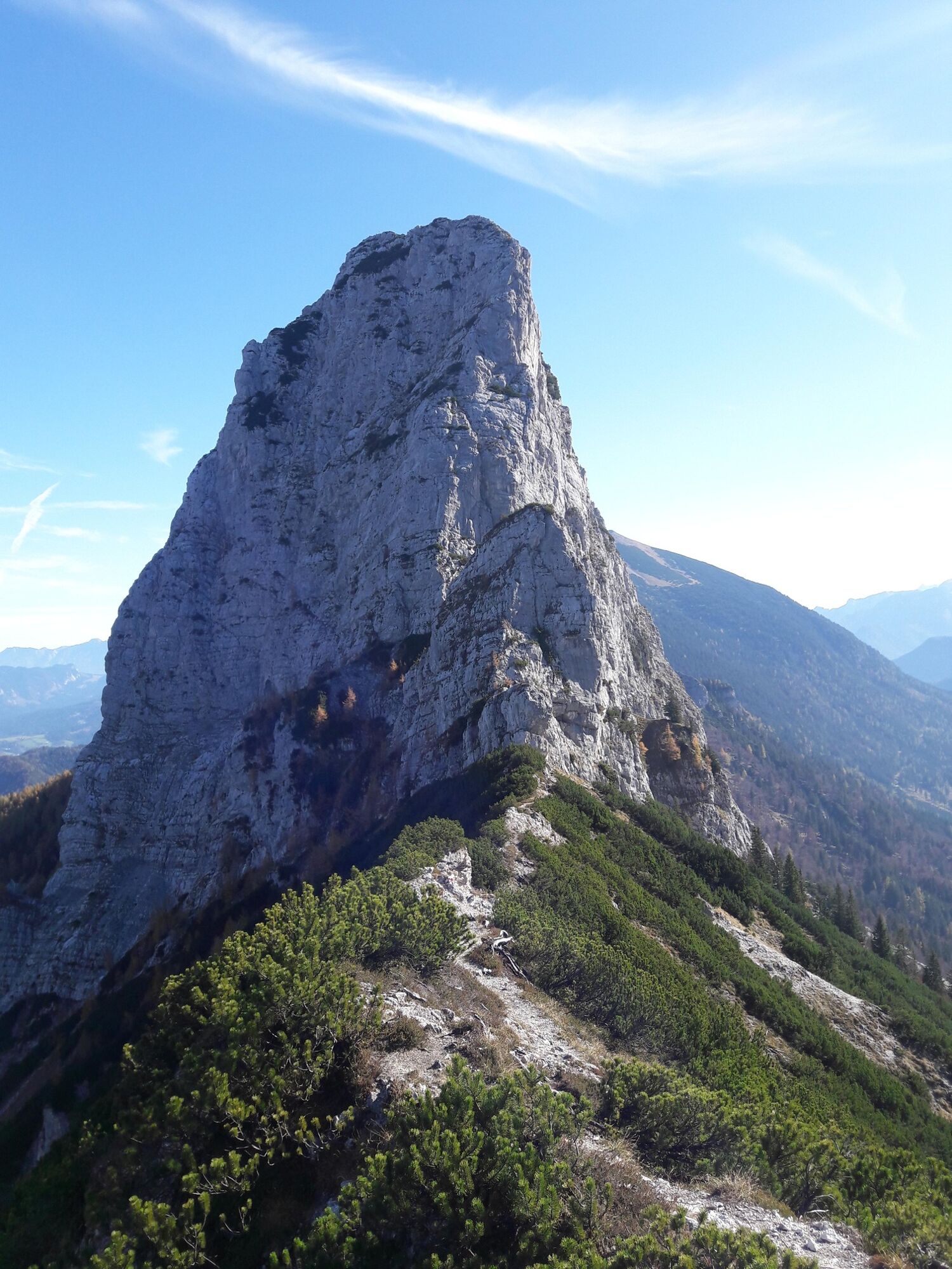
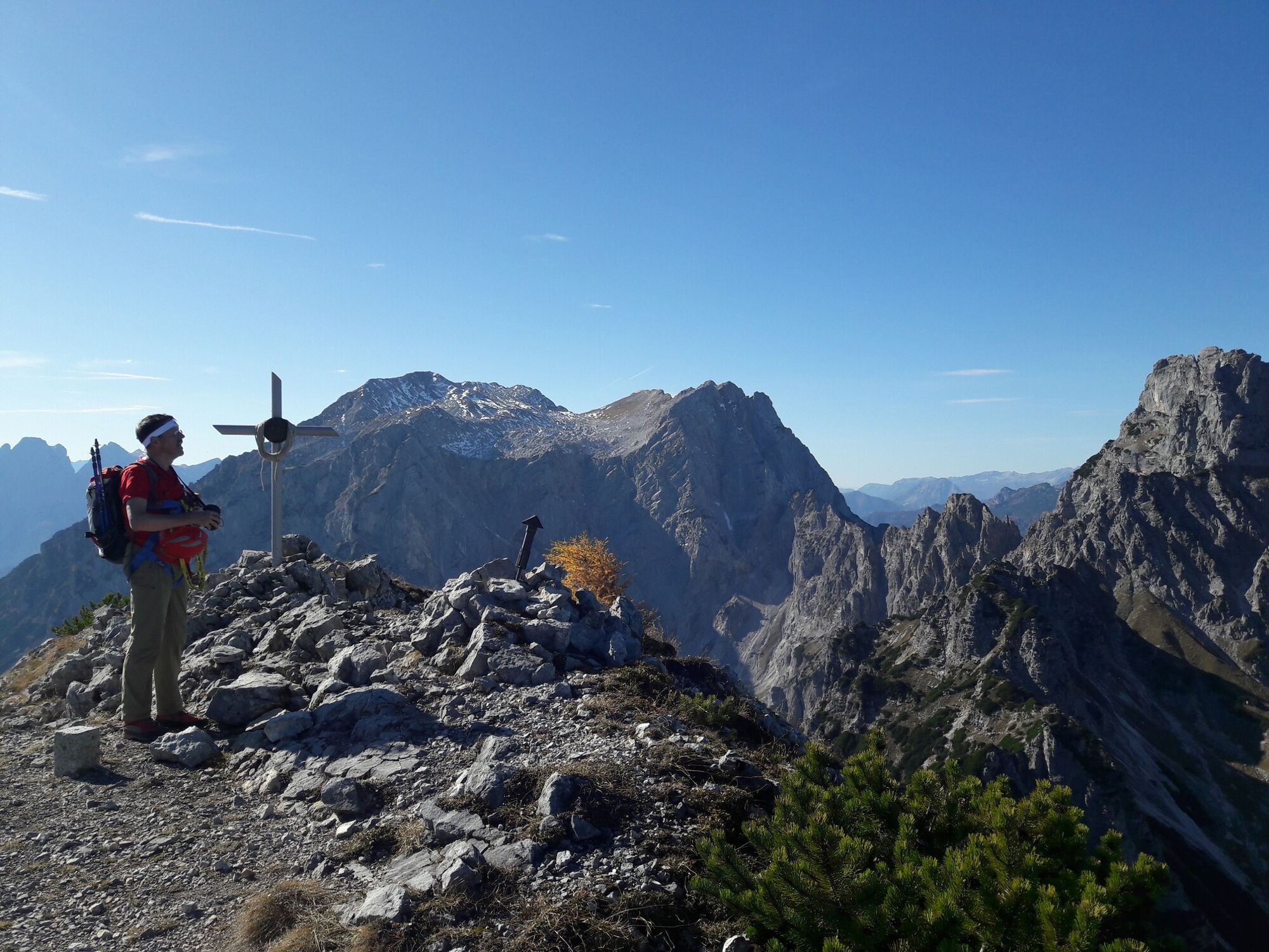
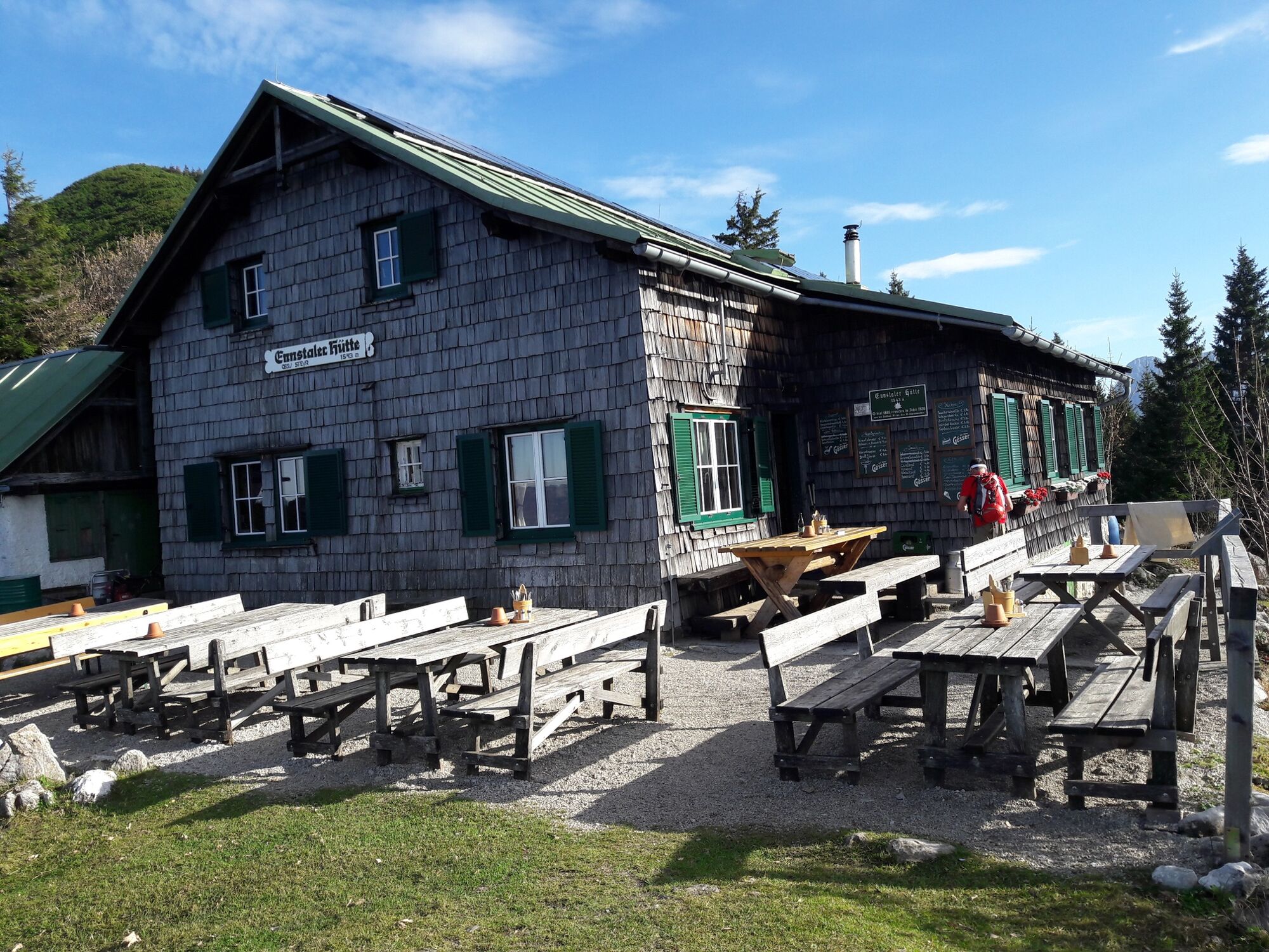
Behind the lonely back of the Gesäuse, if you will, is the largely forested area north of the mountain ridge that stretches from the Großer Buchstein in the west to the Tamischbachturm in the east. One of the peaks literally growing out of this ridge is the Tieflimauer, along with the Kleiner Buchstein, which is a 2nd degree climbing mountain. Due to its prominence, it offers a wonderful view of and into the "Gseis". A little further east on the mountain ridge, at the foot of the Tamischbachturm west ridge, is the idyllically situated Ennstalerhütte at 1544 m above sea level. With its culinary offer and the panoramic guest garden, it perfectly rounds off the mountain experience.
- Directions
-
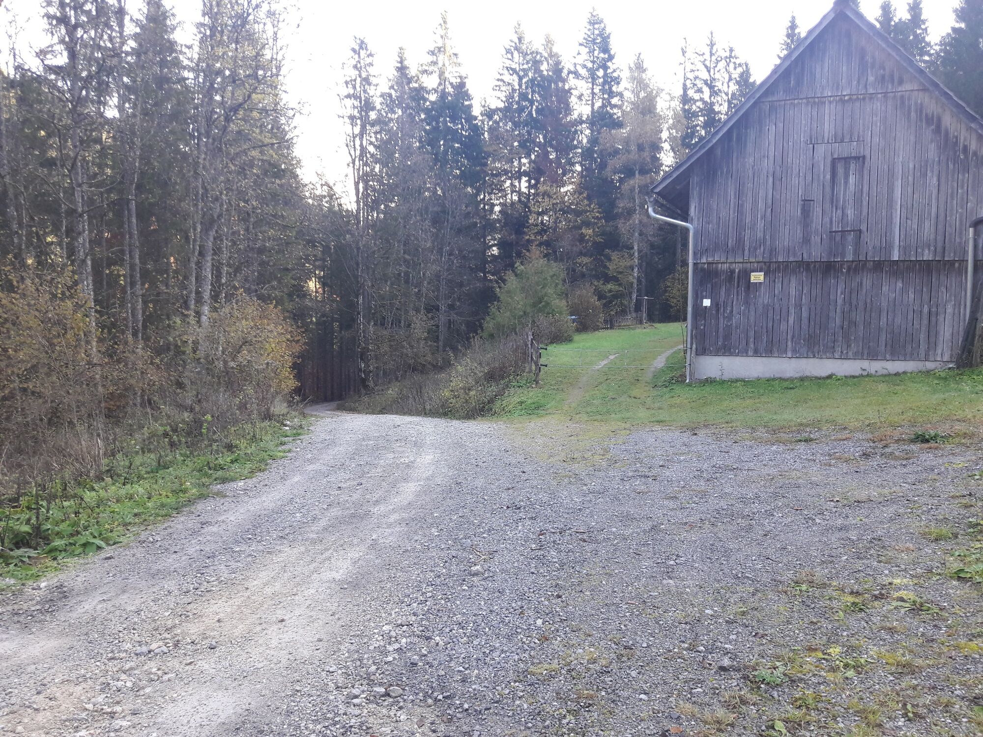
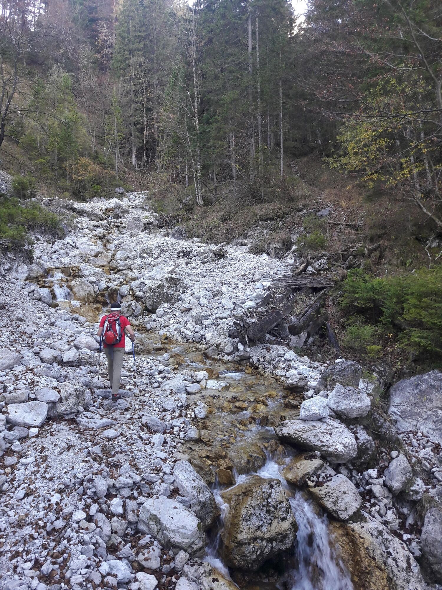
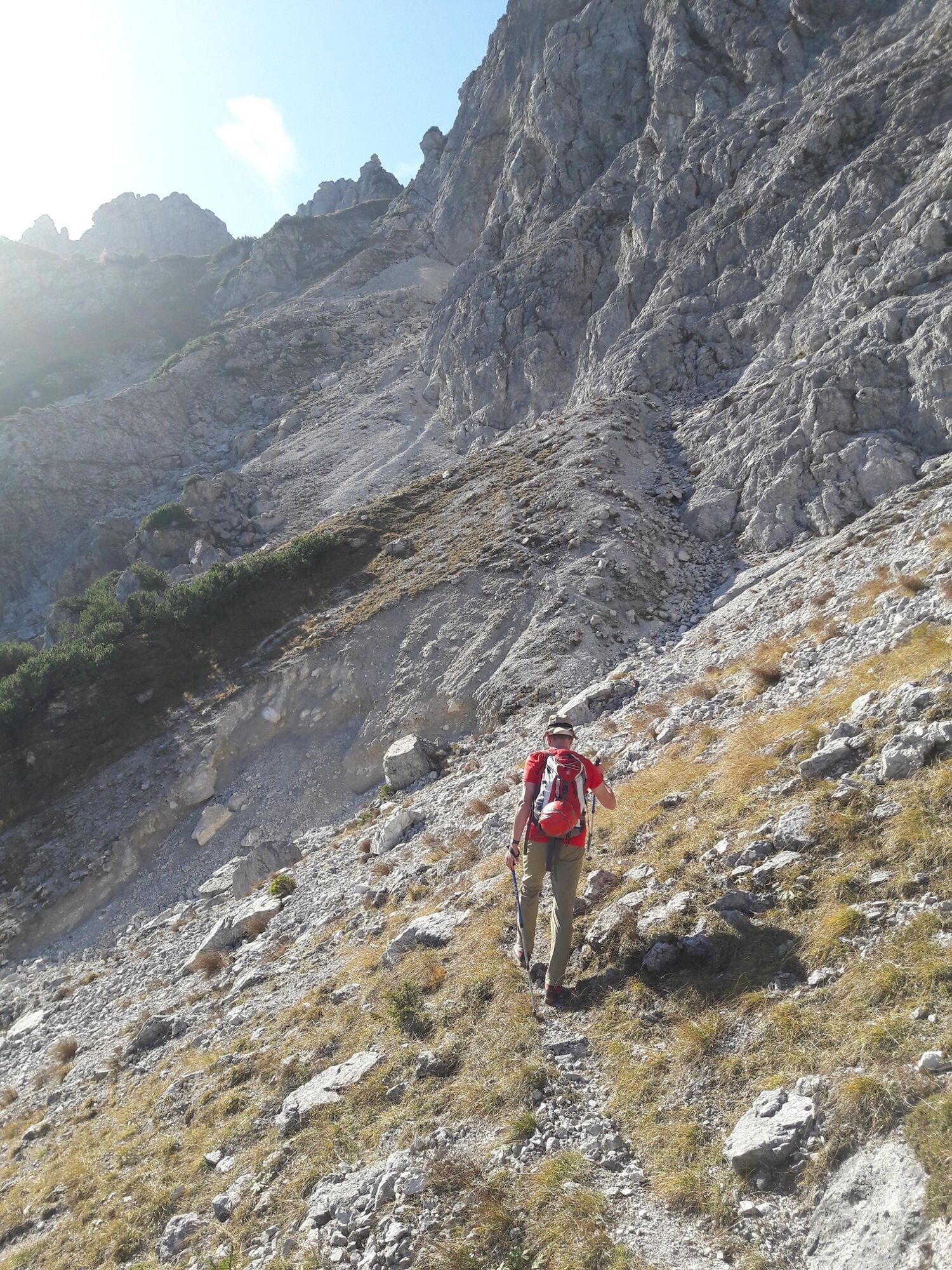
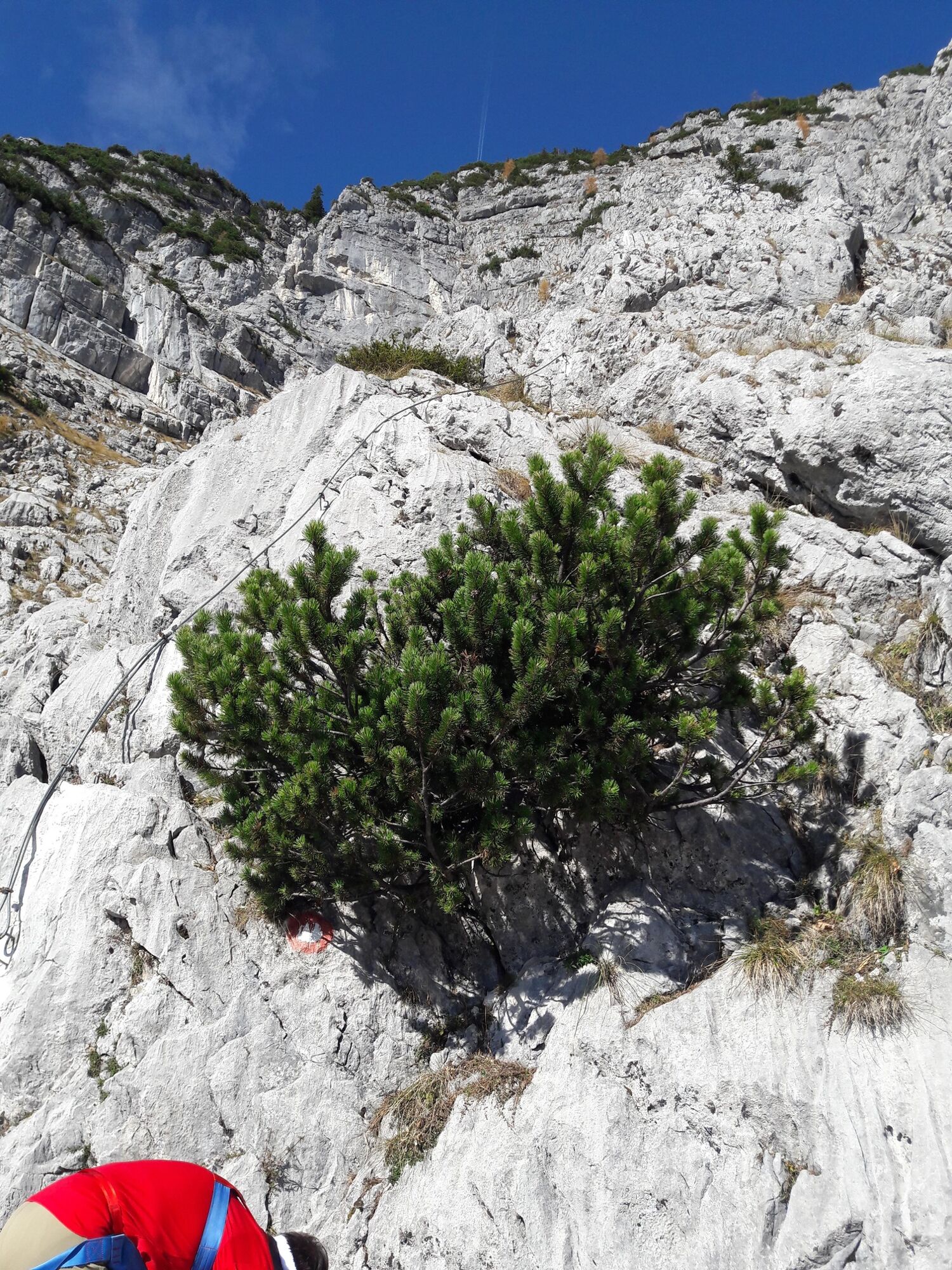
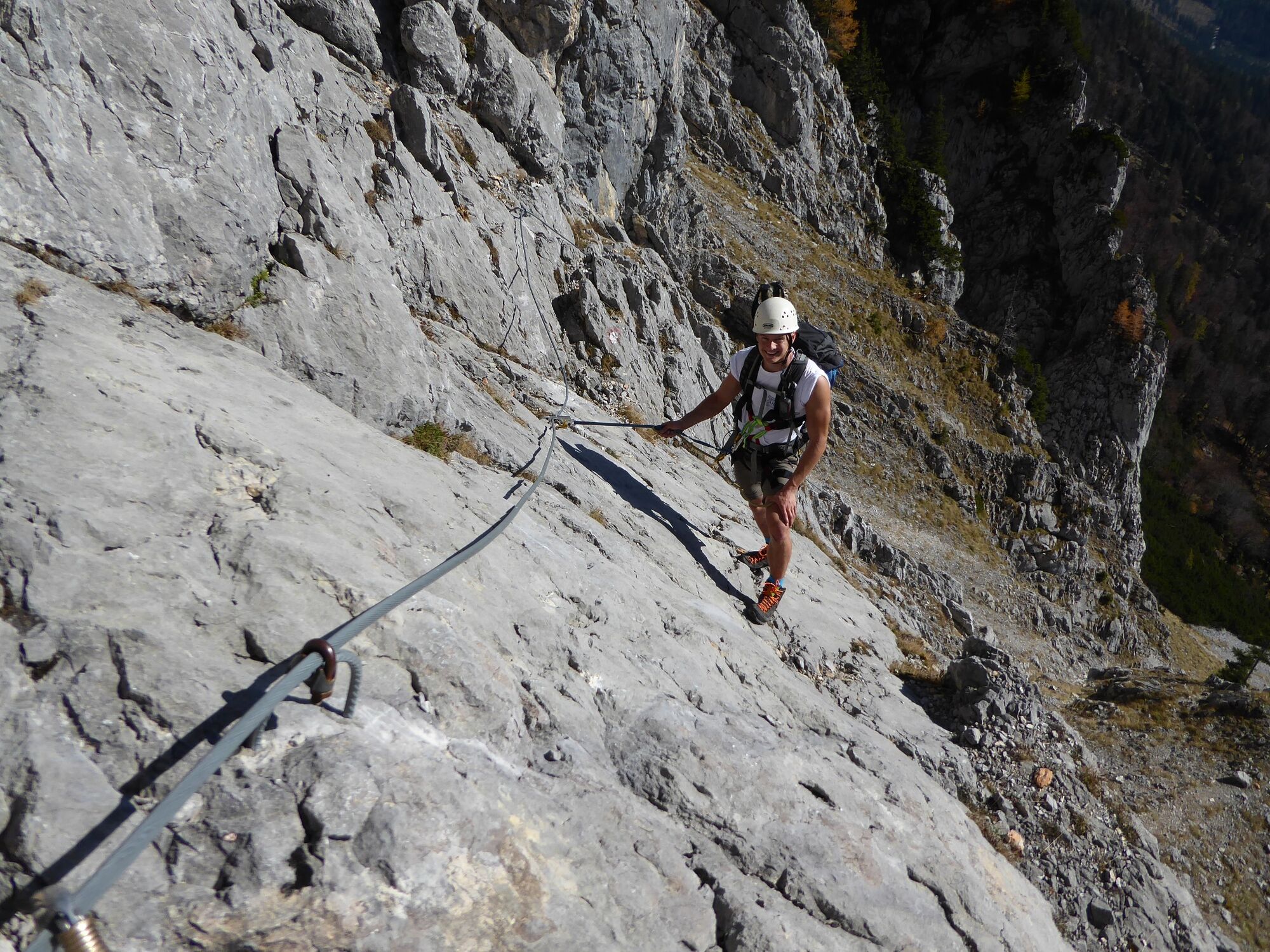
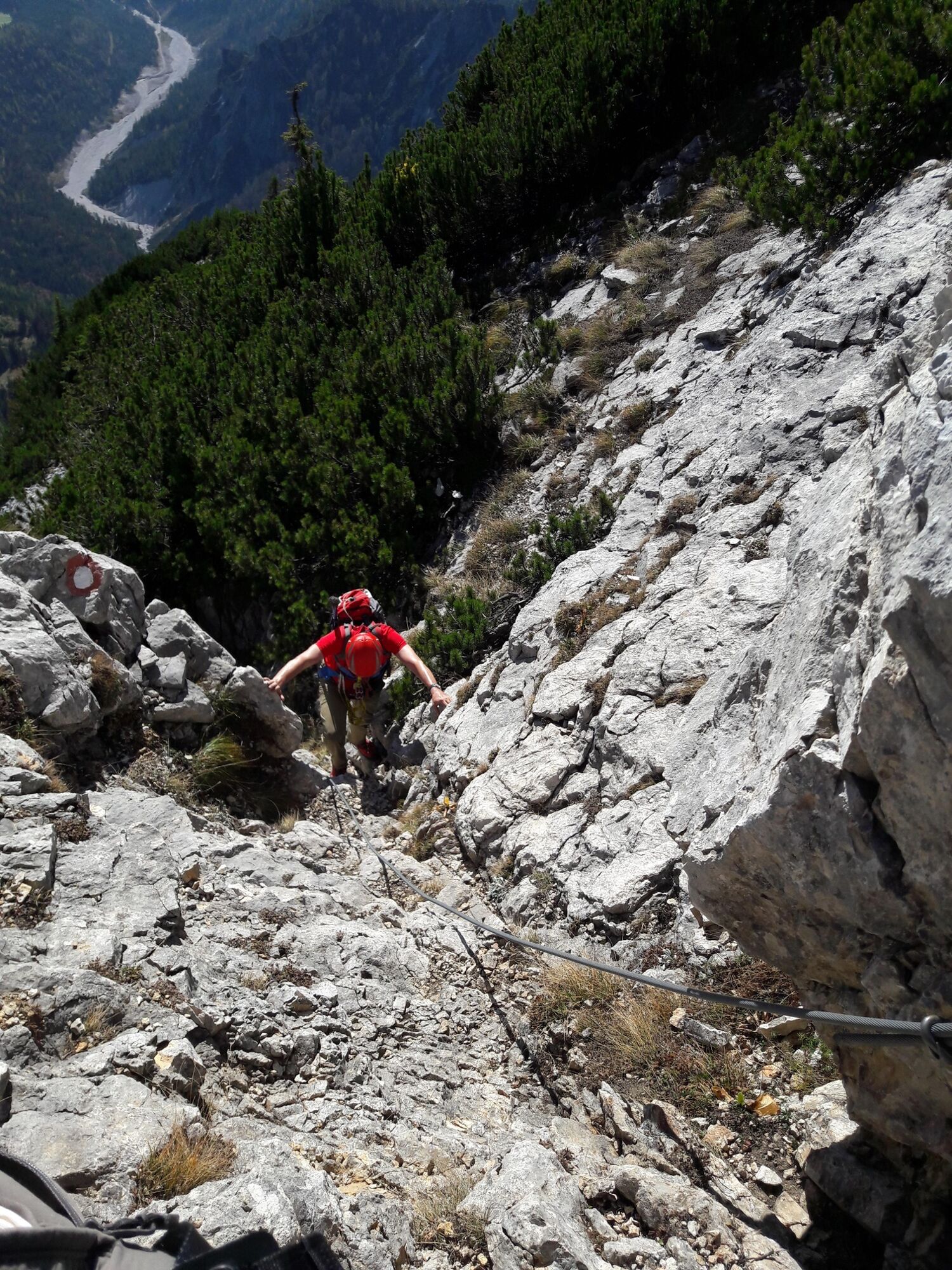
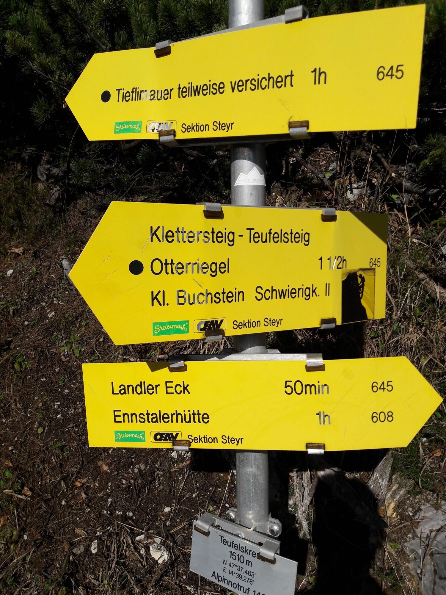
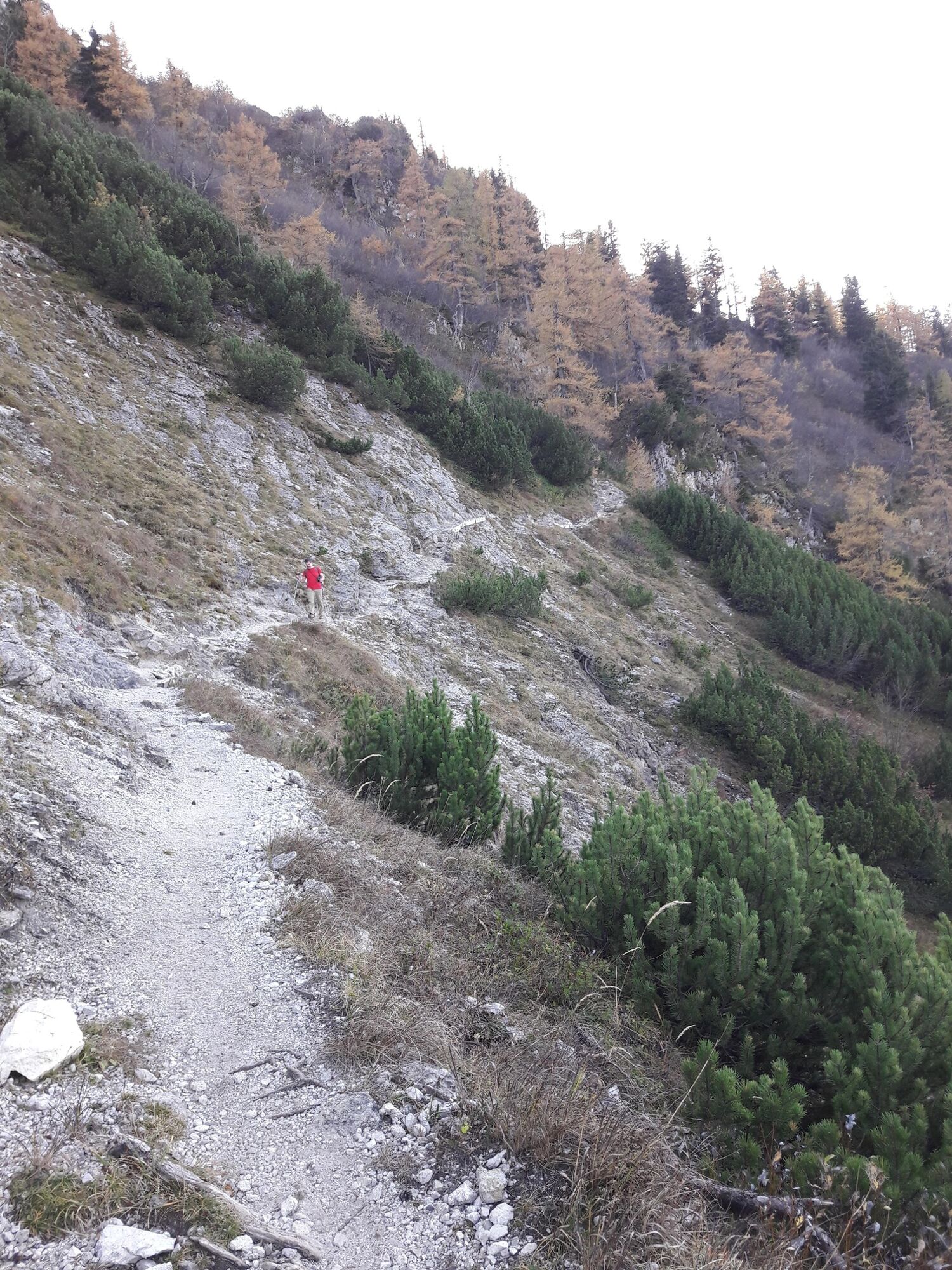
The mountain tour starts from the lower Mühlgraben in Erb and initially leads along the Mühlbach via a forest road to the Mühlbachhaus, where the actual circular tour begins. At the crossroads there, follow trail no. 644 in the direction of "Kleiner Buchstein". The following section is characterised by forest roads, shortcuts through the forest and the sound of the Mühlbach stream, which you have to cross once further up. After the former Haslingeralm at approx. 1050 m above sea level, the trail becomes much steeper, you leave the forest behind and soon come to the Otterriegel crossroads (1485 m). From here follow the marked trail no. 645 southwards to the ridge between Kl. Buchstein in the west and the Tieflimauer in the east. The trail leads along the foot of the eastern walls of the Kl. Buchstein, becomes more sloping and therefore requires surefootedness. After a small loss of altitude, the trail finally leads through the Schneckenmäuer to the ridge, which you reach in a saddle. Continue on the high trail in a south-easterly direction. Head straight towards the Tieflimauer. However, the proximity of the summit is deceptive, as the entrance to the Teufelssteig (via ferrata B/C) is at the southeast foot of the Tieflimauer. This is why you have to walk downhill for about another kilometre before you reach it.
The via ferrata lives up to its name and it is therefore absolutely necessary to have a helmet and harness with you. After the exit, follow the ridge to the spacious summit, from where you can already see the next destination - the Ennstalerhütte. However, full concentration and sure-footedness are also required on the descent to the hut, because even on the normal route there are still a few secured sections for a reason. At the Teufelskreuz crossroads, you rejoin the high-level trail, which leads to the Ennstalerhütte with alternating ups and downs. To get back to the starting point, walk north at Landler Eck over the Landler Stieg'n and follow the marked trail no. 608 over the Bärensattel and several forest roads back to the Mühlbachhaus.
- Highest point
- 1,801 m
- Endpoint
-
Parkplatz Ennstaler Hütte Mühlbach
- Height profile
-

- Equipment
-
Sturdy mountain boots or good trekking shoes, as well as a hiking rucksack with appropriate contents (water bottle, blister plaster, hiking map, snack, etc.). You should also be well equipped for a change in weather. Via ferrata set and rockfall helmet for the Teufelssteig.
- Safety instructions
-
The Teufelssteig is a via ferrata with B/C difficulty and the entire tour requires not only very good physical condition and alpine experience but also a head for heights!
Emergency call mountain rescue: 140
- Tips
-
Plan an overnight stay at the Ennstalerhütte and experience the ascent of the Tamischbach Tower - or maybe even the sunrise - on the second day (from the hut in about 1.5 hours).
- Additional information
-
Tourismusverband Gesäuse
Hauptstraße 35, 8911 Admont, Österreich
Tel. +43 (0) 3613 21160 10
Email: info@gesaeuse.at
www.gesaeuse.at
Infobüro/Salza Wildalpen
Wildalpen 91 – 8924 Wildalpen Tel. 03636/241 infosalza@gesaeuse.at
Mo und Fr. 9:00-17:00
- Directions
-
A9 Phyrnautobahn to exit Ardning/Admont and from there past Frauenberg, approx. 10 km to Admont. Via the B146 (Gesäuse Bundesstraße) coming from the west through the Gesäuse to Hieflau and via the B115 to Großreifling, where you take the turn-off to Erb.
Or via Leoben, Vordernberg and Eisenerz to Hieflau and from there on to Großreifling in the Erb. At the sign "Parkplatz Ennstaler Hütte" at the end of the Mühlbachgraben valley, turn left following the sign.
A1 Westautobahn to exit Ybbs and from there south through Scheibbs, Lunz am See, Göstling an der Ybbs and Palfau to Hieflau. From there via the L714, which runs along the orographic right side of the Salza to Großreifling (and on to Erb as described above).
- Public transportation
-
www.oebb.at
www.busbahnbim.at
- Parking
-
A free and public car park is located directly on the forest road when you drive a short distance into the Mühlbachgraben.


-

-
AuthorThe tour Tieflimauer, durch den Mühlgraben und über den Teufelsteig zurück über die Ennstaler Hütte is used by outdooractive.com provided.


General info
-
Gesäuse
2225
-
Steyr und die Nationalpark Region
1371
-
St. Gallen
174
 & Kaiserschild (rechts)")


")
