- Brief description
-
This is a moderately difficult hike that leads through the nature of the Murau region.
- Difficulty
-
medium
- Rating
-
- Starting point
-
Baierdorf
- Route
-
BaierdorfFilialkirche hl. NikolausBaierdorf10.9 kmFilialkirche hl. Nikolaus11.0 km
- Best season
-
JanFebMarAprMayJunJulAugSepOctNovDec
- Description
-
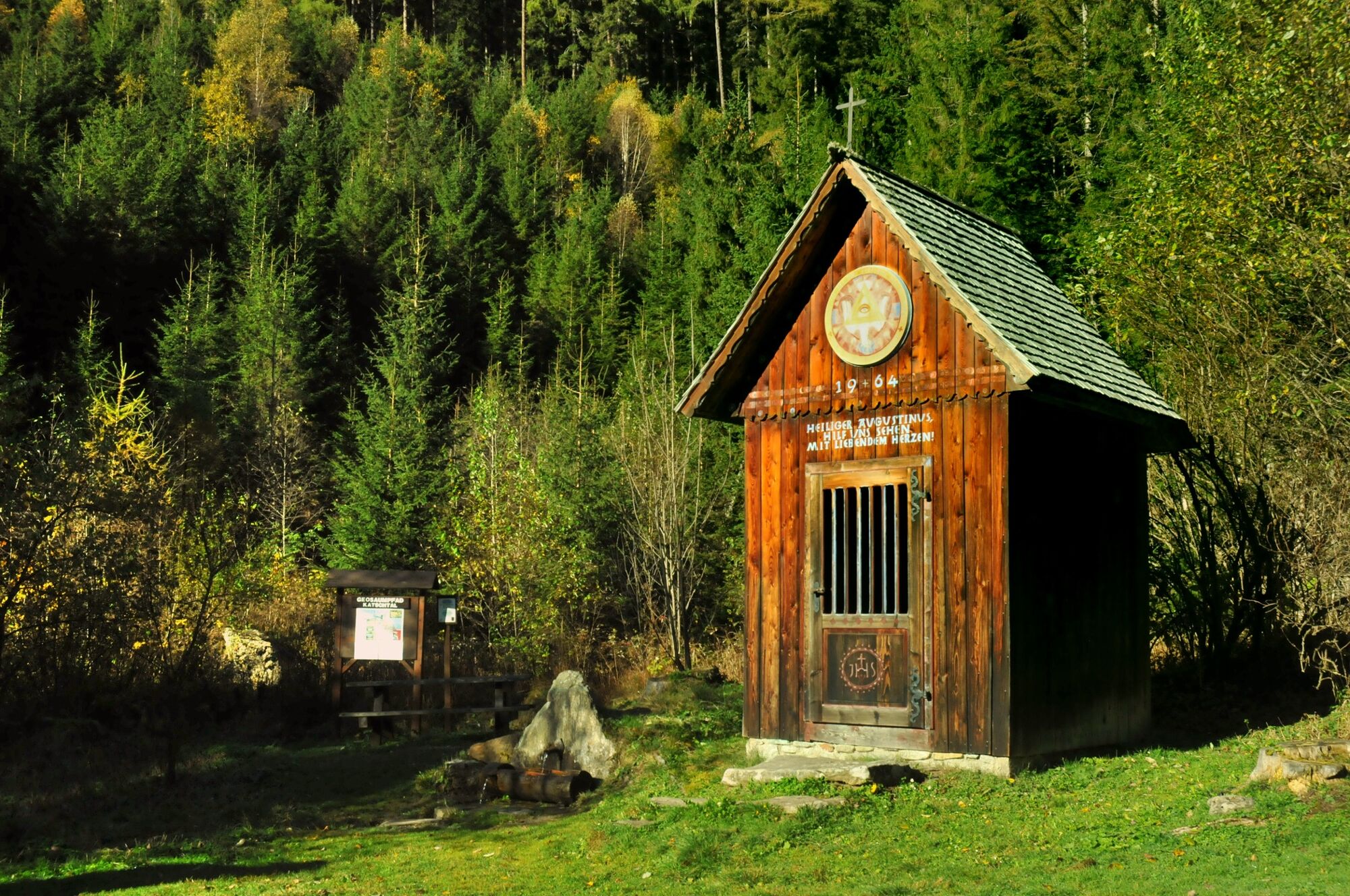
Far away from the main road, this tour leads from Baierdorf to Ausgustinerbründl. Most of the route leads on a forest road through the forest to the destination. The picturesque landscape backdrops can therefore be enjoyed in peace and to the fullest.
- Directions
-
From the starting point S7 you go along the state road to the town of Baierdorf. You walk a short distance along the municipal road to the bridge. After the bridge, turn left and follow the signs along the stream towards "Augustinerkreuz" for about 6 km (hiking trail no. 11). This path to the "Augustinerbründl" is also part of the geopath, which is described in a separate brochure. At the “Augustinerbründl” you have the opportunity to refresh yourself by the water and take a short break.
From the "Augustinerbründl" cross the state road, go over the bridge and turn right. You hike along the forest path, past a barrier, and continue to the next fork in the road. Turn left and follow the steadily slightly ascending path or the signs (No. 12) through the forest on a forest path. At the next fork in the road, keep right. This path leads to the property cf. “Bremsmoar” back into town. You take the asphalted municipal road down into the valley through the residential area. At the next intersection please keep right again. This path leads back to town. Walk over the bridge, turn left towards Gasthaus Neuwirt or the starting point S7 in Baierdorf.
- Highest point
- 1,225 m
- Endpoint
-
Baierdorf
- Height profile
-

- Equipment
-
Good shoes
Sun protection
Sufficient food - Tips
-
According to legend, the Augustinerbründl is known as eye healing water.
- Additional information
-
The ideal time for this tour is from April to October.
- Directions
-
Coming from Judenburg via Unzmarkt to Scheifling. Turn right here and drive to Murau. In Katsch an der Mur, keep right again and drive via St. Peter am Kammersberg to Baierdorf.
Coming from Tamsweg via Ranten (or Stadl an der Mur), keep left and drive via Schöder to Baierdorf.
- Public transportation
-
With the BusBahmBim app from the composite line, timetable information is easier than ever before: all bus, train and tram connections in Austria can be queried by entering locations and/or addresses, stops or important points. The app is available as a free app for smartphones (Android, iOS) - on Google Play and in the App Store.
- Parking
-
Public parking spaces are available directly at the Gasthof Neuwirt.
- Author
-
The tour Augustinerbründl round is used by outdooractive.com provided.


General info
-
TourismusRegion Murau
1745
-
Naturpark Sölktäler
929
-
Schöder
199