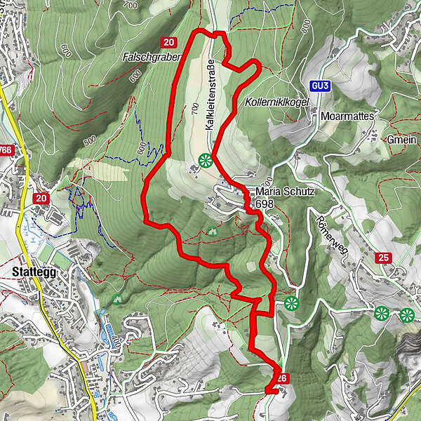
Tour data
6.5km
518
- 747m
223hm
229hm
03:00h
- Brief description
-
Vom Höchwirt nach Kalkleitenund zum Grill -und Spielplatz. Nach einer verdienten Rast zurück zum Höchwirt
- Difficulty
-
difficult
- Rating
-
- Starting point
-
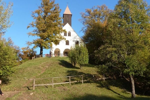
Höchwirt
- Route
-
HöchwirtKirche Maria Schutz1.7 kmSpiel- und Grillplatz Kalkleiten3.2 kmHöchwirt6.5 km
- Best season
-
JanFebMarAprMayJunJulAugSepOctNovDec
- Highest point
- 747 m
- Rest/Retreat
-
Grill -und Spielplatz
GPS Downloads


Trail conditions
Asphalt
(5%)
Gravel
Meadow
Forest
(95%)
Rock
Exposed
Other tours in the regions
-
Erlebnisregion Graz
2783
-
Graz und Region Graz
1524
-
Stattegg
757