


- Brief description
-
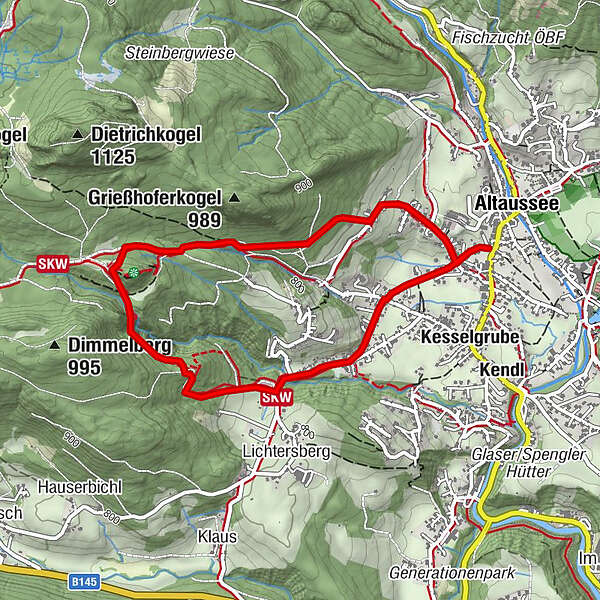
Circular hiking trail to the historic Pflindsberg castle ruins, beautiful viewpoint.
- Difficulty
-
easy
- Rating
-
- Starting point
-
Schneiderwirt Inn
- Route
-
AltausseeWasserfall2.0 kmAltaussee4.2 km
- Best season
-
JanFebMarAprMayJunJulAugSepOctNovDec
- Description
-
This scenic circular hiking trail leads to the Pflindsberg ruin with its observation tower and back to Altaussee via the waterfall trail.
- Directions
-
From the Schneiderwirt inn, the Jakob-Wassermann trail branches off in a westerly direction to the waterfall and the Pflindsberg ruins. The trail leads westward for about 750 meters over access roads to the road that leads to Lupitsch. Continue on this road to the right and pass the "shooting range" of the privileged shooting society of Altaussee, which is located on the left. Follow the moderately ascending road, cross the Trattenbach stream and turn right shortly after the left-hand bend.
Follow the markings on a wider forest path uphill through the coniferous forest. Please pay attention to the markings!
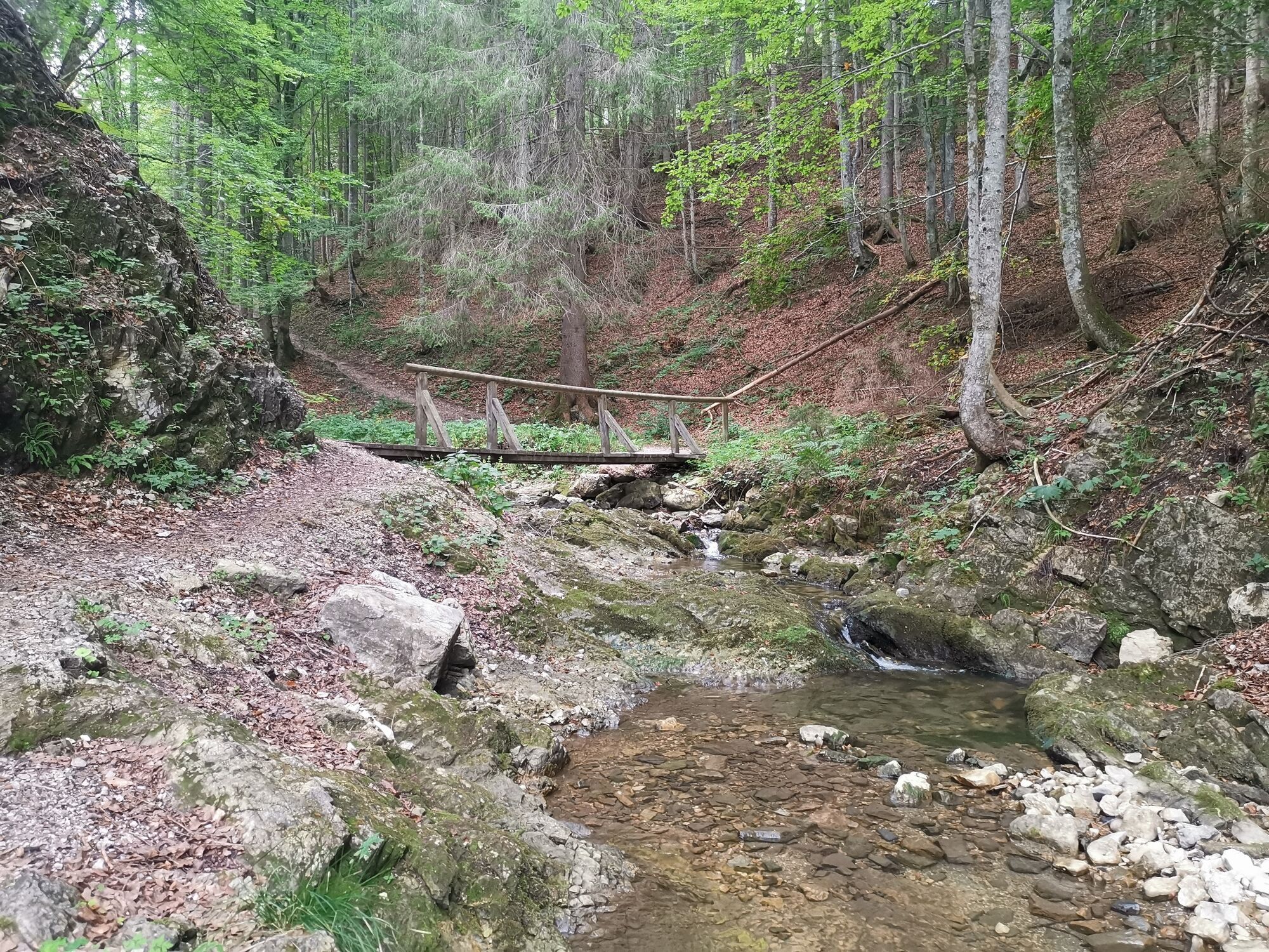
From the wider path, a forest trail branches off to the left and climbs steeply. On this path you again reach a forest road, which you follow to the right. After about 200 meters you will see the waterfall of the Trattenbach on the right. It falls into a rocky basin deep below.Caution. The path leads above this basin to the right, over steeply sloping terrain. Over a narrow footbridge you follow the path further uphill through the coniferous forest. Soon the climb is over and you come to the "Schlosswiese", dialectally called "Gschlosswiesn".Now keep to the right here and walk over the former path first to the east, then climb briefly to the west and thus come to the "Burghof".
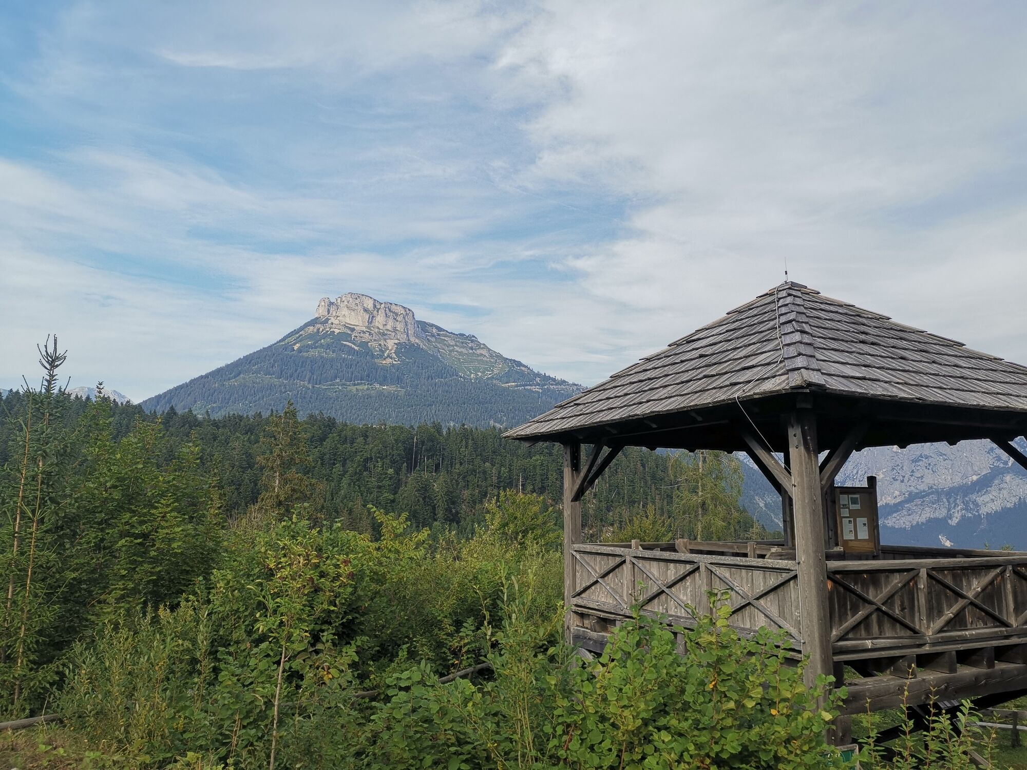
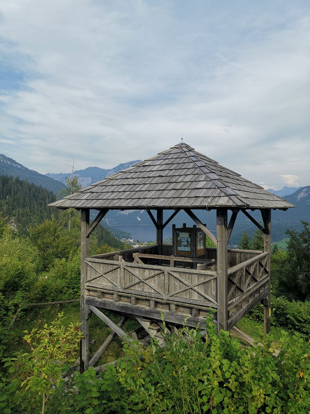
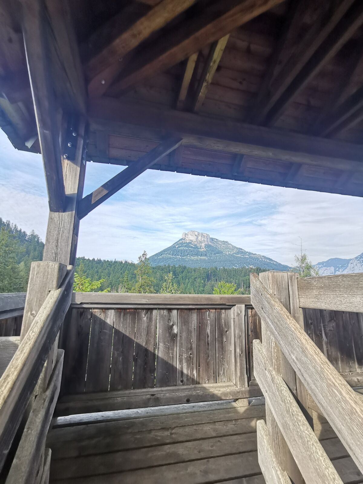
Here the Austrian Federal Forests have erected a lookout post.The small castle, built around 1250, was erected to defend the salt deposits on the Moosberg. From up here you have a magnificent view of part of the Ausseerland and the striking mountain scenery.
The descent from the ruins is the same as the ascent to the castle meadow. Or you can walk from the lookout point in a westerly direction along a narrow, steeply sloping path. This path leads across the still recognizable moat and rampart to the castle meadow. The path leads past the game feeding area on the right and joins a forest road after about 150 meters. Follow this downhill to the right. From Zenzenbichl, in the district of Lichtersberg, an asphalt road leads down to a connecting road. Go back to our starting point on this road to the left.
- Highest point
- 934 m
- Endpoint
-
Schneiderwirt Inn
- Height profile
-

- Equipment
-
Proper backpacking makes many things easier:
pack heavy things first.
The water bottle should always be within easy reach in a side pocket.
All things that are often needed, such as sunglasses, camera or hiking map, belong on top.
An emergency kit including blister plaster belongs in every backpack and a clothing according to the "onion system" is always recommended! - Safety instructions
-
Emergency call mountain rescue: 140
Emergency reporting tip - provide answers to the six W questions:
What happened? How many injured? Where did the accident happen? (possibly GPS coordinates) Who is reporting? (callback number) When did the accident happen? Weather at the accident site? - Additional information
- Directions
- Public transportation
- Parking

- Author
-
The tour Hike to the ruin Pflindsberg is used by outdooractive.com provided.


General info
-
Ausseerland - Salzkammergut
3382
-
Dachstein Salzkammergut
1701
-
Altaussee
298


