
- Brief description
-
A solitary and rather long hike to a well-known peak in the Seetal Alps. Those who prefer longer and more unusual routes will love this tip.
- Difficulty
-
difficult
- Rating
-
- Starting point
-
Rothenthurm town center next to the fire department
- Route
-
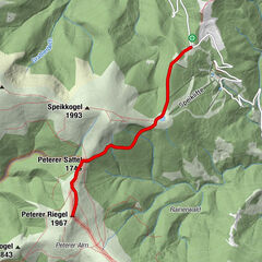
RothenthurmSautratte8.9 kmHohe Ranach (1,981 m)13.5 kmSautratte17.8 kmRothenthurm26.9 km
- Best season
-
JanFebMarAprMayJunJulAugSepOctNovDec
- Description
-
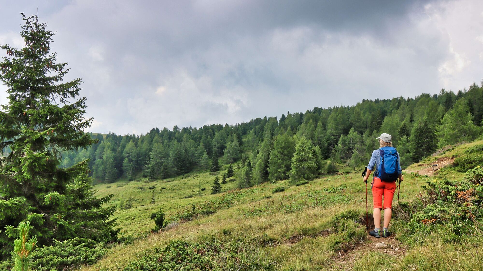
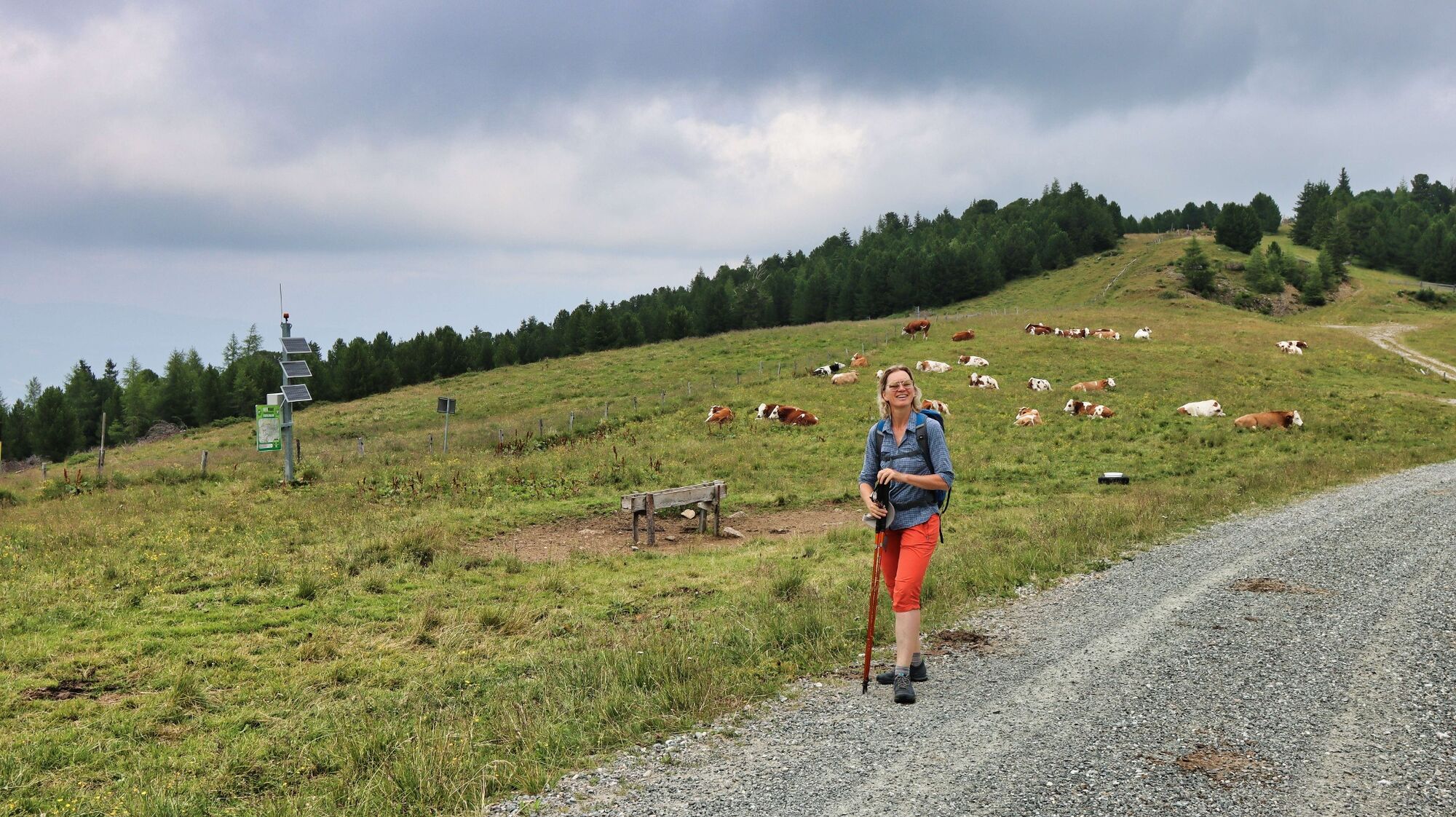
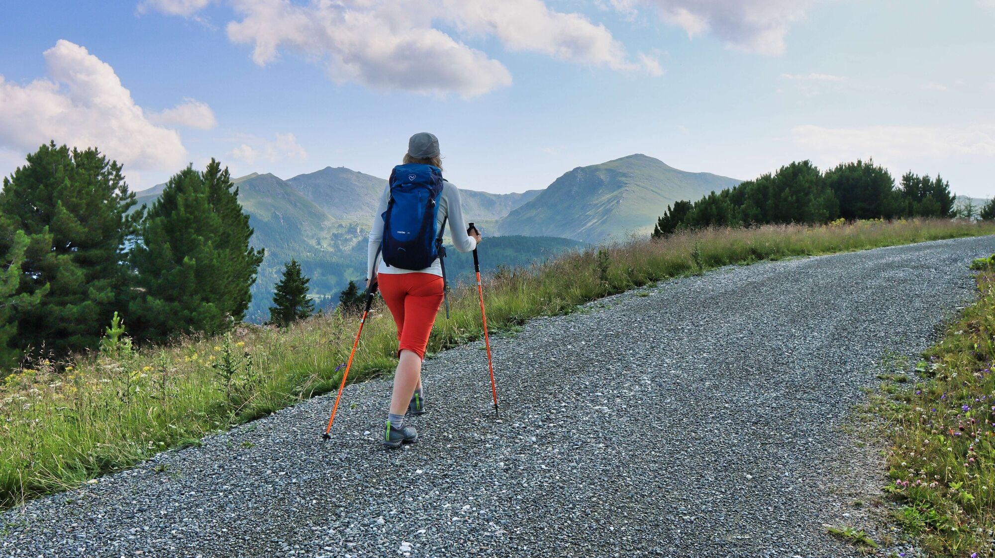
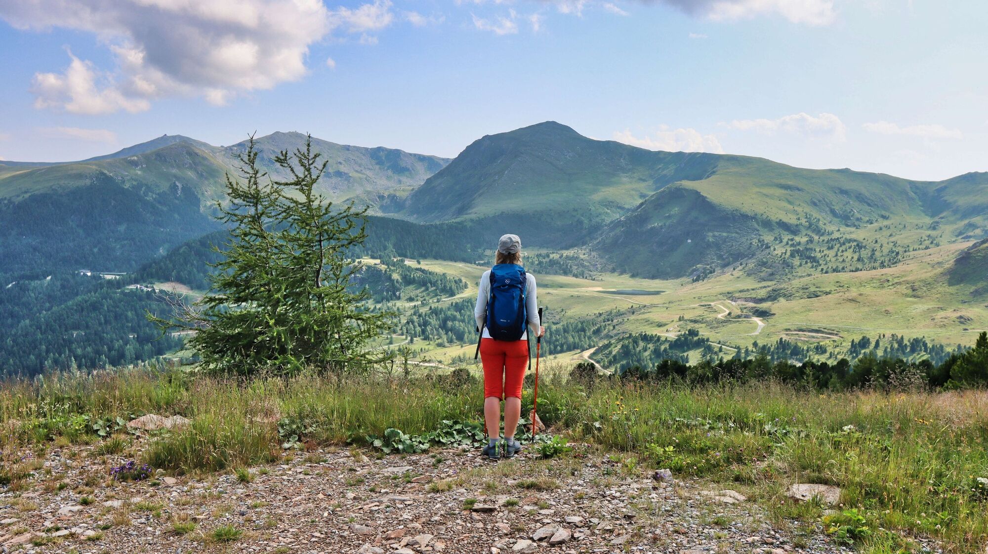
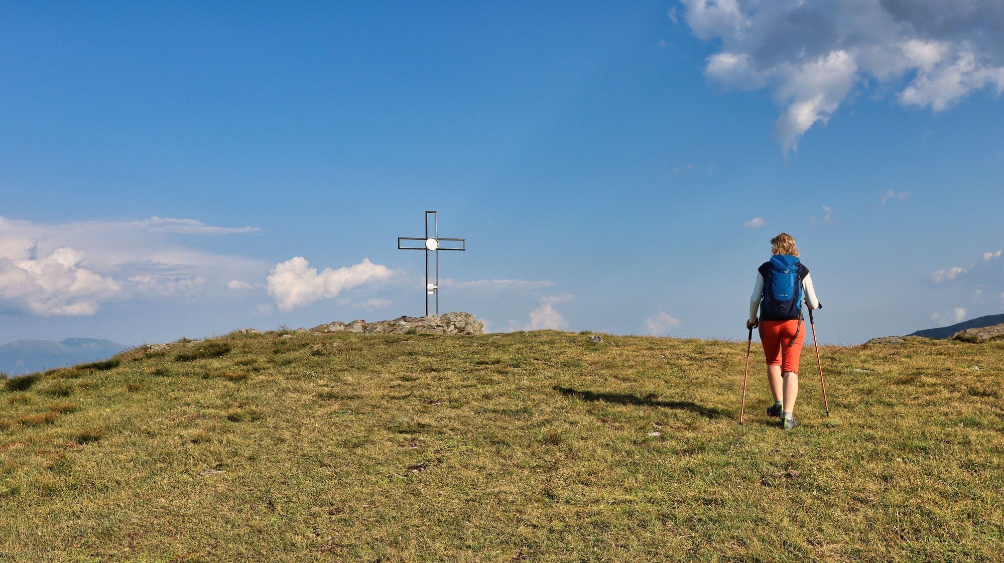
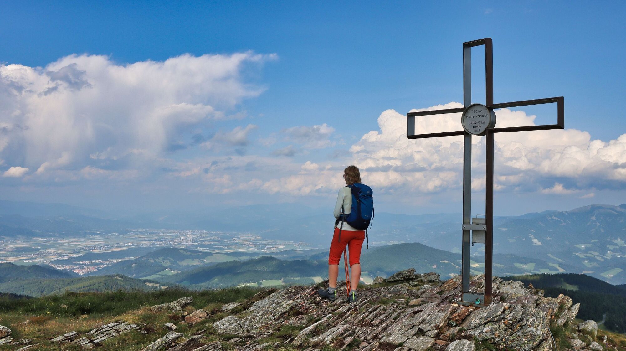
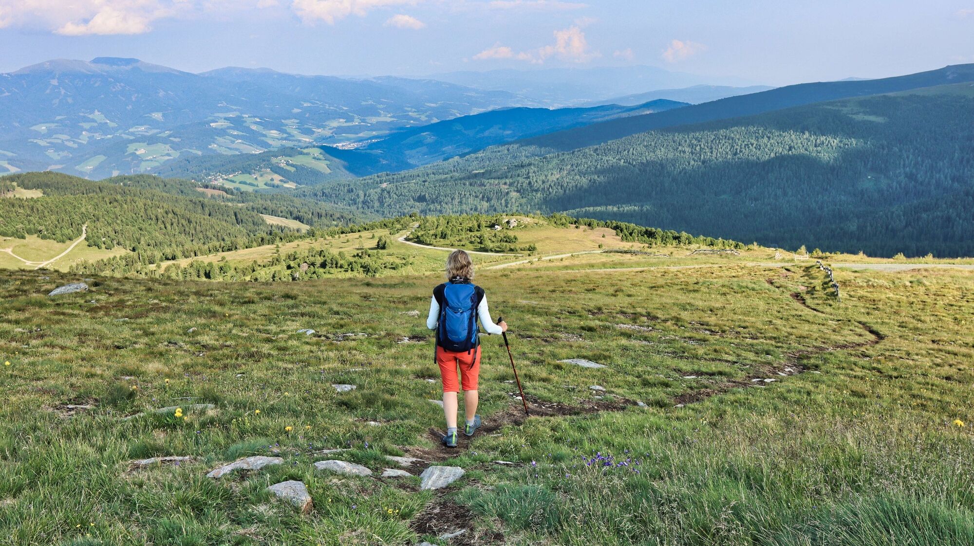
The "Hohe Ranach" destination is known to many hikers, as it is a popular year-round destination in the Seetal Alps. Due to the exposed location of the extensive summit area, you have a wonderful view of the heart of the Seetal Alps, the Judenburg-Knittelfeld basin and the surrounding mountain regions. The long ascent from Rothenthurm (belongs to the municipality of St. Peter ob Judenburg) is rather unusual, so don't be surprised if you meet few or no hikers up to the Mühlbachersattel. Before you set off, you need to know that you are hiking in the immediate vicinity of a restricted military area and that the hiking trail to the Hohe Ranach is closed during live-fire exercises. You can find the closing times on the army's homepage.
- Directions
-
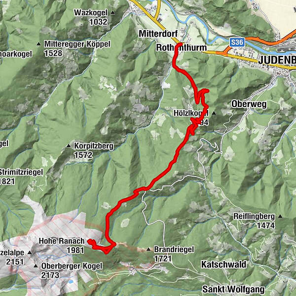
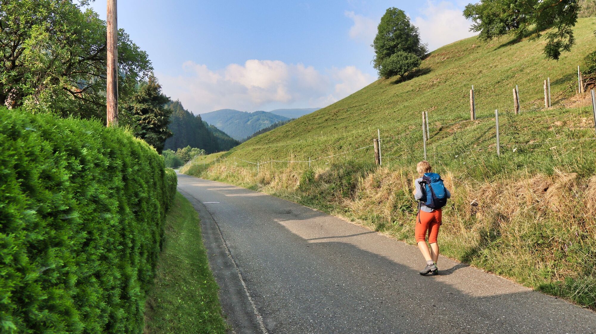
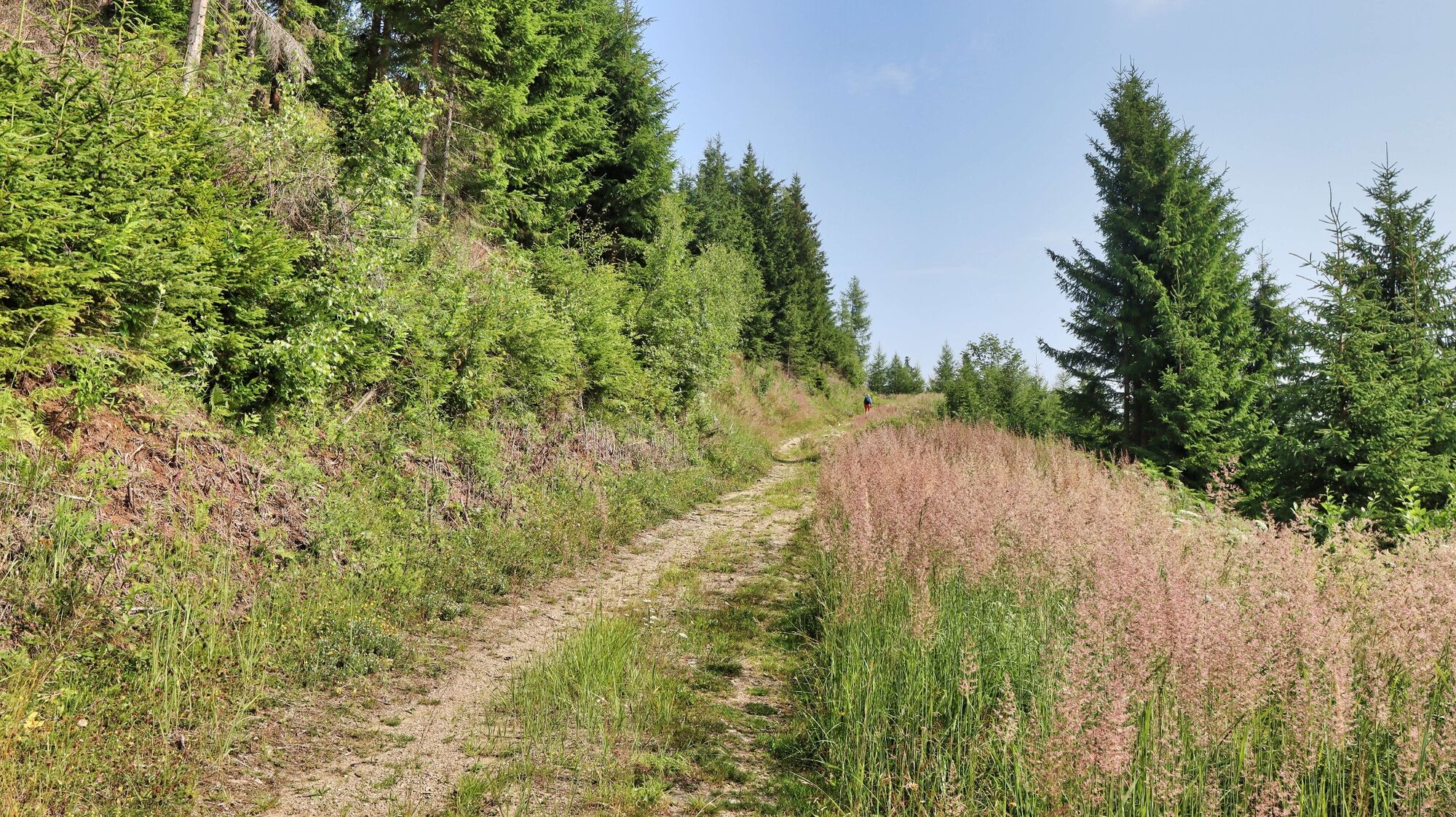
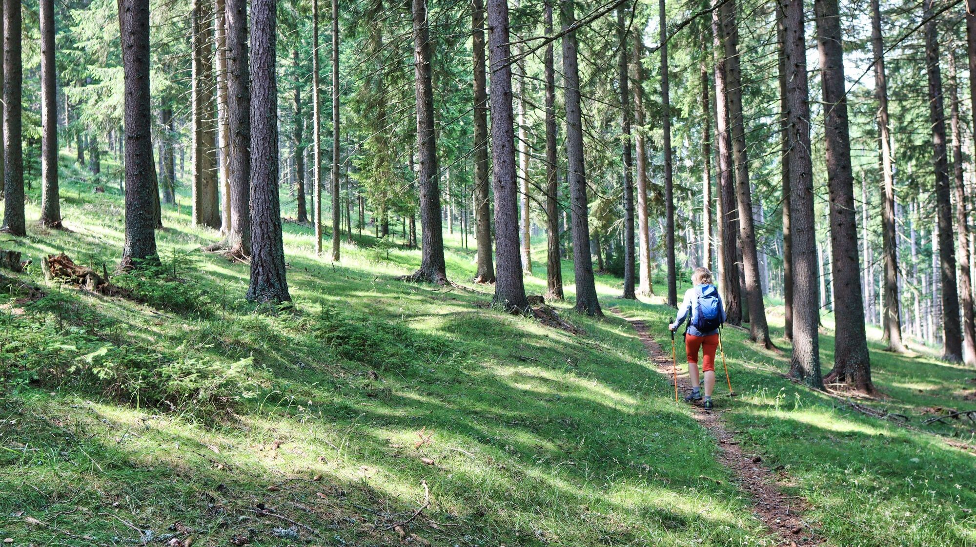
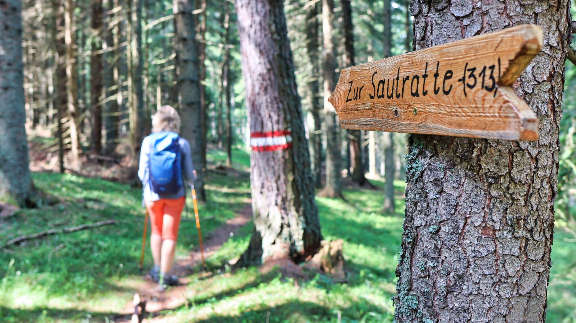
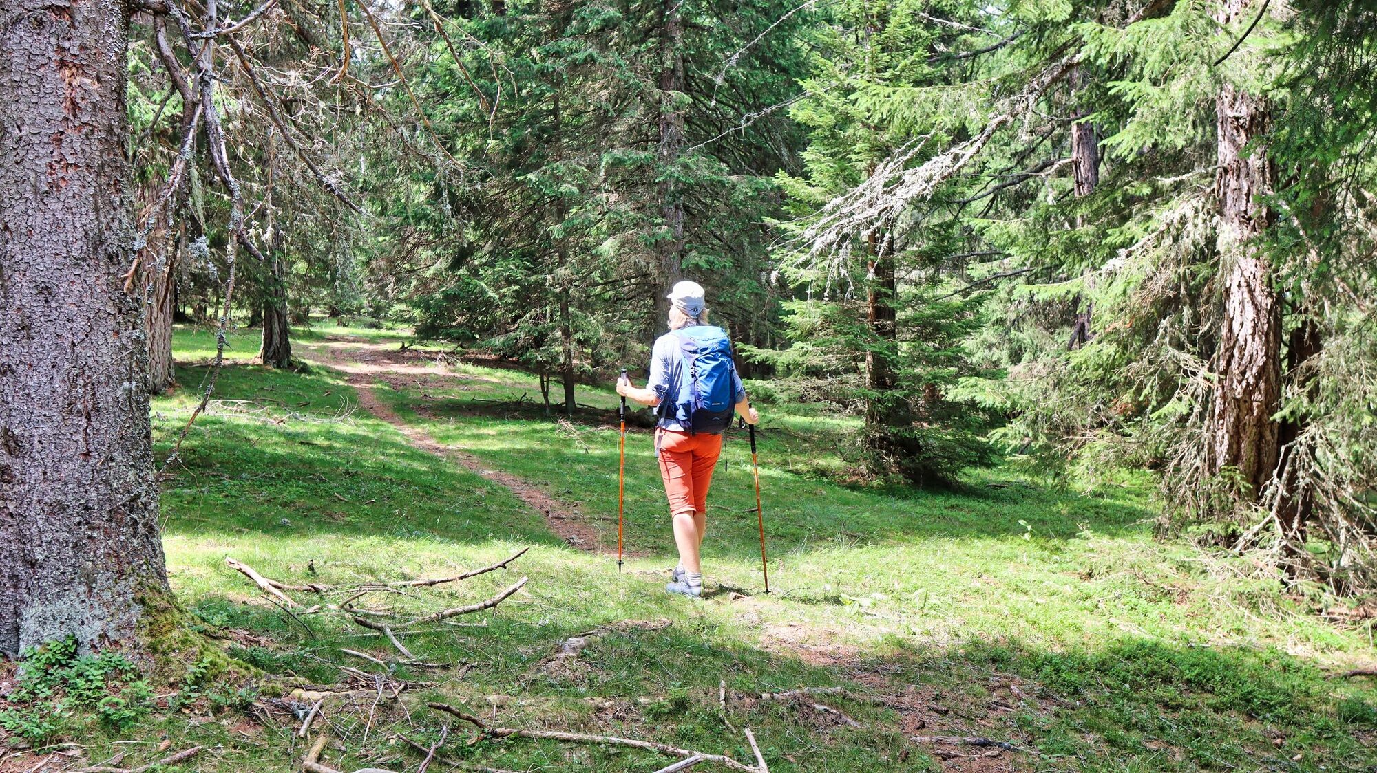
We start in the village center or near the Rothenthurm fire station building (1), 742 m, and follow the yellow signposts in the direction of Hölzlkogel, trail no. 45. We walk leisurely less than 1 km into the valley before turning left at the crossroads in the direction of Feistritzgraben no. 6 - 18. On the asphalt road along the small Feistritzgraben, we walk comfortably uphill past a few houses. We soon continue on a gravel road through the forest, where the red-white-red markings and yellow signposts make orientation easy. At an altitude of approx. 1000 meters we reach a large alpine pasture, where we have a very nice view. At the next crossroads, we see another yellow signpost in the direction of Sperlalm - Wenzelalm Kreiskogel and Zirbitzkogel, trail 313, and follow it. We follow the gravel road and always stay on the main path until the road continues as a path. This is followed by a longer section through the forest, where the markings and wooden signs with the inscription "Zur Sautratte" clearly indicate the route. At the Sautratte (2),1430 m, we come directly to the road that leads to the military training area, to the Schmelzhütte and then to the Winterleitenhütte. A few meters along the road and then we turn right onto the forest road. After a short time, we leave the road and hike uphill along the clearly recognizable path until we reach a wooden passage. There are numerous no trespassing signs here. Continuing to follow the markings, we leave the clearing around the Sperlhütte on the right, so to speak. As the altitude increases, we slowly leave the forest and reach the Mühlbacher Sattel (3), 1787 m, which can be recognized by the numerous military signs. Here we keep to the right and can already see our destination ahead of us. We now follow the gravel road uphill for just over a kilometer until we reach the Hohe Ranach (4), 1981 m. The descent is via the ascent route.
- Highest point
- 1,972 m
- Endpoint
-
Rothenthurm town center next to the fire department
- Height profile
-

- Equipment
-
Backpack with rain cover Telescopic / hiking poles Mountain / hiking boots Gloves: waterproof and warming Headgear / sunglasses Outerwear: Onion layer system, T-shirt, sweater, jacket and winter jacket with hood Hiking pants Seat pad Drinking bottle / thermos flask (on cooler days a warming drink is pleasant) Snack First aid kit with blister plaster and tick tongs
Other important equipment
Route descriptionDetailed plan of the hike Hiking map: For overview a map in scale 1 : 50 000 of the respective region GPS device cell phone - Safety instructions
-
For a conflict-free coexistence on alpine pastures and meadows it is important to observe a few rules, especially when traveling with dogs. (Source: www.sichere-almen.at - 06/2021) Avoid contact with grazing animals, do not feed them, keep a safe distance! Keep calm, do not frighten grazing animals! Mother cows protect their calves. Avoid encounters between mother cows and dogs! Always keep dogs under control and on a short leash. If an attack by a grazing animal is foreseeable: Immediately unleash! Do not leave hiking trails on alpine pastures and meadows! If grazing animals block the way, avoid them as far as possible! When grazing animals approach: Stay calm, do not turn your back, avoid the animals! Leave the grazing area quickly at the first sign of restlessness of the animals!Fences must be respected! If there is a gate, use it, then close it well and cross the pasture quickly! Treat the people working here, nature and the animals with respect!
A few tips for correct and fair behavior in the forest: (Source: www.bundesforste.at - 6/2021)
Hikers should avoid visits to the forest about 1.5 hours before sunrise and after sunset, as wildlife is especially active during this time. Plastic bottles, handkerchiefs, cigarette butts & Co have no place in the forest! Please make sure that you do not leave any trash in the forest. Camping and making fire - is strictly forbidden in the forest! In principle, each person is allowed to collect 2 kg of mushrooms and berries per day for personal use in the forest. It is only forbidden if the forest owner expressly forbids it.Alpine emergency call:
Mountain rescue emergency number: 140
EU emergency number: 112
Weather service: www.zamg.ac.at
Direct link mountain weather Styria: https://www.zamg.ac.at/cms/de/wetter/produkte-und-services/bergwetter/steiermark
- Tips
-
The circular hiking trail to the AuErlebnisweg in St. Peter ob Judenburg is a leisurely walk from Rothenthurm. Just the thing for in between.
- Additional information
-
Refreshment stops nearby - St.Peter ob Judenburg:
Gasthaus Stocker, Tel.: +43 3579 2210, 8755 Furth 16, www.gasthausstocker.at
Gasthaus Messner, Tel.: +43 3579 2207, 8755 St.Peter, Möschitzstraße 1
Liebminger meeting point, Tel.: +43 664 2223058, 8755 Rothenthurm, Triesterstraße 13 (Tieber bus terminal)
- Directions
-
From St. Michael in Upper Styria via the S36 (42 km, approx. 25 minutes)
From Murau via the B96 and B317 (42 km, approx. 30 minutes)
- Public transportation
- Parking
-
Several parking spaces available in the village next to the fire station.


- Author
-
The tour Hohe Ranach by Rothenthurm is used by outdooractive.com provided.