Stage 09 From Glacier to Wine North Route Alpine Variant Admont - Gesäuse Mödlingerhütte


- Brief description
-
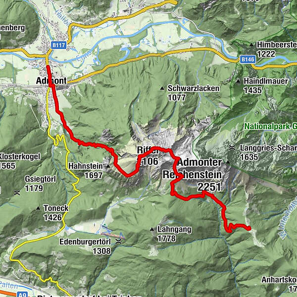
This route not only brings us into the world of the Gesäuse National Park, Austria's youngest national park, but is a truly alpine variation on the main route, which leads via the Kaiserau. The Gesäuse stands for alpine history, and anyone who sets out on this tour will realize why soon after starting in front of Admont Abbey. This alpine variant of the 09th stage on the northern route of the hiking trail "From Glacier to Wine" takes us from Admont over the peaks of the Kreuzkogel with its 2,011 m, the Riffel with 2,106 m and past the peak of the Kalbling - an ascent is possible - with its 2,196 m to the Mödlinger Hut in the midst of the imposing Gesäuse mountains.
- Difficulty
-
difficult
- Rating
-
- Starting point
-
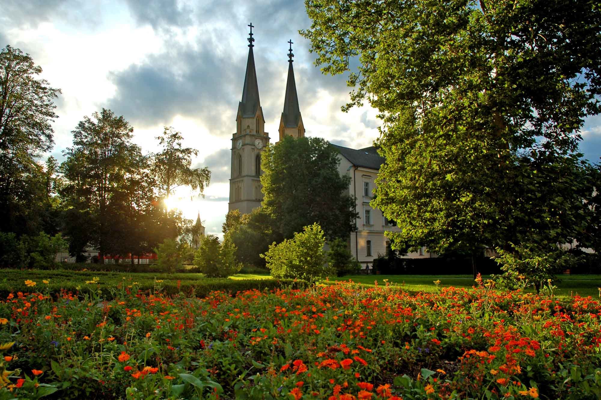
Admont
- Route
-
Admont0.6 kmKematen2.4 kmKematengraben3.4 kmSteinerner Wirt4.9 kmKreuzkogel (2,011 m)7.0 kmRiffel (2,106 m)8.0 kmKalblinggatterl (1,542 m)10.4 kmVordere Flitzenalm11.3 kmMödlinger Hütte15.0 km
- Best season
-
JanFebMarAprMayJunJulAugSepOctNovDec
- Description
-
The Reichenstein group with the peaks Kreuzkogel, Riffel, Kalbling, Sparafeld, Reichenstein and Totenköpfl is one of the most popular mountain massifs for alpinists and especially climbers. The main attraction for climbers is certainly the Kalbling, ideal bases for climbers are the Klinke Hütte and the Mödlinger Hütte, where this stage also takes us.
- Directions
-
A few meters after the start in Admont (Tourist Information Tel. +43 3613 2116010) in front of the monastery of the same name Admont, we keep at the main road before the railroad crossing briefly left and immediately right again to reach the eastern edge of the Oberhofsiedlung in the wooded Kematengraben. Crossing a path and several forest roads, we reach the spring of the Steinernen Wirtes at the foot of the Hahnsteinkante. Here the path becomes increasingly panoramic, leads through mountain pine fields and finally ends in the meadows of the picturesquely situated Scheiblegger Hochalm at 1,660 m above sea level. From this alpine pasture the further tour leads us to the Kreuzkogel, whereby increasingly steeper alpine pastures, which merge into a gully at the top, accompany us to the summit. From here, during a well-deserved rest, we have a fantastic view of the Admont basin with Weng, Hall and Admont, where we started, and the Haller walls on the opposite side.
From the summit of the Kreuzkogel, the trail continues over the striking Riffel ridge to the summit of the Riffel. The crossing is largely no problem for surefooted people, only shortly before the summit the terrain becomes rocky and steep, but a steel rope serves as support here. After a very short descent into Speikboden, the Kalbling-Sparafeldweg is reached. From Speikboden, a marked path leads to the summit of Sparafeld with its 2,247m. If you have time and are fit enough, you should take this detour, because the panorama offered at the summit is unforgettable.
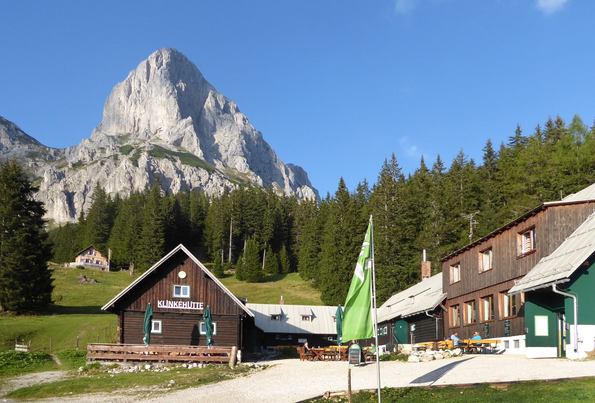
The rest of the trail leads steeply downhill to the Kalblinggatterl, a prominent hiking trail junction east of the Klinke Hut (Tel. +43 3613 2601). Above, at the foot of the rock walls, you will find a beautifully situated bench, which once again offers a wonderful view and retrospective of the tour.
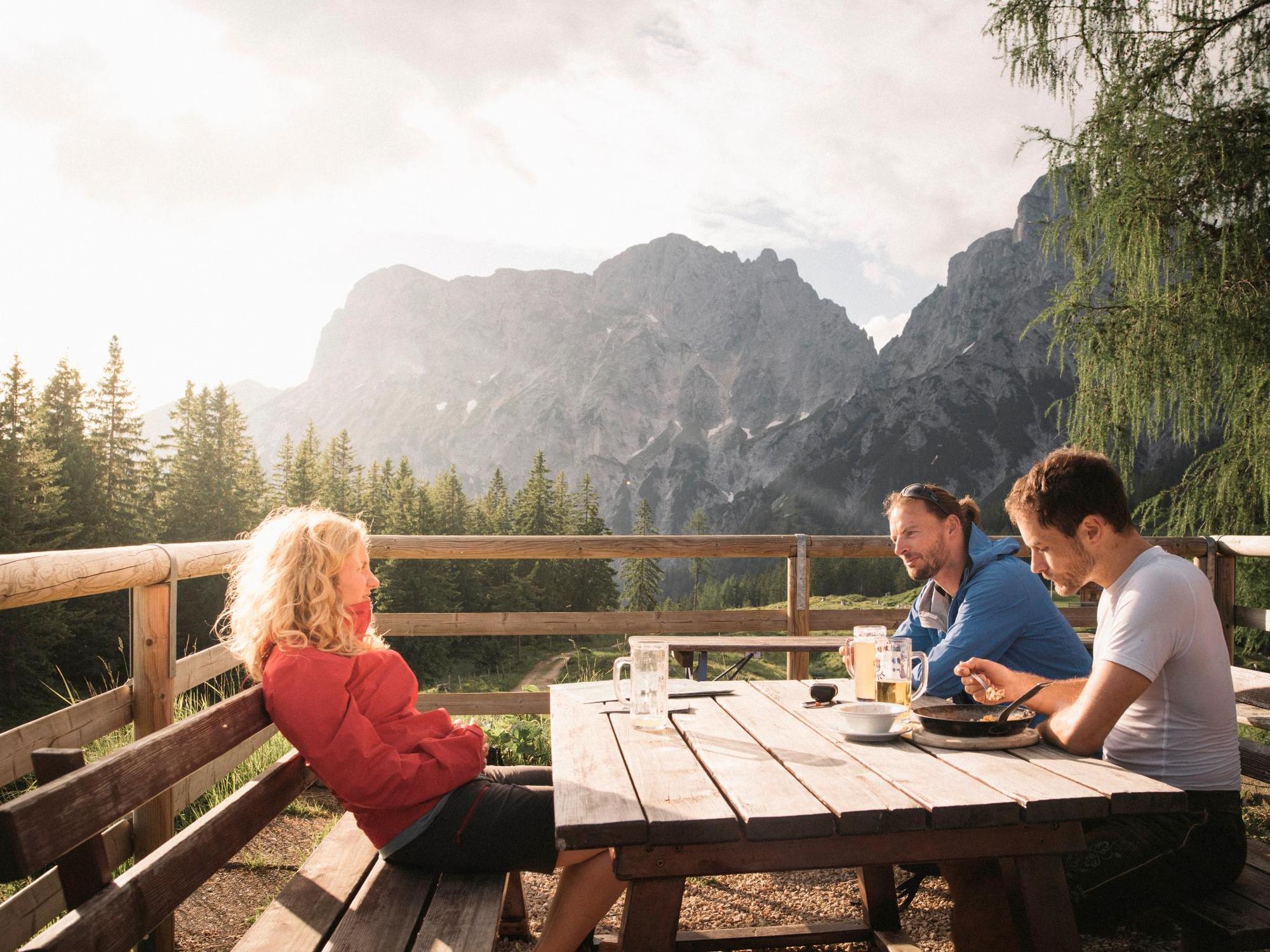
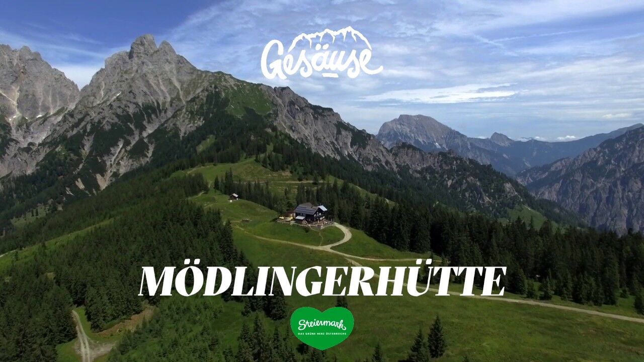
Here at the Kalblinggatterl we meet the main route of the stage from Admont to the Mödlinger Hütte (Tel. +43 680 2057139), our today's stage destination of the hiking route "From Glacier to Wine", which leads from the glacier of the Dachstein to the wine country in the south of Styria. By the way, the double peak of the Admonter Reichenstein, located north of the Mödlinger Hütte, is one of the most popular photo motifs in Styria and should be enjoyed in the evening atmosphere of the Gesäuse mountains. The next morning our tour takes us to the next hut, the Heßhütte in the middle of the Gesäuseberge.
- Highest point
- 2,070 m
- Endpoint
-
Mödlingerhütte
- Height profile
-

- Equipment
-
Proper backpack packing makes many things easier: Pack heavy things first. The water bottle should always be within reach in a side pocket. All the things that are often needed, such as sunglasses, camera or hiking map, belong on top. An emergency kit, including blister plasters, belongs in every rucksack and it is always advisable to dress in layers.
- Safety instructions
-
Emergency call mountain rescue: 140
Tips when reporting an emergency – Answer these six WH questions: What happened? How many people are injured? Where did the accident happen (are there GPS coordinates)? Who is reporting the incident (callback number)? When did the accident happen? What is the weather like at the site of the incident?
- Tips
-
Tip: In spring 2018, a jury and the readers of a major Austrian daily newspaper selected Martina Traisch from the Enns Valley and Manfred Polansky from the Mürz Valley as two "super hikers" who hiked the north and south routes in the summer. You can read about their experiences and adventures at www.steiermark.com/superwanderer: From ideal photo spots to hidden wine cellars in mountain huts. Do you want to follow in the footsteps of Martina and Manfred and also become a "super hiker"? It's very easy: Register at www.steiermark.com/superwanderer and then post your experiences, videos and comments along the hiking route "From Glacier to Wine" - regardless of whether you hike the entire route or just one section. Every 5 stages also beckons a small reward!
- Additional information
-
Steiermark Tourismus
Tel. +43 316 4003
If you would like to hire a tour operator, simply book with Steiermark Touristik, the official travel agency of Steiermark Tourismus:
Tel. +43 316 4003 450,
The Steiermark Touren app, available free of charge on Google Play and the App Store (Android, iOS), offers detailed first-hand information: brief facts (length, duration, difficulty, ascent and descent/elevation gain, ratings), map, route descriptions, altimeter, compass, peak finder, navigation along the tour. You can also create your own personal lists of favourite tours and sites, store tours and destinations offline, use social media channels, and much more.
- Public transportation
-
Accessible by train and bus.
Detailed information about arriving by ÖBB (Austrian Federal Railways) can be found at www.oebb.at or on the Verbundlinie Steiermark website www.busbahnbim.at
With Verbundlinie’s BusBahnBim route planner app, planning your journey has never been easier: simply enter towns and/or addresses, stop names or points of interest to check all bus, train and tram connections in Austria. The app is available free of charge for smartphones – on Google Play and in the App Store
- Parking
-
In Admont, there are numerous parking spaces available at the train station, among other places. Please note any short-stay parking zones.

-

-
AuthorThe tour Stage 09 From Glacier to Wine North Route Alpine Variant Admont - Gesäuse Mödlingerhütte is used by outdooractive.com provided.


General info
-
Gesäuse
2226
-
Urlaubsregion Pyhrn - Priel
1440
-
Kaiserau
293


