- Brief description
-
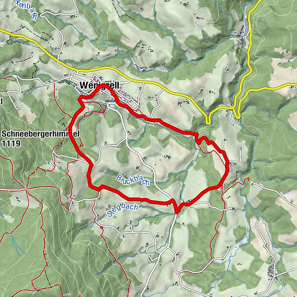
The varied circular trail partly coincides with the Barbara Sicharter Trail.
- Difficulty
-
difficult
- Rating
-
- Starting point
-
Village square Wenigzell
- Route
-
Gasthaus Kristoferitsch0.0 kmWenigzell0.1 kmLafnitzegg3.2 kmJoglland Hotel Prettenhofer8.2 kmWenigzell8.3 km
- Best season
-
JanFebMarAprMayJunJulAugSepOctNovDec
- Description
-
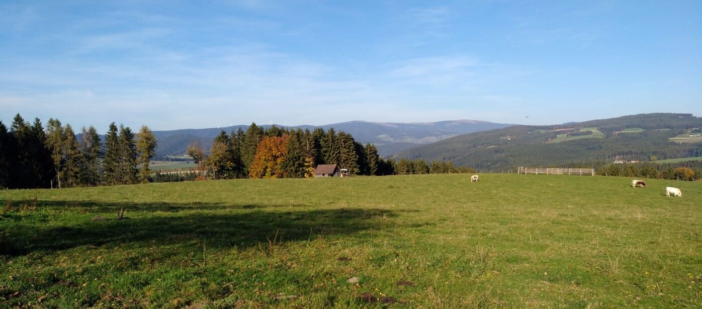
On the scenic hiking trail to Lafnitzegg you can experience the beautiful landscape of Wenigzell as well as great viewpoints.
- Directions
-
We start at the village square, follow the markings and also follow the tracks of the Barbara-Sicharter.
At KFZ-Steiner we turn left, enter a small wooded area (Rehsteig) and continue to the curling hall/ sewage treatment plant.
Across beautiful fields we reach a small bridge where we cross the Haselbach stream, then continue to the right.
Shortly before a pasture - to avoid it - we turn left and have a short steeper forest section ahead of us until we reach the asphalt road.
We pass the farm "Luis am Riegl", "Hans im Lafnitzegg", the carpenter's workshop Hofer (there we leave the Barbara-Sicharter-Weg) and the "Faustenbauer".
After about 200 m on the main road, where we can watch the herd of Murbodner cows grazing, we turn left uphill, past the "Pittermann", towards the "Toten Mann", across fields - what a wonderful view - to "In Reith".
Once on the road, we follow it to the right, after "Hansl in Reith" the middle path. Now we have almost made it and finally get back to the starting point at the village square via "Brunnschneider".
- Highest point
- 910 m
- Endpoint
-
Village square Wenigzell
- Height profile
-

- Equipment
-
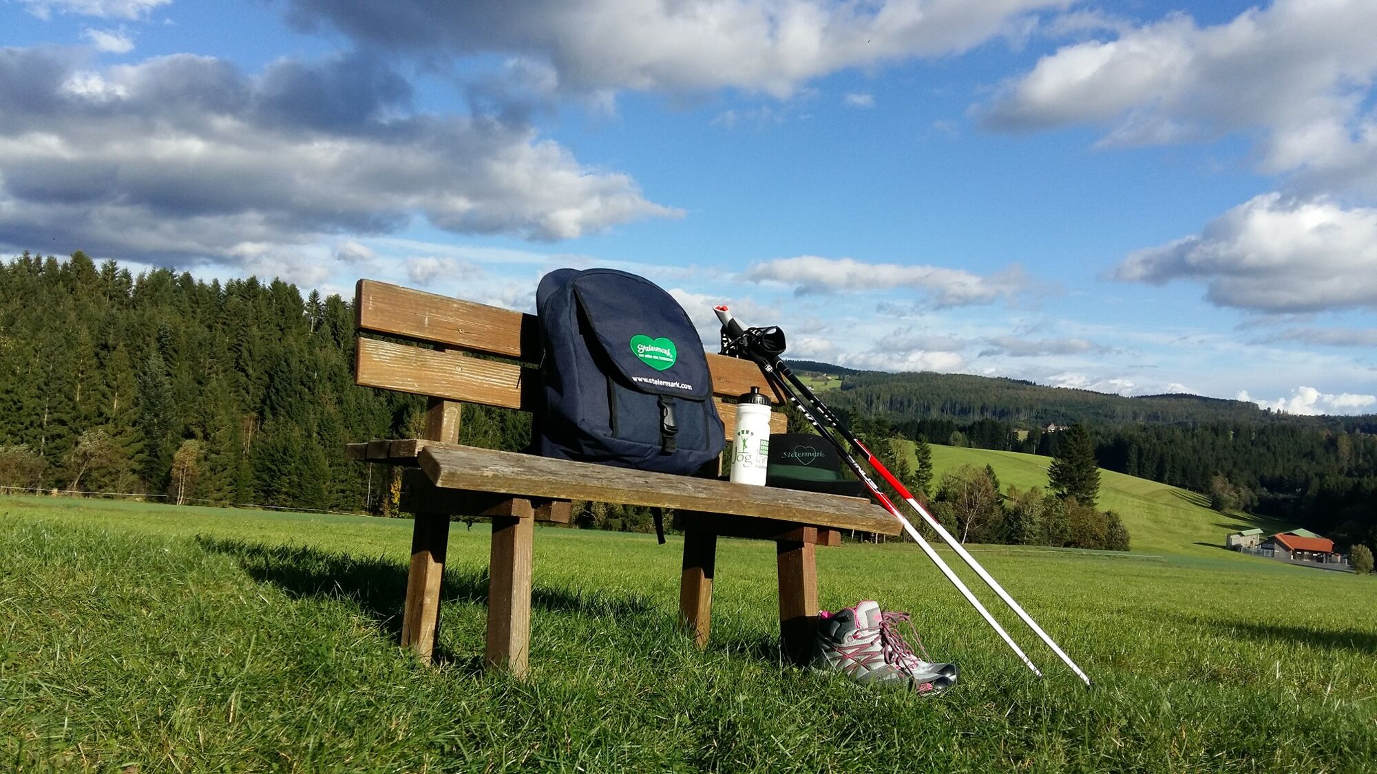
Small rucksack with water bottle (+ provisions)Sturdy shoesAppropriate clothing - if possible several layers - "onion principle".Rain and sun protectionWalking sticks as requiredMobile phoneSmall first aid kitRoute descriptionBefore starting the hike, check the possibilities for refreshments, including opening times, or pack appropriate food and drink.A few tips on correct and fair behaviour in the forest: (Source: www.bundesforste.at )
Hikers should avoid visits to the forest about 1.5 hours before sunrise and after sunset, as wild animals are particularly active during this time.
Plastic bottles, handkerchiefs, cigarette butts etc. have no place in the forest! Please make sure that you do not leave any rubbish in the forest.
Camping and lighting fires are strictly forbidden in the forest!
In principle, every person is allowed to pick 2 kg of mushrooms and berries per day for personal use. It is only prohibited if the forest owner expressly forbids it.
- Safety instructions
-
European emergency call: 112
Emergency call mountain rescue: 140 (if possible please provide GPS data)
Rescue: 144
Fire brigade: 122
Police: 133
A few tips on correct and fair behaviour in the forest: (Source: www.bundesforste.at )
Hikers should avoid visits to the forest about 1.5 hours before sunrise and after sunset, as wild animals are particularly active during this time.
Plastic bottles, handkerchiefs, cigarette butts etc. have no place in the forest! Please make sure that you do not leave any rubbish in the forest.
Camping and lighting fires are strictly forbidden in the forest!
In principle, every person is allowed to pick 2 kg of mushrooms and berries per day for personal use. It is only prohibited if the forest owner expressly forbids it.
- Additional information
-
Information about the region, places to stop for refreshments and overnight stays, excursion destinations, etc., can be found here:
East Styria Tourist Board
Office Joglland-Waldheimat
Church Quarter 24
8255 St. Jakob im Walde
Tel:
Joglland-Waldheimat
Eastern Styria
Current weather
Mobility East Styria with SAM shared taxi
- Arrival
- Public transportation
-
Timetables and travel information can be found at Österreichische Bundesbahnen (ÖBB) or at Verkehrsauskunft Verbundlinie. For local transportation we recommend the SAM-Sammeltaxi Oststeiermark.
- Parking

-

-
AuthorThe tour Circular trail Wenigzell - Lafnitzegg - Wenigzell, No. 2 is used by outdooractive.com provided.


General info
-
Hochsteiermark
4072
-
Joglland - Waldheimat
1511
-
Wenigzell
290