- Brief description
-
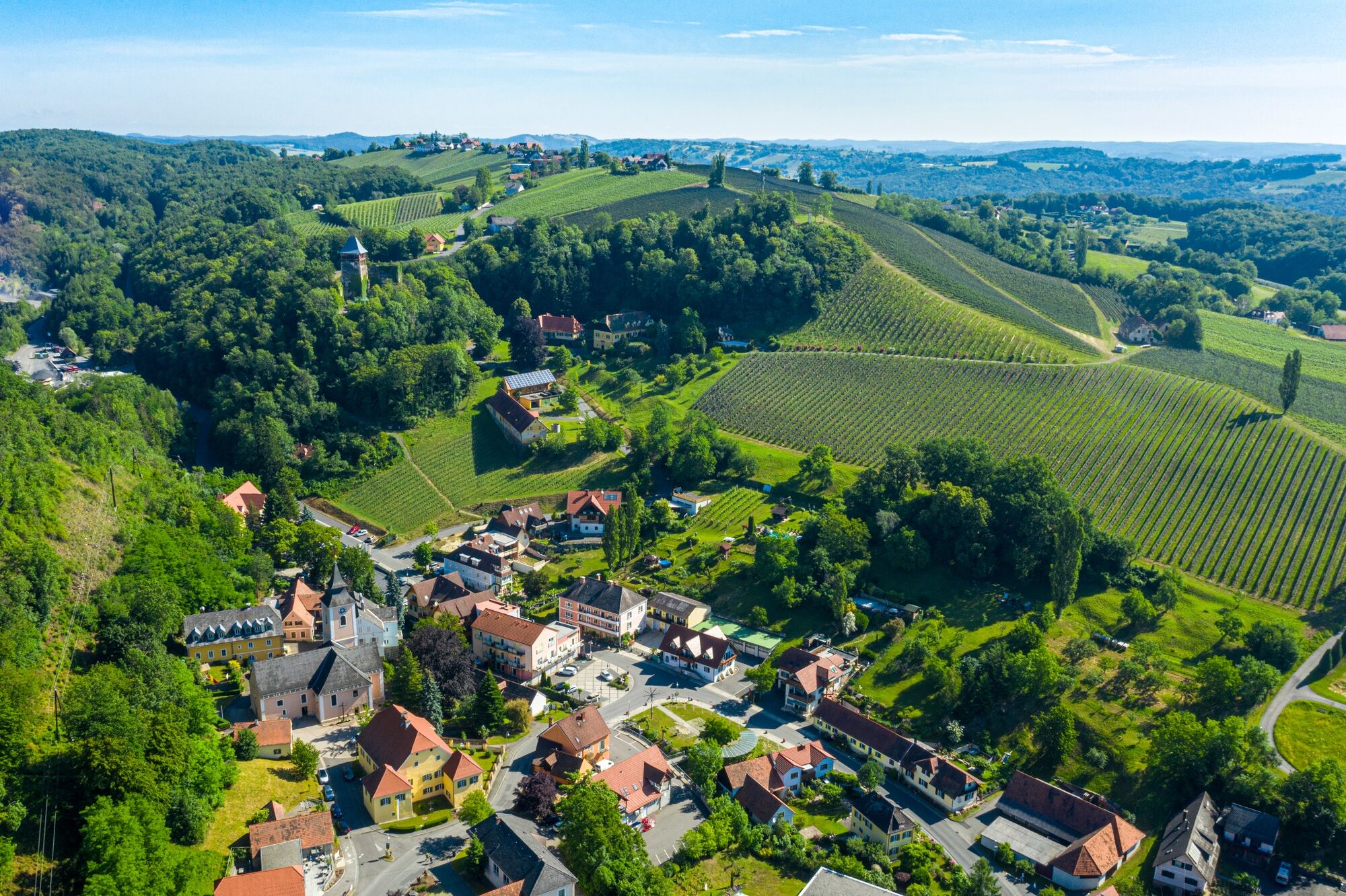
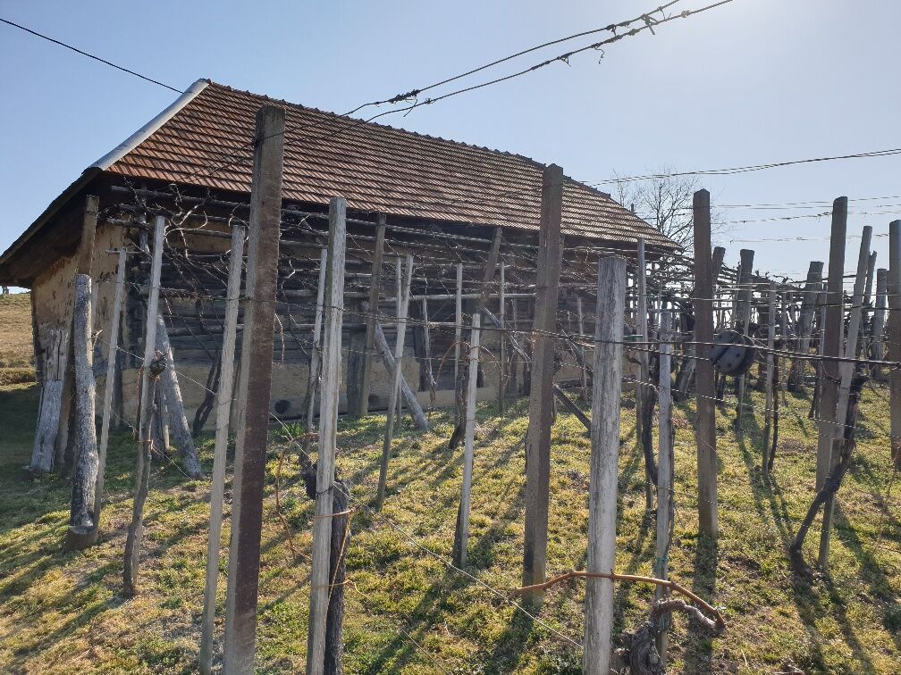
Boundless hiking in the thermal & volcanic land of Styria! Servus! Zdravo! Drop in on your neighbors, experience the countryside and discover farm stores.
- Difficulty
-
medium
- Rating
-
- Starting point
-
Vinothek & Wine Museum Klöch
- Route
-
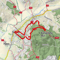
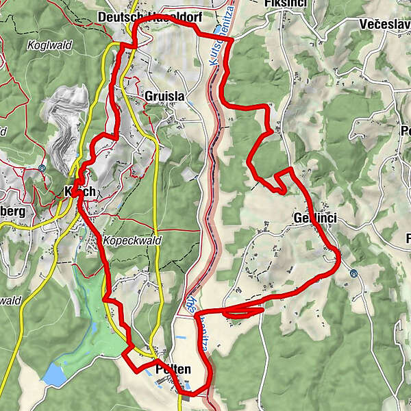
Klöch0.2 kmGustoplatzl1.6 kmPölten3.3 kmizletniška kmetija Kozelinovi7.7 kmJörgelsdorf8.8 kmsv. Anton8.9 kmDeutsch Haseldorf14.0 kmGasthof Weinlandhof14.5 kmKratzer14.9 kmHochwarth15.7 kmBuschenschank Gießauf-Nell16.0 kmRestaurant Klöcherhof17.2 kmKlöch17.3 km
- Best season
-
JanFebMarAprMayJunJulAugSepOctNovDec
- Description
-
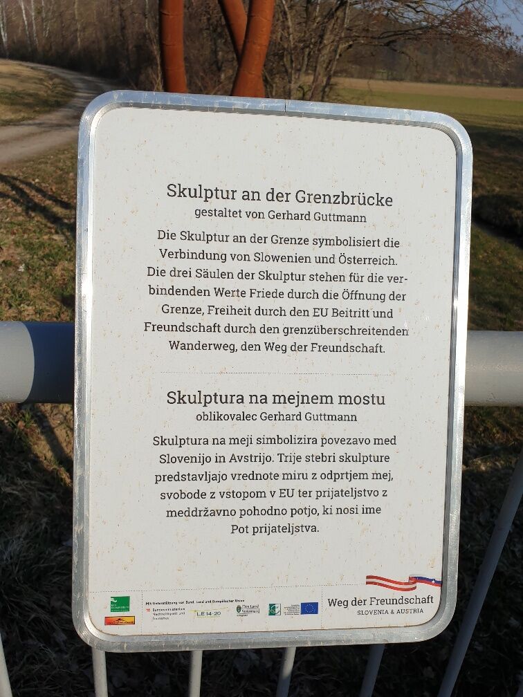
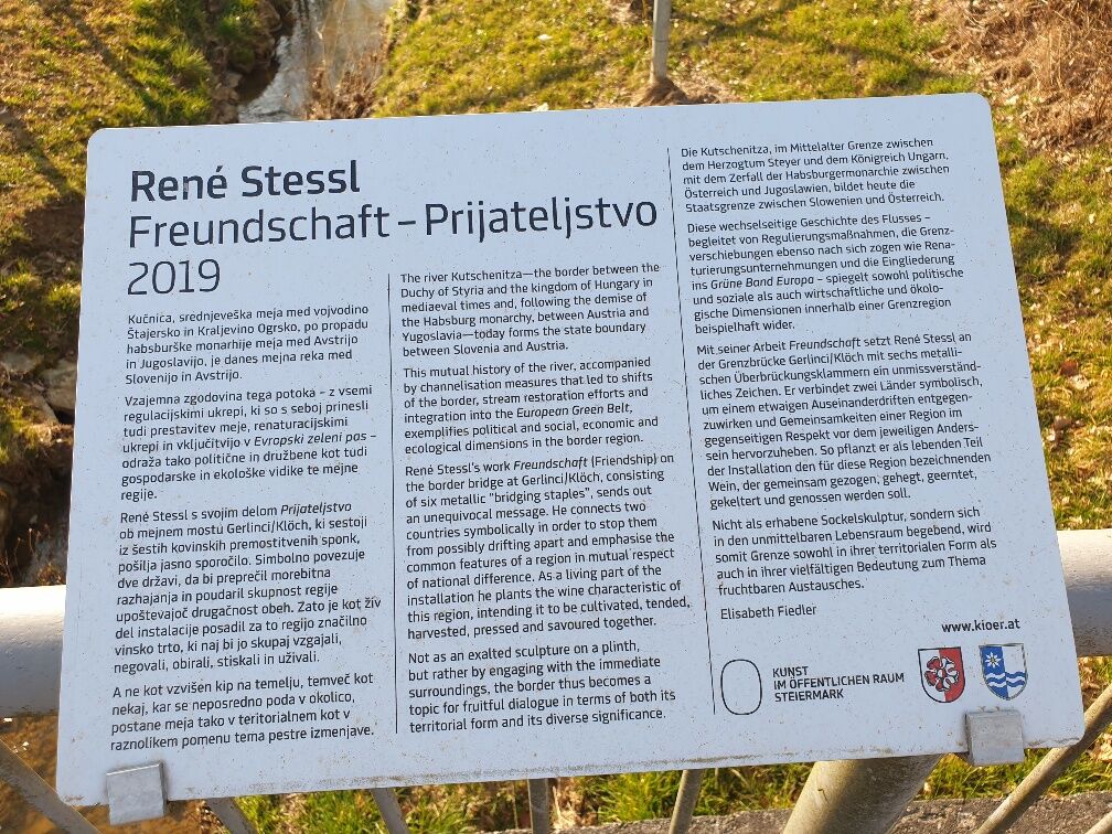
The cross-border 'Path of Friendship' leads from the Vinothek Klöch through the village in the direction of the golf course to the border in Pölten. Over the hill in Slovenia, the trail leads back to Austria. The last stretch via Hochwarth runs parallel to the Traminerweg. The path of friendship was built by the market town of Klöch together with the Slovenian community of Cankova.
- Directions
-
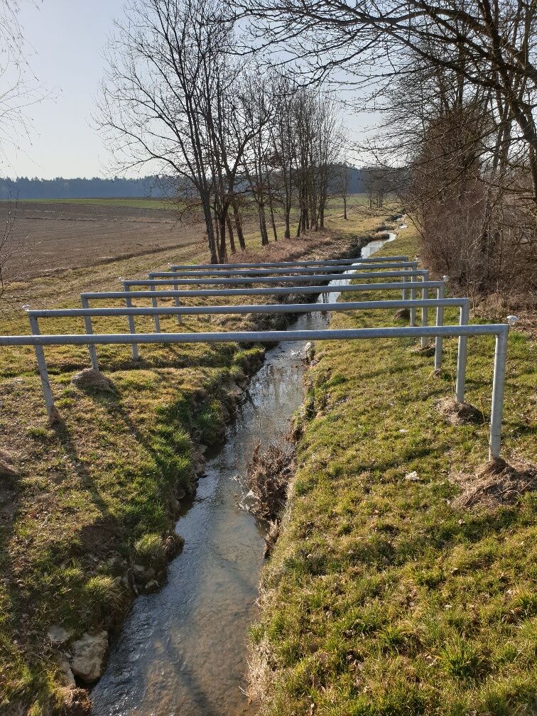
We start at the Vinothek, walk through the village of Klöch to the Pichlerwaldsiedlung. In front of the golf course we turn left into the forest, walk along it for a bit and then come back to the municipal road. 50m down, then turn left, past the "Gustoplatzl" along the ecological strip to the main road. We cross the main road, then turn left and after a few meters turn right. After about 100m we turn left again along the path between the agricultural crops. We then turn left and walk through the village of Pölten, passing direct marketers and refreshment stops. At the end of the village we turn left and walk to the Kutschenitza.
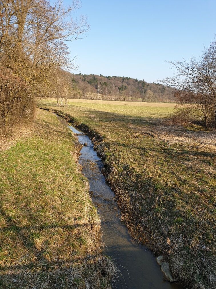
There we turn left again along the gravel path to the border crossing in Pölten. There you have the possibility to choose the shortcut path. This leads us further along the border stream, through the village of Gruisla, where we reconnect with the Klöcher Traminerweg. The second variant is the path across the border bridge to Slovenia. In Slovenia, you walk along the main road for a while, then turn half-right into a forest and continue along the road at the end of the forest, then turn left at the crossroads and walk up the hill to Gerlinci. You pass a wine tavern and an inn, continue through the village until you reach the lookout post at the old elementary school. From there you have a wonderful view. There is again the possibility for a shortcut route, which goes along the road for about 400m, then turns left and rejoins the path.
The 2nd variant leads after the viewpoint left down into the valley, past a bread baker, after a short piece right away into the forest and up to a direct marketer. From there it goes back down the forest, turn right and go along a dirt road past agricultural crops until before the border crossing in Deutsch Haseldorf. We turn left at the road, cross the border bridge and walk through the village of Deutsch Haseldorf past refreshment stations. At the end of the village we turn half-right, walk next to the vineyards up the hill to the main road. There you are rewarded with a magnificent view. Cross the road and turn left towards Weinlandhof, where we rejoin the Klöcher Traminerweg. This leads us to the Hochwarth, down to the castle ruins in the village of Klöch to the Vinothek.
Start: Vinothek Klöch direction golf course / Pölten
- Highest point
- 396 m
- Endpoint
-
Vinothek & Wine Museum Klöch
- Height profile
-

- Equipment
-
Proper backpack packing makes many things easier: Pack heavy things first. The water bottle should always be within reach in a side pocket. All the things that are often needed, such as sunglasses, camera or hiking map, belong on top. An emergency kit, including blister plasters, belongs in every rucksack and it is always advisable to dress in layers.
- Safety instructions
-
Emergency call mountain rescue: 140
ambulance: 144
European emergency call: 112
firefighters: 122
police: 133Tips when reporting an emergency – Answer these six WH questions: What happened? How many people are injured? Where did the accident happen (are there GPS coordinates)? Who is reporting the incident (callback number)? When did the accident happen? What is the weather like at the site of the incident?
- Tips
-
Plan the viewpoint to Gerlinci, with great views of southeast Styria, as a rest stop!
- Additional information
- Directions
-
coming from Vienna: A2 to exit Ilz, continue on L 319 to Großwilfersdorf and L454 and L207 to Fehring and L204 via Kapfenstein and St. Anna am Aigen to Klöch
coming from Graz: A9 to exit Vogau or Gersdorf, continue on the federal or state road to Halbenrain and L234 to Klöch
- Public transportation
-
Detailed information about arriving by ÖBB (Austrian Federal Railways) can be found at www.oebb.at or on the Verbundlinie Steiermark website www.busbahnbim.at
With Verbundlinie’s BusBahnBim route planner app, planning your journey has never been easier: simply enter towns and/or addresses, stop names or points of interest to check all bus, train and tram connections in Austria. The app is available free of charge for smartphones – on Google Play and in the App Store
- Parking


- Author
-
The tour Path of friendship (Weg der Freundschaft) is used by outdooractive.com provided.


General info
-
Südsteiermark
1130
-
Region Bad Radkersburg
215
-
Klöch
83