


- Brief description
-
Valley hike along side streets, forestry tracks and a path, then the route ascends to the Tauplitzalm over well-marked forest trails.
- Difficulty
-
medium
- Rating
-
- Starting point
-
Bad Mitterndorf - church square at the Hotel Post
- Route
-
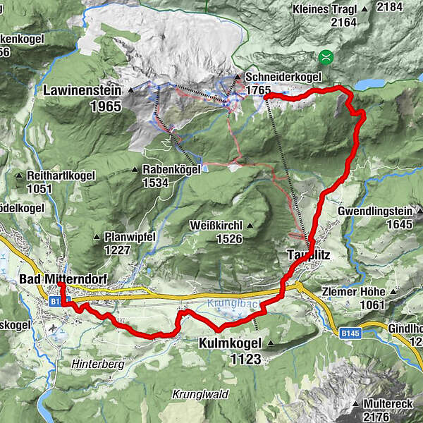
Pfarrkirche zur hl. Margareta0.0 kmBad Mitterndorf0.1 kmKrungl4.6 kmFurt7.9 kmTauplitz8.9 kmFreiberg Rast10.8 kmAlmrausch Hütte14.4 kmTauplitzalm15.6 kmFilialkirche Hl. Dreifaltigkeit16.1 kmBergstation16.4 km
- Best season
-
JanFebMarAprMayJunJulAugSepOctNovDec
- Description
-
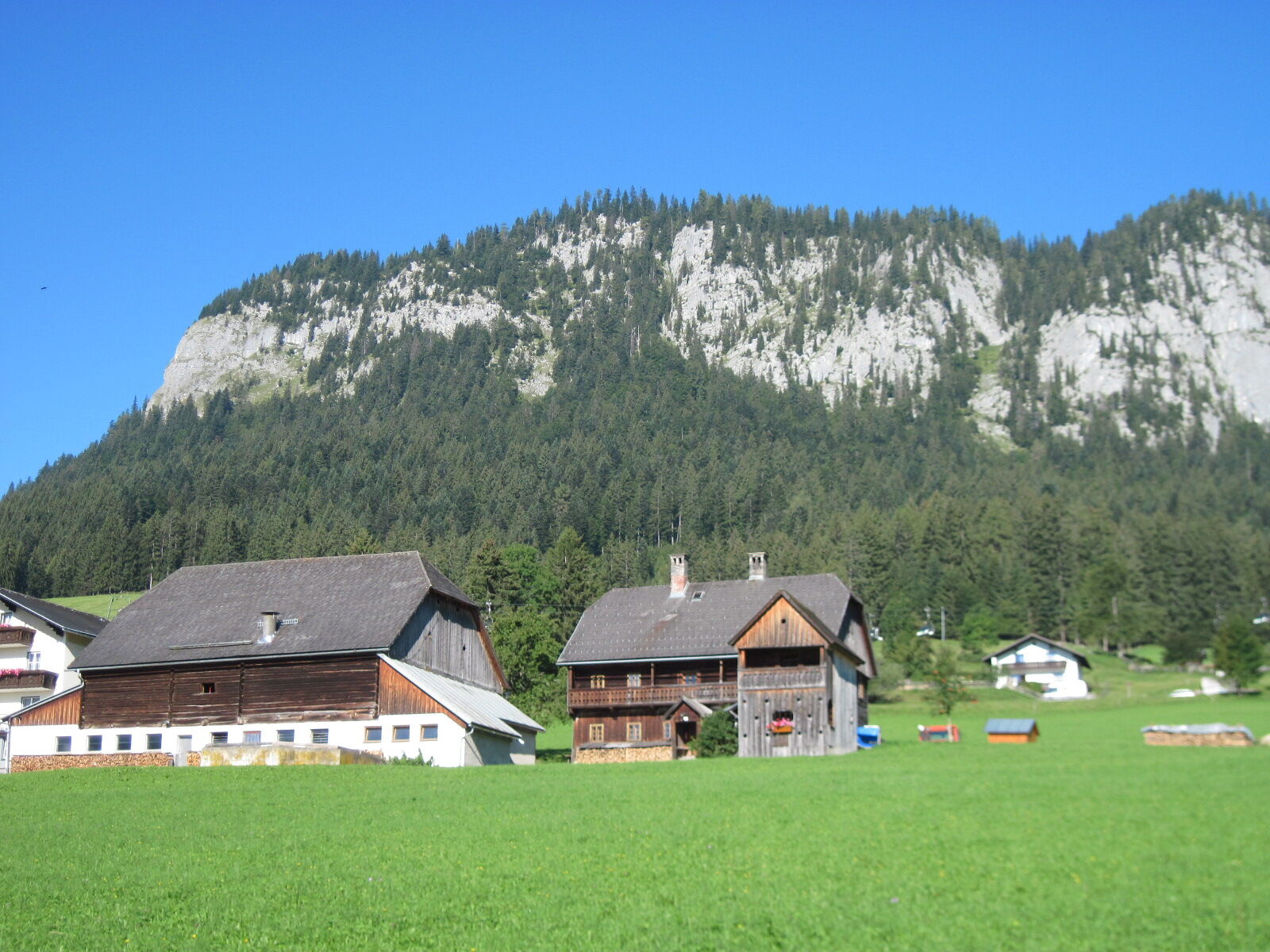
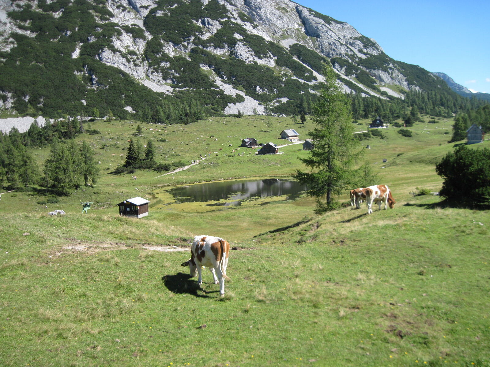
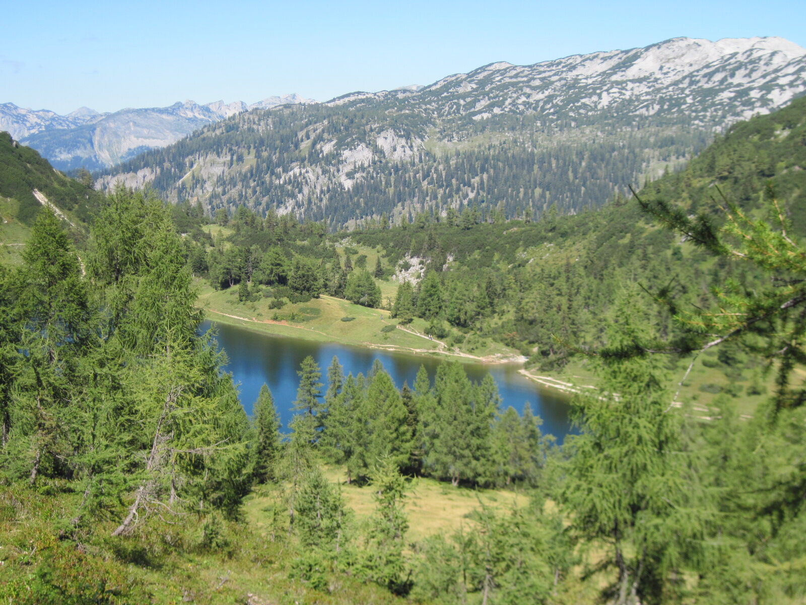
Just like the green foothills of the Dachstein Mountains, the Salzkammergut BergeSeen Trail also crosses the “alpine balcony” in the southern section of the Totes Gebirge Mountains. However, prior to ascending to the Tauplitzalm Meadow located at 1600 metres, which is considered the cradle of skiing in the Eastern Alps, you first explore the broad, flat valley floor between Bad Mitterndorf and Tauplitz. The “Hinterberg”, as this transition from the Salzkammergut to the Enns Valley is called, is also characterised by winter sports: at Kulm you will find one of the largest ski jumps in the world.
- Directions
-
From the bus stop at the square below the parish church of Bad Mitterndorf, go south past the church stairs. Follow Koglergasse until you reach the underpass of the state highway. At the end of the path, turn left onto a trail that leads you to a railroad crossing.
Follow Neuhofenstraße until the first turnoff towards the heating plant. At the end of a small section of forest, turn right onto a road through a wooded area and over the Zauchen Stream. At a neighbourhood, cross Hörmannweg and continue hiking through level forest terrain. From the hamlet of Graben, go left on Krunglgrabenweg into the neighbourhood of Krungl (818 m).
At Hotel-Gasthof Kanzler, turn right in the direction of “Bahnhof Tauplitz” (sign for bike path R 19) and walk along the narrow asphalt street between fields towards the unmistakable cliff face of the 2351-metre-high Grimming Mountain. Below the Kulm Farm, go left towards “Furt, Tauplitz” and to the outrun area of the ski jump at Kulm, which is bypassed with a short left-hand curve (to the left you find the high moor of the wetlands). Continue briefly along the edge of the valley floor following the trail marker “Tauplitz”. Then go left to the Krunglbach Stream and the adjacent railroad underpass. After the underpass, go to the bypass road, which is also crossed underneath. Continue on Steinfeldweg through the neighbourhood of Furt and on Furthleitenweg into the village centre of Tauplitz (896 m). 2:30 h
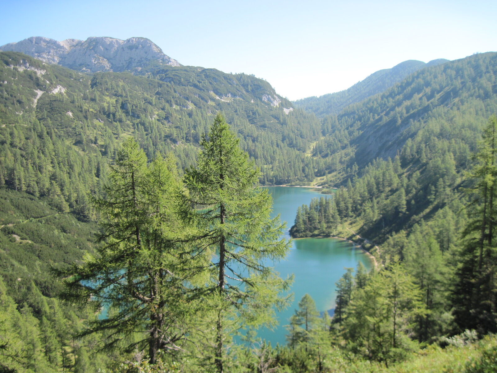
Take Pötschnergasse to the car park at the valley station of the Tauplitz Chair Lift. Above it, turn left onto Hollamweg, from which you turn right onto Freibergweg after a curve to the left. Where this lane makes a sharp right, the route continues straight ahead along a gravel road and uphill over a meadow. After 1 kilometre you reach the asphalted Gnanitzweg on the right at a wood storage area. Turn left onto Gnantizweg and after approximately 200 metres, hiking trail no. 275 (sign “Steierersee, Linzer Tauplitzhaus”) begins to the left. The trail ascends – crossing two forest roads – through a continuously narrowing forest ravine to a meadow of the Niederblas and turns left over steep mixed-forest slopes up into the Lahner Ravine. Finally, hike through a sparse larch forest on the high ridge between the Mitterberg and Tauplitzalm (1520 m). High above Lake Steirersee, go left to the nearby Steiersee huts and continue uphill a short distance along the gravel road to the plateau of the Tauplitzalm mountain station (1645 m). To the left is the Linzer Tauplitzhaus of the Alpine Association. The asphalted road leads straight ahead for about 500 metres to the Naturfreundehaus Tauplitzalm and to other inns and accommodation facilities. There you will once again cross the long-distance Styrian hiking trail “From Glacier to Wine”. 2:30 h
- Highest point
- 1,648 m
- Endpoint
-
Tauplitz - On the high plateau Trauplitzalm
- Height profile
-

- Equipment
-
For all stages, you will need hiking or mountain boots with treaded rubber soles as well as wind- and rainproof clothing. A change of clothes and a small first-aid kit should also be included in your backpack. The amount of provisions you should pack depends on the number of available rest stops. In any case, you should always take along plenty to drink. Telescopic poles are helpful, especially when walking downhill.
- Safety instructions
-
In alpine terrain, be aware of the danger of falling rocks.
Through early summer, you may encounter steep snowfields or firn gullies – especially during icy conditions, there is an acute risk of falling and thus fatal injury!
Due to storm damage, forestry work or construction work, individual trail sections may be difficult or impassable at times.
Cows in the alpine meadows are often curious. Because they are nursing mothers, they develop a strong tendency to protect their calves. Therefore, move through cow pastures quietly, keep at least 20 metres of distance to the animals and never pet calves! In the case of threatening behaviour (pawing, stamping) slowly back away (do not turn your back). Keep dogs on a leash. They must not bark at or chase cows. In the case of an attack, the dog must be released from the leash. - Tips
-
Note: Bus connection (Line 950) from Bad Mitterndorf to Tauplitz.
Note: The Tauplitzalm four-seater chair lift operates daily starting at 8:30 AM from the beginning of July to mid-September weather permitting. Bus connection Bad Mitterndorf – Tauplitzalm between the end of May and the end of September (not on Sundays and holidays except for 15.08.)
Summit detour: To the Traweng (1981 m) – see Tour G8, page 254.
- Additional information
-
Text kindly provided by the publisher KOMPASS-Verlag and Wolfgang Heitzmann.
Further information at trail.salzkammergut.at

- Author
-
The tour BergeSeen Trail 18: Bad Mitterndorf - Tauplitzalm is used by outdooractive.com provided.


General info
-
Ausseerland - Salzkammergut
3382
-
Gröbminger Land
1190
-
Tauplitz
305


