
- Brief description
-
Enjoyable tour through Seckau and a leisurely variant up the Tremmelberg.
- Difficulty
-
medium
- Rating
-
- Starting point
-
Seckau
- Route
-
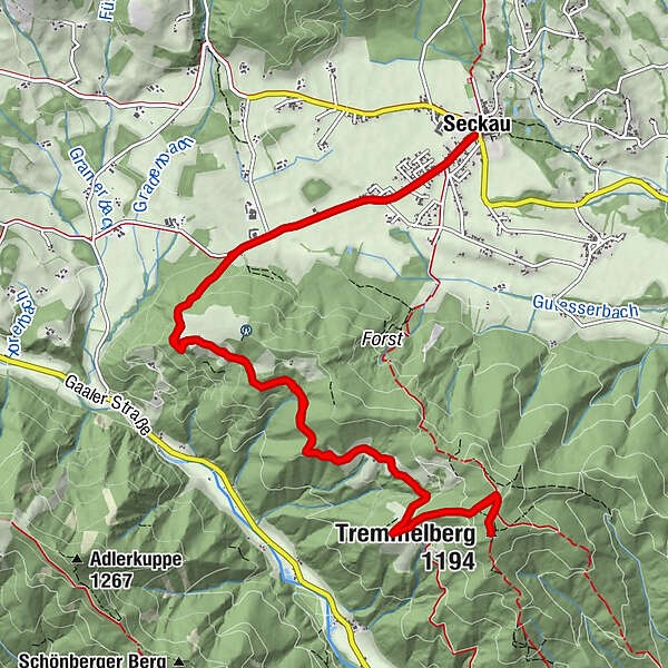
SeckauFriedhofskapelle0.1 kmLuciakapelle0.1 kmGasthaus Puster "Zur Post"0.1 kmHl. Dreifaltigkeit1.9 kmTremmelberg (1,194 m)7.7 kmHl. Dreifaltigkeit13.2 kmGasthaus Puster "Zur Post"15.3 kmSeckau15.3 kmFriedhofskapelle15.4 kmLuciakapelle15.4 km
- Best season
-
JanFebMarAprMayJunJulAugSepOctNovDec
- Description
-
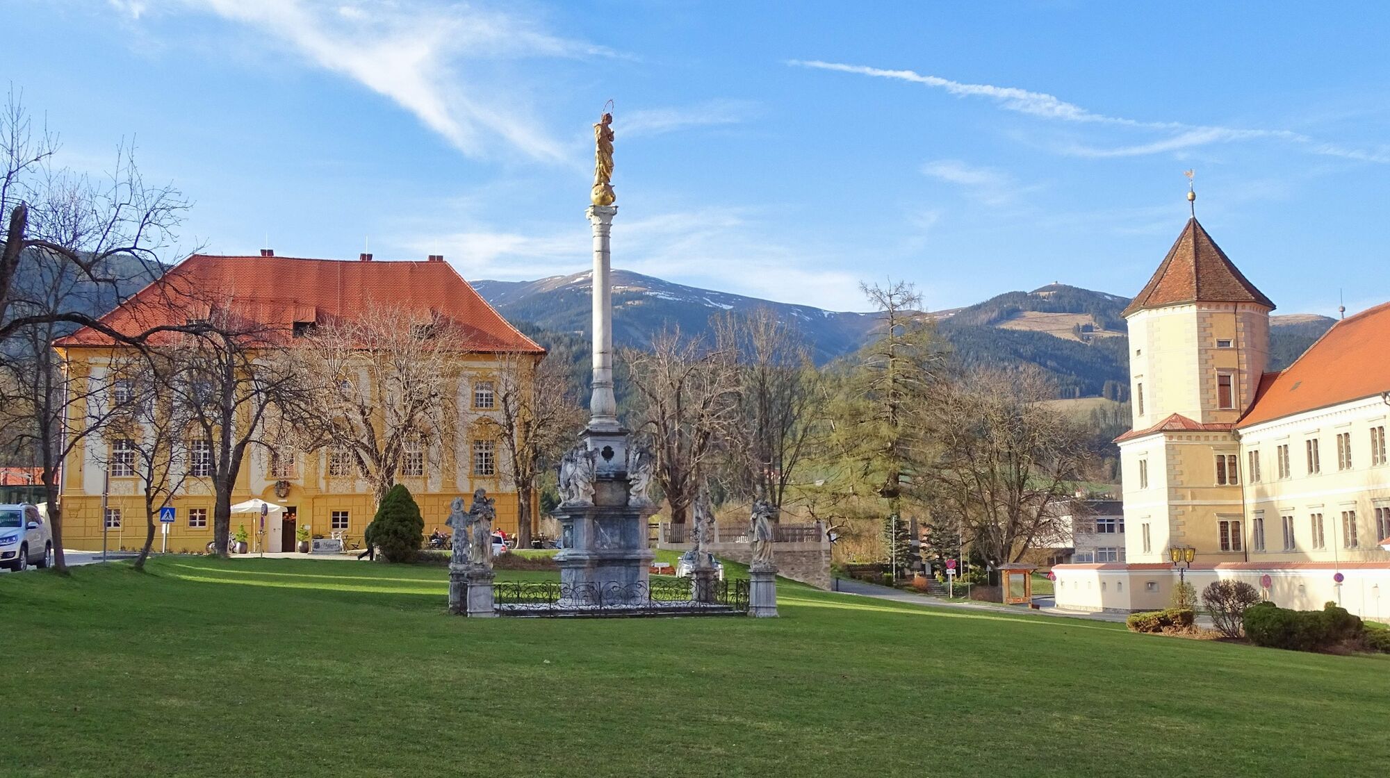
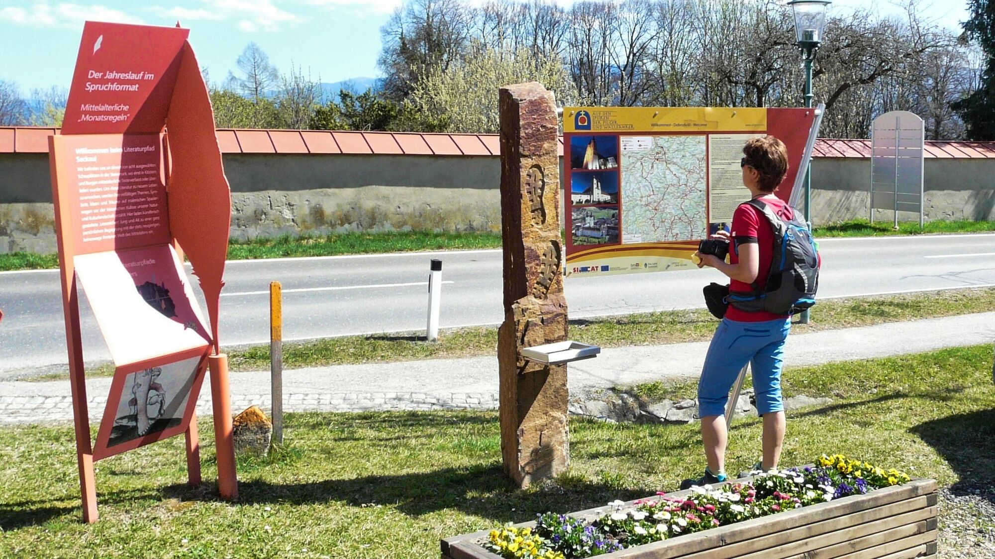
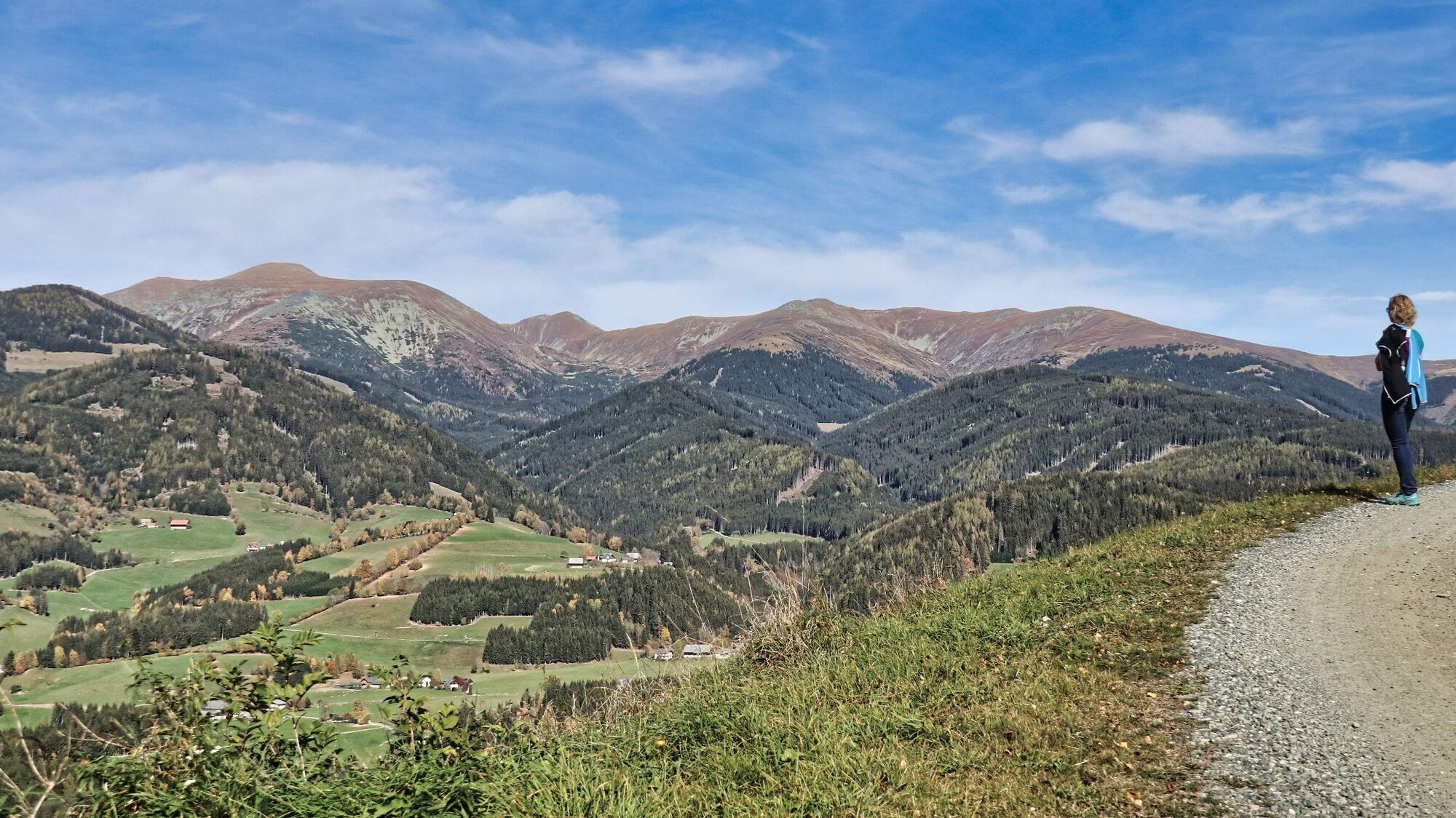
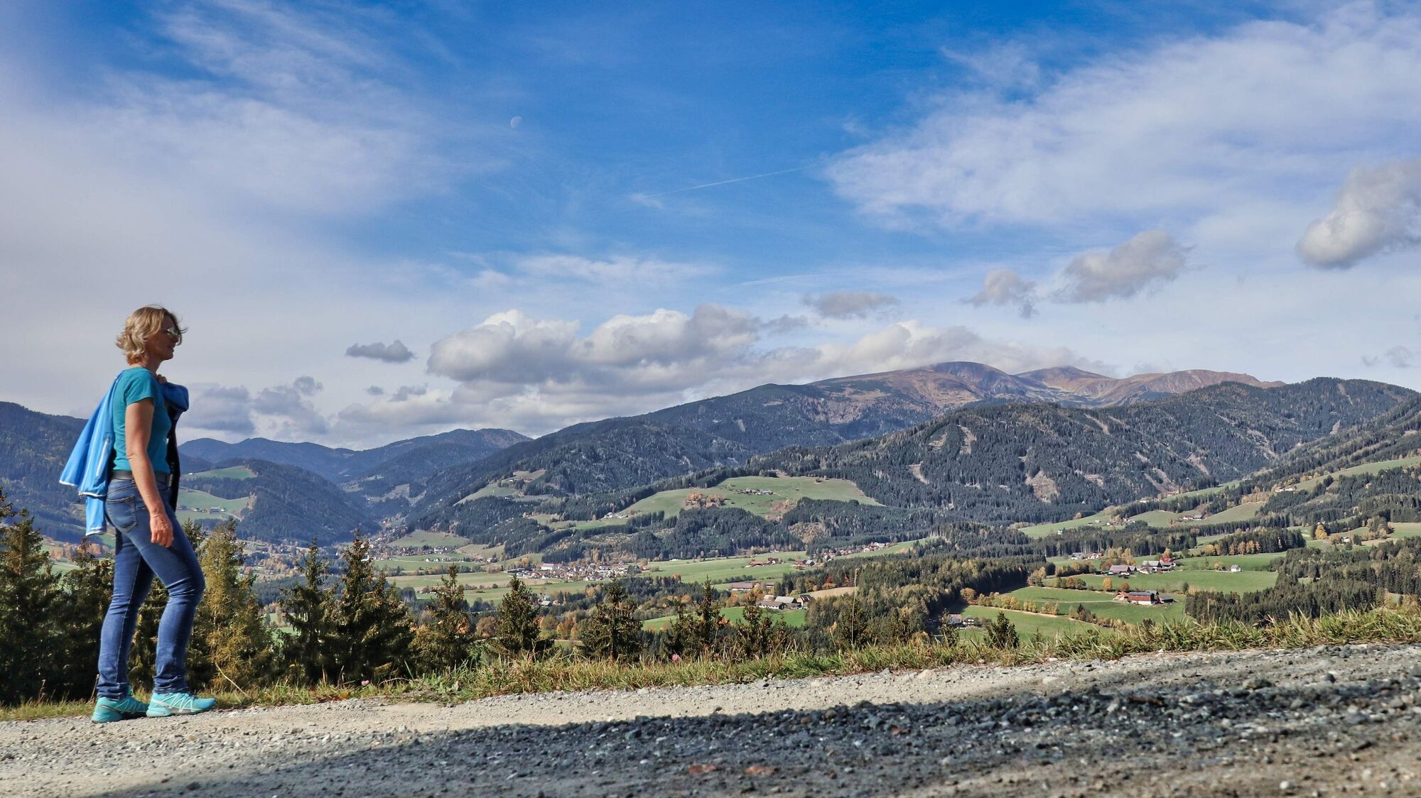
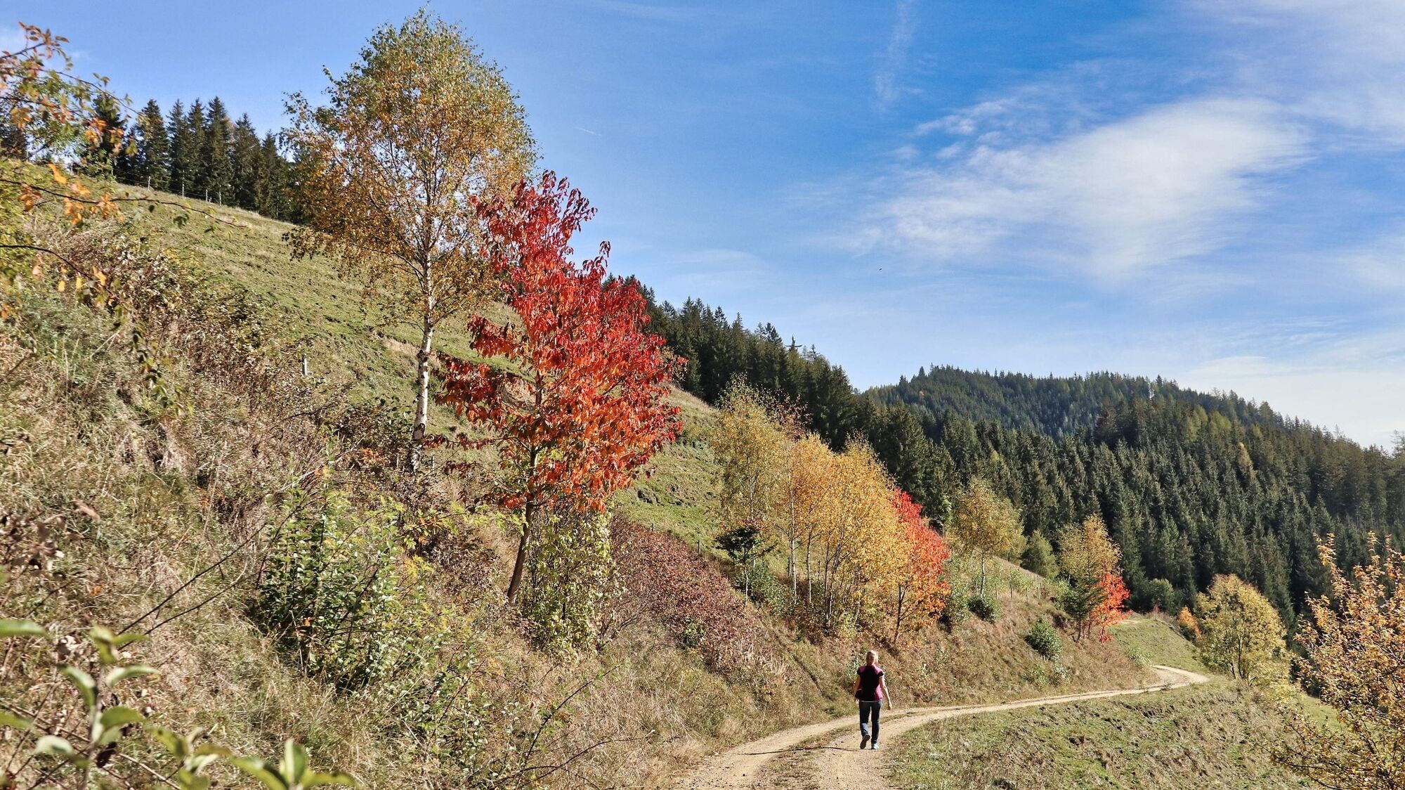
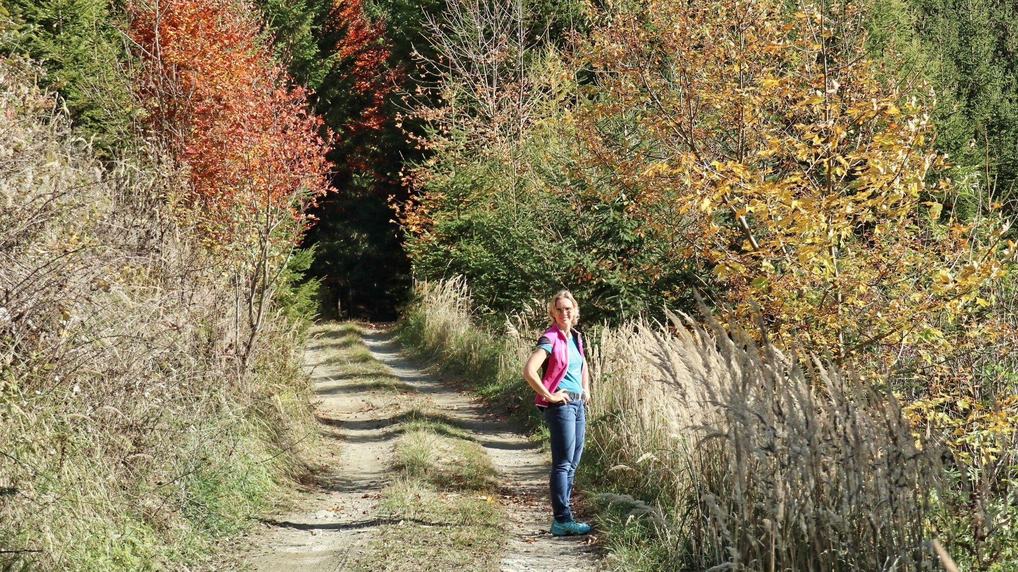
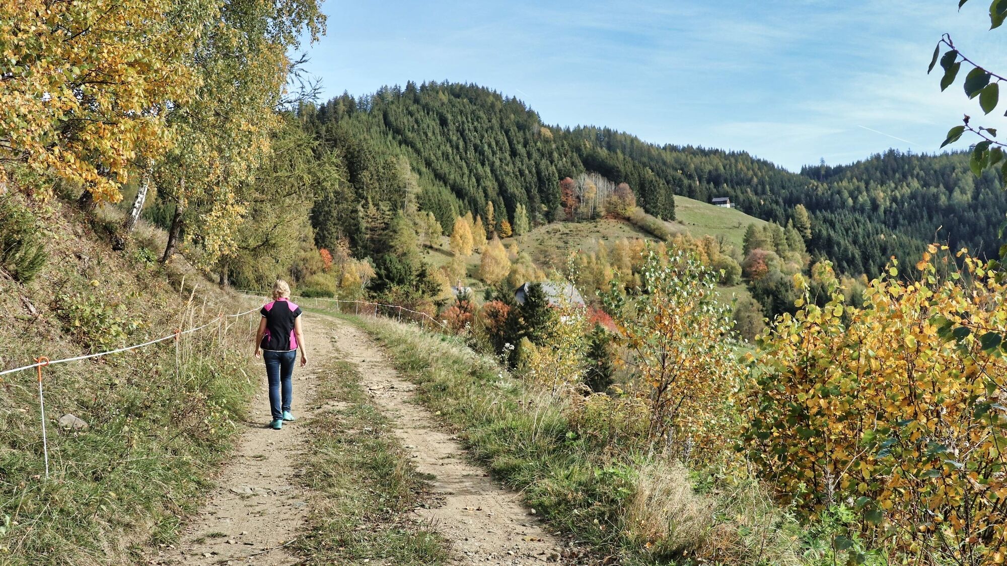
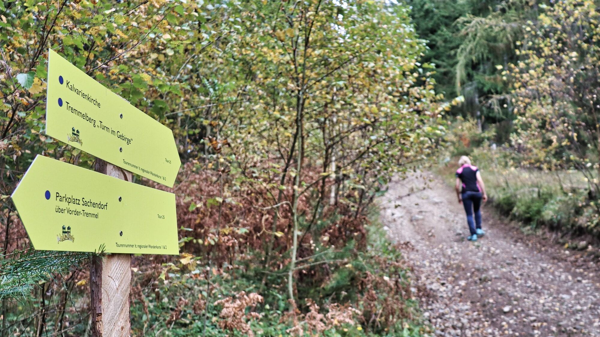
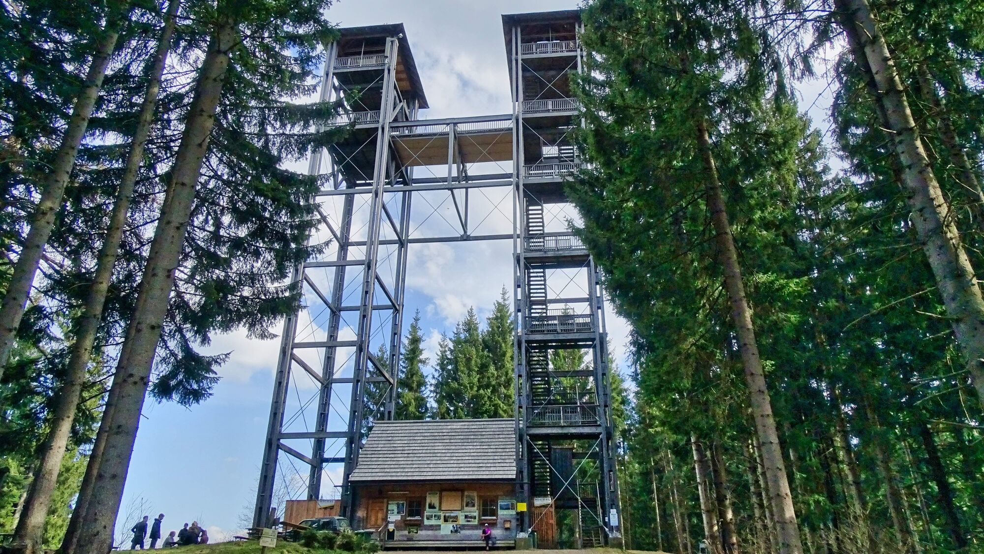
The village of Seckau is a wonderful starting point, so you should plan some time for the town center before or after the hike, as it is a particularly good place to combine culture and enjoyment. The impressive grounds of the Benedictine abbey, the ambience and culinary delights of the Hofwirt and the specialties of the Regner patisserie are the highlights of the market town. While still in the village, you pass one of the most artistically valuable baroque wayside shrines in the Murtal region - the dyer's cross, which stands in front of the former (namesake) dyer's house. During the hike, you get to know the village and the surrounding area of Seckau and enjoy beautiful views of the Seckau Alps, the Styrian Randgebirge and the Seetal Alps. This hike is exclusively on roads, with the majority of the route being on gravel roads. It climbs steadily up to the 1194 m high Tremmelberg. However, the destination of the hike should be the 42 m high "Turm im Gebirge" observation tower (turnstile for ascent: €2 fee, winter closure from November to March), which was built in 1999.
- Directions
-
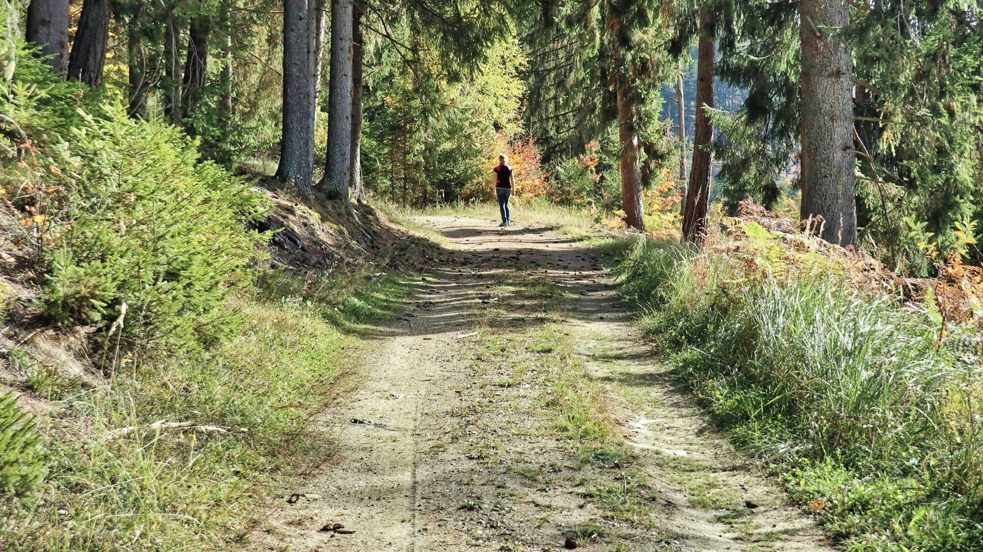
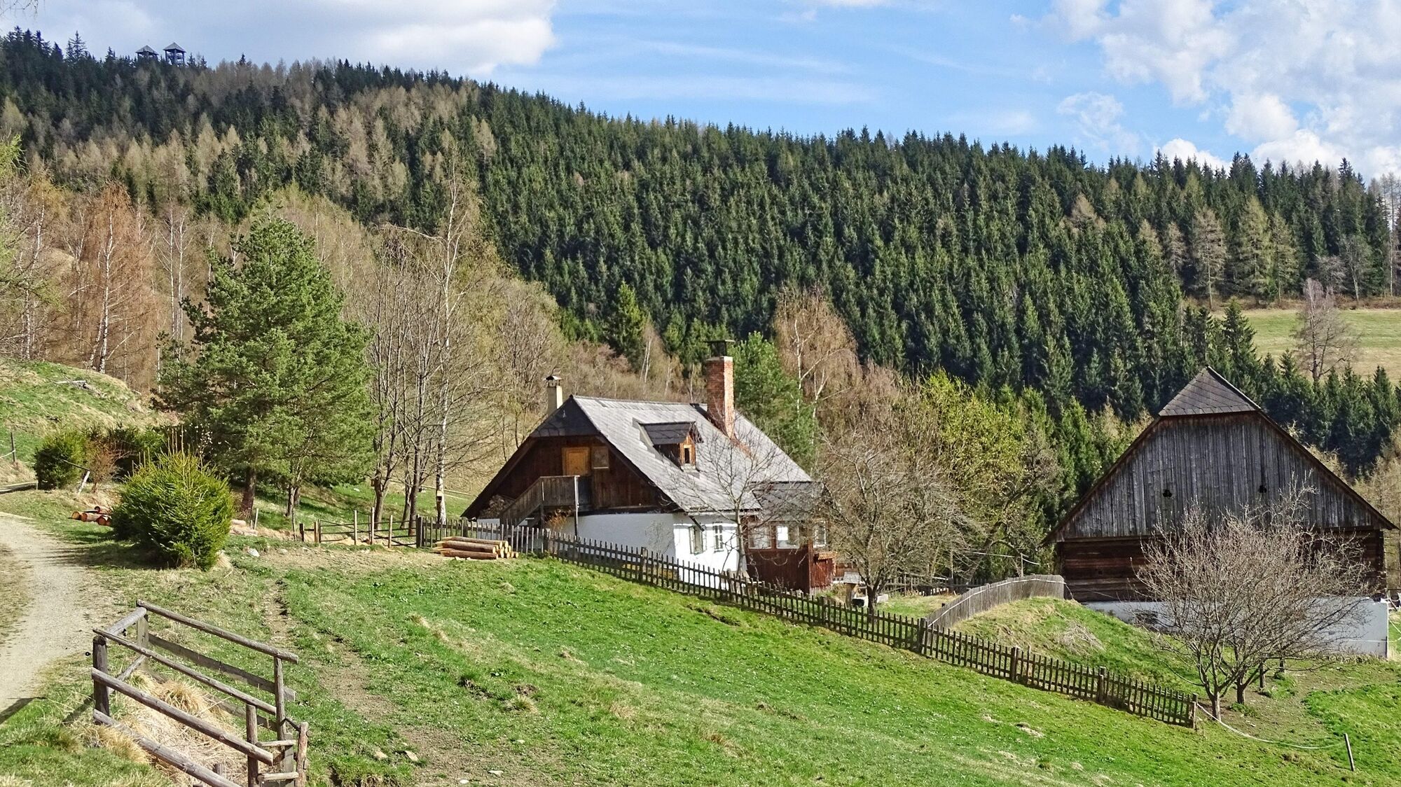
We start at the parking lot in Seckau (1), 843 m, which means we are right in the center of Seckau, where the monastery, the municipal office and the Hofwirt are located. The hiking trail leads directly past the JUFA Seckau in a south-westerly direction. After the Regner pastry shop, we come to a crossroads with a striking wayside shrine - the Färberkreuz. We keep straight on and follow the road for approx. 2 km. After the Hacknerhof (Offenbacher family), the asphalt road leads slightly downhill and then a road branches off to the left. We follow this access road, which leads comfortably uphill for approx. 1 km, first through the forest and then across meadows to the farm vlg. Willhuber farm (2), 1013 m. At the farm we walk directly between the house and the farm and follow the forest road, which continues here. Now the trail continues gently up and down along the forest road to the Hube vlg. Hinter-Tremmel (3), 1010 m. From Hinter-Tremmel, we hike approx. 1 km mainly through the forest until we reach the turn-off to the left towards Tremmelberg. Here too, the hiking trail follows a forest road. We follow this and pass a red barrier and then a wooden barn. Shortly afterwards, we reach a fenced-in crossroads, which we walk past on the right. This is where the steeper section of this hike begins. We follow the narrow gravel road, which leads uphill in a single line. Just before our destination, the road joins the wide forest road, which is also used as a private access road for the Tremmelberg. Here we turn left and follow the road, which leads slightly uphill to the Tremmelberg (4), 1194 m, and the "Turm im Gebirge" observation tower. The way back is the same as the ascent route. A steeper alternative descent is via the Calvary Church (see hike "Tremmelberg via Calvary Church").
- Highest point
- 1,189 m
- Endpoint
-
Seckau
- Height profile
-

- Equipment
-
Backpack with rain cover Telescopic / hiking poles Mountain / hiking boots Gloves: waterproof and warming Headgear / sunglasses Outerwear: Onion layer system, T-shirt, sweater, jacket and winter jacket with hood Hiking pants Seat pad Drinking bottle / thermos flask (on cooler days a warming drink is pleasant) Snack First aid kit with blister plaster and tick tongs
Other important equipment
Route descriptionDetailed plan of the hike Hiking map: For overview a map in scale 1 : 50 000 of the respective region GPS device cell phone - Safety instructions
-
For a conflict-free coexistence on alpine pastures and meadows it is important to observe a few rules, especially when traveling with dogs. (Source: www.sichere-almen.at - 06/2021) Avoid contact with grazing animals, do not feed them, keep a safe distance! Keep calm, do not frighten grazing animals! Mother cows protect their calves. Avoid encounters between mother cows and dogs! Always keep dogs under control and on a short leash. If an attack by a grazing animal is foreseeable: Immediately unleash! Do not leave hiking trails on alpine pastures and meadows! If grazing animals block the way, avoid them as far as possible! When grazing animals approach: Stay calm, do not turn your back, avoid the animals! Leave the grazing area quickly at the first sign of restlessness of the animals!Fences must be respected! If there is a gate, use it, then close it well and cross the pasture quickly! Treat the people working here, nature and the animals with respect!
A few tips for correct and fair behavior in the forest: (Source: www.bundesforste.at - 6/2021)
Hikers should avoid visits to the forest about 1.5 hours before sunrise and after sunset, as wildlife is especially active during this time. Plastic bottles, handkerchiefs, cigarette butts & Co have no place in the forest! Please make sure that you do not leave any trash in the forest. Camping and making fire - is strictly forbidden in the forest! In principle, each person is allowed to collect 2 kg of mushrooms and berries per day for personal use in the forest. It is only forbidden if the forest owner expressly forbids it.Alpine emergency call:
Mountain rescue emergency number: 140
EU emergency number: 112
Weather service: www.zamg.ac.at
Direct link mountain weather Styria: https://www.zamg.ac.at/cms/de/wetter/produkte-und-services/bergwetter/steiermark
- Tips
-
Don't forget a 2-euro coin for the turnstile. Tower ascent closed in winter from November to March.
- Additional information
-
Hotel Hofwirt, Tel.: +43 3514 54290, Seckau 3, 8732 Seckau, www.hotel-hofwirt.at
Jufa Hotel Seckau, Tel.: +43 57083-270, Seckau 2, 8732 Seckau, www.jufahotels.com
Cafe Konditorei Regner, Tel.: +43 3514 5207, Seckau 39, 8732 Seckau, www.lebkuchen-regner.at
Adeg Markt Pressler, Tel.: +43 3514 53100, Seckau 121, 8732 Seckau,
Jausenstation am Tremmelberg, Tel.: +43 664 3383301, 8732 Seckau
- Directions
-
From St. Michael in Upper Styria via the Murtal expressway S36 (toll sticker required) to the "St. Lorenzen" exit; continue in the direction of Knittelfeld via Kobenz to Seckau. (27 km, approx. 20 minutes).
From Judenburg via the Murtal expressway S36 (toll sticker required) to the "Knittelfeld-Ost" exit; continue via Kobenz to Seckau. (30 km, approx. 25 minutes).
- Public transportation
-
The village of Seckau can be reached by bus. The nearest train station is in Knittelfeld. General information about public transportation in the region: www.verbundlinie.at
Murtal Taxi, Tel.: +43 660 1018101, 8740 Zeltweg, www.murtal-taxi.at
Cab Jäger, Tel.: +43 3512 44833, 8720 Knittelfeld
Cab Steiner, Tel.: +43 3512 71718, 8720 Knittelfeld
- Parking
-
Parking lot at the ADEG grocery store and directly at the starting point of the hikes
- Author
-
The tour Tremmelberg "Tower in the mountains" via Willhuber is used by outdooractive.com provided.
General info
-
Erlebnisregion Murtal
1781
-
Steirisches Zirbenland
711
-
Seckau
199