- Brief description
-
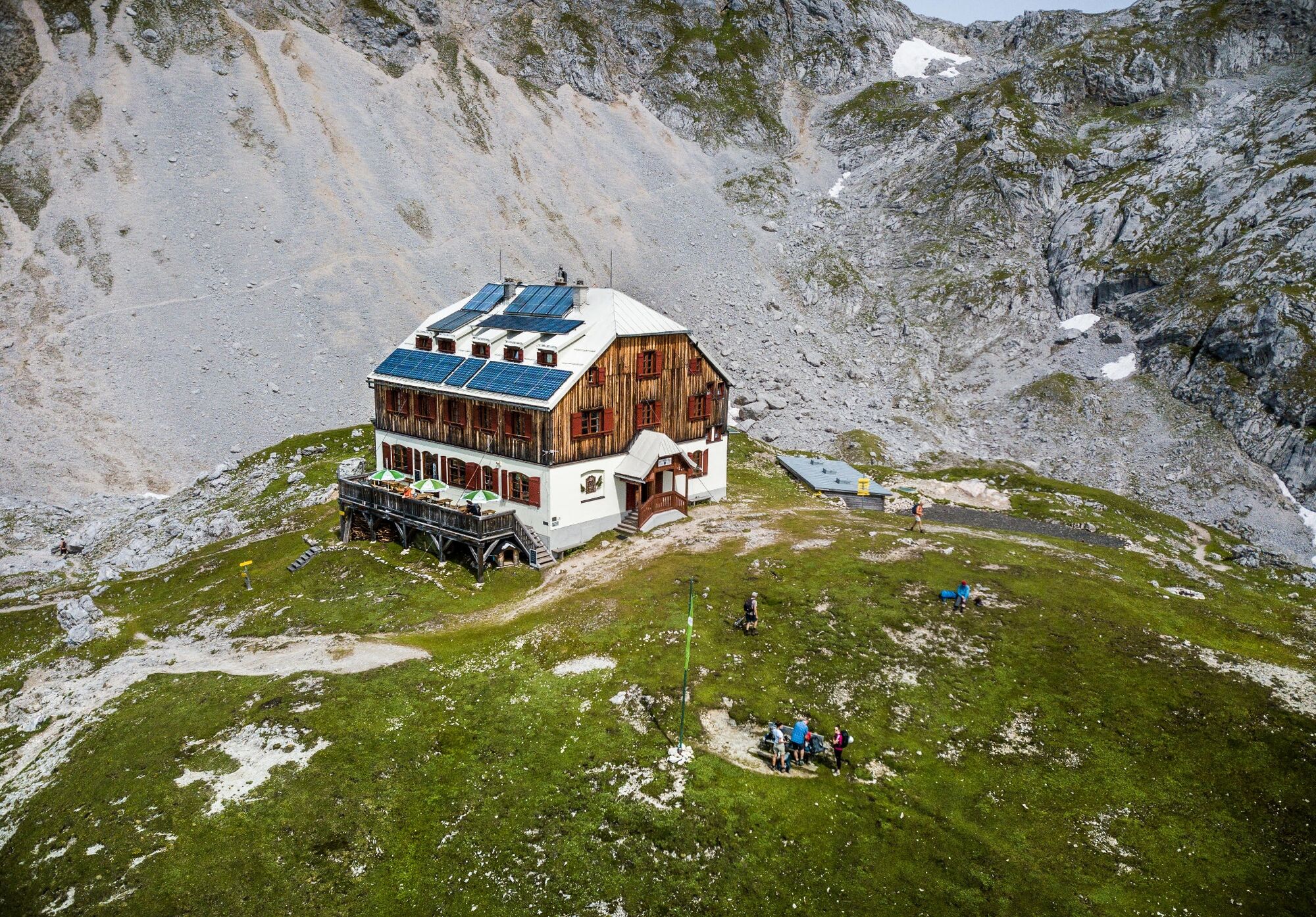
The Guttenberghaus is located at 2,147 m above sea level, making it the highest Alpineverein hut with overnight accommodation in Styria.
- Difficulty
-
medium
- Rating
-
- Starting point
-
Parking lot at trail head Feistererhof
- Route
-
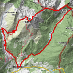
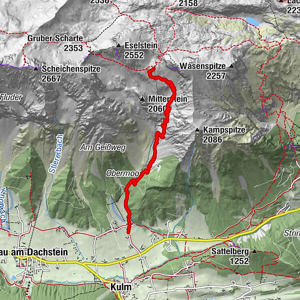
Bio- & Wellnesshotel feistererhof0.1 kmFischermauer (1,668 m)2.9 kmFeisterer Tiefkar3.7 kmFeisterer Hochkar4.6 kmGuttenberghaus5.3 kmBio- & Wellnesshotel feistererhof10.4 km
- Best season
-
JanFebMarAprMayJunJulAugSepOctNovDec
- Description
-
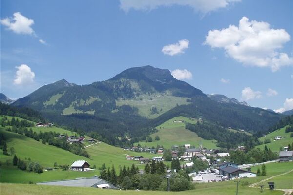
The hike to the Guttenberghaus is a classic in Ramsau am Dachstein. The highest mountain hut in Styria is a worthwhile hiking destination, the view from the Feistererkar to the Ramsau am Dachstein plateau and the Schladminger Tauern opposite is magnificent. The Guttenberghaus is a stage point for several long-distance hiking trails and a meeting place for climbers, via ferratas and leisurely hikers.
- Directions
-
The starting point for the hike is the car park below the Hotel Feisterer in Ramsau am Dachstein. This is where the ascent begins, which initially leads along a wide access road through the forest to almost the rustic and inviting Lärchbodenalm (1,406 m). Then the stony forest path runs through mountain pine alleys up to the rocks of the "Fischermauer". The trail now winds through the free, green slopes of the "Tiefkar", granting beautiful views down into the Ennstal and the rock faces of the Sinabell are getting closer and closer. Arriving at the Guttenberghaus, the panoramic terrace invites you to take a well-deserved rest and refreshment.
- Highest point
- 2,128 m
- Endpoint
-
Parking lot at trail head Feistererhof
- Height profile
-

- Equipment
-
A well-packed backpack is helpful and especially when touring Alpine terrain a tuque, gloves, a windproof jacket and pants are standard equipment. Good, waterproof shoes, sun glasses, sun cream and sufficient beverages are essential too. Torch light, a map of the area, knie and a small first-aid kit should also be in the backpack.
- Safety instructions
-
Due to the direct sunlight, it is recommended to start the tour early in the morning.
Changes in weather patterns, quick falls in temperature, thunderstorms, wind, fog and snow are some of the dangers that can be encountered on a hiking tour. Hosts of alpine huts and mountain refuges have a lot of experience in the mountains and can give good advice about weather and the trails. Poor equipment, overestimation of one's own capabilities, carelessness, poor personal constitution and/or wrong judgement can lead to critical situations. In case of thunderstorms: avoid summits, ridges and steel ropes.
GPS data and orienteering
Available GPS data - just like hiking maps - is only a guidance for orientation and can never depict a trail exactly with all its details. Especially at dangerous spots it is essential to judge on site how to proceed.
In an emergency please call:
140 - for Alpine emergencies (all over Austria) 112 - European GSM emergency number - Tips
-
The Guttenberghaus is the starting point for via ferratas (e.g.: Austria-Klettersteig Sinabell).
- Directions
-
From west:
Tauernautobahn A 10 to the Ennstal junction - exit in the direction of Graz/Schladming - around 20 km on the Ennstal federal road to Schladming - Schladming Mitte exit. From here continue to Ramsau am Dachstein on the Ramsau Plateau and about 1 km after Ramsau Kulm turn right onto Rössingstraße. After a few hundred meters, turn left towards Feistererhof and follow the road to the car park.
From North and East:
Pyhrnautobahn in the direction of Liezen Ennstalbundesstraße to Schladming - exit Schladming Mitte. From here continue to Ramsau am Dachstein on the Ramsau Plateau and about 1 km after Ramsau Kulm turn right onto Rössingstraße. After a few hundred meters, turn left towards Feistererhof and follow the road to the car park.
- Public transportation
- Parking
-
Feistererhof trailhead car park
-

-
AuthorThe tour Hiking to the Guttenberghaus is used by outdooractive.com provided.


General info
-
Schladming - Dachstein
3014
-
Ramsau am Dachstein
1704
-
Ramsau am Dachstein
493