Circular hike: Masenberg - Schloffereck - Volksk. Museum - Masenberg


- Brief description
-
THE hike for summiteers in the Pöllau Valley Nature Park!
- Difficulty
-
difficult
- Rating
-
- Starting point
-
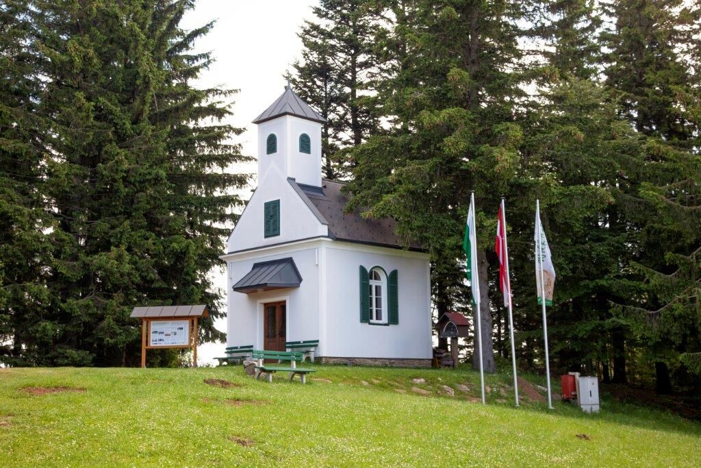
Pöllauberg, Masenberg refuge
- Route
-
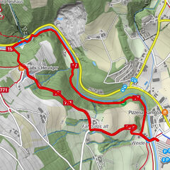
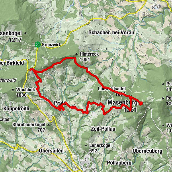
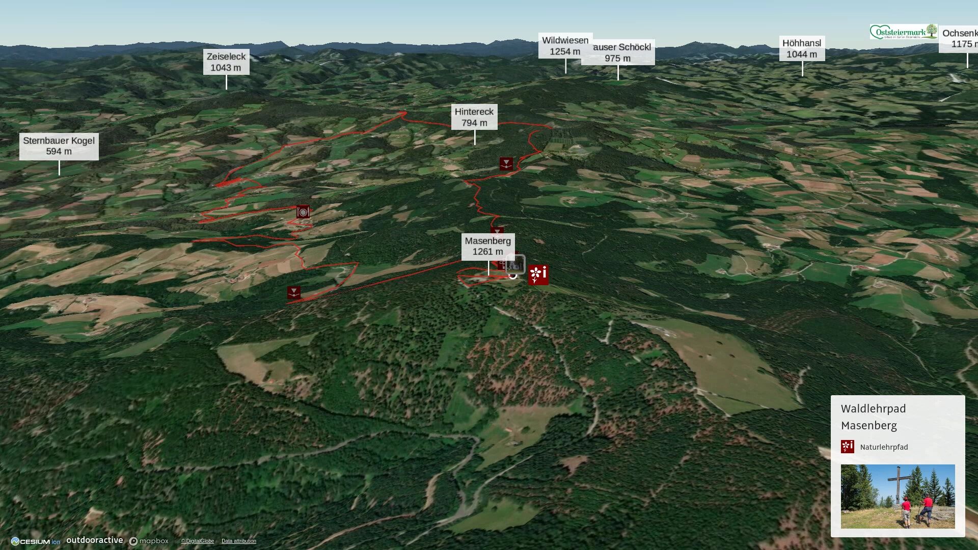
Schutzhaus Masenberg0.0 kmGlückskapelle0.1 kmMasenberg (1,261 m)0.1 kmLüßwaldsattel (1,066 m)0.9 kmPrätis13.7 kmKrughöf14.6 kmStraßhöf15.4 kmHotel- Restaurant Muhr17.4 kmPanoramablick Pöllauberg18.4 kmLüßwaldsattel (1,066 m)21.3 kmMasenberg (1,261 m)22.1 kmSchutzhaus Masenberg22.6 kmGlückskapelle22.6 km
- Best season
-
JanFebMarAprMayJunJulAugSepOctNovDec
- Description
-
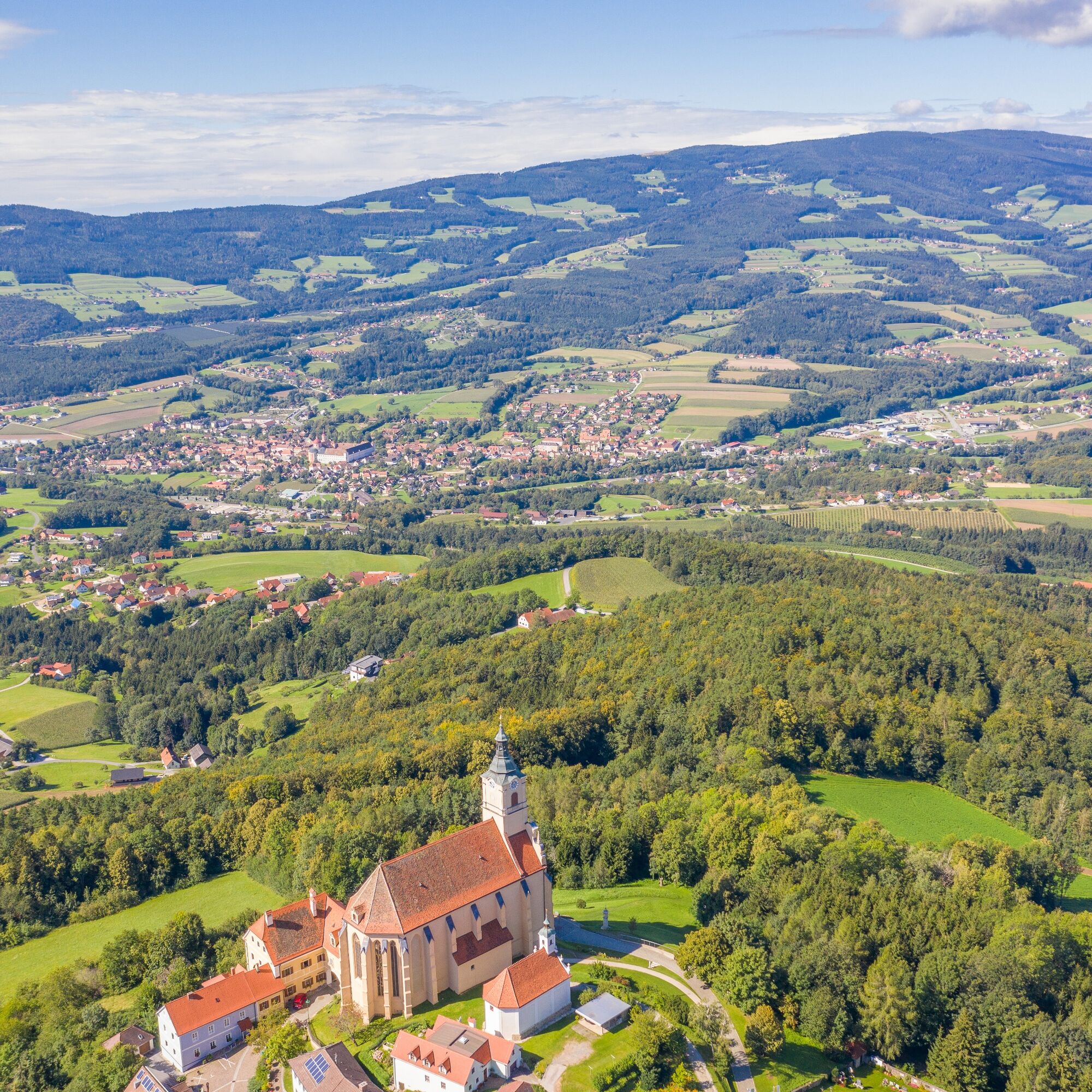
Starting from the parking lot at the refuge on the Masenberg, we can pay a visit to the Glückskapelle chapel right at the beginning before our actual hike begins at the summit cross just above.Following the forest nature trail, we reach the Lüßwaldsattel, via which we continue to the Zisser tavern (former inn) and Schloffereck. Here we have a wonderful view of the Pölauer Tal nature park in front of us. Now it's almost all downhill until we come to the Prätis stream, then past the Folklore Museum and here the ascent soon begins - past the Hotel Muhr - again via a (different) section of the forest nature trail to the starting point at the summit cross on the Masenberg.
- Directions
-
Masenberg - Lüßwaldsattel
From the summit of the Masenberg (1261 m) above the refuge and the Glückskapelle chapel, the trail descends steadily and relatively steeply, following the red-white-red markings no. 913 and the yellow then blue dots of the forest nature trail to the Lüßwaldsattel saddle. Here you overcome a difference in altitude of 180 metres over a walking distance of 800 metres. The trail is well marked, but you should take care when walking downhill. The stations of the forest nature trail are waiting to be discovered (back of the board with instructions or interactive with smartphone)!Lüßwaldsattel - Grünauer - Zisser tavern
Once we reach the Lüßwaldsattel, we keep to the 913 red-white-red hiking trail in the direction of Kreuzwirt, which is also the forest nature trail. After a short ascent, we hike relatively flat to house no. 116 vulgo Höhschuster. Between the barn and the house, the path leads us back into the forest. We hike through the forest on a beautiful forest path, encounter station boards and reach the Zeiler Dorfstraße with the Grünauer Wegkreuz with a rest area. We then follow the markings along a short stretch of road to the Zisser tavern in the Sonnhofen district.Zisser tavern - Schloffereck
We leave the forest nature trail at the Zisser tavern (former inn), follow the red-white-red markings no. 913 and walk north along the tarmac road for approx. 300 metres, then turn left into a wooded area, walk through it and along the forest/meadow border until we reach a game reserve. We follow the white-green-white marked hiking trail no. 10 towards Schloffereck. We walk along the forest road past the barrier, first a little steeper and then slightly downhill to Sonnhofen house no. 46, vulgo Kogl-Luis. Once there, let's take a look at the "landscape frame picture". Try to capture your favourite piece of scenery and take it home with you! There is also a bench here to treat yourself to a little refreshment or just to relax and unwind. The route continues along the Almerweg until we reach the Schloffereck after another 30 minutes.Schloffereck - Prätisgraben
Arriving at the Schloffereck, we first see the information board that welcomes us to the Pöllau Valley. We hike back a little way along the path we came along until we come to the white-blue-white signpost "Pöllau via Prätis" with the number 11. We follow the signpost, hike through the forest and walk along the forest/meadow border to the estate of the Grasser family, Prätis No. 58, vulgo Flach. Following the signposts, we reach an asphalt road, the Schloffereckweg. Passing an idyllic fish pond, we follow the path for approx. 1.5 km to the Köppelreith estate no. 9, Kornhofer farm. We turn left and walk along the Kerschbaumerweg to the Bachler farm, Köppelreith No. 7, where hiking trails No. 4 (white-yellow-white) and No. 11 (white-blue-white) join up.Prätisgraben - Folklore Museum
From the Bachler farm we follow the Roseggerweg in a southerly direction and after about 10 minutes walk we come to the next fork in the road, the turn-off to the Folklore Museum or to Pöllau. On the left-hand side we see an old smelting furnace.
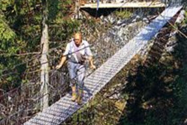
From the Folklore Museum - Hotel Muhr
We follow the white-yellow-white markings no. 4 through the forest, a somewhat steep ascent, then we reach the northern end of the Prätis settlement. We follow the Prätis settlement trail to the other end of the settlement, to the Prätis Folklore Museum, which is well worth a visit. This museum is well worth a visit. Admission is free, but a small donation towards its upkeep wouldn't go amiss. After this very informative stopover, we continue to the Muhr restaurant, which is still some distance away. We walk northwards along the front of the ethnological museum and leave the former "Römerweg" (now asphalt road) turning right at the end of the settlement near the sports field. A meadow path leads steeply downhill to the metal bridge over the Prätisbach stream and up again on the other side. Through an avenue of fruit trees via a field path we reach a property, continue straight ahead at the yellow house (markings on the corner of the left-hand outbuilding!) over a small stream and come to a tarmac road. From here, we follow the tarmac road for about 500 metres until we turn right downhill at the junction with Zisser-Tavern-Straße and pass the "Franzl in der Strass" estate in Straßhöf. Immediately afterwards, we turn left onto the path into the Zeil. We walk along the steadily ascending path, past the Prätis farmstead no. 23, Kohl vulgo Stefan im Stoa, and after a further 2 km we reach the Hotel Muhr via forest and meadow paths.Hotel Muhr - Höhenweg
From Hotel Muhr we walk along the road for about 500 metres and turn left at a meadow path up to the fork in the road "Pöllau/Höhenweg Pöllau". We are once again on a section of the forest nature trail.Höhenweg - Panoramablick - Dorfhanslweg
We follow the signpost "Höhenweg Pöllau" to the landmark "Panoramablick Pöllauberg". After enjoying the panoramic view, the trail climbs steadily and we reach the Zeiler Dorfstraße, which we follow for approx. 100 metres uphill to the next crossroads with a weather cross. Dorfhanslweg - DorfhanslAt the crossroads, we turn right into the main Dorfhanslweg, past the Wetterkreuz and a wayside cross with a wonderful panoramic view of the Pöllau valley, and follow it to the end of the tarmac road.
Dorfhansl - Chapel - Lüßwaldsattel
After the "Dorfhansl" farm, the forest path continues for approx. 300 metres to the next fork in the path, where the Dorfhansl chapel with signpost is located. Once there, we follow the forest road to the left and take the red-white-red hiking trail no. 941 towards Lüßwaldsattel, which we reach in approx. 15 minutes. Here the circle closes.Lüßwaldsattel - Masenberg
From the Lüßwaldsattel, follow the markings on the right up a fairly steep climb to the summit of the Masenberg. The trail is well marked, but you need a bit of stamina for the ascent. The "Glückskapelle" chapel, which the Wilfinger businesses bought at auction on "ebay", invites you to stop for a prayer. You can also stop for refreshments at the nearby Olmstoll inn. - Highest point
- 1,253 m
- Endpoint
-
Pöllauberg, Masenberg refuge
- Height profile
-

- Equipment
-
small rucksack with water bottle (+ provisions)
Sturdy shoes
Appropriate clothing - preferably several layers - "onion principle"
Rain and sun protection
Hiking poles as required
Mobile phone
Small first aid kit
Route description
Before starting the hike, check where you can stop for refreshments, including opening times, or pack suitable provisions. - Safety instructions
-
Important telephone numbers:
European emergency call: 112
Emergency call mountain rescue: 140 (if possible, please provide GPS data)
Rescue: 144
Fire brigade: 122
Police: 133
The trail is easy to walk and therefore suitable for the whole family.
Correct behaviour when hiking: Rules of behaviour when hiking
A few tips on correct and fair behaviour in the forest: (Source: https://www.bundesforste.at/english.html)
Hikers should avoid visiting the forest approx. 1.5 hours before sunrise and after sunset, as wild animals are particularly active at this time. Plastic bottles, handkerchiefs, cigarette butts etc. have no place in the forest! Please make sure that you do not leave any rubbish in the forest. Camping and making fires is strictly forbidden in the forest! In principle, every person in the forest is allowed to collect 2kg of mushrooms and berries per day for their own use. It is only prohibited if the forest owner expressly forbids it. - Tips
-
Experience the scenic diversity of the Pöllau Valley Nature Park. Plan enough time to enjoy the culinary delights.
- Additional information
- Directions
-
Pöllauberg, Masenberg refuge
The Pöllau Valley Nature Park is located in the heart of Eastern Styria, the garden of Austria, approx. 60 km north-east of Graz and approx. 150 km south of Vienna
By car from Vienna
If you are driving from Vienna to Pöllau bei Hartberg, take the A2 towards Graz and drive about 110 kilometres until you reach the Hartberg exit. From there, follow the B54 in the direction of Pöllau.By car from Graz
To get to Pöllau bei Hartberg from Graz, take the A2 motorway in the direction of Vienna. After about 30 kilometres, take the Gleisdorf West exit and then take the B54 towards Hartberg/Pöllau. Follow the B54 for about 25 kilometres until you reach Pöllau.By car from Salzburg
To get to Pöllau bei Hartberg from Salzburg, take the A1 motorway towards Vienna. Drive about 110 kilometres to exit 109 (Salzburg junction). There change to the A9 motorway in the direction of Graz. At St. Michael, follow the S6 towards Kapfenberg. Continue on the S6 until the Krieglach exit. From there, take the B72 and then the L405 to Pöllau. - Public transportation
- Parking


-

-
AuthorThe tour Circular hike: Masenberg - Schloffereck - Volksk. Museum - Masenberg is used by outdooractive.com provided.


General info
-
Oststeiermark
2126
-
Naturpark Pöllauer Tal
1095
-
Pöllauberg
353