- Brief description
-
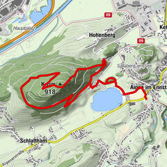
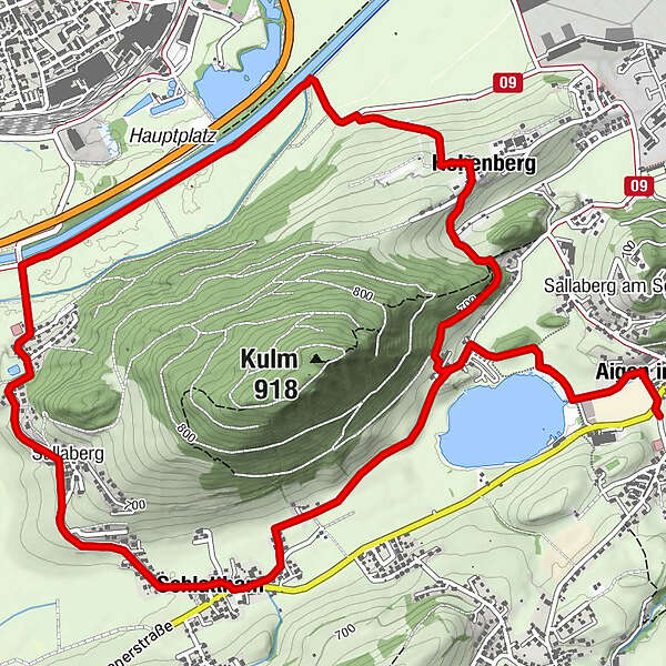
Varied running course around the Kulm with slight inclines and flat sections for "tempo polishing". At the Putterersee you can cool off on hot summer days.
- Difficulty
-
medium
- Rating
-
- Starting point
-
Parkinglplace tennis court Aigen
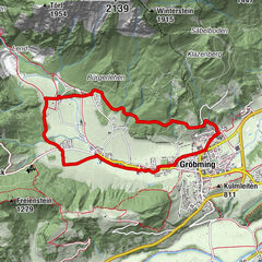
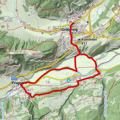
- Route
-
Aigen im Ennstal0.1 kmSchlattham2.5 kmSallaberg3.5 kmHohenberg6.7 kmAigen im Ennstal8.8 km
- Best season
-
JanFebMarAprMayJunJulAugSepOctNovDec
- Description
-
Surface: 53% asphalt, 47% gravel
Ideal starting points and entry points: Schwarzer Weg, Sallaberg bridge, Windsack Bundesheer, campsite, Schlattham.
Conditional requirement: The course length and the slight inclines require the runner to be in medium to good physical condition. Not a beginner's course.
- Directions
-
Trail number: 12
- Highest point
- 700 m
- Endpoint
-
Parkingplace tennis court Aigen
- Height profile
-

- Equipment
-
Trail running shoes - no asphalt running shoes
Running backpack or vest depending on the length of the tour hydration bladder or softflasks
thin windbreaker
first aid kit, including emergency blanket
cell phone
energy bar
money
change of shirt
Headband
Sunglasses - Safety instructions
-
Plan your trail in advanceInform yourself about the course of the trail and its demands
Pay attention to weather forecasts and weather changes
Let others know where you are going
Adapt your equipment to the weather and the trail
Be aware of livestock when crossing pasture - Tips
-
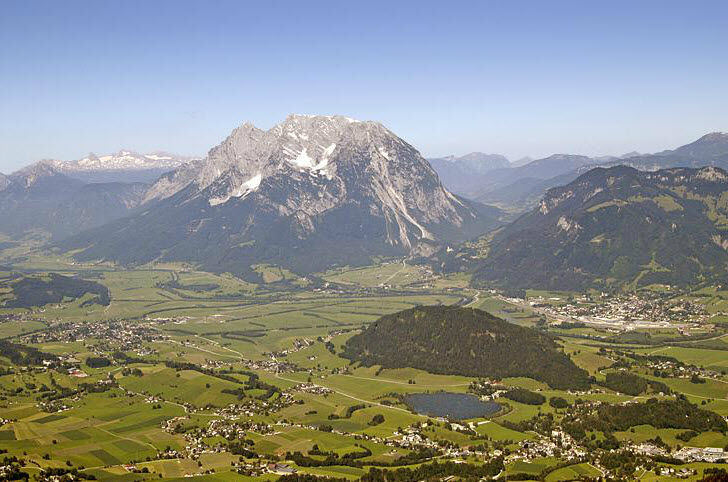
With its gradients, the Kulmrunde offers varied, diverse training opportunities (driving game training). The Grimming is a constant companion.
- Additional information
-
Tourism information: www.schladming-dachstein.at
Tourism blog: www.derbergdastal.at
www.schladming-dachstein.at/de/Sommer/Wandern-und-Bergsport/Laufen-und-Trailrunning
Tourist Office Schladming-Dachstein
Ramsauerstrasse 756
8970 Schladming
T: +43 3687 23310
Garbage on meadows and paths can not smell mountain and valley. Please take it with you. Agriculture and forestry are important partners for Berg und Tal. They allow you to walk and drive on many of their paths. Be aware that only good cooperation will guarantee your recreational enjoyment in the future.
- Directions
-
- From Schladming/Salzburg on the Ennstal federal road B320 to Pürgg-Trautenfels.
- From Bad Aussee/Bad Ischl on the Salzkammergut federal road B145 to Pürgg-Trautenfels.
- From Trautenfels in the direction of Irdning and further past the Putterersee to Aigen.
- From Liezen/Graz on the Ennstal federal road B320 to Wörschach and further past the barracks with airfield to Aigen
- Public transportation
- Parking
-
At the tennis court Aigen
- Author
-
The tour Roundtrail Kulm is used by outdooractive.com provided.